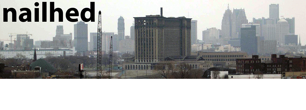
RETURN to part 4
Click for trail MAP


I had brought mostly winter clothes, and for food I had a 19oz loaf of bread, three apples, three 16oz bags of trail mix, two 5oz bags of jerky, and that last pasty from Soumi Bakery that I would eat tonight. Fires are outlawed on Isle Royale for the most part, and I don’t own or like to carry a camp stove, so that pretty much limits me to dry goods. Again, the only way to get water is by filtering it, but there are dangerous parasites in many of the inland lakes here, so you also have to use iodine. Or, you can just stick to Lake Superior like I did.

In fact, I was a mere 12 hours away from learning a harsh lesson in Isle Royale weather conditions myself.

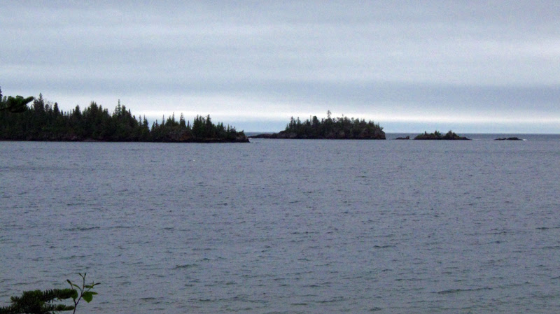
A couple miles later I came within sight distance of the Rock Harbor Lighthouse:


Daisy Farm has no daisies. I’m not sure how it got its name, because the only settlement that I’m aware of that was ever here was that of the Ransom Mine, a “town” that was built here in 1847 and consisted only of five log houses, a wharf, an undoubtedly crude smelter, and a larger log storehouse for food and equipment. There were many deaths due to “equipment and mining accidents.” Apparently ventilation and flooding were a problem with the mines here. According to my maps there were up to six shafts and/or adits here, so I should have plenty to explore tonight. Most of the ore here was barrel work, meaning “bundles or strings” of copper, “bound together in some veinstone” which must be broken up with hammers. Despite good initial prospects, Ransom Mine had about as much copper as Daisy Farm had daisies--it was a huge failure and closed in 1849 after only two years, with the company unable to even recoup the cost of supplies and transportation to the isle. In 1866, most of the buildings here were destroyed by fire.
Leaving my pack behind at the shelter, I donned raingear and wandered the camp a little bit to see if I could find anything. Nothing really presented itself. There were quite a few mines marked here, so I found it hard to believe that I could find nothing. But despite my efforts I could turn up no evidence…I even hiked pretty far afield, and did some bushwhacking up on the hill as well. I did find what appeared almost to be a very overgrown poor-rock pile, but nothing else around it. I was pretty bummed by this, and headed back to camp. I did see this thing, which looks kind of old, but I’m not sure if it’s 1847 old…

Scarpino further states that the area has seen "discontinuous, but long-term human use for thousands of years," and "is one of the most significant archaeological sites on the Island." According to him, a "mine pit and poor rock piles mark the location of what in the 1840s was a large mine by the standards of Isle Royale," to be found a "short distance inland, hidden by forest cover and brushy understory." Well I guess I didn't look hard enough.

One thing I noticed about the trails here on Isle Royale is that despite being well-defined, there are no side trails. In any other popular nature area where there are trails, you will always see fainter trails branching off in a million directions because of the sheer volume of people and deer who trample through those woods all the time.
Here, not only are there no sidetrails branching from the designated main trails, but the brush and closely packed spruce trees make it unappealing to try and blaze one. In spots, they are so dense that walking down the trail is like bumper bowling.
Here, not only are there no sidetrails branching from the designated main trails, but the brush and closely packed spruce trees make it unappealing to try and blaze one. In spots, they are so dense that walking down the trail is like bumper bowling.


Another thing I noticed was that the mosquitoes here are tougher than your average breed; like monsters in the higher levels of video games they require at least two hits to kill, otherwise they are just dazed for a few minutes and will get back up and fly around again. I stopped reading the walls for a minute, and gazed at the label on the back of the Yukon bottle…under the picture of the haggard, sullen backwoodsman read the caption, “Yukon Jack is a taste born of hoary nights, when lonely men struggled to keep their fires lit and cabins warm. Boldly flavorful, yet surprisingly smooth, there is no spirit like Yukon Jack.”
I became bored pretty quickly on this hoary night--having not realized quite just how much daylight there was left on this, the longest day of the year. I felt like an ass for sitting wimpily inside my little shelter instead of being out enjoying this supreme king among wildernesses, but the rain kind of made it pointless. The view from my shelter wasn’t even that good. All I had to stare at was spruce trees and be tortured by a bunch of berry-less thimbleberry plants. Could be a hell of a lot worse though; I could be trapped inside my teeny pup tent, unable to even sit up. I began to see now why people always talk of bringing a “good book, to read on those long nights” to the isle. Personally I have never brought books or any kind of entertainment while camping...aren’t I supposed to be out here enjoying nature instead of sticking my nose in a book? I can do that in the city.
I realized how remarkably well-designed these shelters were…or at least well-maintained. There was some very old graffiti here, much of it from the 1970s. Each shelter had a broom in it, hanging on a nail. Along the short walls planks were nailed on, for draping your wet articles to dry. After what seemed like quite a few more empty hours, I perceived the gray of the forest begin to subside into darkness, and I got into my sleeping bag. Still though, I felt quite numb, and a bit stir-crazy. Time seemed to drag on forever, and the walls of the shelter ceased to be as much of a luxury, and became more like a cell. I got back up for awhile and decided to sweep out my shelter a bit. That should kill some time. I actually did it twice. Finally, after some more sitting and staring, I was able to go to sleep, at long last. The rain continued.
They thanked me profusely as I secretly wished they had come along last night so I would’ve had someone to talk to. They said as they stood there under my eaves that they had been in a tent up on the hill nearby. The guy was from Calumet, and she was from Houghton. I guess they had hiked in from McCargoe Cove last night in the rain, and it had gotten the best of them.

Blah, at least I have dry ones to change into when I get to McCargoe. Pretty soon this became quite an annoyance however, and the rain began to fall even harder. I drew my poncho tighter around me and forged ahead, glad that the wetness was not bothering any other part of me. I kind of wondered how the hell this particular issue had never become a problem in my life before. Raingear pants are something I have not owned since I was in Cub Scouts. I hike all the time, why has this not come up until now? Oh well, whatever--when I get home that’s one thing I will definitely purchase, because this was ridiculous.

As I trudged along my resolve did not flag one bit however; I was here on Isle Royale, my own personal Ultima Thule, and I was used to adverse conditions, with little stomach for giving up. I was well prepared, and I was dressed warmly. As long as I kept moving I would have no problems. As I came up to more open areas on the sides of the ridge where I could look out, the weather began to increase in intensity. No longer was it just a stiff rain, there was also a stiff wind, and visibility was poor. I could tell that on an average day there would be a splendid vista from here, but today I could see nothing but a gray curtain of murk and soggy gloom. The valley that yesterday had been deathly quiet was now alive with the roaring of bending trees. Quite often I could hear deep groans and creaks, and stuttering "clucks" from the many old gnarled trees that had died or were still dying while gripping this stony mountainside. There is not much for a layer of topsoil atop the bedrock, so root systems are always spread outward instead of downward, meaning a lot of relatively unstable trees easily torn from their places. I could see that they swayed dramatically more than trees you see in other less rocky places. I was concerned that if one decided to fall over I wouldn’t be able to get out of the way in time. Not to mention these trees were all big enough to crush a shelter with ease.
The weather ramped up its anger another couple notches, becoming what I would definitely call a storm…this must be the gale predicted from yesterday finally coming to call. I wondered when the hell I was going to get to the top of this thing, then suddenly remembered that there is an observation tower at the peak. I could not see any tower anywhere, and this discouraged me. It was another 15 minutes of climbing with heavy wet feet before I came around a corner to see the tall shape of a Forest Service fire tower looming up ahead. I plowed onward like a bull, just anxious to get past the summit and back down into the cover of the woods as soon as possible.


So the answer is no--no, I did not climb the Mt. Ojibwe watchtower, as much as I would have liked to. I knew that soon I would be battling hypothermia if I didn’t find shelter and get dry. This definitely reminded me of my wretched night atop Norwich Bluff. I had to get to at least one of the Chickenbone Lake camps, even if it meant going to East Chickenbone--the one the ranger had told me to “stay away from.” Incidentally, East Chickenbone was the nearest camp, and I knew it…I was now lamenting this rueful turn of events with a feeling that the worst was yet to come. For the moment I was still not very cold per se, but that was because I was exerting myself at full capacity. Obviously I couldn’t keep that up indefinitely. As I was running across the summit, I strained against the stinging rain to look up at the fire tower to see if I could maybe get inside, but it was undoubtedly locked. I was not in dire enough straits to resort to busting my way in (or risking a lightning strike), so I charged ahead on the trail toward the next campsite which I knew was not far off.
I could hear my boots audibly squooshing and frothily wheezing with every broad stride I took over the rocks. They were so heavy from the water sloshing around inside that it felt like I had little water balloons on my feet. Filthy little bubbles constantly rushed between my toes. I just hoped that I could get a shelter tonight instead of having to set up a tent in a torrential gale and getting all my gear wet in the process. It wasn’t even 10 o’ clock in the morning yet! According to the topo map (which due to the downpour I had not taken out to look at since last night) I knew there to be another trail junction just past the peak of Mt. Ojibwe, about halfway to Chickenbone. I figured my distance now to the nearest camp was a mere four miles--no sweat. That should put me in camp early enough in the day to secure a shelter, assuming they’re not already full of people hunkering down from the storm.
I came down a little along the ridgeline into some more woods after awhile, and was glad to be out of the whipping winds and sizzling, stinging rain. I was putting on some serious speed along the trail, though burning up quite a bit of energy to do it. My only thought was warm dry clothes in a shelter, some food, and a couple shots of whiskey. Maybe someone there will have hot coffee to share. I was on a mission. Exactly 1.5 miles later I came to the trail junction, but the milepost said something I did not expect:
Chickenbone Junction: 5.6 Miles >>
<< Daisy Farm: 1.7 Miles
WHAT!? I had hiked almost four miles from Daisy only to find out that I am now still three times closer to where I started from than I am from the next nearest camp?! Oh hell no…no effing way can I keep this up for another six miles with dishpan feet. I stood there staring in disbelief at the trail marker and my map wondering how the hell this had happened.
I obviously had to make a very heavy decision--soon, because I was getting soaked standing here. Keep going, and risk serious physical discomfort (and hypothermia), and not getting a shelter? Or give up and go back. Those were my two options. Each of them was equally disgusting in its own way. I could not accept defeat. I stood there at the fork in the road with raindrops running down the inside of my glasses, blurring the lines on the map. I could see my breath in the cold summer air. The trees roared above me in the wind again, their huge trunks creaking like the guttural voices of the Ents. I felt a shiver of cold now, for having stood still for this long…and the weather might be about to get a lot worse. I knew I had to turn back. I was crushed.
This meant that I was going to miss out on the mines in the Minong Ridge--the main thing that I had set out this way to see. If I was lucky, there would still be a shelter for me at Daisy Farm. I needed to get dry. I was already tired and sore from having humped this far over rugged terrain with almost no breaks, and it wasn’t even noon yet. I had a bad feeling that I was about to go all the way back to Daisy and find there were no shelters left. In shame I turned to face the way back downhill to where I had come from. I’ve never had to turn back before. Never. I’d finally met my match. Isle Royale had just handed me my ass. I started walking.

References:
Sarah and I just got back from Isle Royale. It didn't hand us our asses quite as much as it did for you, but we still got stomped on a few times. I didn't fully understand just how rugged that place is until I'd experienced it for myself...
ReplyDeleteAmen.
Delete