Showing posts with label Wayne County. Show all posts

The "Other" Dequindre Cut

Not far from downtown, on the city's west side, there is another overgrown old railroad cut full of graffiti and homeless people, just like how the Dequindre Cut used to be before it was gentrified. Granted, this one is smaller, but it is also about to be gentrified, so I guess I'll bring it to you now before that happens. By the way, I explored the Dequindre Cut in an older post.

I'll admit I knew about this one for a long time but never went down into it until recently, when I panicked because I noticed they suddenly cut back all the overgrowth to turn it into part of the new "Joe Louis Greenway" project. Looking down into the cut while driving along Rosa Parks or Fort Street provided one an enticing glimpse of old stone ruins from long-gone bridges and layers of graffiti, not to mention I knew it also corresponded to the path of an ancient creek bed. For all those reasons I had always wanted to check it out "someday," but now it was getting shot to the top of the list.
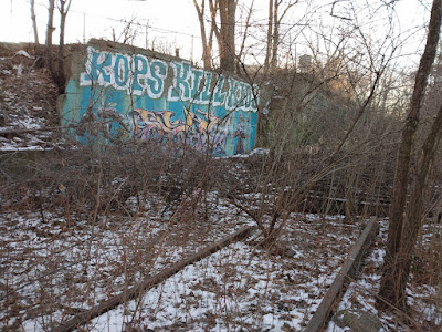

The Detroit Riverfront Conservancy set spring of 2022 for groundbreaking on the new "May Creek Greenway," which would eventually link up to the greater "Joe Louis Greenway" that is currently stretching across the city and includes the Dequindre Cut. The May Creek name refers to the ancient stream that used to flow through here. My colleague Andrea Gallucci recalled reading something in perhaps a newspaper or the Journal of Common Council that talked about how May's Creek was encased in a wooden sewer pipe in the 1860s. I looked at the Sanborn maps going back to 1884 and no surface creek was indicated, so I would definitely say that the stream was put underground before that time. In the 1860s this area was already becoming highly industrialized. Then starting in 1906 the railroad tunnel to Canada was also dug along the same path as the former creek, right underneath this railroad bed.

Another colleague of mine, Paul Szewczyk, wrote a post some years ago about the ancient streams that once veined across what is now urbanized Detroit. He showed a map drawn by Silas Farmer that superimposed the native streams on top of the downtown street grid...and you can see the original course of May's Creek (at lower left) and where it corresponds to the current railroad right of way:

Image from Silas Farmer, click to enlarge.

Farmer writes,
The stream more recently known as May's Creek, after Judge May, was formerly called Cabacier's Creek, from Joseph Cabacie, or Cabacier, who lived here in 1780. It was designated in 1747 as Campau's River. It is claimed that Jaques Peltier erected the first grist-mill on the stream, just north of what is now Fort Street, and near the railroad crossing. The stream supplied water sufficient to run the mill six or eight months of the year.
If the Cabacier name sounds familiar, you may recall that Cabacier Street parallels this railroad corridor, a few blocks to the east. Looking at a Sanborn map, I thought his below-grade rail corridor used to be one of the approaches to the old Union Depot (which stood at Fort & 3rd), and the even older train stations that stood there before it in the heydays of railroading, well before the current Michigan Central Station was built. Local railroading guru Peter Dudley informs me however that it merely passed very close to the Union Depot (see his comment below this post).

Here we see that the Fort Street bridge over the railway has also been rebuilt in the past couple years:
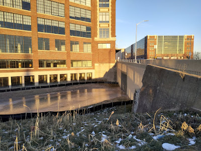

There is a bit of water down in here now, and a lot of phragmites...almost as if May's Creek wants to reappear. 

I have to wonder if the fencing over the opening is to keep more homeless people from seeking shelter under it...?
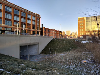

...It certainly isn't big enough to accommodate trains anymore. And the railroad tracks have already been removed from the cut anyway, all except for the siding seen in the first photo.
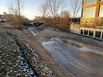

By the way, this is what the spot looked like in July of 2016, before the Fort Street bridge was rebuilt:

Image from Google Streetview

Despite its appearance, the large building on the corner here was not originally an old automobile factory...it was the Edson-Moore & Co. Wholesale Dry Goods warehouse. It was renovated around the same time and now appears it is going to be more lofts or something.
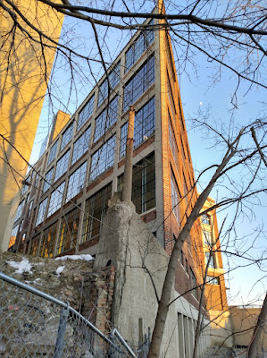

Note the ~1920s concrete streetlight pole, that looks like it may have flanked a bridge that no longer exists...? Which would be odd, considering this was not a street, but an alley. No such bridge is shown on the 1921 Sanborn map however, and no corresponding bridge footing currently stands on the opposite side. Perhaps it was more like a ramp or stairway down to the railroad tracks, for loading / unloading goods. It just reminds me a lot of the art-deco style lamps that you see on some of the other bridges around town, such as the one that passes over the Rouge River at Warren Avenue:

Image from Google Streetview

Anyway, I dug into the archives for more info on when the May's Creek was put underground. Some reports I found in the Free Press from the Common Council referred to the creek in 1859 as being in a "culvert" at Fort Street, the covering and completion of which was being hotly debated by Council as to the costs associated. One from 1858 mentioned that the appropriations involved "mason work."

The Annual Report of the Controller of the City of Detroit for 1860 refers to funds for the May's Creek Sewer, as well as for several other sewers around town including Bloody Run (another "ghost" stream put into a sewer). The Detroit Water Board had just been established in 1853 by the way.
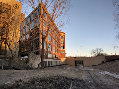

Beginning my walk up the cut to the northwest, towards Michigan Central Station:
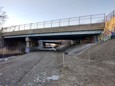

The first bridge you come to after Fort Street is Lafayette Street...you can see part of the abutment for the old bridge still making up a section of the wall:
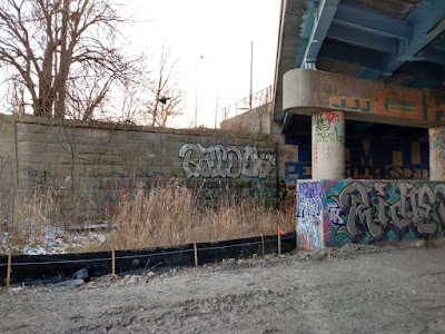

Good ol' Lafayette...if you recall your Detroit geography, it also crosses the Dequindre Cut. ;)

The 1921 Sanborn refers to this crossing as a "steel trussed viaduct"...
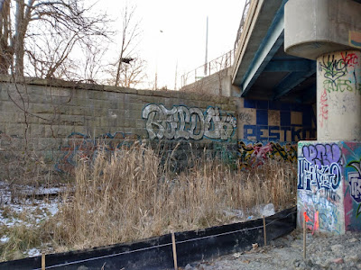

This much more modern replacement seems to have been built adjacent to the original?
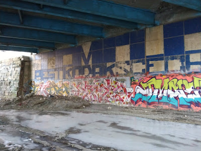

This is really starting to remind me of Dequindre...in fact, I wonder if any of these homeless people here used to live in the Dequindre Cut before getting kicked out when it was gentrified?


This weird curve is actually the intersection of Lafayette and Rosa Parks:
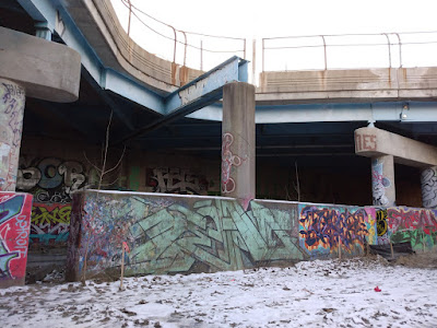

Looking back south toward the river:
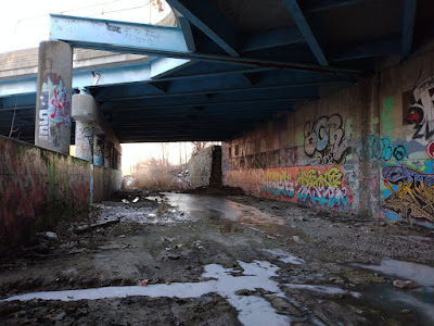

Ahead is a tent belonging to one of the people who live down here:
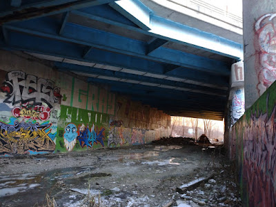

One of the things that I detest about the "New Detroit" is that you hear about all these new developments and restorations of things that were once broken or abandoned announced with such bluster and fanfare, and everyone claps like a seal...but we all know damn well that they're just going to come through and make the police kick all the homeless people out, herding them somewhere else. Not solving anything, not addressing the issue of homelessness, not reducing poverty...just shooing it away so that yuppies can move in without having to look at it and feel guilty. 

If anyone knows different, feel free to comment below or email me. I mean, I'm down with increasing bicycling infrastructure (especially for those who can't afford cars), but if we spent as much effort and money on addressing housing, poverty, and public transit in Detroit as we do on bike lanes for yuppy newcomers, we would be doing much better.
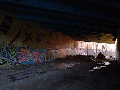

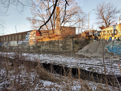
In the midst of its much-touted "rebirth," Detroit is still tied for the #1 highest poverty rate of any city in America (as of 2021). Foreclosures are still gutting the neighborhoods, while taxes and cost of living are going up, and truly affordable housing is disappearing. Corruption is even more pervasive than it was under Kwame. Downtown looks nice though, right? I don't know how we can look at another ribbon cutting ceremony with that grinning leprechaun Mayor Duggan and keep pretending like everything is all good. 

We are witnessing the implementation of apartheid in Detroit.


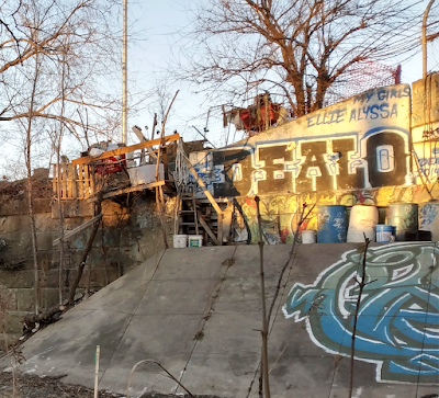
 This is the main encampment here...I say "encampment" because they have been here for about five years:


You can see that they have built semi-permanent staircases to make access to the "above world" easier, and have collected drums for perhaps storing water?


Because of the severe cold today, the inhabitants were all huddled inside their cocoons underneath the viaducts for warmth, paying me little attention, and I wasn't trying to be nosey. I noticed they also had stacks of firewood around that they had gathered for cooking and heat, and the usual spare clothing hanging on bushes and fences. I would say that this is an extraordinary level of work and detail put into creating a habitat by and for homeless people, but I have seen even more elaborate than this around town. Take a closer look, especially back in the wooded freeway medians and cloverleafs and you will see some shanty towns that rival the Hoovervilles of the supposedly "Roaring" 1920s. Question it whenever the elites tell us that America is prospering...and do not become blind to the poverty that's right in our faces every day.

This is what the same spot looks like from alongside Rosa Parks Avenue, the only clue to its existence visible in the outside world:

Image from Google Streetview

They had been living there since at least 2018 as best as I can recall. Now all of their items have been cleared out, and there is a NO TRESPASSING sign posted in this spot. 

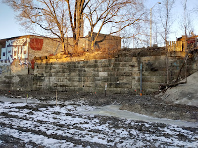
This stone section of the wall used to be the eastern abutment for the Howard Street viaduct, another steel trussed bridge:

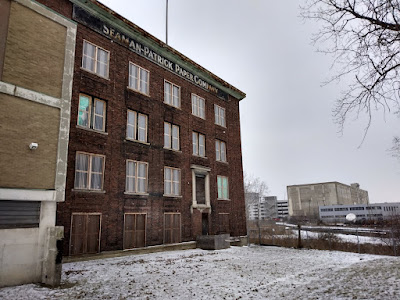
Up ahead can be seen the former Seaman-Patrick Paper Co. warehouse, which I recently explored in a previous post:
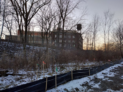
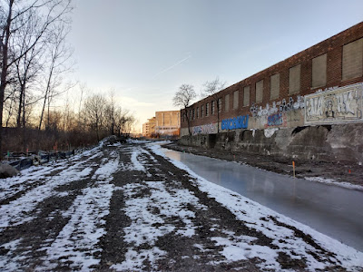
Now we are getting close to the mouth of the train tunnel to Canada, in fact we are standing on top of the tunnel here...


It also seems like graffiti is almost disappearing from the cityscape. Except for "sanctioned" walls sporting fashionable murals and comfortable messages, real street art is nearly gone from Detroit, and that has been the result of Mayor Duggan's relentless buff campaign (graffiti removal), and prosecution of painters. In my opinion this equates to a sort of censorship of dissent, ironically enough imposed by a suburbanite mayor, in order to make suburbanites "feel safer" in Detroit. In other words, worrying more about the feelings of outsiders than the feelings of residents. Since 2013, Detroit has felt more and more apartheid to me, and the change in the graffiti scene has been part of that. Other than the insides of abandoned buildings, this pit of despair along the cut seems to be one of the last refuges of real graffiti; you just don't really see it in the public thoroughfare anymore.

Now some of you may be asking why I would lament such a thing; you may think graffiti is pure vandalism and should be eradicated. You may also deem it to be one of the symptoms of "the big city" that in your mind make it dirty, decadent, and dissolute, completely at odds with your suburban or rural lifestyle. All I can say to that is mind your own business where you are, and be glad I don't judge the characteristics of your home as harshly as you judge ours.
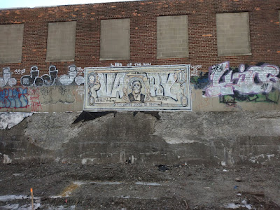

Speaking of apartheid in Detroit, 77% of Detroit Police officers reside outside the city. The DPD is almost 50% white, and of those white officers 97% of them do not live here...yet they are policing a city that is almost 80% black. Sounds kind of like an occupying army to me, especially when you consider the DPD's tactics during the Summer of George Floyd, and their efforts to suppress protest.
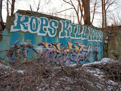

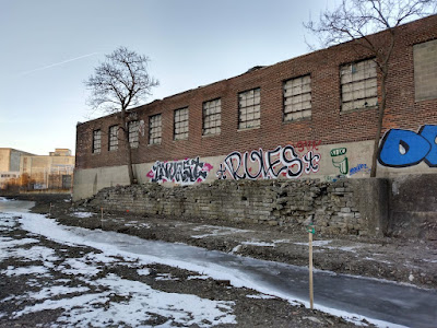
The sandstone wall here is the western side of the Howard Street abutment, by the way:


You may remember from my post about the Seaman-Patrick warehouse where I pointed out that Howard Street takes a strange dead-end right there...well, that is what it looks like from below.

These limestone blocks may indicate that something especially old may have been here at one time...they were in common use in the 1850s:
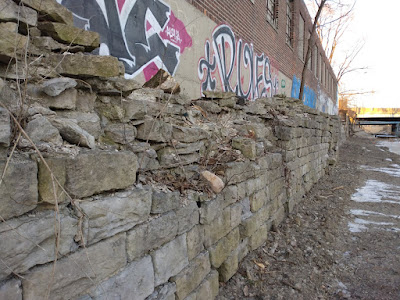

For what it's worth there was not a corresponding wall of limestone block on the opposite side of the cut from it.
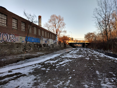


References:
Common Council column, Detroit Free Press, August 25, 1858, p. 1
Common Council column, Detroit Free Press, September 7, 1859, p. 1
Common Council column, Detroit Free Press, May 27, 1859, p. 1
The Annual Report of the Controller of the City of Detroit, Detroit Free Press, May 18, 1860, p. 6

The Corner of 13th & 13th

This was a place that Navi and I had scrutinized once before, sometime around 2016. At the time we couldn't be sure whether it was abandoned or not. It was right next to the railroad tunnel to Canada, so it was an interesting little nook of the city and I was pretty sure no one else had been inside. But recently I happened to cruise through there again and noticed that the front door was propped open...so naturally I did what I do best, which is to stick my nose where it doesn't belong. I apologize for the blurry nature of some of these photos...I was still getting used to how this new camera works, and was moving through the place pretty quick since it sounded like there were workers present somewhere in the building. 

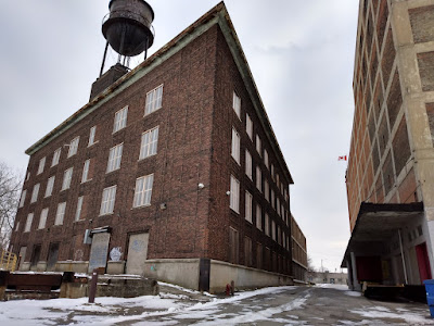
I knew by the faded letters on the water tower that it was once part of the Seaman-Patrick Paper Co., which seemed to correspond to a few other buildings in the immediate area also relating to the paper production trade, such as the Chope-Sievens Paper Co. and Tullar Envelope plants on the other side of Fort Street.

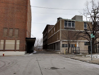
The building has two halves, an older 4-story building and a newer concrete 3-story building (seen above, to the right). I was surprised to see that the older section was actually all timber-framed with wooden floors, an absolutely gorgeous old survivor...but now I was curious as to how old this factory actually was, and whether the Seaman-Patrick Paper Co. name painted on the outside was the original company that built it. The first thing I did (as always) was go to the c.1921 Sanborn map, which showed only the timber-constructed section of the building to be standing then. It was labeled as a warehouse for the International Harvester Co. of America. The 1921 Sanborn also shows the new and old city address numbering systems, which is super handy.


The address of the building today is 2000 Howard Street (which points to the modern concrete addition), but the Sanborn maps show Vermont Street addresses on both the west and east sides of the old wood-framed structure...which is awfully strange. The west side of the building was addressed 98-104 Vermont (1226-1252 by today's numbering), and the east side of the building was addressed 97 Vermont (1225 by today's numbering). That of course references the "floating" front door seen in the photo above...why is the original front door hovering in space on the second floor of the building? Looks like we have ourselves a dandy of a mystery to unravel. You're lucky you have me to sort all this out for you! ;) 

So I went back all the way to the c.1884 Sanborn map, which showed the area of this structure as a mostly vacant lot with a few houses standing. I learned something interesting however; Vermont Street was called 13th back then. 

The plot thickens.

Turning to the c.1897 Sanborn map, this structure was still not shown yet, so that means it was built somewhere between 1897 and 1921. 

To my eyes this place looked like it was built before 1900, but I could be wrong. But the streets do a funny trick again: on this map Vermont was now labeled as Lafferty Pl., and 13th was the next block east, jogging off of "Vermont" at Howard, and around the east side of the building. All I knew was that this was going to make it really tricky to do any further searching based on addresses...I now had two streets that shared three different names, and potentially two sets of numbers to plug in for each one. Things were going to get even trickier because due to the pandemic the Burton Historical Library downtown was closed, meaning I would not be able to access the Polk's City Directories...which would have made this a breeze. 


But at least now I knew that an occupant was International Harvester, a manufacturer of trucks and farm implements. They sprang from a merger by the famous Chicago businessman Cyrus McCormick in 1902...which made me wonder if in fact they were the original builders of this structure, or if there was still someone before that. Seaman-Patrick Paper was not founded until 1911, so it couldn't have been them.

I also managed to figure out that 13th Street was officially renamed Vermont Street on September 3, 1904 by act of Mayor Maybury. Both 13th and Lafferty Pl. had been previously changed to Vermont Street on November 23, 1903. It bears mentioning that the railroad tunnel to Canada was also under construction around this time, from 1906 to 1910, and 13th / Vermont used to cross over the railroad tracks right where the mouth of the tunnel is now. 
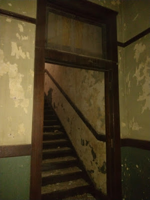
It used to continue over the railroad on a steel bridge, as you can see in the c.1921 Sanborn map below (north is to the left):

Detail from c.1921 Sanborn map. Click to enlarge.

And that is the story of why there is no more unlucky 13th Street in Detroit. 

The map also shows there used to be a tiny "concrete bridge" going from the front door of this building to join the "stone approach" of the Vermont viaduct over the railroad tunnel—which explains why the "floating" main entrance is on the second floor! I'd like to check out the vertical files in the Burton Collection to see if I can find an old photo of it, but alas...Covid.


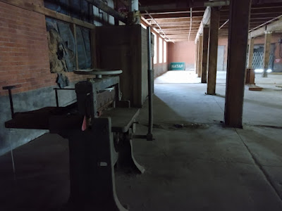
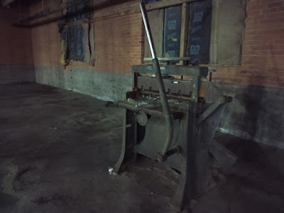
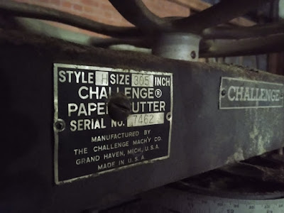
This beast was a paper cutter, undoubtedly left behind from the building's Seaman-Patrick days. In fact, it was made in Grand Haven, Michigan:


Feeble morning light filtered through the dirty window coverings and warmed the freezing interior:


Also shown on the Sanborn is an underground cistern, off the northwest corner of the building, which also appeared on the 1884 map. Howard Street used to continue east over the railroad yard as well, on a "steel trussed viaduct" which has apparently been gone for quite awhile. 


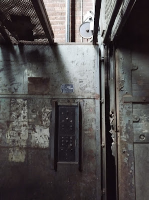
The elevator was covered with all kinds of dated graffiti about hockey and racist attempts at imitating Ebonics, which speaks to the suburban white boy demographic of who likely worked here in the late 1990s. Navi did not find the "Official Maltby Fan Club #18" as funny as I did...


I started searching newspapers.com for International Harvester and the 97 Vermont address (which seemed the most likely), and pretty soon I came up with a bunch of hits for old Free Press advertisements. All I had to do was find out the earliest reference to that company and that address together, and I might have the build date of the structure. 

The physical clues were definitely on my mind as well:


Here is an ad that references both the address and the company, from April 22, 1917:

Another from September 23, 1917:


Going back further, to March 17, 1912:

June 11, 1911:

June 5, 1910:


This was the oldest ad I could find, and trust me, it was not lost on me that the delivery truck shown was for a paper company...which made me start wondering more about the building's past use by a paper company.


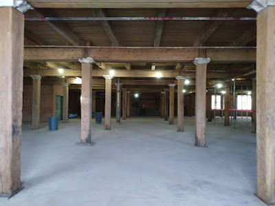
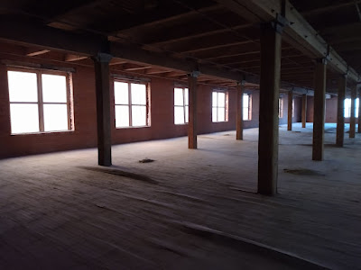
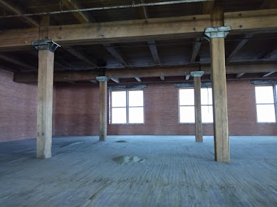
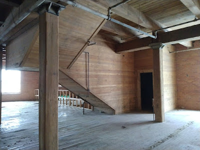
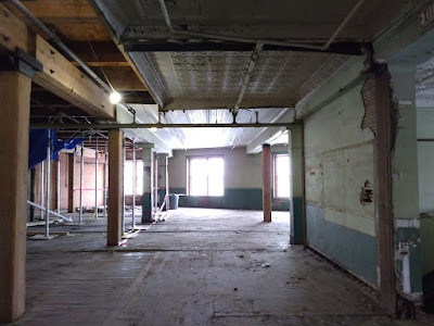
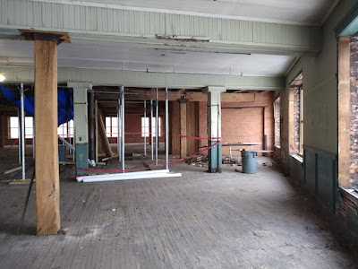
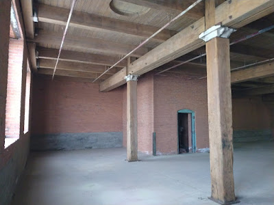
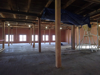
The caliber of timber used in this building impressed me...and surprised me with how good of shape it was in. You just cannot get wood like this anymore; this place is a gold mine of old-growth pine and fir.


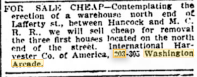
Another ad from September 5, 1906 says that International Harvester had offices downtown at 303 Washington Arcade, and a court case also refers to the same address in 1904. A May, 1910 ad listed a piano company at 303 Washington Arcade, so it stands to reason International Harvester may have moved out, and into this building by that time.

Then I came across this classified ad from February 15, 1909 that seems to indicate that International Harvester had just bought the parcel this building is standing on, and intended to build a warehouse there:


...I'm going to go ahead and assume that "Hancock" was someone's bad handwriting translation for "Howard," since Hancock does not intersect Lafferty or the Michigan Central RR...everything else lines up. It looks like we may have just pegged the date of our building between 1909 and 1910. No hits for the address 97 Vermont appeared anywhere prior to June 5, 1910, so until I can get a look at a Polk's Directory, that is as accurate as I can get. 


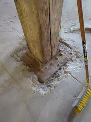
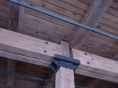
Here is a closer look at the construction...the posts are solid pine trunks about 12"x12" (maybe 16"x16" on the main floor), and the beams are doubled 8"x20" or so, supporting 8"x8" joists, and lag-bolted together. The iron collars on the posts seem to match up with the 1910s era of construction, now that I think about it:


The subfloors are 3" tongue & groove fir, given a beaded profile underneath so as to provide a pleasing appearance to the ceiling of the floor below...which I've never seen before. On top of that is a layer of 1" oak flooring.

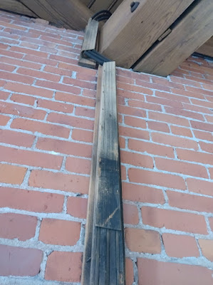
Wow, fully intact knob & tube electrical wiring, in an original wooden track:


This place is one hell of a time capsule!


Now that I've cleared up the mystery of who built this place and when, on to the later history of the building. A hit on snaccooperative.org gives a rundown of the Seaman-Patrick Company's history based on info in the Burton Historical Collection.

In Google Books I came up with a c.1911 issue of the trade journal "Walden's Stationer and Printer," which explained that the Seaman-Patrick Paper Co. of Detroit came about when the Bermingham-Seaman Co. of Chicago bought up the stock of the defunct Cousins Co. and took over the Dresskell Paper Co., both in Detroit. At the time a Mr. Robert A. Patrick was then manager of the Dresskell Co., and subsequently became president of the new company, Seaman-Patrick. George W. Seaman was vice president, and its secretary was the former secretary of the Whitaker Paper Co., while F.W. Starling acted as treasurer, another former member of the Dresskell Co. The article went on to say that the newly formed company would be looking for a new, larger headquarters. One might assume that was when this building came into the picture, but they in fact did not move in here until 1925.


Surprisingly I was unable to turn up any references to the Seaman-Patrick Co. in any of my usual tomes, such as Clarence Burton or Silas Farmer. I did manage to find a reference to Mr. Patrick however, in the c.1914 edition of the Book of Detroiters. It said that Robert Alexander Patrick was born in Detroit in 1882, married in 1912 to Mary Everson (the year after he became president of Seaman-Patrick), and had one son. The company office was located at the corner of Cass & Larned, while his residence was at 108 Gladstone (by the old numbering). Mr. Patrick enjoyed automobiling, baseball, and swimming, and was a member of the Detroit Boat Club, Detroit Athletic Club, Adcraft, and Wolverine Automobile Club. 

Imagine enjoying "automobiling"...lol. Ah, the age of innocence in Detroit! Nowadays "automobiling" is just the unpaid part of your work day called a commute, where you have time to question your reason for existence while also compiling a mental list of all the things you still have to do to keep your life from going off the rails before you're allowed to sleep so you can survive another day of toil as a piece of corporate chattel property tomorrow. But then, when you are the president of the corporate plantation, you get to operate like every day is a vacation. Sadly, Mr. Patrick died of pneumonia on February 6, 1920, at the very young age of 39.


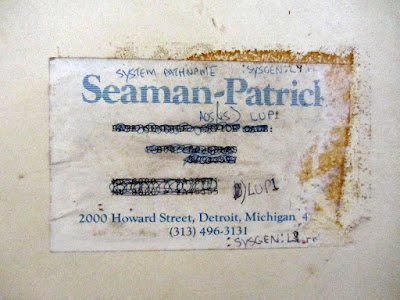
As of 2008 Seaman-Patrick still existed, operating in the old Tullar Envelope plant at 2065 W. Fort Street, which I also explored in a different post. Ironically, a 1990s-looking sticker I saw in that building showed the company's address to be 2000 Howard Street:


The earliest reference I could find to their modern 2000 Howard address was a help wanted ad in May, 1957...I would guess by the Mid-Century Modern exterior styling that it was probably built around that time.

Although gone from Detroit, Seaman Paper still exists today, and according to their website the company is a global supplier of value-added specialty lightweight papers. The company history on their website doesn't mention the Detroit connection, but it explains that the company "filled a need between the paper mills and the printers and converters," and at one point was the largest paper merchant house in the United States. In 1917 the Detroit firm changed its name to "Seaman-Patrick Paper," while the Chicago parent company renamed itself simply "Seaman Paper Co." In 1946 they bought a paper mill in Otter River, Massachusetts and relocated headquarters there from Chicago.


As I was moving around in here I was trying to mentally reconcile the evidence of long-term water damage with the surprisingly good condition of the wood framing...I guess that speaks to the rot resistance and stability properties of old-growth wood versus today's green bananas you get off the shelf at Home Despot or Blowe's.

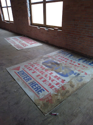
Ammex and Duty Free signs...I wonder if this place was lately used for storage by the Matty Maroun empire:


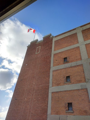
Nextdoor, Canadian and U.S. flags fluttered from the roof, indicating that this may still be the case: 


A vault? Closet...?


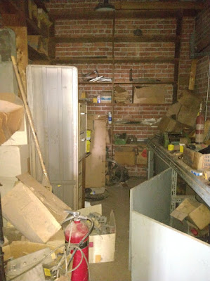
Old supplies and repair parts for forklifts:


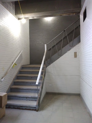
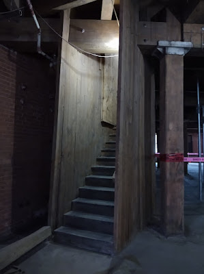
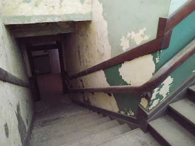
Leaving the second floor, I noticed that there was a second staircase that started here...


I had a hunch that this led up to the original company offices from the 1900s...which meant there could be some nice old decor still left behind.


Sure enough, this was where visitors entered through the "floating" front door, before ascending this nicer staircase to the offices:


Looking back down:


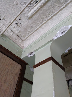
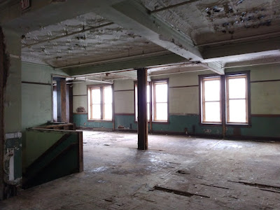
I was now in an area with coffered tin ceilings, plastered walls, a records vault, and fine oak trim.


It was clear that there had once been office dividers here at one time, and a lot of the original walls had already been removed as well. 


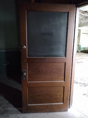
A ladies' bathroom survived, but the mens' had apparently already been axed...I had a feeling that this originally used to be an executive office however:


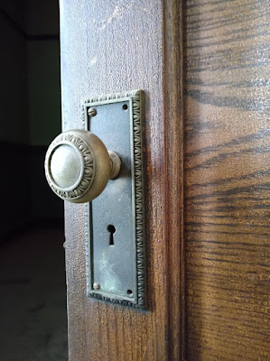
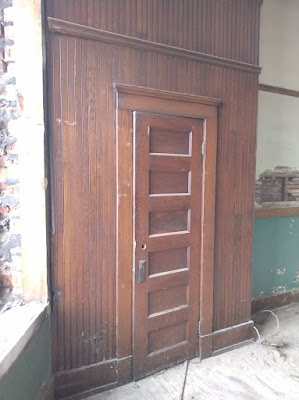
Original doorknob and original finish on the wood, all of which had somehow escaped the paintbrushes of the philistine and the infidel:


Sadly all the original wooden windows in the building had been ripped out at some point and replaced with temporary junk, but I guess it was better than boarding it up.


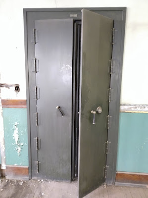
The records vault, which amazingly wasn't smashed to hell by some idiots thinking there might be gold bars left inside:


Still in very nice shape. 


I was getting the impression that despite some obvious losses, someone had intentions of preserving this office space in as close to its original condition as possible.

This next shot shows the odd dividing line between utilitarian warehouse and pretty office space, now that a hallway wall had been knocked out:


Old telephone closet...?


The beadboard was strong with this one.


The stairway is to the left in this shot:


Evidence of structural stabilization work increased as I went higher in the building...I was getting curious as to the condition of the roof, as it was clear that there had been major water damage at one point, but it nonetheless seems to have been dry in here for a long time:


Stepping into the modern section of the building was like passing through a time warp:


Looks like it used to be some modern offices in front here:


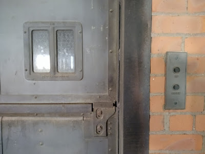
A fancy marble-trimmed elevator door here seems to confirm this:


That's Howard Street, dead-ending at the railroad cut where it used to bridge over and continue downtown:


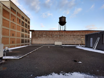
The modern section was only three stories high, so I hit the roof real quick:


I turned around and was excited to find a faded ghost of an old painted sign with a company name on it that I hadn't noticed from the ground...


You can definitely make out "International Harvester of America," something about Motor Trucks, 
and an overlap of the Seaman-Patrick name, which is also visible in the rust on the watertower.


Back inside to the more photogenic parts of the building...a round hole in the ceiling here indicates a large chimney or chute of some kind may have once been here:


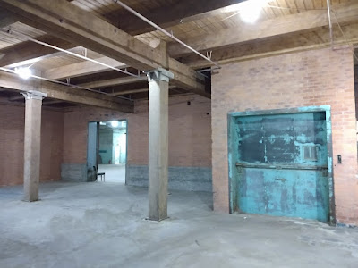
A smaller freight elevator:


Because of its parcel's irregular shape, the building took on an oddly acute angle in this corner:


A view out of a hole in a window gave a glimpse of the railroad cut running behind the building:


...as well as the mouth of the railroad tunnel to Canada:


Michigan Central Station would be to the left of that shot, and you can also see the warehouse at 1448 Wabash, which I explored in an older post

In this c.1910 photo you can see this building standing to the right of the railroad tunnel, as well as the Vermont Street bridge that used to cross over it and in front of the building:

Image stolen from local railroad guru, Peter Dudley. Click to enlarge.

...Across the top of the building you can even make out the International Harvester of America name.


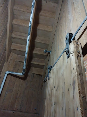
Reaching the top floor, I could see that the roof was not in good shape, but the owner had erected some elaborate leak-catching devices to funnel the runoff back out through a system of pipes to the window:


Some supports had also been installed to shore up the collapsing timbers in the worst area:


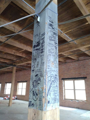
Hmmm, apparently this place had once been painted, judging by this one column that was apparently spared from the stripping process...in order to preserve some worker graffiti? Interesting:


This column had been carefully removed from the damaged area:


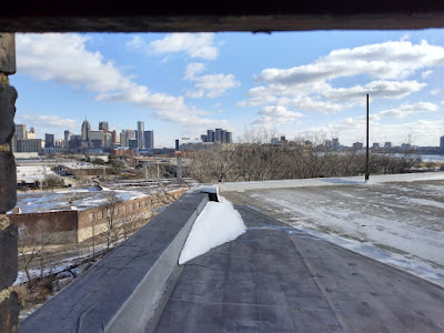
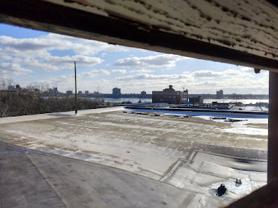
I tried going up onto the roof and maybe climbing the watertower, but the door to the outside was locked so I just shot a few from the elevator penthouse window:


There's the sinkhole...it doesn't look as bad from this side, lol:


To give you an idea of the context of this warehouse at the time that it was built, here are a few of the other businesses that were shown around it on the older Sanborn maps. To the west was Detroit Refrigerating Co., Disco Electric Mfg. Co. (electric starters), Michigan Wire Cloth Co., G&G Mfg. (auto parts), and Universal Car Loading & Distributing Co.'s general merchandise warehouse. Lichtenberg & Son grain elevator & feed mill was right on the tracks behind the cold storage. The big warehouse on the railroad cut at Fort Street was Edson-Moore & Co. Wholesale Dry Goods.


Not sure what the future holds for this beautiful old building...it's hard to tell whether it's getting better or getting worse. In Detroit it's so hard to tell sometimes which factor a historic building will succumb to first: wanton demolition or wanton gentrification. As aways, we will let the almighty dollar decide for us!


References:
Sanborn maps of Detroit, Vol. 1, Sheet 35 (1921)
Sanborn maps of Detroit, Vol. 1, (1884)
Sanborn maps of Detroit, Vol. 1, (1897)
https://www.seamanpaper.com/us/history
https://snaccooperative.org/ark:/99166/w61k5vxb
"The Book of Detroiters," 2nd Ed., 1914, by Albert Nelson Marquis
"Walden's Stationer and Printer," Volume 34, Pt. 2 (1911), p. 31
Advertisement, Detroit Free Press, April 22, 1917, p. 77
Advertisement, Detroit Free Press, September 23, 1917, p. 4
Advertisement, Detroit Free Press, June 11, 1911, p. 70
Advertisement, Detroit Free Press, Jun 5, 1910, p. 18
Classifieds, Detroit Free Press, Feb 15, 1909, p. 9