
I tried to get good taxi-window shots of the dramatic Juan Valdez-esque coffee country and El Yunque rain forest that lies between the Fajardo area and San Juan, but sadly they all came out blurry. Please suffice it to say that Puerto Rico's lush mountainous countryside is far more exquisite and scenic than I had been prepared for, especially during times of sunrise or sunset.

During the 90-minute ride we passed through rainstorms and sunny skies, and back to rainstorms. Entering the metropolis of San Juan, I wanted to get taxi-window shots of the city, sadly this is the only one that is usable:

Yep, an abandoned(?) building with graffiti on it.
The taxi dropped me off in Old San Juan, near one of the forts. My first order of business was to find the Hotel Milano, which I had read in my guidebook was among the quality budget places of lodging, plus it was described as being in a "renovated warehouse," so I was expecting something interesting in an industrial area near the port.

By following the addresses however, I was quickly seeing that this was not the case, and that the Hotel Milano was among the more attractive "warehouses" I had ever seen before. It's the taller one with the big windows in this next photo:

The address was 307 Calle Fortaleza. For $110 I decided that I had indeed found the cheapest lodgings in touristy Old San Juan that did not involve piss-scented hard concrete. There was even a rooftop restaurant / bar, which I made immediate use of:


I noticed that one of the taps in this bar had a picture of the iconic Puerto Rican-style lighthouse on it, so I ordered one of those, even though it was an IPA. It was actually pretty damn good. For Navi's reference, it was Boquerón Brewing Co.

After finishing my beer and "savouring" this rooftop view, my plan was to wander the streets here and maybe check out one of the two main castillos (castles) that protected the fortified "old city."

If I felt like I was in a foreign country on Vieques before, I definitely felt like I was back in Europe here. But no, this was still technically 'Murca.

Total flashbacks to my time walking around in Spain, Italy, and France.

I followed Calle Fortaleza to its end at the city walls.

Here is a view from the actual "fortaleza" looking toward the port...you can see one or two of the big cruise ships docked:

One of the many sentry turrets (garitas) that ring the old city's walls:

Some of these buildings appeared to be abandoned, or at least heavily decayed:

The streets here were something else; they were paved with a really strange type of hard ceramic brick that had a glossy, glazed(?) bluish finish. I think I have a better picture later. I also think I saw the same material used as roof tiles on a church?

I was sort of making my way westward toward the Castillo del Morro, which guarded the harbor entry.

Umm, I stopped suddenly when in an unexpected gap between two buildings I saw an abandoned courtyard guarded by cats:

This intersection marked the western gateway to the city's outer walls:

The National Park Service has turned the outer walkway into a park, sort of like the Parco delle Mura ("Park of the Walls") I had hiked in Genova, Italy.

The sign below says "Please Pardon Our Appearance," and goes on to talk about the ongoing hurricane cleanup.

There were sections of the walls that were covered in scaffolding and were being cleaned and restored, although I think that may have been independent of the Maria situation.

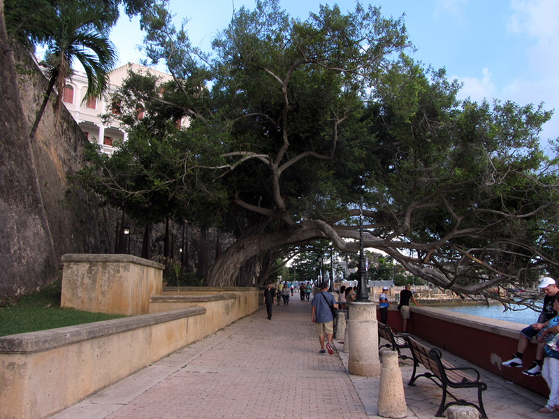
A row of magnificent old trees, arching completely over the sidewalk:
Looking back at the gate:

So apparently feral cats guard this castle now, and they are everywhere. And there is an organization that cares for them, and leaves food out for them.

Still working my way around this huge walled city:

This place was every bit as magnificent as Luxembourg, or the many other old fortifications I explored in Europe.

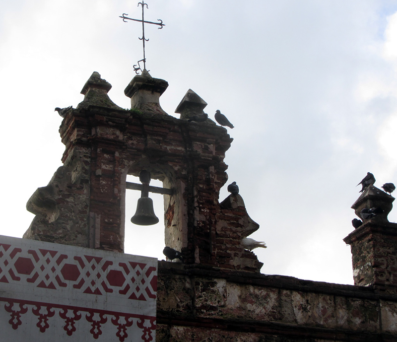
Apparently it is the licking hour at the castillo...


Finally, I reached the western tip of the old city, at the mouth of the harbor. The main fortress, El Morro, was above me.

A view across the harbor entrance, to show the opposite peninsula, Palo Seco, being pounded by surf:

The structure you see over there is actually the ruins of an old leper colony, something I had considered putting on my itinerary, but which I would not have time to get over to.

Time to find a way back up. I was getting hungry.

Oh, but first, a side trail...

Even though I was already getting hip-sore again from walking so much, this diversion was worth it for the views...

This part of town on the beach below the walls, is called La Perla:

It is considered the "ghetto" of Old San Juan, and is sort of kept hidden from the tourist track. I will talk more about that in the next episode.

Oh hey, the old cemetery:

A couple shattered, discarded headstones, at what used to be an old entrance:

Somehow I had come up on the rear of the old graveyard of San Juan. It is open to the public, but the entrance is on the city-side...which due to being located outside the city walls is accessed through a tunnel, now that I read more about it.

It is named Cementerio Santa María Magdalena de Pazzis, and its burials date from 1845 to 1884. Which surprises me since San Juan itself dates back to 1508 AD, when Spanish explorer Juan Ponce de León founded the first white settlement here.

The construction of San Juan's fortifications began in 1533. They were built to repel not only European rivals, but also the native Taino people, who were apparently mad about something.

Oh shit, another lighthouse? And part of a fort?! Navi's gonna shit when I get up in this one tomorrow...

Brittanica.com says that in the early 16th century San Juan was the point of departure for Spanish expeditions to unknown parts of the New World. Its fortifications repulsed the English navigator Sir Francis Drake in 1595 as well as later attackers, but George Clifford, 3rd earl of Cumberland, captured it briefly in 1598, and a Dutch force took the city from the landward side in 1625.

In response, the fortress of San Cristóbal, the largest Spanish fort in the New World, was built to the northeast, and, from 1634 to 1638, walls were erected across the southern part of the city, facing the harbour. The bastions existing today were largely added during the period 1765-83. In May 1898 the guns of San Cristóbal engaged a U.S. fleet that bombarded the city. Puerto Rico became a U.S. territory under the terms of the Treaty of Paris that same year.

San Juan National Historic Site, established in 1949, includes the El Morro and San Cristóbal fortifications; this area, along with La Fortaleza, was designated a UNESCO World Heritage site in 1983.
Fortwiki.com has some good aerial photos of El Morro.

This is the entrance to the Castillo San Felipe del Morro, also known as El Morro for short. I didn't have time for a full explore tonight, but tomorrow I should have enough time to do it and San Cristóbal before having to get to the airport. I went in the front gate for a quick look, but a National Parks ranger told me that they were just closing for the night, and would reopen tomorrow at 9am.

I was surprised at how many people were out and about here on the grounds of the historic fort...both tourists and locals alike. If only Fort Wayne back home held such appeal. As I made my way back down the parade grounds behind the fort and into the town, I saw this two-masted sailing vessel passing a catamaran in front of what looked like the fort's primary magazine, and a perfect little palm tree:

With the brutal sun finally gone, and the constant sea-breeze now sweeping across the parade grounds from the Atlantic, I could finally say that the weather here was heavenly (aside from the fact that it was still crushingly humid).

It started sprinkling rain on me again too.

While walking around Old San Juan during my two days here, I sometimes spotted a church whose facade was covered as if repair work was being done. Sadly I never quite managed to get over to it; it was the San José Church, begun in 1532, which is the oldest continuously used church in the Western Hemisphere. It is currently listed by the National Historic Trust as one of its 11 Most Endangered Sites.

I did however manage to pop into the Catedral de San Juan Bautista, since its doors were open just now. It seemed that maybe a wedding or something had just broken up, and some people were snapping pictures inside, so I joined them. In case you're wondering what denomination the church is, I'm pretty sure that Puerto Rico is 110% Catholic.

This is San Juan’s cathedral, begun in 1521, rebuilt in 1540, and again in 1802. The Spanish conquistador Ponce de León is buried in here. I wish I would have known that at the time; I would have looked around more. You may remember Ponce de León from 5th Grade social studies class as the guy who "discovered" the Gulf Stream, founded St. Augustine, Florida, gave Florida its name, sailed with Christopher Columbus, and searched the world for the Fountain of Youth (plus gold).

San Juan reminded me so much of the cities of Europe that I visited back in 2012, and it was just as old.

Time for sleep.

I woke at dawn again, and hit the streets before most people were out and about. First order of business was hitting the ATM:

The other major fort in San Juan is the Castillo de San Cristóbal, which is sort of on the opposite end of the old city from El Morro. In my early morning walking in search of the first place to open with food and coffee, I decided to stroll up from the ATM to this outer part of Castillo de San Cristóbal.

It didn't open to the public until 9am either, so I spent some time checking out its outer works while I waited. This is the other end of the old city wall that encircled Old San Juan, which I walked most of at dusk yesterday:

This looked like a World War era addition:

This is El Capitolio, in other words the territorial capitol building of Puerto Rico, viewed from the eastern works of Castillo de San Cristóbal:

I was getting hungry, and hopefully now some places would be open for a quick breakfast.

Some street (alley) art:

I found a park somewhere with one of those permanent kiosks (probably built around 1900, judging by the florid architectural decor), where a vendor sold coffee and sandwiches. Again I wasn't really sure what I was ordering, but it was delish. In fact I had to go back for a second café cortado, since it was so good. I had actually been going pretty lean on my usual coffee and beer intake levels during this trip.

I sipped the cortado while walking over to the Capilla del Santo Christo de la Salud, a chapel dating to the 1750s, which according to legend was erected after a miracle occurred at this site.

The story goes that back in the 1700s horse races were conducted on this street, Calle del Christo (so named because it passes in front of the cathedral I saw last night). During one of these races in the 1750s, a young man was unable to stop his horse in time and plummeted off the cliff. Don Tomás Mateo Prats (a local government official) supposedly saw this and invoked Santo Christo de la Salud, and the young man was saved from death, so the chapel was built here in honor of that saint.
A more practical version of the story says that Don Tomás Mateo Prats ordered the chapel built in order to keep horses from being able to run straight off the cliff. Furthermore, a local historian has supposedly confirmed through research that the man who fell did in fact die, and was not saved by saintly intervention.

A side view of the chapel, and you can see the tile streetsign on the other building which names the cross-street, Calle de Tetuan:

There are no architecturally vulgar things such as conventional streetsigns to be found in Old San Juan.

Since 9am was still a ways away, I had time to kill while waiting for the forts to open. I walked the same path along the city walls that I had followed last evening, but this time I stayed on top of the parapet level instead of being down below.
A full-zoom view of another small fortification on the opposite peninsula of the harbor entrance:

Again, that is Palo Seco, where I mentioned the ruins of the old leper colony were. The Bacardi distillery is located over there too.

One of my big disappointments over my logistical screw-ups on Vieques was that because I didn't follow my original plan of biking out along the northern road of the island, I did not get to see the old landmark Ceiba tree by Mosquito Pier. It is a monstrous thing, estimated to be almost 400 years old, and its species is believed to have been viewed as sacred by the indigenous Taino people. This link shows some pictures of the tree: vieques.com/vieques-attractions-ceiba-tree/

Thankfully, I was just now finding out that there are some majestic old-growth trees here next to El Morro...this is not a Ceiba tree, but it is one of the largest of this type of tree that I saw during my trip:

It is hard to tell if these things are a tree or a bush, or...?

Across from it, another elder tree, of another species unfamiliar to me...with a crown probably 60ft across:

I think this is the same species as the super-massive one that I saw along my hike to the sugar mill ruins on Vieques.

And yet a third example of the more unique native trees that I had been seeing in Puerto Rico:

I was glad to be finally getting some decent pictures of these unusual trees I had been seeing around; how convenient to have them all grouped together like this. If only there were a Ceiba tree to complete the set.
Oh, hello...

And now we have our complete set! A playground had been built in the shade of a Ceiba grove here, and you can see a swing-set in that photo above to get an idea of scale.

As a matter of fact, this grove was right behind the small building occupied by the feral cat nonprofit (or whatever it is) that looks after the swarms of cats that guard El Morro. By the way, Ceiba is pronounced "say-EE-bah."

And there is the rear flank of the El Morro itself:

It took a while to cross the vast parade ground, and naturally I had some thoughts on mowing this grass during my walk, but I will spare you from such torture.

Overlooking the cemetery again, from one of the garitas, or sentry turrets:

North, into the Atlantic Ocean:

The blobs on my lens indicate it was probably half-raining again. Oh hey, there's that fairy-tale lighthouse again:

Down below some weird little tiny ruined building sat perched above the roiling surf:

And now to finally enter Castillo San Felipe del Morro:

For $7 I was able to enter both El Morro, and Castillo de San Cristóbal on the other side of town just by showing my receipt, which I planned on doing later. Both are operated by the National Park Service.

This was the central interior plaza. The flags of the Spanish Empire, Puerto Rico, and the U.S. were hoisted:

Hey, let's go check out that shimmering lighthouse first!

The Faro de Morro was the first lighthouse (faro) anywhere in Puerto Rico, erected here at El Morro in 1846, although it was located on a different bastion of the fort at that time. It was replaced in 1876, but was knocked out of service by American naval shells during the Battle of San Juan in 1898.

The light we see today was built in 1908...why the Lighthouse Board was in such a good mood when they appropriated funds for building this fancy little fairy-tale tower is not a mystery that lighthousefriends.com seems willing to unravel.

Originally outfitted with a 3rd-order Fresnel lens, it was actuated by a counterweighted clockwork mechanism before being mechanized in 1932. A keeper's dwelling was added in 1920, but I assume that is now gone, probably demolished after 1962 when the light was fully automated.

You can see some WWII-era fire-control observation posts grafted right onto the ancient walls of the fort.

I was more than a little disappointed to see that the door to the lighthouse tower was in fact closed and locked, with no indications that it would be opened anytime soon.

Dammit, this is one of the coolest lighthouses I've ever seen, too.

Again we have the ruins of the leper colony on Isla del Cabra...can you tell I really wanted to get over there?

It was built in 1876 and closed in 1926. Here is someone's photo of it on: flickr.com.
The mini fort nearby is Fortín San Juan de la Cruz (aka, El Cañuelo), built in 1670 by the Spaniards:

There is another mini fort on the eastern end of town, the Fortín de San Gerónimo de Boquerón, but I wouldn't have time to see it either.

Deciding that it was time to answer the call of nature, I located a restroom. This is probably the most creative use of a former artillery casemate I've ever seen:

So just in case you inexplicably forgot all of my ravings on the nomenclature of historic fortifications from six years ago, a casemate is a chamber where a cannon is fired from an aperture in the outer wall. And this one has a particularly nice view:

More casemates...

I think this room was described by the sign as having been used as a jail:

It was handy that all of the signage was in both Spanish and English.

And now a descent to a lower battery level.

No, skateboarding and BMXing are not allowed. Navi.

Looking back up at the level I just came from:

This is the foremost bastion, which guards the pointy tip of the peninsula...

There are so many arches in this place—not for style, but because structural steel didn't exist yet:

I ducked out of the sprinkling rain into a really old stair to go back up to a different level:

These are carriage tracks for swiveling, pintle-mounted cannon:

Now descending into the heart of the forward bastion, to the oldest part of the fort...

Stairs led down into a round, dungeon-like room that actually used to be a lookout tower, built on the cliff overlooking the harbor entrance before the rest of the fort was built.

So in other words, this room was built in like 1539. This diagram in the next photo shows how the existing fort was built right over it in the 1700s...could you imagine the army today updating an existing facility by incorporating an existing 200-year-old structure?


Here was another one of those constantly threatening hot rain showers...

...here one second, gone the next, doubling the already intolerable humidity every time.

This was a kitchen area:


More arches...


CLICK HERE FOR THE FINAL EPISODE
No comments:
Post a Comment
Note: Only a member of this blog may post a comment.