Maheras Mystery Tunnel

November, 2011.

Once for work I was sent to the private security-gated section of Grayhaven Island. The part where you can only reach it by dialing a number of the resident who you are trying to visit into the kiosk, and they have to buzz you in for the gate to open. While I was there I noticed what looked to be ruins of old moorings hidden in woods on the other side of the canal, so I made a mental note to check that out at some point when the leaves had fallen.

I also neglected to take a photo of the front of the former "Purple Gang house" there at 450 Keelson, so a few months later I decided that if I went to Maheras-Gentry Park on the other side of the canal from Grayhaven Island, and went into the woods there, I might be able to get a decent shot of the rear of the house.


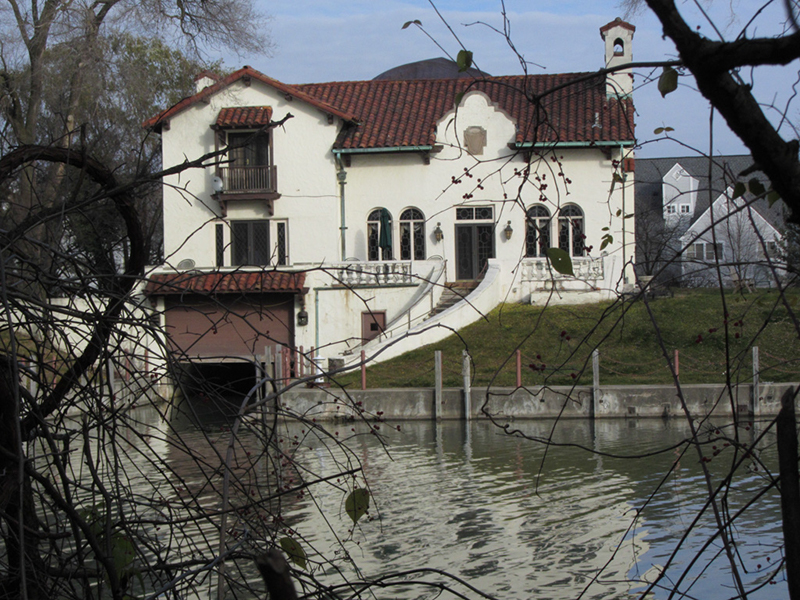
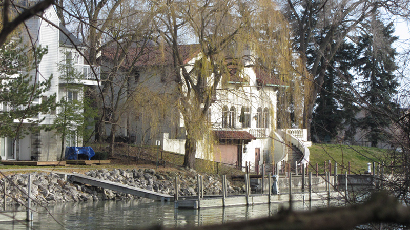
As you can see there is a boat-well that leads right up into the house on this private island, which I'm sure came in pretty handy during Prohibition. The mansion was rumored to be designed by renowned theater architect C. Howard Crane in 1929, though I doubt that is correct. According to a website, this was a "haunted mansion with a basement that was formerly used as a sex dungeon," as featured on a December 2009 episode of the TV show Paranormal State. The link also however claims the mansion was built in 1925 by the Dossin family (who to my knowledge were not affiliated with the Purple Gang). A swingers club did operate in the house in recent years, but I don't know about a "sex dungeon."

Today the house is a rentable event space questionably called "Pirate's Cove," with a website that disagrees slightly, saying the house was built by Walter Sheetz, president of R.C. Mahon Steel Co. and sold almost immediately to Walter Dossin. According to another website, Ernest Dossin started Dossin's Food Products in 1898, out of a horse drawn cart. He expanded through the years to include other food products, and by the 1930s Dossin's Food received the bottling and distribution franchise from Pepsi-Cola for Michigan and northern Ohio. By the 1940s brothers Walter, Roy and Russell Dossin owned and raced four Gold Cup class speedboats to boost advertising for their business. All this would explain why the speedboat seen on display at the Dossin Great Lakes Museum on Belle Isle is called the Miss Pepsi. Walter Dossin and his family were deeply interested in Great Lakes Maritime History and donated the funds to create what is now the museum that bears their name.

According to the description on the Pirate's Cove facebook, the Dossin house was sold again in 1942 to Hans Aichler, a German immigrant who lived there until 1996 "and supposedly still haunts the premises." So there doesn't seem to have really been any Purple Gang history behind 450 Keelson, I think that was just something whipped up by a real estate website in order to help the house sell. Perhaps they should have went with "haunted by an ex-Nazi," but that's probably not as desirable a selling point as "used by Jewish mobsters."

One of the theories as to why the house is allegedly haunted relates to the fact that the Fox Creek Massacre occurred near here in 1712, though the Fox Creek sits at least 12 blocks east of Gray Haven. After the Fox tribe attacked Fort Pontchartrain in order to secure a British alliance, the French defenders pursued the Fox all the way to what is now Grosse Pointe, where the battle took place.

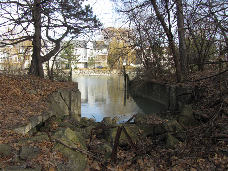
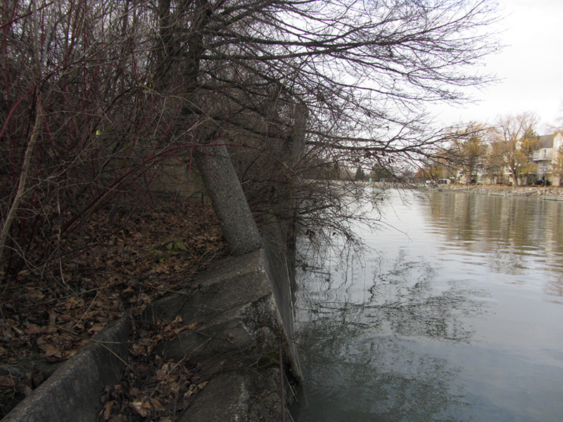
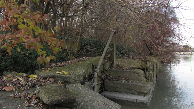
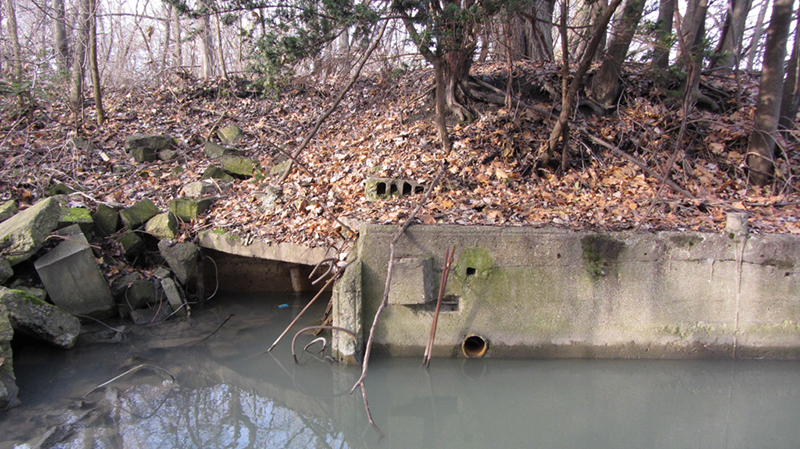
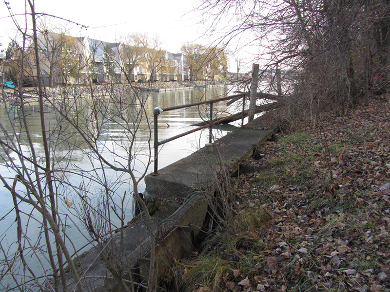
So anyway I got my photos of the Dossin house, but while I was there poking around in those woods I found some other very interesting things. There had clearly been other houses here on this side of the canal at one time, as illustrated by the presence of this ruined boat slip:


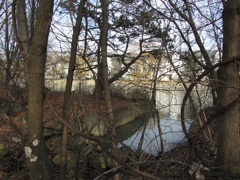
So naturally I took some more time and began poking around in the vicinity to see if I could uncover any other ruins or clues as to what used to be here.


Grayhaven Island, which was part of the Gray Haven real estate development, was named after one of Henry Ford's lieutenants, engineer Edward Gray. Gray is credited with helping Albert Kahn design the world-famous Highland Park Model-T Plant to accommodate a moving assembly-line, according to Henry Ford's needs and specifications.

According to a user on Flickr who claimed his grandfather worked for Gar Wood, Ed Gray left Ford to go into real estate and conceived the Gray Haven idea in the late 1920s. By 1931, Gray "had attracted the attention" of three prominent Detroiters who all built large homes in Ed Gray's development: Lawrence Fisher, of Fisher Body fame; William Koerber, a Prohibition era brewer; and Gar Wood, whose speed boats not only won races but "made the rum-runners happy." But as usual the Great Depression intervened, putting the grand Gray Haven vision on indefinite hold (I wrote of Gar Wood's famous exploits on the Detroit River in another post).

Eight other smaller homes were built on the island, and on the mainland along the Port Lagoon. "But Gray's dream did not come to fruition during his lifetime," since he died in 1939 "his widow had to let the remaining vacant lots revert to the city for nonpayment of taxes."


Someone's landing:


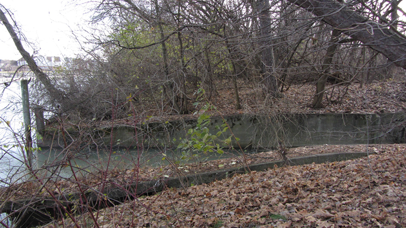
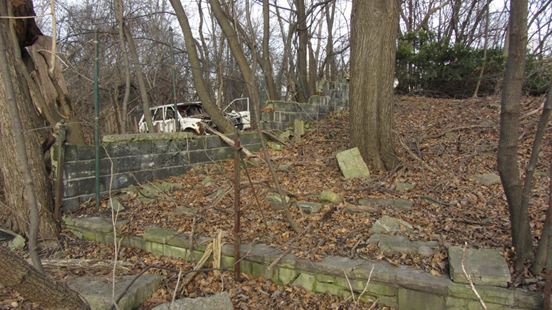
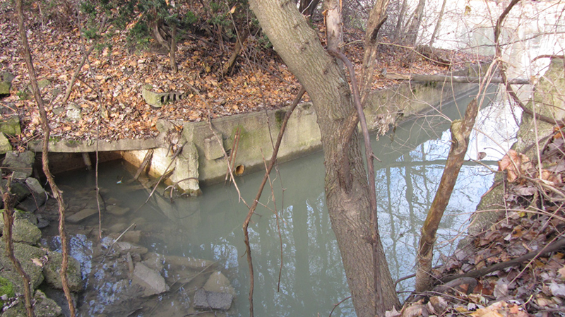
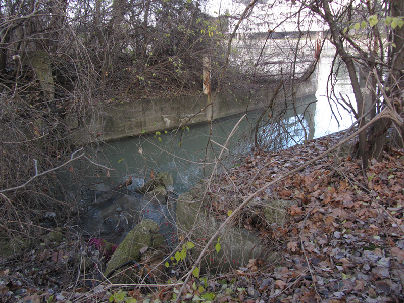
This stone wall was intriguing:
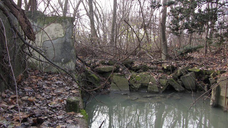

Another slip:


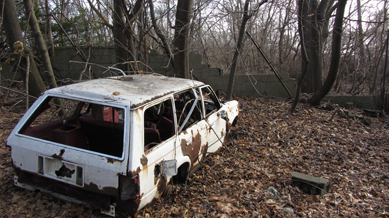
A wrecked...Escort wagon?


Anyway, a quick historical note on the park itself; it was originally named Algonquin Park in 1928, then renamed after Peter Maheras, one of the first Detroiters to die in combat in WWII. The "Gentry" part of the name was added in 2002, after an African-American resident who lived nearby since the 1950s and championed this neighborhood and its residents' right to have a decent park and rec center in their neighborhood, at a time when the city was known for allocating recreation funds mostly to white neighborhoods. Bronson Gentry was a janitor by trade, but also became a national horseshoe-pitching champion.

In the 1990s when city government was looking to turn this part of the riverfront into new developments catering to affluence in an effort to lure white residents back the city, Bronson Gentry again fought to preserve the park he had fought for in the '50s. Mr. Gentry died in 2003, one year after the park was named after him.


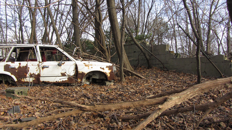
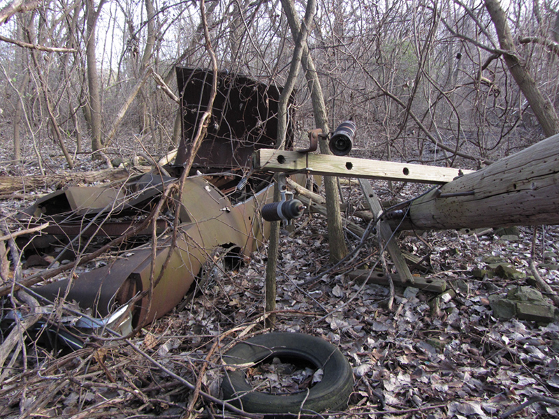
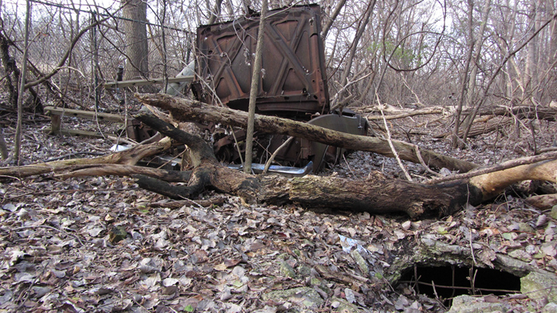
Apparently at some point the place found a secondary use as a spot to dump unwanted cars.

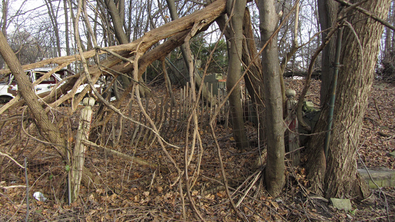
Nearby, obscured in the tangle of brush were two fading old wooden fenceposts, with wire fencing strung between them:


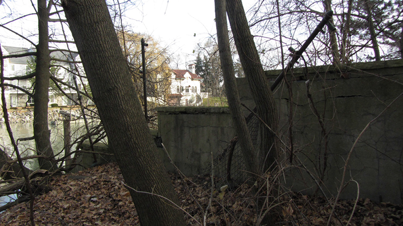
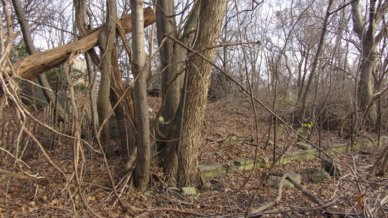
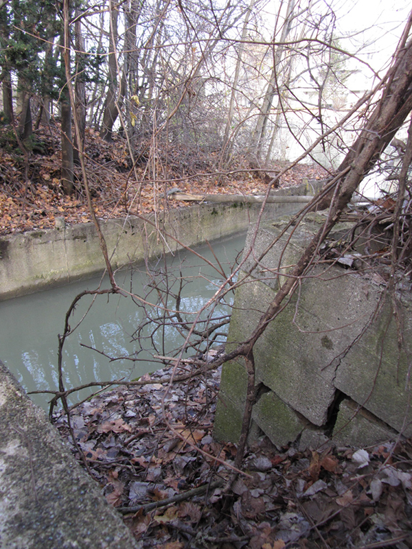
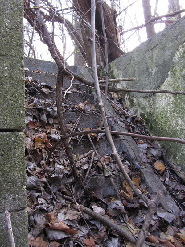
More wall foundations nearby:


It looked as if there had once been a whole neighborhood here--a street lined with houses--but they had all apparently been torn down simultaneously at some point, and the street completely covered by leaves and soil. 

The north-south street that would have come through here was Kitchener Street, but the end of it seemed to have been blocked off and abandoned when this land near the waterfront became Maheras-Gentry Park?


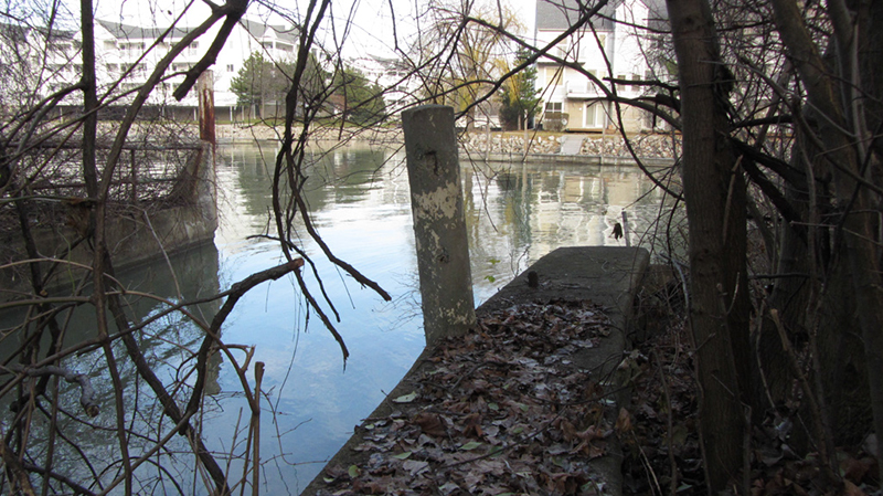
Another boat landing:


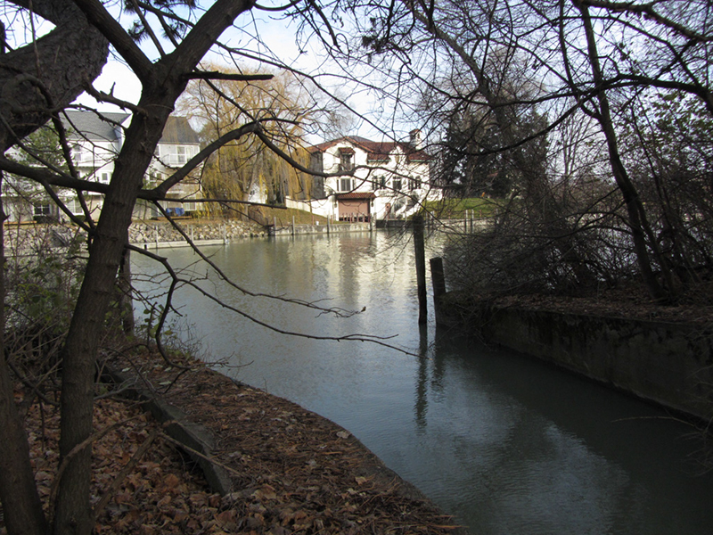
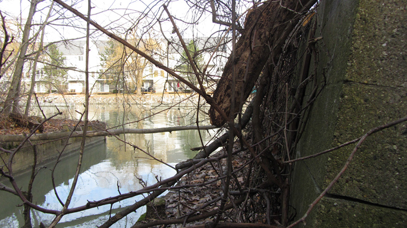
I didn't own a boat yet, but this area seemed like a good place to investigate while afloat. Greyhaven Island and the Dossin house again:


This slip came in rather far:


An old staircase hidden under the fallen leaves of many autumns lay nearby:


I wonder if this slip too used to have a house built over top of it...


If that was the case, it was probably a long time ago judging by the thickness of some of these trees:


Steep staircase:


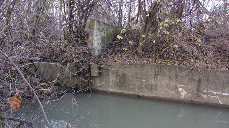
Yet another fancy concrete seawall:


And another slip...


As I started making my way back to the trail leading out of the woods, a 1980s-vintage Buick Riviera appeared, that was rusting into the ground:


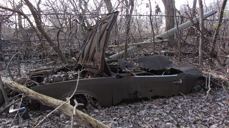
I used to drive one of these beasts when I was in college, which I had nicknamed the Bebop. Mechanically it was a piece of shit, but the interior and the ride quality were superb...it was like riding around in a casino cruise ship.


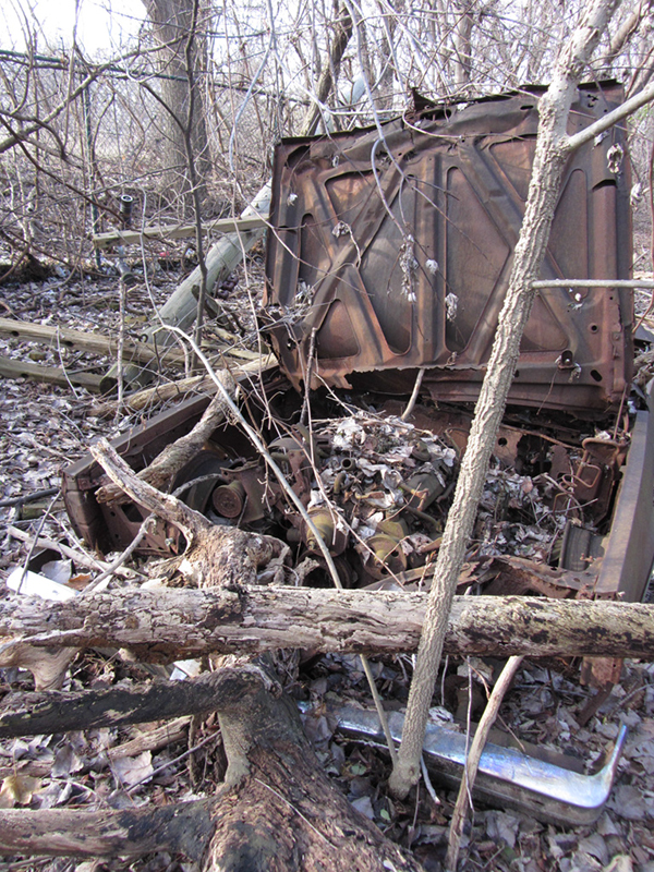
This ocean liner still had its 307ci Oldsmobile V8 engine intact, though the hood had been ripped open like a sardine tin, while the roof had been crushed-in like a tree might have fallen on it at some point.

A broken-off Edison pole lay on the ground nearby:


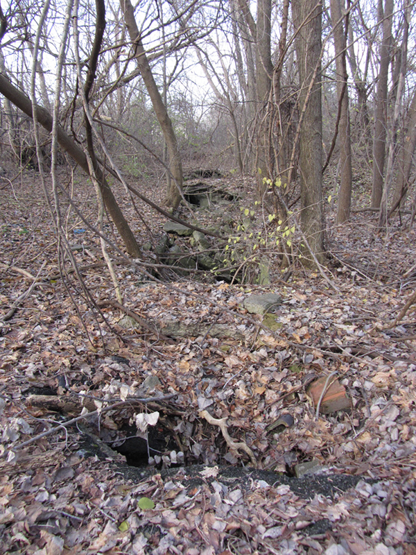
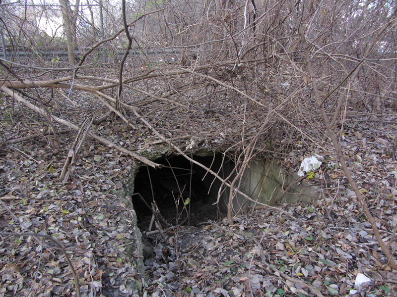
More curious was the presence of this odd hole in the ground (lower right):


A minute later, I noticed something even stranger...the hole lined up with a whole series of other collapsed sections of the ground, which seemed to imply the presence of...a tunnel?


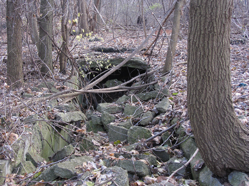
Being a westsider, my knowledge of what used to be in this part of town is fairly limited, so I can only guess as to what kind of tunnel might've been needed here. With building excitement, I quickly followed this trench along the forest floor to see if there was anywhere with a big enough hole for me to look inside.

It wasn't long before I found an opening big enough to squeeze into.


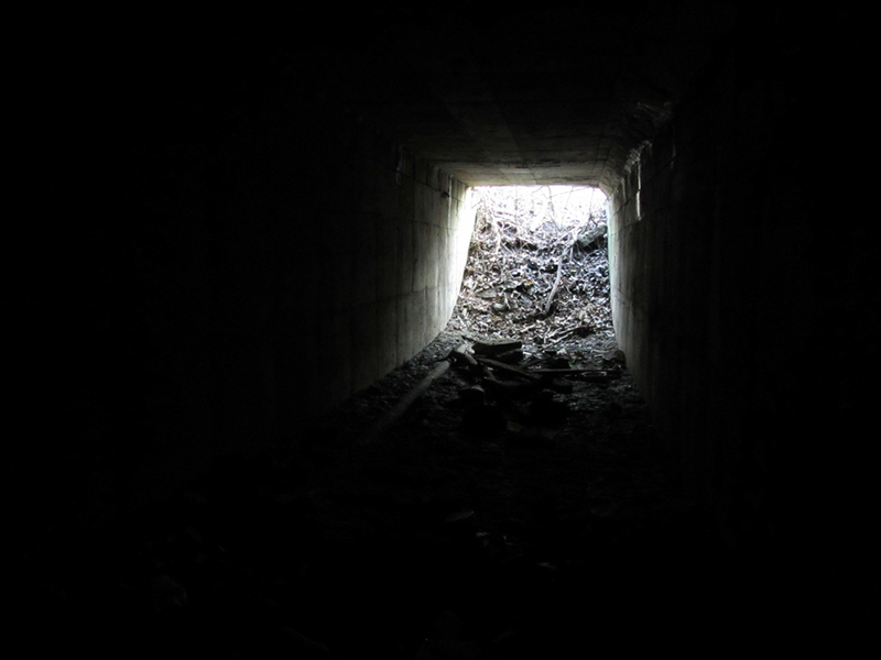
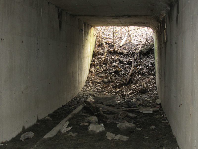
Now this is a trip...


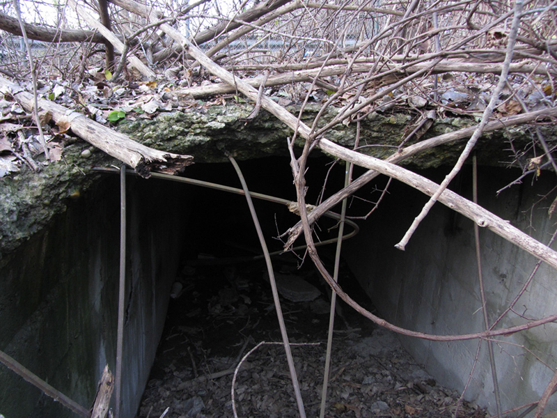
This section only ran about 30 feet before another cave-in blocked the way:


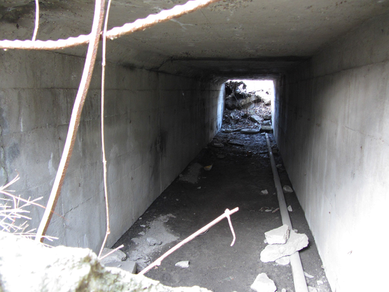
However another opening presented itself further up:


It appeared to continue running north up into the neighborhood, perfectly in line with the foot of Kitchener Street. This section of tunnel also seemed to run about at least 30 feet, but I couldn't see the end of it, so I went in.

Looking back toward the entrance:


I needed to light it up with a flash to see what I was looking at:


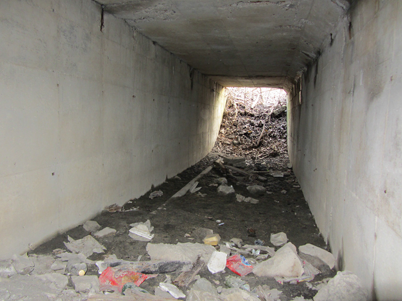
Naturally I was all too eager to ascribe this tunnel's existence to some Purple Gang-type Prohibition Era smugglery, since it seemed to give access to the Detroit River, but I clearly would need to do more research to see what used to be here on this piece of land. The tunnel's poured concrete construction looked like it could plausibly have been poured as early as the 1920s, but a more mid-century date seemed likely. It didn't seem quite weathered enough to be that old.

The end of the tunnel looked like it made a 90-degree turn to the right, but it also looked like it had once continued straight ahead but had been walled-off or oddly patched at some point:


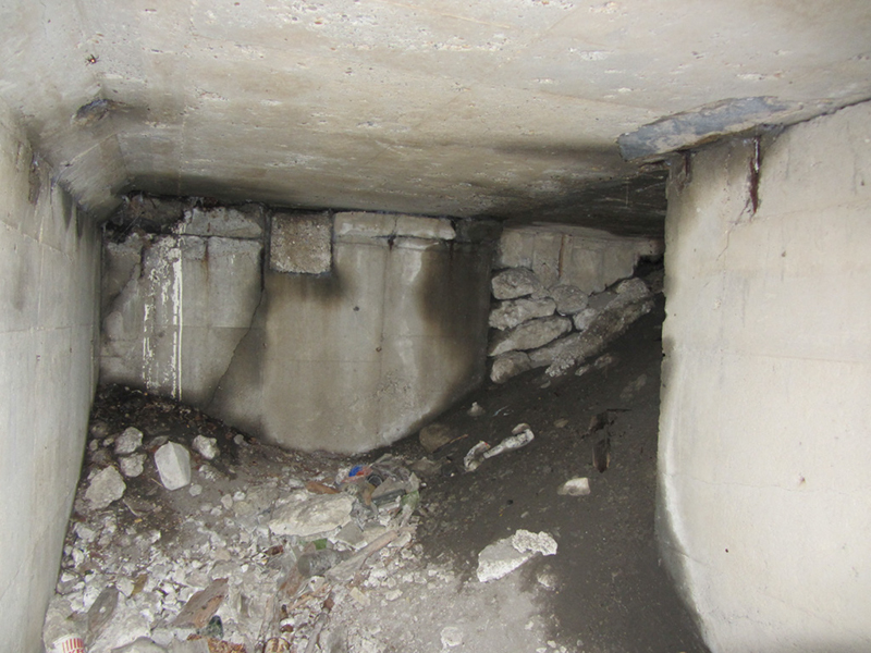
At any rate I could go no further, so I turned back.

There did not seem to be any brackets or anything that I noticed that would suggest that this was a steam or utility tunnel; this seemed to be a pedestrian tunnel. But for what purpose? There was a small pipe on the floor:


This called for more research. As soon as I got home, I got on Google Earth and looked at the area from above to see if any outlines might present themselves, but the tree cover was just too thick:

Click for full size.
But a look at HistoricAerials.com provides us with imagery from 1973, which shows Kitchener Street definitely extending down past where it dead-ends today, and there are indeed what look like houses along it:

Click for full size.
Very fascinating.

I decided that since the internet was of little help, a look at Sanborn Maps might be a good idea since they usually show any existing tunnels, so I headed to the Detroit Public Library. The Sanborn Map for Detroit, Vol. 11, circa-1916, Sheet 24 shows nothing but undeveloped land; also, Kitchener was named Tennyson Street at that time.

The Sanborn Map for Detroit, Vol. 11, circa-1929, Sheet 93 shows a street here named "Port Drive" (not Kitchener), going all the way to the riverfront with a cul-de-sac at the south end, shown with subdivided lots all along its east side, but nothing along the west side of the street. 

Click for full size.
There are five lots with homes built on them, plus one home built on the cul-de-sac, across from what appears to be the former Gar Wood Mansion. The lots appear to have been part of the Gray Haven development. No tunnel is shown, but there is a canal seen extending up into what is now Maheras-Gentry Park. Unfortunately, 1916 and 1929 were the only maps available. 

I also did more searching online. A self-proclaimed Gray Haven historian, posting on the DetroitYes forum under the name Sumas, asserts that Gray Haven began long before Prohibition, in 1913. However, the c.1916 Sanborn map of the area shows there to be no development in that area yet (though the process of dredging and filling could have been underway). Furthermore, Ed Gray was most likely still very busy as an engineer for Ford Motor Co. at that time. Sumas also states that there were no speakeasies there, and no history of rum-running, "although the well to do enjoyed access to the river, to provide for their personal cellars."

William Koerber built his house at the end of Port Drive in 1925, facing the Detroit River across the canal from Gar Wood's mansion on Grayhaven Island. According to the "Pirate's Cove" website, the Koerber family came from Ionia, Michigan, where they founded the Michigan Brewing Company in 1912. The Koerber family closed their Ionia brewery during Prohibition and instead used their trucks to ship what they called "near-beer" from Toledo in order to stay in business, at which time they presumably took up residence here in Detroit. That's where the Purple Gang connection seems to come in; allegedly, according to this version of the story, the Purples saw them as competition, so the Koerbers closed up shop in 1923.

A person claiming to be a descendant of the Koerbers said that the house had an indoor boat well just like the Fisher Mansion, and his grandmother told him stories of the family brewery and how there was "a false wall inside the boat house" that was used to hide booze smuggled from Canada. "I walked through the home when it was still standing back in '80-'81 and sure enough the false wall and hidden room was still there." The point where the Koerber mansion used to stand has been completely reconstructed, and no trace of the Gray Haven past remains there today.

Online I unexpectedly dug up the text of an old brochure by the Government Printing Office from 1985, Know Your Riverfront Parks, A Historical and Informational Brochure. It said that at the conclusion of World War II, temporary housing for returning veterans was built on Maheras Park, and remained there until the early 1950s. Additionally, from 1953 to 1969, Maheras was used as a Nike Missile site. Very interesting; most people know about the Nike site on Belle Isle, but this was a new one on me. "Today, Maheras has no remaining military vestiges," it says.

Nonetheless I decided to make another trip to Maheras-Gentry to take a second look, and explore the southern end of the woods where I didn't go on my first visit. I didn't really find much except more dumped cars:


Late-1970s Cadillac:


Some other modern piece of crap:


As far as I could tell, no traces of any more tunnel could be seen down this way, but perhaps it just hasn't collapsed yet? I didn't go check on the stuff I saw last time in the northern end, because the mosquitoes were just going batshit crazy on me.

I did happen to see this odd barren concrete open area in the trees:


According to a website that specializes in the history of the Nike-Hercules missile system, the installation here at Maheras was classified as D-26 IFC Area, and included several structures. The "IFC" stands for Integrated Fire Control, which means that this (along with nearby D-23 IFC at Alfred Brush Ford Park) was the control site for the missile batteries that were located on the eastern tip of Belle Isle, just across the river.

It is not clear on the blueprints or aerial photos provided that there was a tunnel however, but it also looks like most of the military buildings were down closer to the river anyway. I have also explored the much more intact Nike missile base in Newport, Michigan

UPDATE:
One of my readers, "prentz," brought to my attention a new piece of evidence that may lend explanation to the mystery tunnel I found. The Detroit Public Library's Burton Historical Collection holds the architectural drawing for the Edward Gray residence at the foot of Continental Street (which is the next street east of Kitchener/Port Drive), and it shows what is labeled as a "Service Tunnel" off to the side, which held utilities such as electric, telephone, and steam heating mains. Below is a zoom detail from the photo, but you can also view the whole drawing on the DPL's website

Burton Historical Collection
Did this tunnel near Continental Street also continue on down Port Drive to the other houses in the Gray Haven development? If so, it would have existed in the 1920s, and could indeed have plausibly been "used" for certain "activities" during the Prohibition era. I also recently dug up a historic image showing this area of Gray Haven, in the Manning Brothers Photographic Collection:

Manning Brothers Photographic Collection


References:
Sanborn Map, Detroit Vol. 11, 1916, Sheet 24
Sanborn Map, Detroit Vol. 11, 1929, Sheet 93

Ultima Thule, Pt. 11: “Man on the Silver Mountain”

June, 2011.

RETURN to part 10

The reflection on the hood of my car was that of a thick leafy canopy rapidly passing overhead as I nosed headlong into the deeps of the Ottawa National Forest. I had good general directions on how to reach my goal…however, what I should have done was print out this map that ROC had shown me:


The clouds had come in again, dulling the sky, but I cared not. I was back in the saddle. Up ahead I needed to veer onto Forest Highway 2270 and stick to its winding course through the woods for several miles. Ah yes, the four-digit roads. Don’t let the “Forest Highway” moniker fool you; they are merely narrow gravel paths snaking through the forest with no speed limits. As much as I wanted to check this place out, I also wanted to get home at a decent hour tonight, so I careened forward like a bullet. Finally I came to my turn and followed it to the base of Silver Mountain.

I was now very near the Houghton-Baraga County line, but it didn’t really matter much since it was nothing but wall-to-wall forest cover from here to forever…MAP

There were some sprinkles on my windshield as I arrived, so I packed my raingear in the small backpack I would take up the mountain. I gobbled up my last day-old pasty that I had gotten from Kaleva, and strode off to the start of the trail. The very first thing I saw was this--a sealed adit:


This was the National Mine, a failed silver venture that was bored 150 feet (or 240 feet, depending on who you talk to) into the base of the mountain. However, the Ojibwe saw this place as maazhii-manidoowaadizi…literally meaning "bad magic," or "negative spiritual activity;" in other words, "haunted," or "bad luck"…and the discussions of it on CopperCountryExplorer forum reflected this.

White man’s initial forays into the area eventually uncovered the knowledge that the natives occasionally found silver flecks along the riverbanks nearby when gathering water or fishing. Predictably, it wasn’t very long after this revelation that miners hacked their way through the wilderness to this mountain and digging began.


In the autumn of 1847, the mine was found abandoned, along with two well-furnished log cabins, and a blacksmith shop. Supposedly no silver was ever found inside the mine, and there is no story explaining why everything was left behind. Maazhiise….

I wished I had some tobacco to leave as tribute to Gitchee Manitou before beginning my mission. I left part of my pasty. Though I had no real map in hand for this, I had studied closely the Google Earth map I had plotted using the GPS coordinates that ROC had cited for the three potential mine openings in the mountain. I was staring right at the National adit right now. It looked like despite being caged, I could easily climb over and behind the grate to get in. Perhaps on my way back to the car, I’ll try it.


There was a trail at my left running along the base of the mountain to the west through the woods, or there was a steep wooden staircase going straight up. I opted for the less steep trail to the left. When the Civilian Conservation Corps was established they eventually erected a fire tower here at the summit, but that was abandoned when the Forest Service started using airplanes to detect fires. It eventually deteriorated, and was removed in 1971, but the tower’s ruined concrete footings still remain, along with the stairs up the mountainside. This mountain is 1,312 feet tall and its bald head still bears the 10,000 year old scars of the glaciers.

Some excerpts from discussions between oldsters on CopperCountryExplorer’s forum:
The following is quoted from Early Days of the Lake Superior Copper Country (1938) by Orrin W. Robinson in regard to the Silver Mountain location:
“It is certain that mining was done on the SE of the SE of Sec. 1-49-36 more than 60 years ago and that the mineral obtained was silver. An adit was driven from the western slope of the mountain towards the East in the direction of Section 6-49-35, a hundred feet or more and a shaft sunk to an unknown depth as it filled with water and could not be measured.
Lumbermen working in that vicinity along in the seventies and eighties [1870s and 1880s] frequently visited the place, explored the adit and old buildings and found evidences that silver had been mined there. In what had been an old blacksmith shop they found many blocks of maple wood which had served as moulds for casting rings, crosses and other charms. These moulds were charred inside showing that molten metal had been poured into them.
[He goes on to describe meeting a man in 1885 that had worked there in the silver mining operation and corroborated the story of the lumbermen]
There is an Indian tradition that there is a great cave lined with silver in the vicinity of Silver Mountain which the white man has never discovered. That it belongs to the Indians and every white man who has tried to reach it has met with death. That the “Ketchi Menedoo” (Great God) is protecting and keeping it for the Indian and that no white man will ever find it and live to profit by the discovery.”
In the Yoopee, the lore of copper’s discovery is obviously quite rich, as one could well imagine, being that it was so plentiful and made so many men wealthy. But the tales of that rarer, more valuable element silver, which never was found in any significant quantities in Michigan, is what gets the real rumor-mill churning.
When I read that description of the silver mine on the west side having an adit and vertical, water-filled shaft, I was thinking that the shaft would be at the end of the adit, but that would not necessarily be the case. The adit and the shaft might be two separate items, with the shaft out in the open. The whole general idea of silver being a focal point at the Silver Mountain site is intriguing. I camped at the end of the road on the east side once. When night fell, it was absolutely, 100% silent. Not a breath of sound could be heard. Even in Glacier Park, you can hear the distant roar of a hundred waterfalls at night.
Another comment, from ROC described that a “haunted adit” that sits about 20 feet above "Snake Head Rock," on the west face of Silver Mountain. He posted his picture of "Snake Head Rock," saying, "Tell me this ain't spooky." It was a large boulder that uncannily resembles the head of a sleeping snake. If you know anything about Ojibwa mythology, you’ll recall that giant snakes are significant, and actually are in a sense equated with forces of nature, similar to the Thunderbirds.

As I began walking I quickly found that this trail had not been maintained for at least all of this year, maybe longer. There were lots of trees down across it, and sometimes the trail was hard to follow. It didn’t seem like many people came this way, otherwise there would be new paths wrapping around the fallen logs. At times I merely trailblazed on my own along the skirt of the mountain.

More discussion from CCE:
In the case of the raise in the adit, they probably found something of interest and sunk a winze to see how far it went, since they were a ways underground, it would have been quicker than a shaft. The map I have shows the adit being maybe 250 feet to 300 feet in length. I will scale it [on a map] tomorrow.... I was never in there, just looking though old reports.
As far as the “haunted adit” goes, it’s spooky... not sure what to make of it though!
As always, ROC was being the joker again:
Was up to Silver Mountain late Saturday afternoon…I believe the adit we are looking for is just below the water filled shaft. There is a good amount of rock strung down the hill there and I'm sure it didn't come from the shaft. The “Haunted Adit” is natural but there may be an opening inside headed towards the east. Very many tons of large rocks balancing overhead right there…may be a trap set by "Ketchi Menedoo" guarded by the big snake. Right at the time I was looking in, drums started to beat (maybe just made by a grouse drumming) but I wasn't taking any chances--bye-bye!
Another member wrote,
Here's something new I found about the Silver Mountain legend. It originally ran in the Marquette Journal and was reprinted in the Ashland Press (Wis.) on June 12, 1875.
Article states that about 20 years earlier (1850s?) two young men from New York went to Silver Mountain. They were, quote: "students of chemistry and metallurgy" and had conducted earlier "researches" in Mexico. Locating at Silver Mountain they spent a short time "prospecting" and then built a cabin and settled in. Article states: "It was evident...that they had discovered something which enticed them to stay" and that their "mysterious bivouac" was only known to a few of "the early explorers and guides who traversed the country at that early day."
The upshot was that one of the pair went to the Sault for supplies and was murdered there. The other was stranded at Silver Mountain for the winter and died of starvation there. But before he died, the article states: "he seems to have secreted or destroyed all evidence which would lead to the identity or give a clue to the procrastination of their stay." The body was found the next spring by members of the "general survey" and buried nearby. As late as "last season" (1874?) their cabin was still visible.
Is that the origin of the name Silver Mountain on Keweenaw Point? Does it date any earlier than the mid-1850s? Did these two young explorers have a secret silver mine there? The article hints at it, although there is no mention of their bringing silver out, and that the reason the one was murdered was because of his "valuable pair of boots."
Pretty soon I hiked into an area where I could see a tall cliff reaching up beyond my sight:


I quickly realized this was no ordinary cliff--it was a big sumbitch. I had never seen terrain like this in Michigan before…


Now I could hardly wait to get up on top of this thing. I just hoped that the “rustic trail” that I had been trying to follow in order to avoid a steep stair climb wasn’t about to lead me straight up a sheer cliff. The hardwood forest I was meandering through was fairly mature, and many of its trees were quite tall. However, no matter how tall they were, the cliff was always taller--soaring up out of view on my right.


The Wall of Silver: A Treasure Hunter's Dream is a book published in 2004, by Richard Kellogg that sparked immense controversy in the Yoopee. Supposedly Mr. Kellogg found a lost mine in this area that had never been finished. Inside, a huge wall of pure silver that had been drilled and was ready to be blasted, but for some reason had been left abandoned in this state.

Silver Mountain was not necessarily the implied location of the “Wall,” but it is definitely a top candidate.


Others maintain however that the legend of a lost "silver-lined cave" pervades the Copper Country, and was not originated by Kellogg. Allegedly there were also gold coins hidden there from whoever had been secretly mining the lost location and slowly cashing in piece by piece…there's a quick rundown of the legend on Youtube. Plausible or a profiteering hoax? The best part is there is practically no way to know, and this falls squarely within the realm of traditional Upper Peninsula folk tales. But now there are treasure hunters out there crawling all over the Yoopee looking for the supposed “Wall of Silver.” 


Finding a sheer rock wall in the woods was definitely very out of the ordinary:


Soon after passing the soaring cliff of stone on my righthand side, my trail began to lead upward. I could tell I was now on the western slope of the mountain.

At least we have two openings to look for--the adit, plus the water filled shaft. I would think if there were buildings there they would have been on somewhat level ground. Some signs of the foundations may still be there. 
And that’s precisely what I was setting out to do today.
Silver Mountain has a mysterious way about her. Adits, shafts, lost silver prospects, haunted adits and rows of scratch marks that are eight inches deep…not to mention the dead silence as darkness falls. I'm not so sure that miner starved to death. Could be Ketchi Menedoo sacrificed him on the “Big Snake Head” rock!

Several more people attested to the "eerie silence as darkness falls" here at Silver Mountain. Unfortunately I would not be around long enough today to experience it.
I know what you mean about those sensations of strangeness. I've never been to Silver Mountain but have experienced similar feelings in the Lake Superior region, Keweenaw Point, and on Isle Royale. The Indians knew about those places so any spot with a legend of a spirit guardian is worth exploring--just beware!

As I climbed the steep backside of the mountain, the sun beat down fairly hard, and I was soon sweating profusely. I kept a sharp eye however, on every crack and crevice in the mountainside, and for anything resembling attle. The dense summer foliage however made it almost silly for me to be trying this, but again, this was just a preliminary run.


I'm told that this lonely promontory off in the distance in the next photo is called Limestone Mountain, the only outcropping of Pre-cambrian rock in the western Yoopee...while another reader informs me that on the contrary Limestone Mountain is actually the only outcropping of non-Precambrian rock in the western Yoopee. Either way, it looks cool:


The views off the top of Silver Mountain are exceptional. Here is the panorama to the south, with Sturgeon Gorge:


It was out there that I would be heading next.

Foster & Whitney in their 1850 report (p.68) visited Silver Mountain and said this: "It is known as Silver Mountain, (lucus a non lecendo,) which rises up isolated and dome-shaped to the height of a thousand feet, and occupies an area equal to 3 sections....Mining operations were prosecuted there a few years since by the National Company. The hill was perforated by a gallery to the distance of 100 feet, along the course of a fissure, dipping 63' to the northwest. That attle which lay about the opening was minutely examined, but we failed to detect any traces of copper; nor did the appearance of the wall-rock or the fissure afford any well-founded hopes of the presence of metalliferous deposit."
I'm guessing the National Company F&S said worked at Silver Mountain previous to 1850 is one described in Houghton & Bristol's 1846 book. The dates are right. F&W place the mining there "a few years" before their 1850 Report. That agrees with what you said about the works abandoned by the fall of 1847.
F&W didn't have a very good opinion of the name Silver Mountain. The Latin phrase "lucus a non lecendo" means "an illogical explanation or absurd derivation or piece of reasoning; a non sequitur..." Like giving the name "Brains" to a moron or the name "Shorty" to a seven-footer (Brewer’s Dictionary of Phrase & Fable, Oxford English Dictionary). Certainly no mention of a silversmith shop or hardwood molds used to cast items of precious metal.
On the other hand, it's my belief that some early geologists concealed or downplayed certain discoveries in order to return later and profit by them….
The history of Silver Mountain it seemed, was nothing if not shady.


Although I said earlier that silver was never mined successfully in the Yoopee, that is not to say that it was not taken out…almost every copper mine in the region had small amounts of silver found in their veins adjacent to the copper. However these nuggets usually left the mine in the overalls pockets of the sneaky trammers, instead of in the trams themselves.

Those who were smart enough kept their finds secret…otherwise unscrupulous characters would come for the nuggets themselves, or for the knowledge of where they were found. More than one person likely died for their finds this way, victims of “the curse”…. Similarly, those who knew of secret silver may have slain men and left them in the woods rather than have their treasures known. More victims of “the curse.”


Same is true for the early French in the 1600-1700s. I believe they explored and prospected in more places than the books tell. In fact they may have prospected in at least one place in the interior of NW Wisconsin on a tributary of St. Croix River. They went where Indian rumors of copper, silver and GOLD led them. These places were covered and hidden before the arrival of the hated English.
If you read the history of the French and English wars in North America, you'll find how much the French hated the English. The Indians initially held the same attitude against the English, although they later sided with the English against the more dangerous Americans. The Indians felt closer to the French than any other European group, and may have showed them valuable mineral deposits. But the Indians themselves said that when the French lost the region to the English, these locations were covered and hidden so the English would NOT find them.
Herb wrote,
In Wisconsin, the silver legends usually have an Indian origin and this one seems to be the same. I found this tidbit from the Detroit Free Press from 1897: "For many years past vague tales have been afloat regarding the existence of a rich silver mine in Baraga County, somewhere in the neighborhood of a hill which grew to have the name of Silver Mountain. The various stories were to the effect of the existence of a mine that was known to a number of the older Indians of the Chippewa tribe, whose reservation is near here and that adventurous spirits who have attempted to locate the mine met with misfortunes which deterred them from further attempts or cost them their lives."
Knowing that I was venturing into lonely country where I may just encounter the ghost of a jealous miner still guarding his secret bounty was a little unsettling. Knowing the legends of vengeful spirits, and worse yet, “bad luck,” I tried to surround myself with good vibes. Also, I carried protection...just in case I run into any jealous, non-ethereal modern day "miners."

I noticed something else, more than just folklore, that definitely put me in an enchanted state of mind. It was the fact that as I hiked, I noticed more and more burned-out stumps of trees. I had never really seen this before anywhere else. Something about this mountain seemed to attract lightning more than any other. Could it be that Silver Mountain is so rich in the conductive metal that it is basically a big lightning rod? Indian legends indeed…yikes!


I started to come under attack from the black flies, and put on my head mesh, and some more DEET. I also noticed some more new wildflowers on this mountain.


The creepy stories kept coming...
Also, in the 1908-10 period Silver Mountain claimed at least two victims. One guy was living up there and was referred to as "a homesteader" but maybe he was a wannabe silver hunter too. One hard winter he froze to death in his isolated cabin and wasn't found until spring when a trapper passed by.
Another guy who spent some time up near Silver Mountain (didn't give the reason), came down to Pelkie where something possessed him to stick the muzzle of a .30-30 rifle into his mouth and then pull the trigger with his toe. Ouch!
Said to be sane at noon, his brains were splattered over the walls and ceiling of his shack when a visitor peered into the window and beheld the grisly sight.
On September 14th, 2010, ROC was deer hunting near Silver Mountain and made this incredible discovery, which was what spurred me into making this trip:
Found a small opening and crawled into it. Inside the adit walls were a colorful cauliflower-looking rock, some of it black--doesn't silver turn black when exposed? The adit stopped when it ran into a more solid smooth-looking rock. I doubt if anybody has been in here for a while because there was a set of 17 hand chisels with lengths from 10 inches to about 4 feet. I've never seen a full set before. There were also some round rods with a mushroom end on them of different lengths, for tamping powder? The fancy mushroom end is down in the picture and you can't see it. I just noticed that in my picture at the end of the adit, there looks to be some type of markings in the upper left hand corner, didn't notice it when I was in there.
I think the silvery stuff is the reflection of the camera flash off the condensation, the black stuff is what I was looking at. All I had for a light was just a AA battery flashlight which was useless…I could tell there was color there so I took pictures. I pulled the chisels out and took some pictures, and then put them back. I didn't spend much time in there as I had to take my jacket off just to squeeze past the rocks and roots, and being by myself I was a little nervous…thinking maybe if she caved-in a deer hunter might find my backpack. Wonder what happened to the miner, leaving everything behind, maybe scalped by "Ketchi Menedoo." Hope that writing or symbols at the end of the adit isn't an Indian curse…lol.
My interest in this mountain became about as white-hot as that of any other location i wanted to explore in Michigan, but the haste with which I planned my Isle Royale trip left me only enough time to do a cursory overview here…I had originally planned to camp the night here so I could spend more time on it. No matter--a return trip in the coming fall will be the real deal. I might even buy a bullwhip to wear like Indiana Jones. ROC’s pictures of his find in the haunted adit sparked some amazed commentary on CCE…
I would say that chisel set has been sitting in there pushing 170 years. They were all together in a neat stack just waiting to go back to work. The Quincy Mine used to hand drill to just 30 inches before charging the holes, because the longer length chisels would absorb the hammer blows. This set is capable of going quite a bit deeper than that. This is old old…I doubt there is any record. I'm thinking maybe a couple of Alexander’s men broke off from the main party and traded information about the silver legends for some firewater, never to return.
Think back to the geologic/tectonic diagram I hand-drew of the Lake Superior Basin for a moment. If molten copper deposits formed in the Keweenaw after the crust collapse under the lake, and twin copper deposits appeared at Isle Royale, and if there are rich silver deposits at Silver Islet / Thunder Bay…then couldn’t there be a mirror deposit of that Canadian silver somewhere in the southern Keweenaw, right about where I was standing…? This is tantalizing indeed...but I am no miner.

So far I had been bushwhacking a couple hours and hadn’t found jack. No mines revealed themselves to me, but I had reached the summit. The footings of the old fire tower were a nice place to rest:


I kept wandering all over this mountain…the more I wandered, the more faint trails I found, and the more false trails I found. A couple times I started to get lost, or realized that I was wandering too eagerly and would end up too far afield, so I grudgingly retraced my steps back to the summit. According to ROC’s map that I showed in the beginning of this post, there was also an old Indian trail running through here from Keweenaw Bay to Sidnaw (and probably beyond) as of 1846.

Despite there being “NO CAMPING” allowed, I knew that I had to camp here next time. There were so many good spots. A few of my comrades were talking about maybe coming up here to the Yoopee with me the following October, so perhaps a better-prepared run at this spectacular tower of rock was in the cards. (Then I would have someone to sacrifice to Gitchee Manitou so I can learn the secret of the lost Wall of Silver).

I had got here just before 11am, and the day was starting to wear on into evening. In the west I could see storm clouds building…and I thought about all the charred stumps around me again. I started down the mountain with haste.


I took the stairs this time. Wow, were they steep. They cut up through a craggy throat of broken rock and deep forest, and when I got to the bottom there was the National Mine's adit again:


I dropped my backpack off at my car and made ready to dive in. I stood at the mouth, peering between the bars with a flashlight and saw that there was another cage further in, but it had been cut open at some point, just big enough for someone to crawl into. Wow, there was a lot of mosquitoes here. I stuck my camera through the bars:


I put on my gloves and climbed the steel bars up to the left and decided that I could indeed slide down in between the rock and the last bar of the grate. However when I shined my light in, all I saw was a hanging horror of countless fat atrocious spiders of a very ill-looking breed, and immediately changed my mind.

I hadn’t seen poisonous spiders this disgustingly fat ever…they had been gorging themselves all year on the clouds of mosquitoes that swarmed near the cool moist breath of this mine. F’ all that mess. Gitchee Manitou can keep his silver. I got in my car and left, thinking maybe later in the year when it’s too cold for those bastards. Or I’ll just come back with Sting….

(If you would like to skip ahead to my 2012 mission where I explored Silver Mountain better, CLICK HERE.)


I continued through the winding four-digit “highways,” knowing that somewhere near the intersection of 2270 and 2200 that I would find a path to the falls of the Sturgeon River Gorge. This came soon, though I had to sit at the intersection for a minute verifying that I indeed was going the correct way.

I finally hit the spot where the trail to the falls was, and realized that it was part of the North Country Trail. I had hiked sections of the NCT before; it is now the longest scenic trail in America (4,600 miles from New York to North Dakota). I had to don my head mesh again because the flies came at me here too.


About a half mile into the woods I came down a terrible incline that was totally washed out…it seemed like maybe the shoddiest trail engineering that I had ever seen anywhere. I decided that I would take the faint switchback I had passed a minute ago on my way back up instead of dealing with this crap again. Another mile and a half later I cam to the spot where the Sturgeon River was cutting through stepped bedrock in a torrential series of rapids.


It had been cutting this gorge out for millenia; the whole region I was in was once a dried lake bed in prehistoric times, and the whole canyon was indeed carved by the last trickle of that massive ancient lake.


Being in the vicinity of waterfalls always makes me a little nervous…it is easier for someone or something to sneak up on you under the constant white noise of the rapids.


Nonetheless I eventually came to sit at the foot of the main falls for some time with my shirt off, letting the breeze and mists that were generated by the roaring cataract cool me off.

The sound can hypnotize you as well. It’s like sitting in front of your TV and staring into the loud static snow.


The brown tinge to the water is due to the dye of hemlock trees with roots in the river.


Finally I remembered that I had to go home, and sailed through the pine barrens and backroads of the Baraga Plains. This adventure was at an end, but I thought to myself, since I have now seen Ultima Thule, where next to conquer? Where in this great state shall I now seek the unknown? Was there any wide wilderness area left that I had not set my foot upon in all these years of coming up here? Could it be that I had now pretty much seen, or at least sampled everything great that there is to explore in Michigan?

Ahead of me now was the edge of the Huron Mountains…an enormous swath of land cut off from the rest of the Yoopee by the fact that M-28 skirts around the bottom edge of the mountains, and Lake Superior hems them in to the north, east, and west: MAP. I remembered a conversation with Dopeness I had last year about how no road goes directly through this gigantic area of the state. I put my atlas in his lap and rhetorically told him to find me an actual road that went all the way through, and was safe for me to drive on in a car. He could not. My atlas merely shows a rat’s nest of unnamed dotted lines--probably rutted logging roads and ORV trails. They all snake around, dead end, or spider web into oblivion, and there are no significant towns anywhere between L’Anse and Marquette, or north of M-28. Several three-digit state roads make the attempt to penetrate the wilderness, but none go very far. They all eventually peter-out into nothingness in the lost hills of this gigantic section of the Yoopee. The total acreage of the Huron Mountains area is almost equal to that of the entire Keweenaw Peninsula.

A serious 4x4 looks to be a necessity out there. I’ve been over some seriously rough country in Michigan, and just by looking at this store-bought road atlas, I knew I wanted no part of this shit in a Buick. But therein lies Mt. Arvon and Mt. Curwood, Michigan’s highest points. And hundreds of other peaks besides. Small sections were designated Ottawa National Forest, Escanaba River State Forest, the McCormick Wilderness, or Huron Islands National Wildlife Refuge, and there was Indian land as well…but most of it is open. Just completely open. Spanning two counties…wow. Not to mention the mysterious finger of land known as the Abbaye Peninsula.

I also had yet to penetrate into the mysterious "Gogomain Swamp," or Drummond Island in the eastern Yoopee. Grand Island, and Les Cheneaux were other large areas that I hadn't yet set foot on. It is nice to know that there will seemingly always be yet another new place to explore in this huge state.