
On Detroit's near-east side there is a north-south running trench over two miles long called the "Dequindre Cut" that used to hold numerous railroad lines, but it sat abandoned for decades and became known as an infamous underworld where graffiti artists, the homeless, and junkies roamed freely below the sight of the rest of the city. I used to sometimes hear it referred to as the "St. Aubin Rail Hole" or the "Graffiti Trench," although now that it has an official name on a sign, everyone calls it the Dequindre Cut. It was also a convenient place where a lot of garbage got dumped, like expired produce from Eastern Market, carcasses, old tires, or chopped cars. With the recent "rebirth" of Detroit it has been transformed into a sort of park / bicycle trail that has been scrubbed of the grime that so defined it for so long.
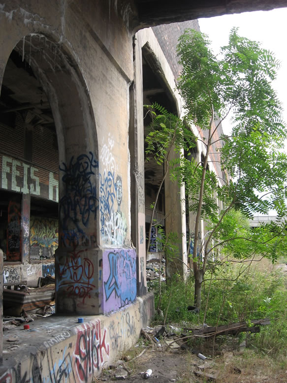
We used to walk the Dequindre Cut like we used to walk the Packard Plant: in a squadron of four or five, with Maglites on our hips—prepared to either klonk some feral beast prowling in the bushes, or to dip into any darkened opening that presented itself in an explorable structure along the way (we also had some chickin' and a 40, just FYI). Those were the days; back before I really had *adult* responsibilities yet, and could spend my weekends ghetto-tripping around in the city's crevices, before I fully understood its history and was just here to absorb its aesthetics.
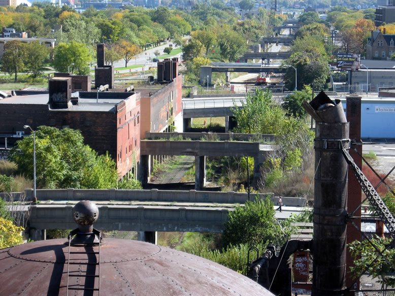
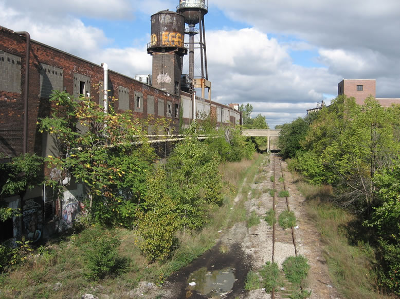
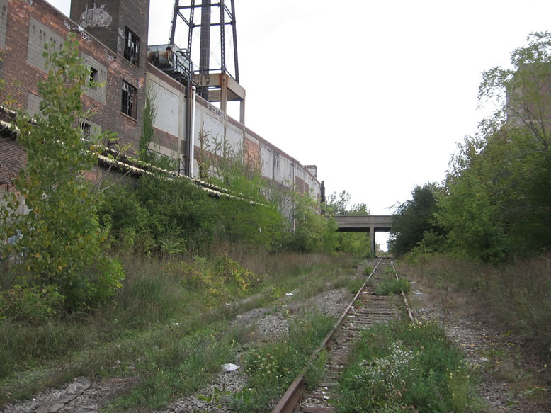
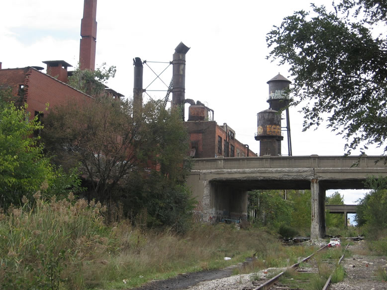
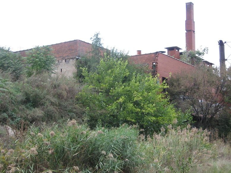
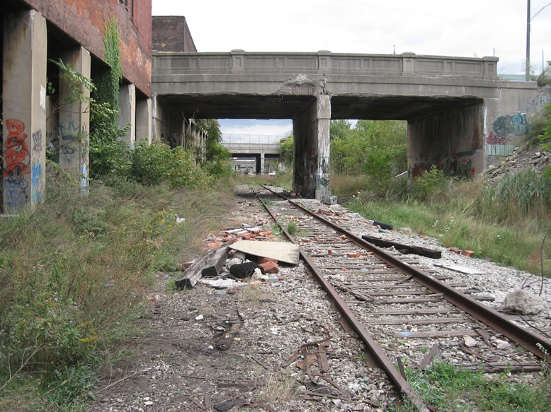
I took these first two shots from the roof of the Thorn Apple Valley Slaughterhouse, looking south down the Dequindre Cut to the Detroit River. That is where I will begin this post, at the Cut's northern end, and follow its course southward toward the river.
But first, a look north up the tracks from the Wilkins Street bridge, which is the northernmost bridge over the Cut. After crossing Palmer Avenue, one track splits to the west to join the old Belt Line Railroad swinging through New Center, across the west side to Delray and on downriver, while the other continues north through Milwaukee Junction, past Highland Park, Hamtramck, and onward to Pontiac and Durand. You can see the ruined silos of the now-demolished Koenig Coal Co. on the right:

Even though it wasn't technically in the trenched part of the Cut, I considered Koenig Coal to be part of the Dequindre Cut "experience," since it marked the beginning of the hike for those of us who started at the north end. I explored Koenig in more depth in an older post. The buildings you can see in the extreme distance up the tracks are Hoban Cold Storage and Fisher Body Plant #10.

For your reference, here is a master list of all the bridges that ever crossed the Dequindre Cut, from north to south...the underlined ones were standing when I took these photos. The ones in italic were already demolished:
Wilkins (was standing, now rebuilt)
Brewster
Alfred (was standing, now demolished)
Division (was standing, now rebuilt)
Adelaide (was standing, now rebuilt)
Gratiot (standing)
Waterloo
Jay (now a steam pipe crossing in that spot)
Antietam (standing)
Chestnut (standing)
Maple (ruined abutments remain)
Sherman (ruined abutments remain, now aligned with Chateaufort Pl. on the west and Hyde Park Dr. on the east)
Catherine (still standing, but Catherine Street itself no longer exists)
Mullett (ruined abutments now aligned with Cherboneau Pl. and Thornhill Pl.)
Clinton (ruined abutments)
Macomb (was standing in line with Pembridge Pl., now demolished)
Monroe (ruined abutments)
E. Lafayette (standing)
E. Fort (was standing in line with Ducharme Pl., now ruined abutments)
E. Congress (standing but abandoned)
E. Larned (standing)
E. Jefferson (standing)

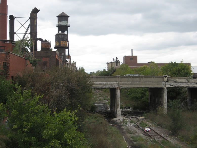
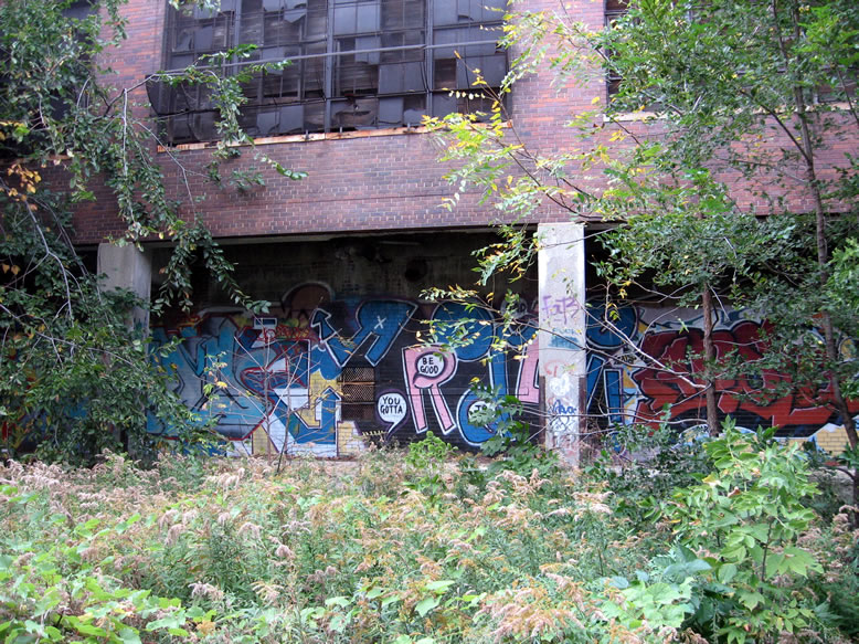
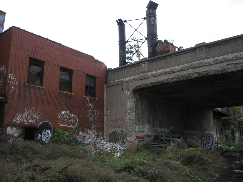
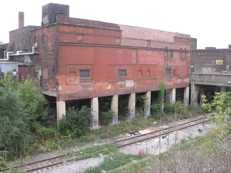
Standing on the Alfred Street Bridge, the structure in the above photo is the Armour & Co.'s Detroit warehouse. Most of the buildings along the Cut were grocery warehouses, some meat cold storage warehouses, and several small coal yards.
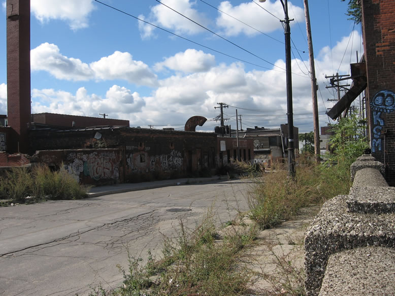
Probably the biggest abandoned building on the Dequindre Cut was across the street—the Thorn Apple Valley Slaughterhouse, which I explored in an older post:

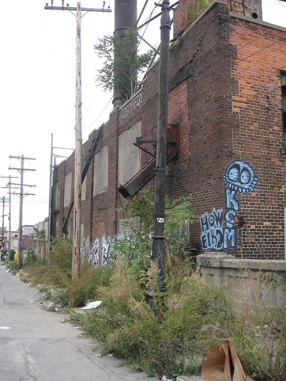
Notice the ancient wooden streetlamp, and the metal chute projecting from the slaughterhouse out to the street:
I have a hunch that before the Thorn Apple Slaughterhouse was built in the 1930s, Brewster Street may have crossed the Cut in this spot with a bridge like the rest (it is shown as a through-street on the c.1897 Sanborn map before the Cut or the slaughterhouse existed):
Here is what the same area looks like now, in 2018:

Back when I took this next photo in 2007, vile puddles of funky green ooze stained the ground in front of the slaughterhouse, perhaps with mutagenic properties that could turn me into some sort of martial arts-trained reptile with a penchant for fighting crime...gnarly!
Maybe it's lucky that I didnt come into contact with the green goo, since I later returned to the same spot on another visit to see it cordoned off with HazMat containment devices placed by perhaps the EPA or MDEQ. All I know is that it smelled absolutely pukey. Actually, it reminded me of the room in the Packard Plant's south end where the drums of restaurant grease were leaking everywhere.

The old railroad line that eventually became known as the Dequindre Cut was first laid down in 1836 by the Detroit & Pontiac Railroad, a predecessor of the Grand Trunk Western system. The tracks ran from the former Brush Street Depot (which used to stand where the RenCen is now), then curved north to run along with Dequindre Avenue after leaving the riverfront (hence the name "Dequindre Cut"), and eventually out to Royal Oak, Pontiac, and Durand (near Flint).
Dequindre Avenue itself was so-named because it denoted the former boundary between the Dequindre farm to the east (an original French colonial family in the 1700s), and the Witherell farm on the west. I believe the first trains were pulled along the rails by horse teams, if I recall correctly. From the mid-1800s to the early 1900s the Dequindre rail line serviced the east riverfront, which was teeming with industries along Jefferson Avenue from downtown to the Belle Isle Bridge, as well as the Eastern Market produce warehouse district.
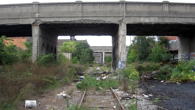
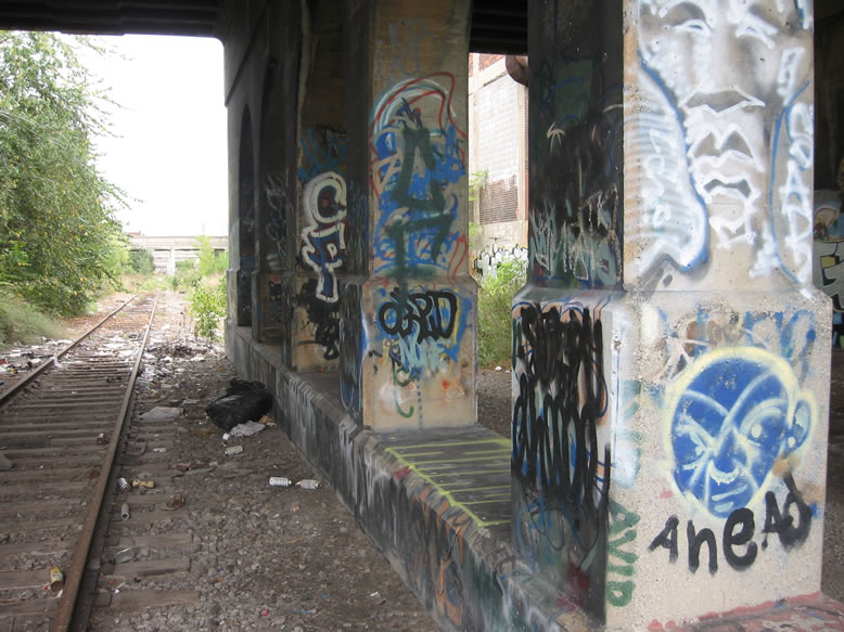
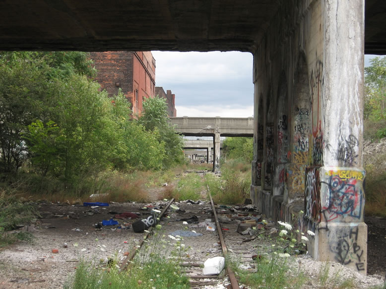
Peering down the line through the zoom lens, you can see that we had quite a hike ahead of us...
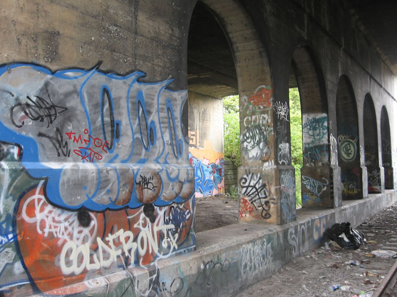
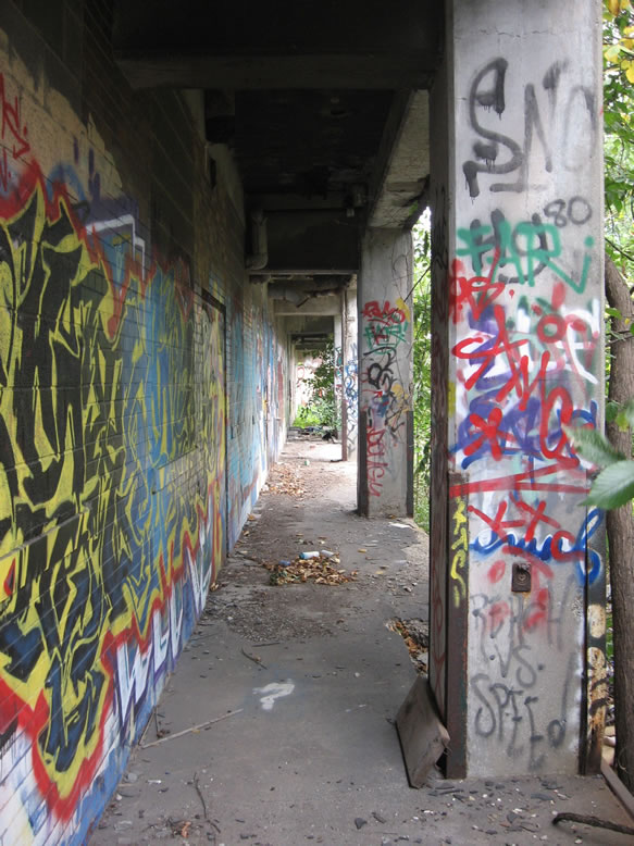
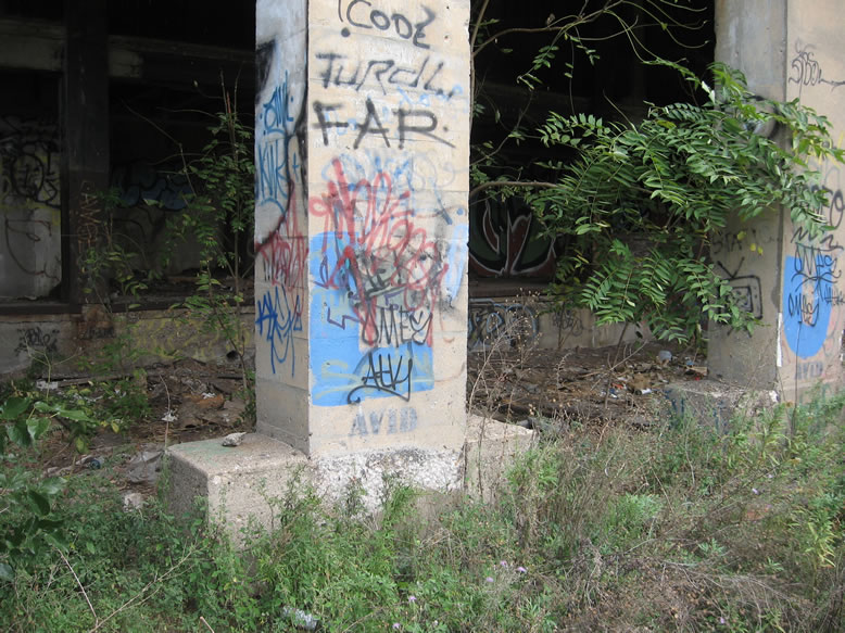
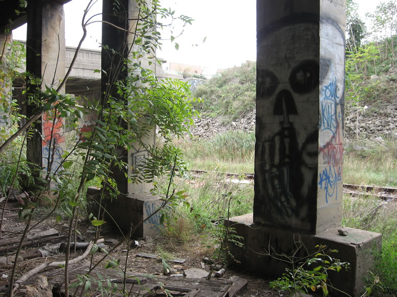
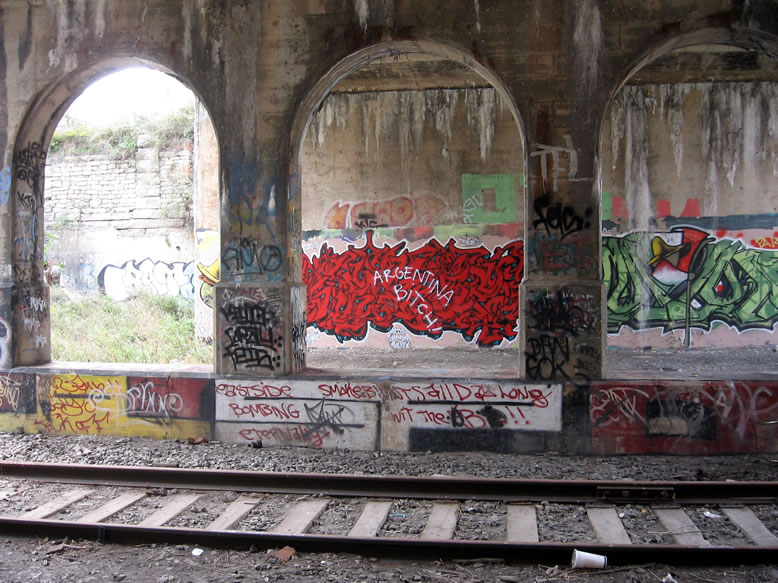
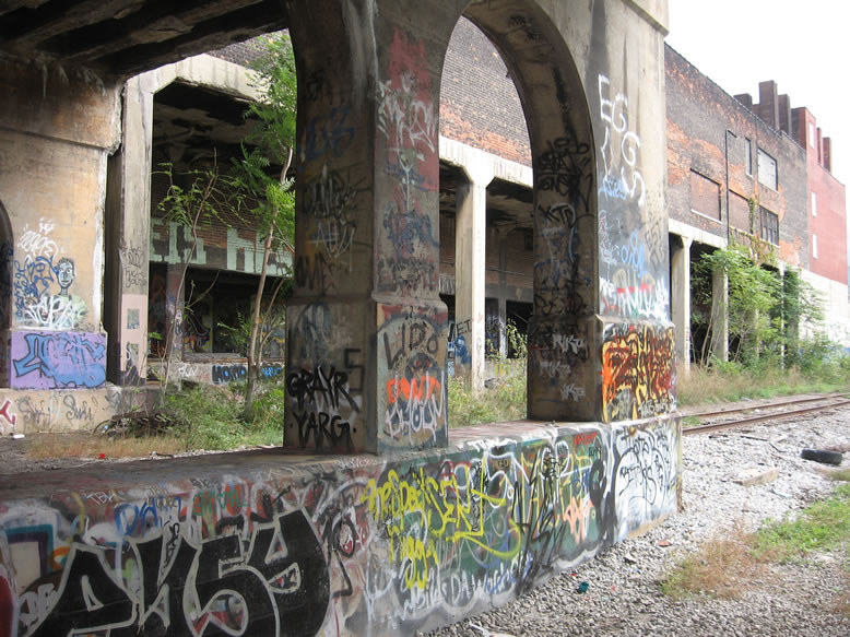
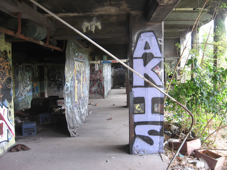
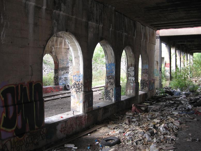
You'll have to excuse me during this post, as I was never much of a graffiti photographer; normally I concentrate on photographing structures and skylines, allowing graffiti to adorn my subject (instead of the other way around). All the same, in this post I think you'll spot quite a bit of old graffiti, super-old graffiti, and a lot of not-so-old-but-it-seems-old-now-in-comparison-to-today's-gourmet-graffiti.
I was never much of a graffiti writer either, although I did make a habit of kicking discarded rattlecans whenever I came across them to see if there were still a few squirts in there left behind by the name-brand writers. So invariably a few small "NAILHED" tags ended up here and there across the city, but it took me a long time to develop anything that resembled like a respectable tag. If only I had the same Can-Fu skills as I had climbing skills, I could've been a force to be reckoned with. Also, the fact that I was always too cheap to actually buy paint pretty much precluded my ever having a career as an infamous vandal.
Although I will say that once Detroit became "cool" in like 2008 and everyone's cousin was coming here to be part of a scene, the amount of free paint left on the ground increased like tenfold. Not only that, but the uppityness of the paint went up...no longer was the stolen can of Krylon from the Westland Meijer's store the weapon of choice for taggers, gourmet sh*t like Ironlak began to be seen littered all over the hot spots, and larger quantities leftover. I mean, who can afford to leave half-empty cans on the ground, really? Must be nice.

Usually the cans you'd find left on the ground had bad tips or they were some useless color, like white, or pink. Again, as time went on and the graffiti got pricier, I started finding better colors like blue or black—sometimes even silver or gold, which in my opinion are the best for throwies. And now you know more about the life and progression of orphaned paint cans in Detroit than you ever dreamed.
Usually the cans you'd find left on the ground had bad tips or they were some useless color, like white, or pink. Again, as time went on and the graffiti got pricier, I started finding better colors like blue or black—sometimes even silver or gold, which in my opinion are the best for throwies. And now you know more about the life and progression of orphaned paint cans in Detroit than you ever dreamed.
I remember explaining to some people in about 2012 or so that Detroit had become so popular with young vandals as the place to be, that they were actually vacationing here from other states and other countries. The constant publicity of Detroit as a "blank slate" and the fact that the crackdowns on graffiti in places like Philly or NYC had made a round-trip plane ticket to Detroit cheaper than it was to risk a vandalism case anywhere else in the nation pretty much made us the weekend vacation spot du jour for any aspiring street artist. I can vouch for this since I began regularly hosting out-of-town friends in 2005 who had read the media hype and saw the ruin porn images, and had to see Detroit for themselves.
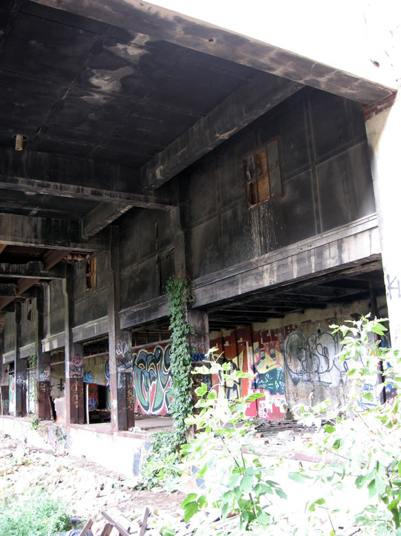
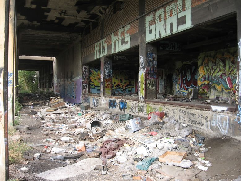
This heavily-overgrown loading dock by the way was once Schmidt Brewing Co.'s bottling plant:
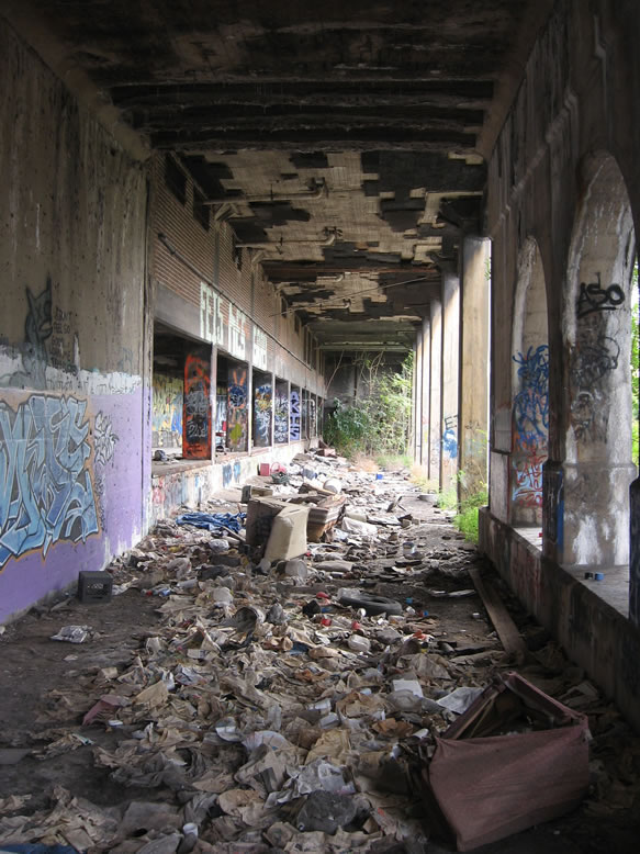
All the trash hurled down here reminds me of that one song about London's Portobello Road from that movie "Bedknobs and Broomsticks"...
Ditch where the rotten cabbages get throwed.
Anything and everything a chap can unload
Is hurled from a truck down into Dequindre road.
You’ll find lots of funk in the Dequindre road.
This couch sure doesn't look like it's about to do much more time traveling:
 |
| Photo by Cavemonkey |
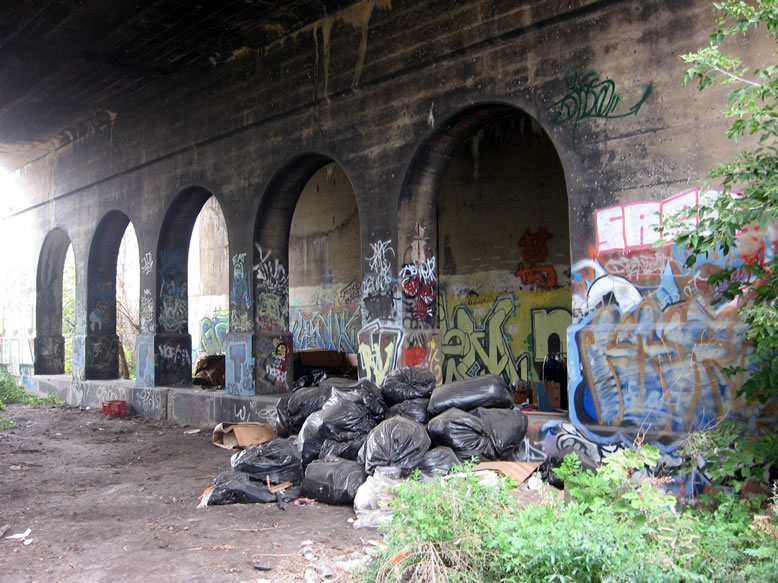
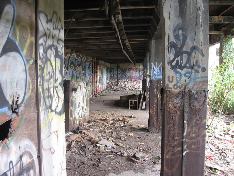
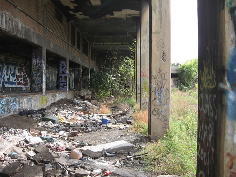
I also remember one particularly grueling winter's afternoon walking into the Cut from the north end, and passing the Thorn Apple Valley Slaughterhouse to hear the sounds of some junkie painfully and loudly howling in what was apparently a very deep and complex sort of agony, which echoed from somewhere within the depths of the building and through the silence of the barren urban canyon in a most disconcerting way. Back then the slaughterhouse was still a sort of homeless colony where as many as ten or 15 social outcasts hid themselves away in its filthy cloak of grimy darkness, out on the fringes of downtown where they could be left alone.
Standing on the loading dock of the former Schmidt Brewing bottling plant, the jungle growth is in full effect...


Passenger trains stopped running on the Dequindre line in 1982, and a couple years later freight trains abandoned it as well, heralding the final failure of the archaic industrial sectors of the east riverfront area. This left the tracks to become overgrown with weeds and transform into the urban jungle canyon of lawlessness that we came to know for the past 20 or 30 years.

There was a proposal during the 1990s to turn the Dequindre Cut into a sort of freeway connector to give direct traffic access to a planned riverfront casino district, but this obviously never came to fruition, as the casinos were built elsewhere. Thankfully the Dequindre Cut never became another trenched freeway, since I think it's already easy enough for people to travel through Detroit at high speed without ever having to look at it. Not to mention we already have one I-375, I don't think we need another.
My colleague Paul Szewczyk wrote a recent article for the Metro Times that listed the reclaimed Dequindre Cut as one of the urban planning triumphs of Detroit's history. Despite the fact that it seems awfully overbuilt for a mere rollerblade path, Szewczyk astutely notes that "one unintended benefit of this project is that it preserves a right-of-way formerly occupied by a commuter rail," which leaves open the possibility that one day it could be used again for mass transit, effortlessly connecting the suburbs to the city center. If only our elected leaders and "captains of industry" were as astute in their attempts at installing regional mass transit.
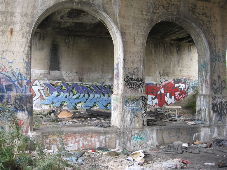
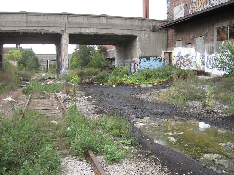
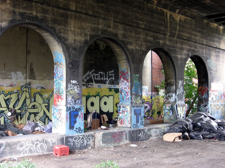
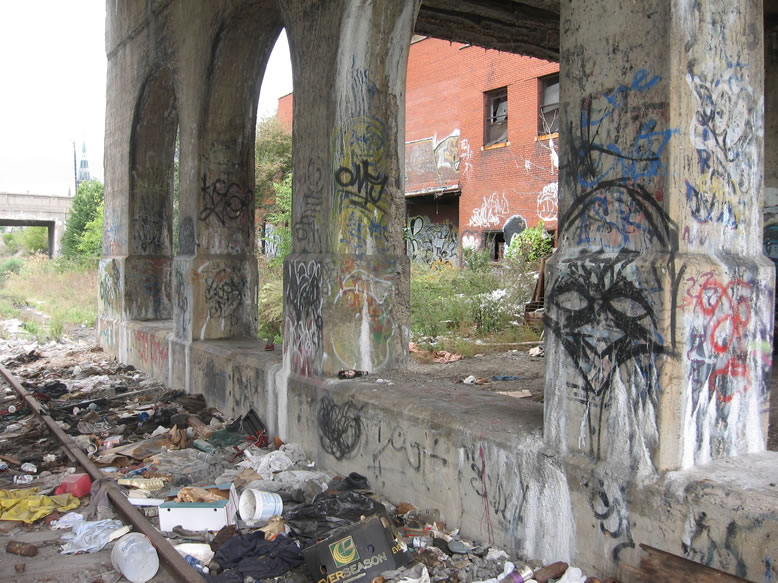
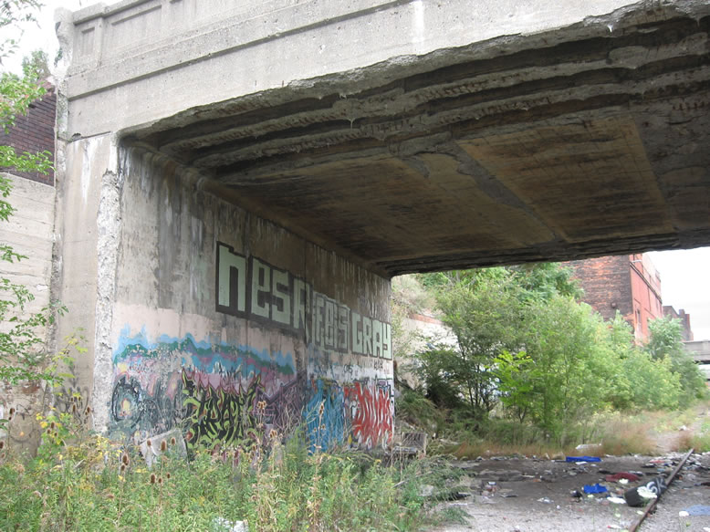
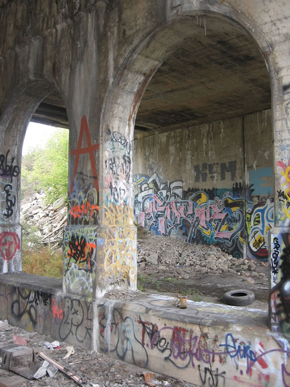
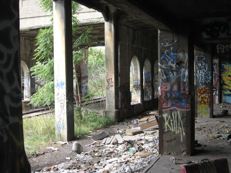
Judging by the flaky condition of the concrete of some of these bridges, I'd say deferred maintenance was already well in effect by the time the railroad stopped using the Cut...the whole wall fell off of this one:
Looking at the Sanborn maps of the area from 1921 and 1922 (right before the Cut was dug to put the rails below the street grade), I'd have to imagine that street traffic in that area was absolutely nightmarish. This part of town was bustling with foot and horse traffic in the 1900s, and with constant trains sharing the road it probably caused a hellish snarl at all times of day—to say nothing of how bad it would've been by the time masses of automobiles were introduced into the mix, piloted by impatient middle- and upper-class citizens who undoubtedly grew tired of having to wade through the impasse.
I have a hunch that the push to separate the rails from street traffic back in the 1920s was bolstered by pressure from the wealthy businessmen who worked downtown but had to cross the Dequindre line on their commute from upscale Grosse Pointe, which was quickly growing as the place for the elite to live at that time. And as we all know, not much ever gets accomplished in government until angry rich people get involved, heh. But regardless, that is awfully ridiculous to have a busy railroad line cutting off half of the city.
The Michigan Dept. of Transportation (MDOT) website explains that a joint plan was launched in January 1923 between Detroit Public Works and the Grand Trunk Railroad to put the rails down in the Cut, and for preserving street traffic through the erection of 22 bridges across it over the course of 10 years, with both the city and the railroad sharing the costs of the project. So in other words, the Dequindre Cut will be 100 years old soon.
Here is a photo of the Cut under construction, at Gratiot...it also looks like the Swift meat warehouse was under construction as well:
 |
| Image stolen from atdetroit.net user Hornwrecker |
This here is the Division Street Bridge, by the way.

Under Division, looking back north at Alfred:
But today as you can see the Alfred Street Bridge no longer exists...

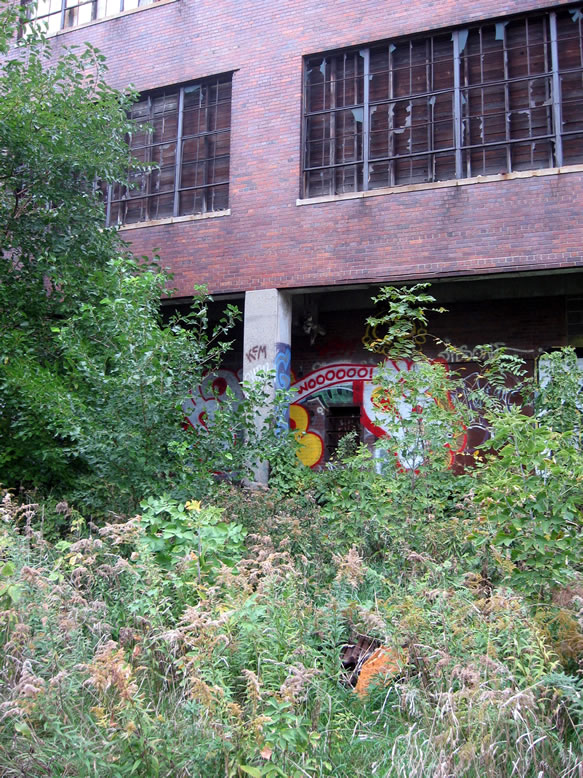
Even though the slaughterhouse is still vacant, it has been cleaned up on this side, old rusty smokestacks have been removed, and the area is now totally family-friendly.
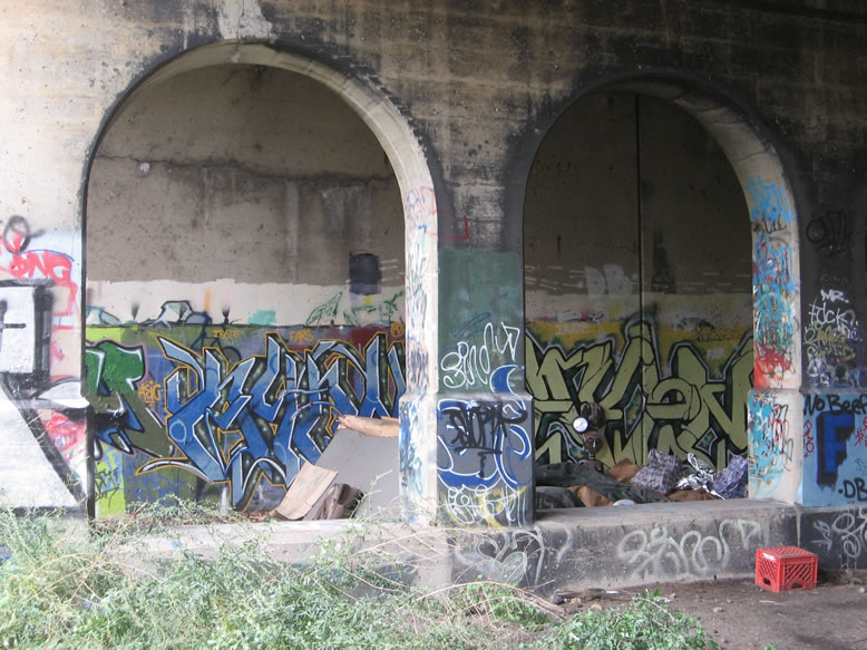
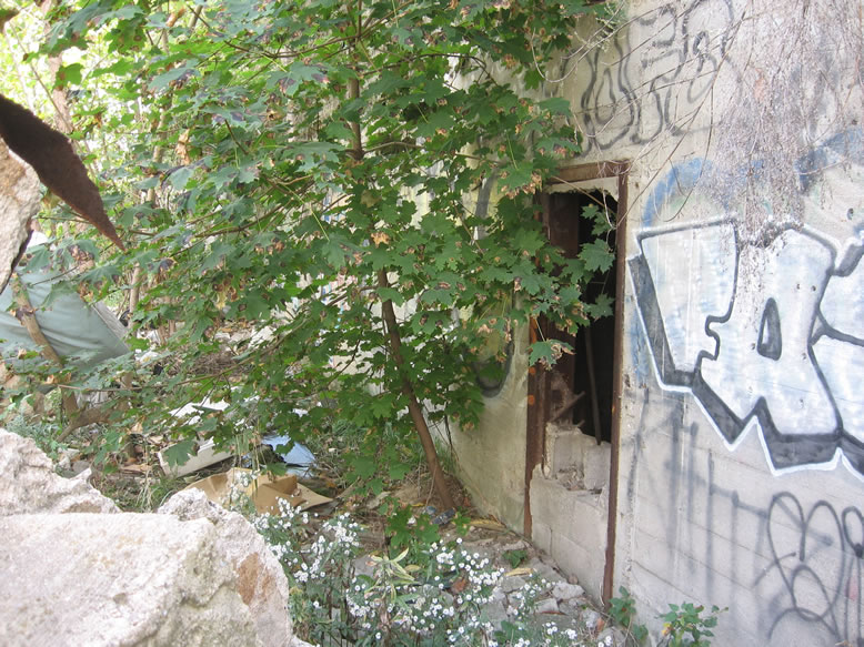
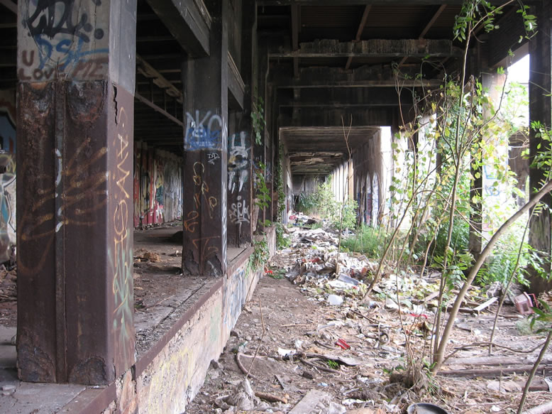
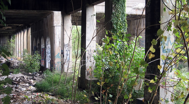
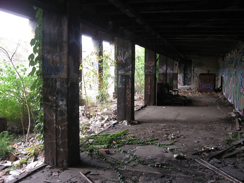
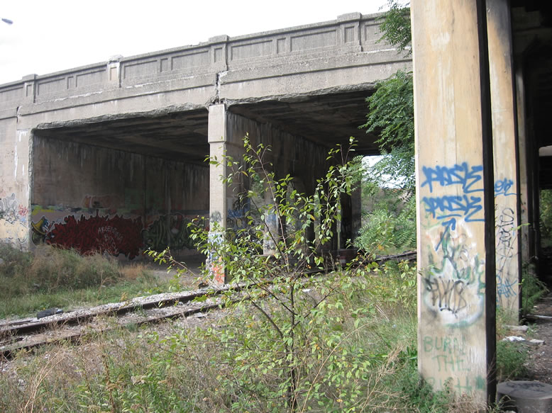
Here's one of those "darkened openings" I mentioned earlier:
And speaking of "feral beasts lurking in the bushes," it looks like one of them got a deer...

...We aren't bullshitting when we tell you that coyotes roam the D at night.

This is the Detroit Beef Co. meat warehouse, while the next building south across Adelaide from it was the Morris & Co. meat storage house (there's a better view of it later):
With the new Greenway all these loading docks are fenced-in now, to keep curious looky-loos at bay:
Here you can still see a couple old railroad ties from where the old spur used to be:

You can tell not much light ever gets in here, due to the fact that the overgrowth abruptly stops:
The rail on the ceiling in the next photo once had meathooks on it for moving dressed beef carcasses on or off the trains:
I was surprised to find a sign indicating that a fiber-optic trunk line ran underground through the Cut in this area.
I always envisioned this loading dock as it might've been in the olden days, with burly, grizzled Polish or Italian brutes pushing heavy carts of provisions on and off the boxcars.

There was something about these below-ground / rear basement loading docks that I just found intriguing...like what mysterious cargo was so taboo that its dealings had to be moved down underground, out of the view of the public? Obviously it was just a matter of expedience, however; when the tracks were moved below grade-level, the loading docks behind the buildings had to follow suit.
The covered spur continued under the Adelaide Street Bridge here to the next loading dock down the way, which was below the Morris & Co. meat warehouse...
When they completely rebuilt the Adelaide Bridge during construction of the greenway, this was no longer an open space under the bridge, and was completely filled in with concrete, so you can't look all the way down the spur anymore like in the above photo.
The refurbished Dequindre Cut is actually only a fraction of what is planned to be a 26-mile "Inner Circle Greenway," according to a Free Press article. Just as Lower Manhattan's High Line "provided for New York City a grand vision for how the city could be connected by reclaiming community assets and building non-traditional public spaces," the Dequindre Cut too has achieved an admittedly surprising level of popularity (both debuted in 2009).
Originally I was quite skeptical of making it a tourist attraction, since...it doesn't really go anywhere. I guess it connects the riverfront with Eastern Market, but after that it just spits you out into the old Forest Park ghetto-prairie, where your next destination of note would be the odiferous trash incinerator. Seems to me that this would dampen the excitement of the average tourist, but I concede that on any nice day I pass over the Cut in my car, I look down to see it full of people in stretch clothing...biking, skating, jogging.
Although both started out as disused rail corridors, the Free Press contrasts the Dequindre Cut with New York's High Line however, describing it as "threatening" when it was abandoned, "much more ominous than the High Line"..."out of sight to the unfamiliar, and to those aware of it, a very scary place, the Cut was not immediately thought of as a place for the public to enjoy."
Although I'm not too familiar with the High Line, I tend to agree with this appraisal, although I have ventured into New York's "Freedom Tunnel," which I would say is more of an equivalent to the Cut since it was known as a haven for graffiti and the homeless. I mean sure, the Dequindre Cut was very Gotham, but to call it "scary" simply because it had graffiti and homeless people seems like a very sheltered perspective.
Not to be left out of this rail-trail craze, Chicago came out with their own "Bloomingdale Trail" on an old elevated line in 2015. The planners who created it came to Detoit beforehand to study the Cut before returning home to start work.
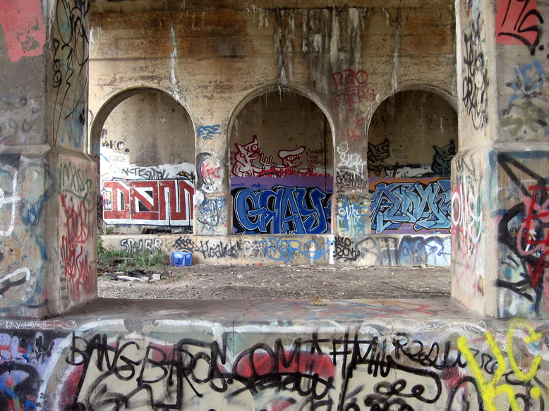
Several recognizable names under the Adelaide Bridge here...DEMS, GRAY, DEAD KRAKHEAD, ARMY:

...in fact I think I can still make out an old faded "DETROIT BEEF CO." in white paint there on the side of the building.
Another view of how the old Adelaide Street Bridge divided the Morris & Co. loading dock from the Detroit Beef Co. dock:
Naturally, the dock provided a nice sheltered place for homeless people to live.
Adelaide Street didn't look to be in that bad of shape in my opinion...
I think another reason they fenced this off with the new greenway was to eliminate a blind spot where people can lurk in ambush of monied rollerbladers and cyclists...I think a lot of people would have been too scared to use the Dequindre Greenway if it still had recesses like this where people can hide. So for now, it's fenced off, at least until they can turn it into an artisanal bistro or a little boutique where super high-end leather goods are sold.
Judging by the tarp and makeshift seating, it appeared to be a mini squatter colony at the time, but no one was home...
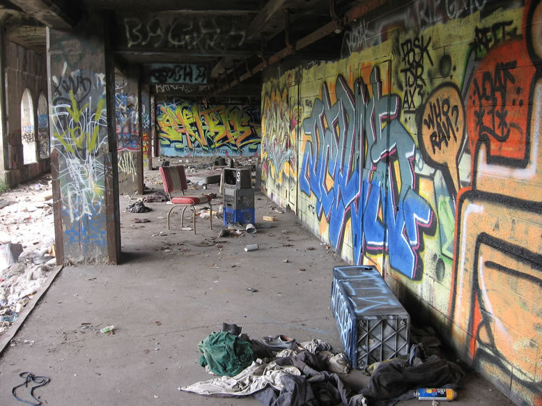
This little setup was photographed plenty of times, I assure you:
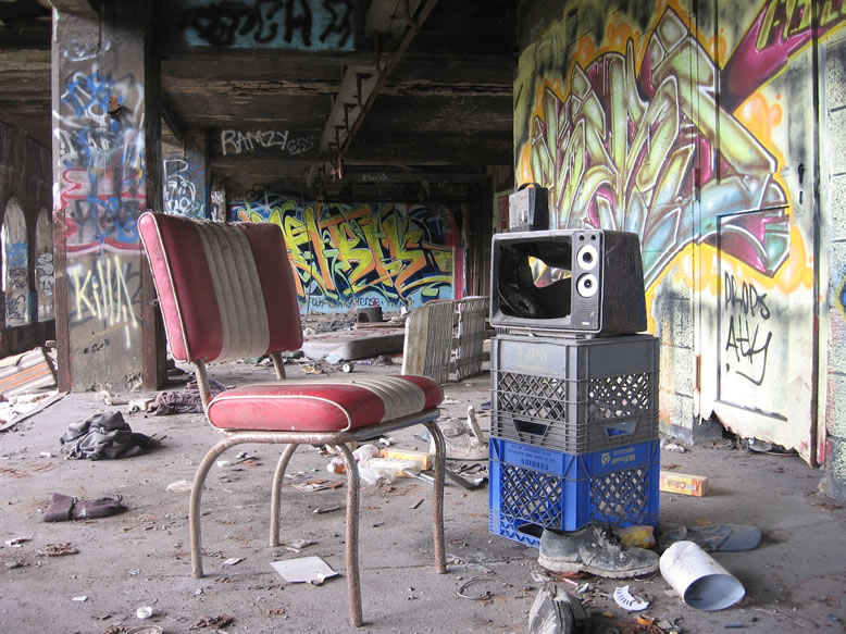
Retro furniture, plus retro TV, plus urban decay? That's ruin porn PAY DIRT, boy. Angle the orphan shoe a little more, it's not poignant enough. Oh no, we forgot the fake flower bouquet and scantily-clad female model! And where is my excessively gaudy watermark?!
Again, this open spot under the bridge no longer exists since it was rebuilt:
Here is a c.2018 view of the same spot, showing how the bridge was totally rebuilt with a different design, and all the fun areas are fenced off:

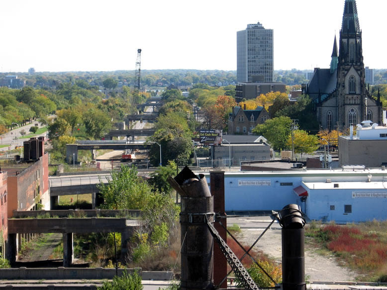
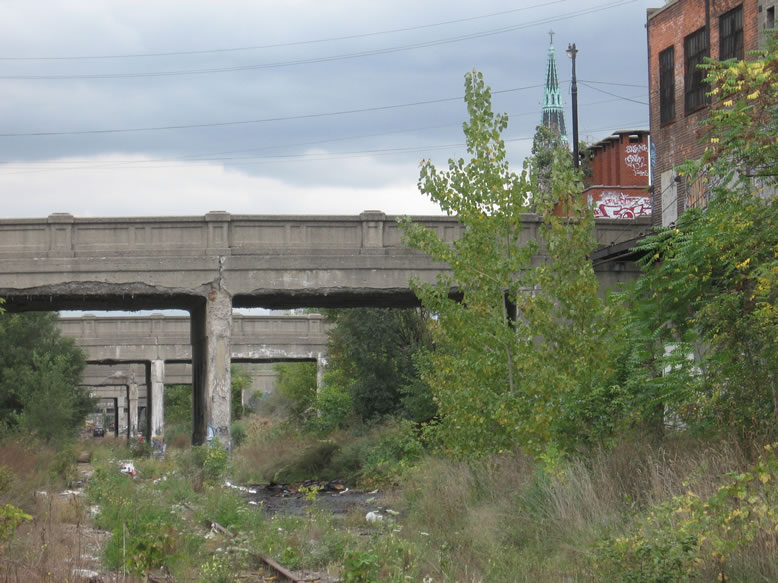
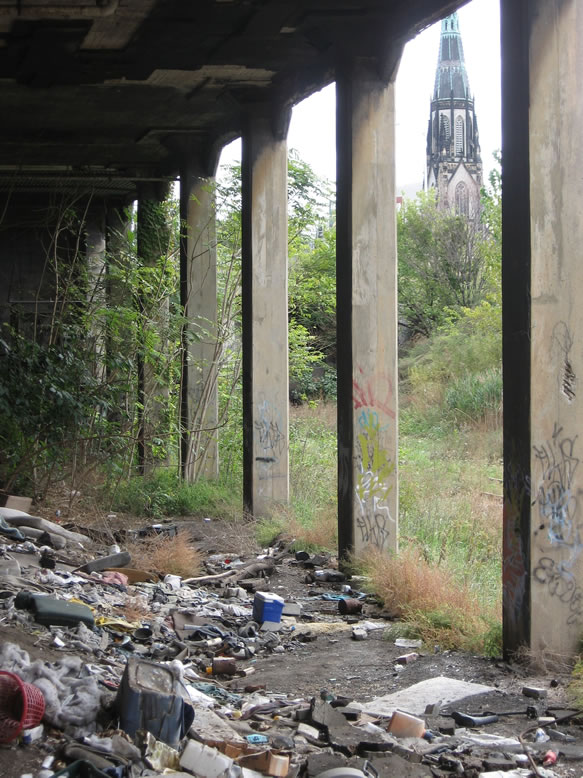
St. Joe's massive steeple looms above the periphery of the Cut, as a distant reminder that the real world still exists just outside of this fantasy apocalyptic jungle dimension:
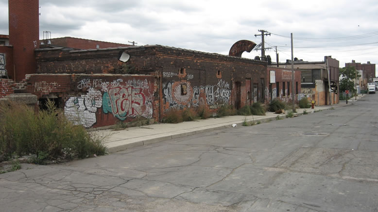
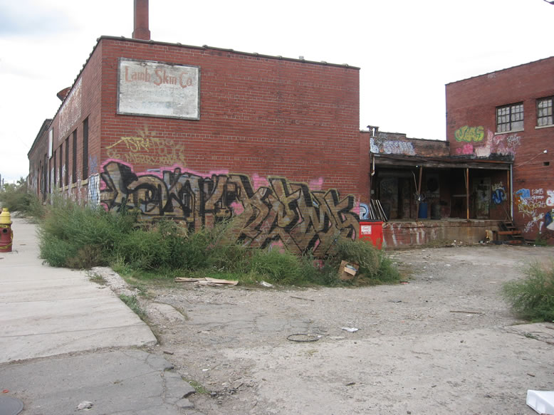
Before I end Part 1, let's rewind back to the Lamb Skin Co. building at the north end, at the now-demolished Alfred Street Bridge:

According to a c.1921 Sanborn map, this building was the Armour & Co. grocery warehouse and loading dock:

However, the sign on this building in the modern day says "Lamb Skin Co.", and that's exactly what they did...

...more often than not their dumpster was overflowing with jiggling mounds of skin stripped off of slaughtered lambs, surrounded by a swirling cloud of flies. Just another of the wondrous sights and sounds of the Dequindre Cut and Eastern Market. Pure Michigan!

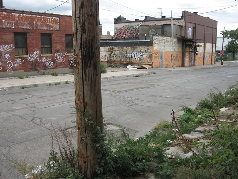
Down in the Cut, here are the remnants of their old railroad loading dock:

For reference, directly across the Cut from here was one of Edgar's Sugar House warehouses.

Yeah, better tighten those laces...

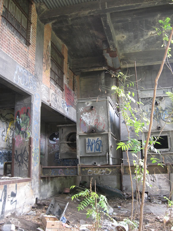
Poking inside, we found more than we bargained for—two giant boilers:

In order to get to the rest of the collapsing building we had to go back outside, climb back up out of the Cut, and enter at street level.

I think this place burned in October 2008 if I'm not mistaken...

Judging by the wooden structural architecture, I'd say this place was originally built around the 1890s like most of the other similar buildings along the Cut.

My two New Jersey colleagues who joined me that day, Ange and Conor, standing in front of a row of some kind of stalls:

According to a c.1921 Sanborn map, this building was the Armour & Co. grocery warehouse and loading dock:

However, the sign on this building in the modern day says "Lamb Skin Co.", and that's exactly what they did...
...more often than not their dumpster was overflowing with jiggling mounds of skin stripped off of slaughtered lambs, surrounded by a swirling cloud of flies. Just another of the wondrous sights and sounds of the Dequindre Cut and Eastern Market. Pure Michigan!
Down in the Cut, here are the remnants of their old railroad loading dock:

For reference, directly across the Cut from here was one of Edgar's Sugar House warehouses.

Yeah, better tighten those laces...

Poking inside, we found more than we bargained for—two giant boilers:

In order to get to the rest of the collapsing building we had to go back outside, climb back up out of the Cut, and enter at street level.

I think this place burned in October 2008 if I'm not mistaken...

Judging by the wooden structural architecture, I'd say this place was originally built around the 1890s like most of the other similar buildings along the Cut.

My two New Jersey colleagues who joined me that day, Ange and Conor, standing in front of a row of some kind of stalls:

Next stop Gratiot Avenue, the halfway point of our journey through the Cut...
CLICK HERE for Part 2
References:
Sanborn maps for Detroit, Vol. 3, Sheets 39, 40, 21, 22, 23, 24, 25 (c.1921)
Sanborn maps for Detroit, Vol. 4, Sheets 39, 40 , 41, 42, 43, 44, 45, 46, 47, 48 (c.1922)
Sanborn maps for Detroit, Vol. 3 Sheet 25 (c.1897)
American Odyssey, by Robert Conot, p. 399, 444-445
http://www.porthuronandnorthern.com/dtRickel.html
http://onedayindetroit.com/tours/20
http://web.mit.edu/nature/archive/student_projects/2009/jryoung/Pages/dequindre_history.html
http://www.michigan.gov/mdot/0,4616,7-151-9623_11154_11188-29422--,00.html
https://www.freep.com/story/opinion/contributors/2016/05/01/dequindre-cut-detroit-future/83702990/
http://www.roguehaa.com/a-brief-history-of-detroits-black-bottom-neighborhood/
http://www.miesdetroit.org
https://www.metrotimes.com/detroit/inside-detroits-merciless-graffiti-crackdown/Content?oid=5702408
http://www.atdetroit.net/forum/messages/6790/61926.html?1133416263
https://www.metrotimes.com/detroit/detroits-top-10-urban-planning-blunders-and-10-successes/Content?oid=11680985&showFullText=true
Special thanks to my homies Navi and Cavemonkey for their assistance on this post.