
Photos date from 2007 to 2010.
When we left off, we were between the Adelaide and Gratiot Avenue bridges, heading south.
The iconic Rickel Malt silos were once located here along the west side of the Cut at the Adelaide Bridge, a familiar landmark to old Detroiters that has long been erased. H.W. Rickel & Co. Maltsters provided the necessary grains to the city's breweries for making beer. At one time Detroit had several sizable breweries operating in this part of the city.
Some model railroader named Dave Held has apparently made a very convincing scale model of the Cut, which can be seen at porthuronandnorthern.com. This photo of his was taken in 1981, looking north from about Jay Street, with Rickel Malt seen prominently at left:
 |
| Photo by Dave Held |
 |
Photo by Dave Held
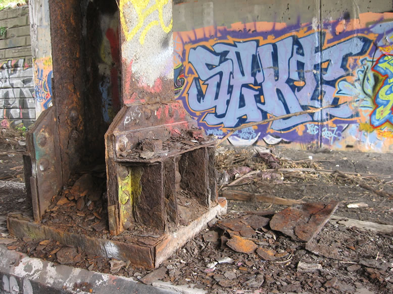
At the corner of the Adelaide Bridge, there is evidence of old limestone foundations from archaic buildings torn down long ago...this is where Rickel Malt used to stand, although I didn't realize it was old enough to have a stone foundation:

A closer look:

The 1897 Sanborn shows Rickel here on this spot, but a large portion of it was marked "destroyed by fire" in May of that year. Buildings in Detroit that are built with this limestone generally date from the 1840s to the 1890s.
 Here is what the area looks like all cleaned up, in 2018, with the Adelaide Bridge completely rebuilt: 
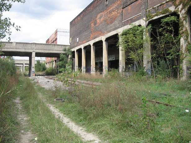
Standing across the Cut from the old Rickel Malt, this was the Morris & Co. meat warehouse (seen below); Swift & Co. had their meat warehouse immediately adjacent, at the northeast corner of Gratiot (next photo).
|
Detroit's own Hammond & Standish Meatpackers were represented in Eastern Market too, but their building was demolished for the I-75 freeway, and no longer stands.
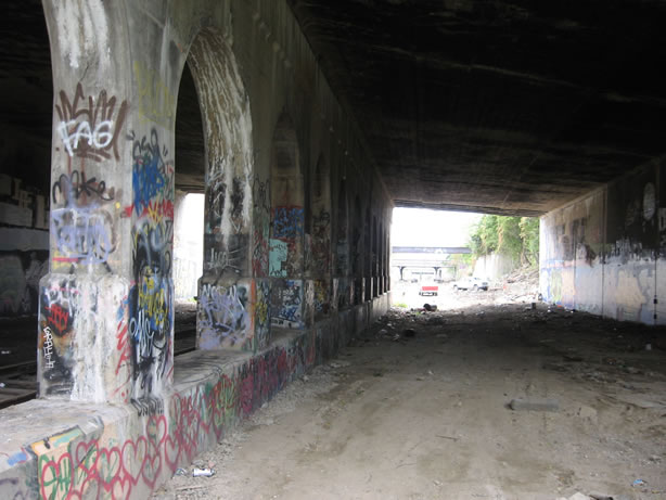
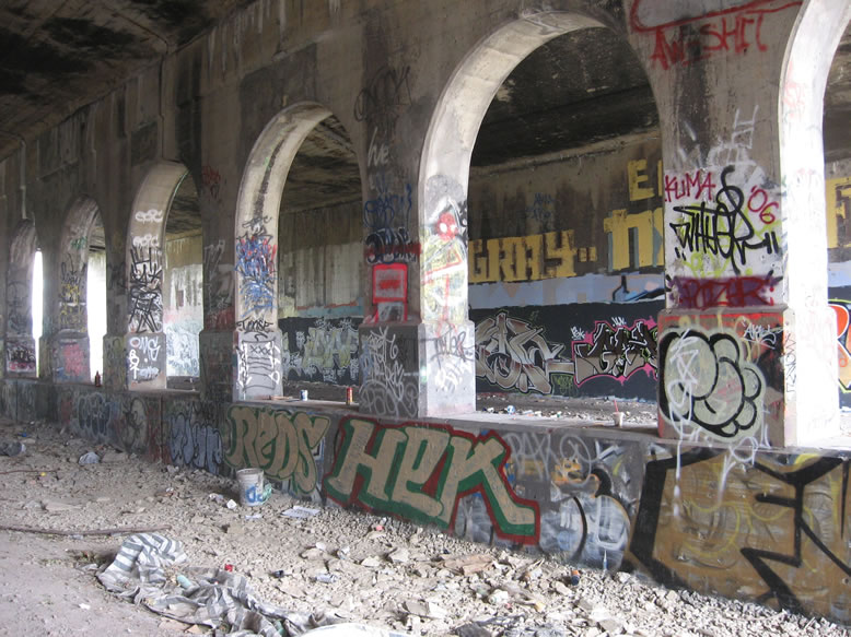
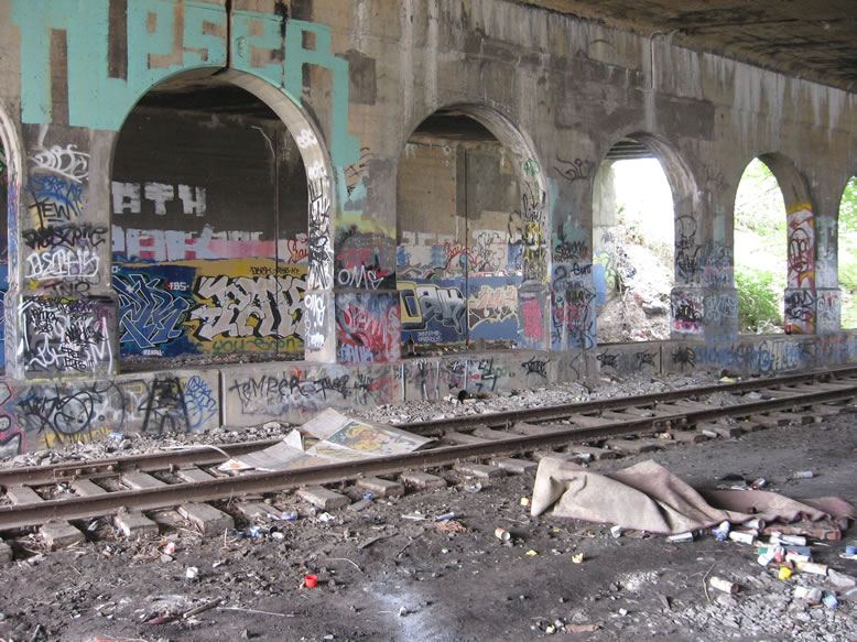
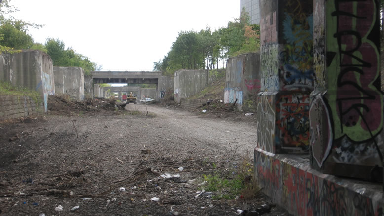
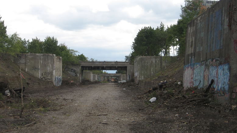
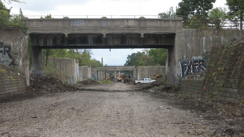
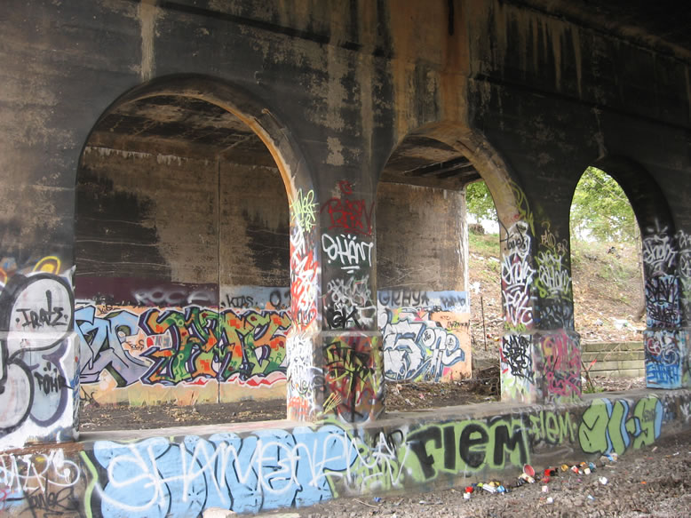
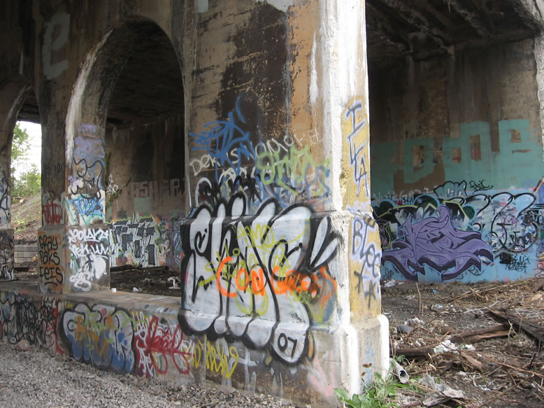
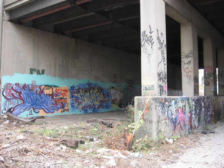
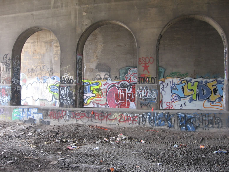
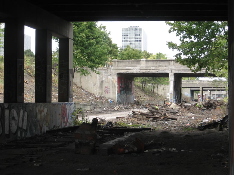
Going under Gratiot Avenue, the halfway point of our journey through the Cut:
As you can see it's a bit wider than your average bridge here...about three times wider.
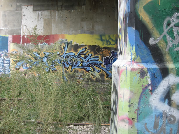
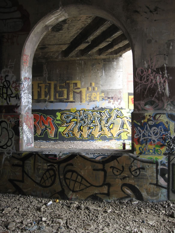
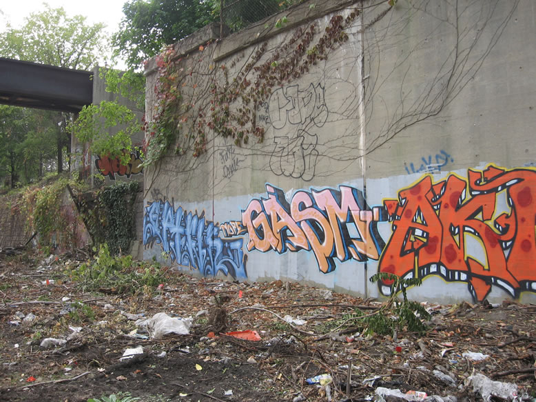
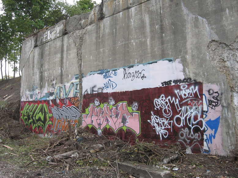
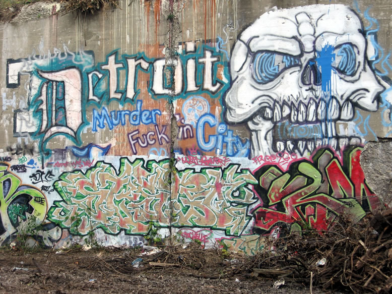
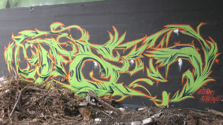
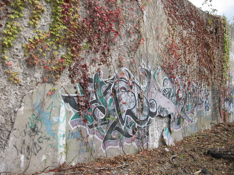
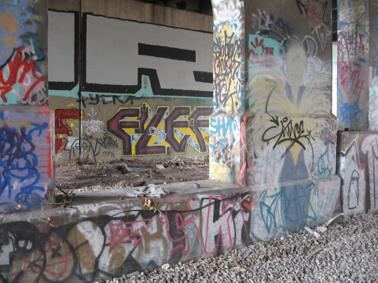
...with some nice smooth walls for painting:

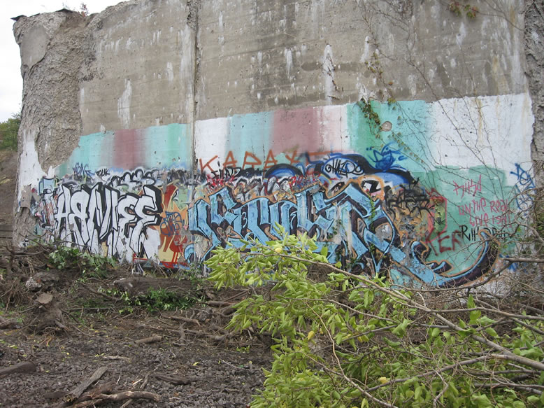
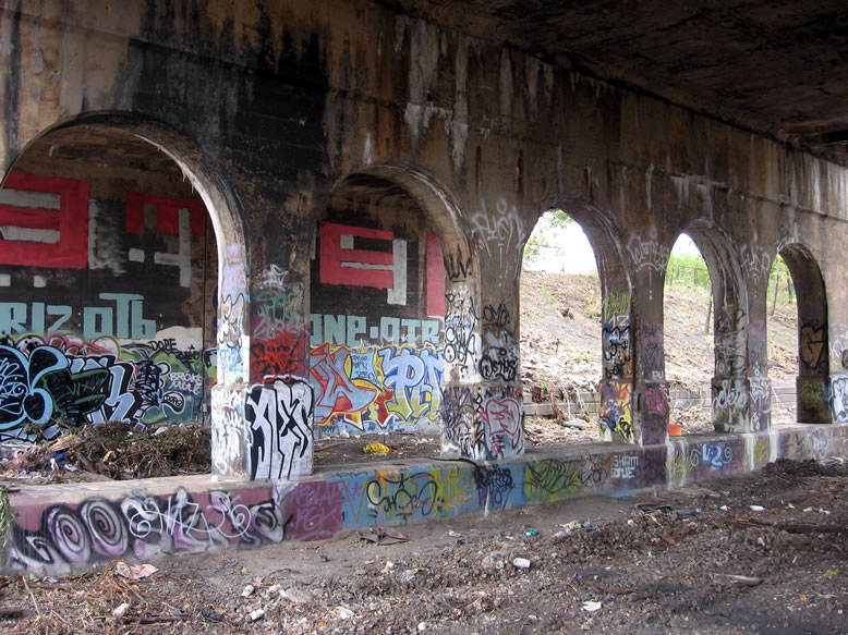
Gratiot was one of the areas in the Cut where there were so many layers of graffiti that the walls were a flaking palimpsest of old and new paint:
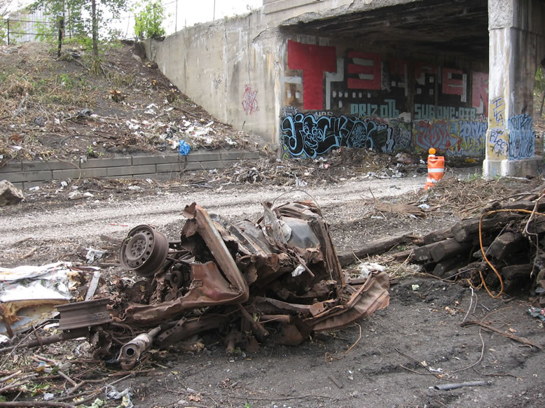
Gratiot is also where the initial construction phase for the greenway project stopped.
To my regret, I apparently never took many photos of the Cut south of Gratiot when it was fully overgrown; I guess I just assumed it would always be there. When I realized that it was getting all torn up I made a hasty trip back down there to photograph before the old school murals were all covered up with G-rated stuff. I was also interested to see just what the Cut actually looked like, with all of that foliage stripped away.

This was a shock to the system to suddenly have the view completely opened up all the way down the Cut from every leaf, twig, and branch suddenly being annihilated. It was equally disconcerting to see work trucks parked in here...suddenly the Cut's magic spell seemed broken, and its clean-scraped bones were on display as if on a morgue table. Nonetheless I felt it was important to keep documenting this strange transitional phase in the Cut's history, before the raw graffiti and nasty old bridges were whitewashed and replaced with things that would be easier on the eyes of the upscale rollerbladers and cyclists for whom this renovation was presumably being done.
On my last couple visits to the Cut after the renovation was complete south of Gratiot, I was witness to one of the most surreal and most quintessentially "Detroit" scenes I've ever beheld in all my years of photographing the city. Underneath Gratiot Avenue, there was a giant chain-link fence erected, separating the newly rebuilt Dequindre *Greenway* section designated for yuppy-style activities from the raw, uncensored Dequindre Cut of blight and overgrowth (there was a long delay between the completion of the southern and northern halves of the greenway). People talk about the stark liminality of crossing Alter Road, and the two worlds that it separates, but this was like that scene in the Wizard of Oz where Dorothy crosses from the world of black & white to the world of color.
Unfortunately despite all my ranting about how photogenic this was, I failed to take a photo of my own.

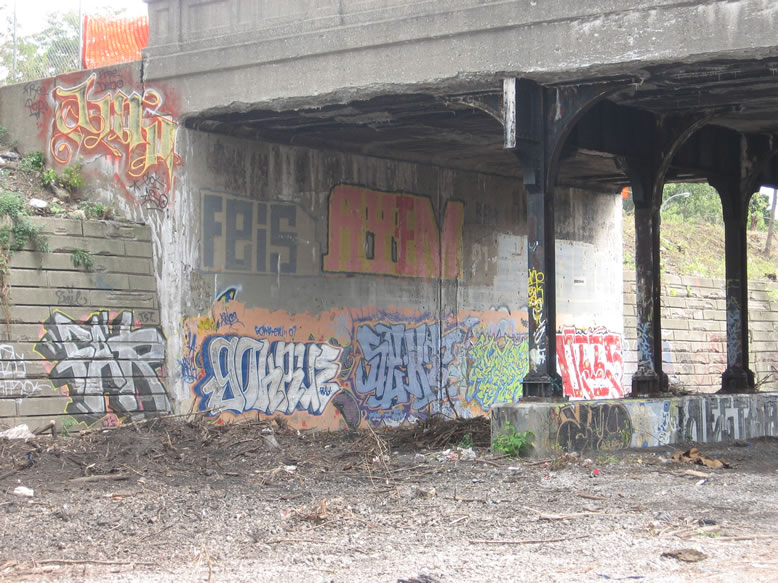
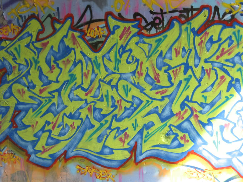
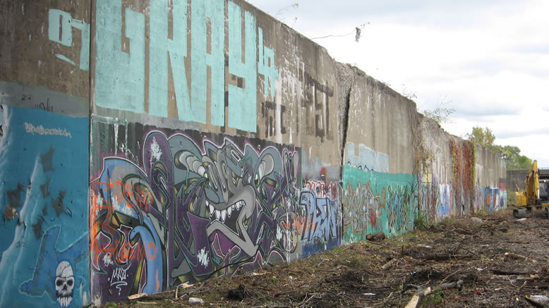
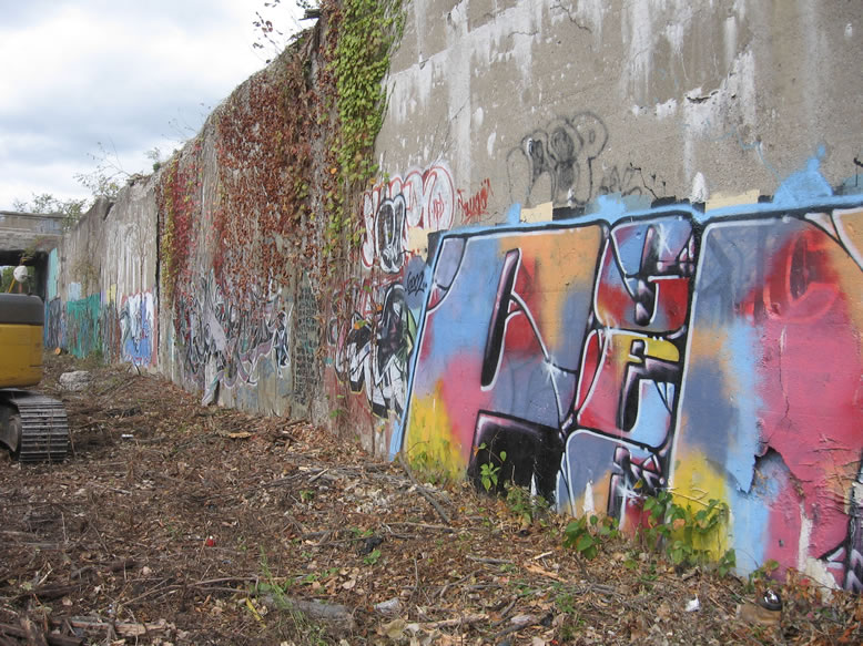
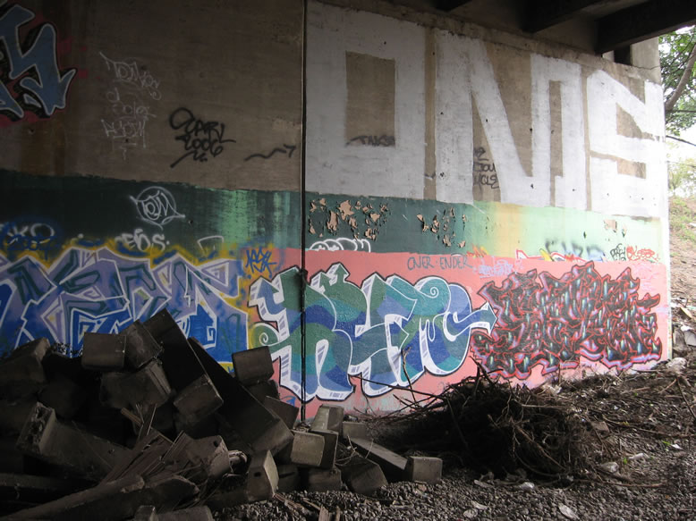
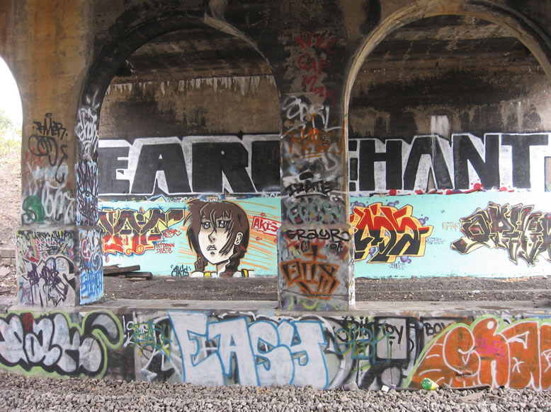
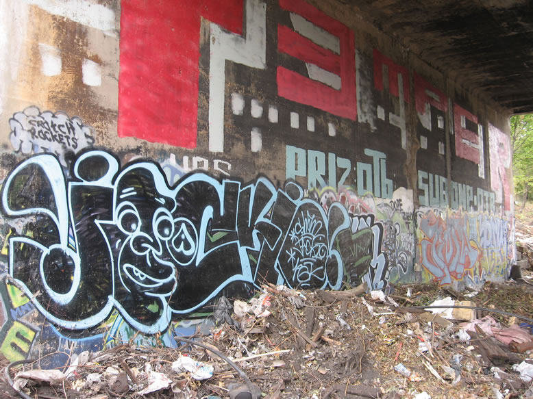
More LOAF, KUMA, GRAY, etc. under Gratiot...
Here is what Gratiot looks like today in 2018...

I was surprised to see that so much of the graffiti is still unchanged from a decade ago. The addition of streetlights, pavement, and porta-potties really feels bizarre. If that weren't enough, as I am writing this an event is taking place where people are actually camping down in the Cut. I mean don't get me wrong, I am all for camping, but I don't know if anyone took into account just how wet the ground is down there...I'm thinking there were some soggy sleeping bags that night. I would never pitch a tent down there. Up on top of the abandoned bridges, sure.

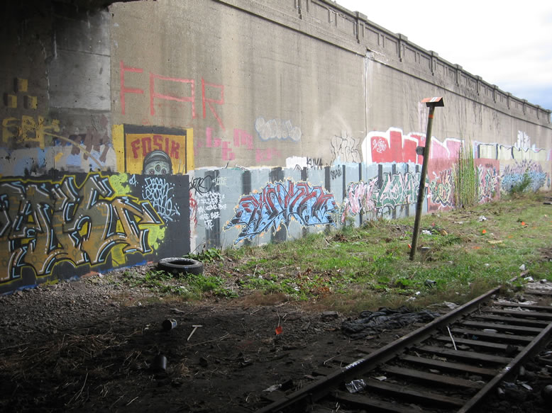
Back to 2007, there's that old FOSIK that I remember seeing before it was gone over:
A couple "kneecap" dudes under this one, old EGGS, SISTO, PHERS, and a TURDL:
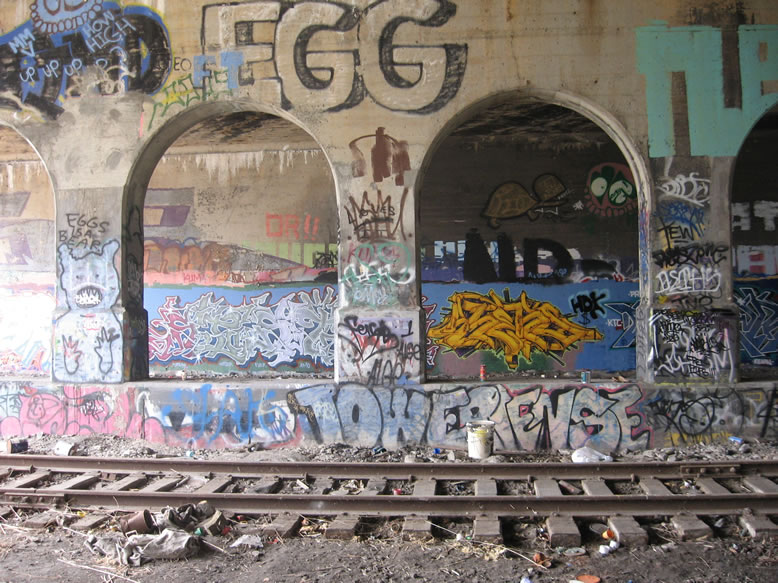
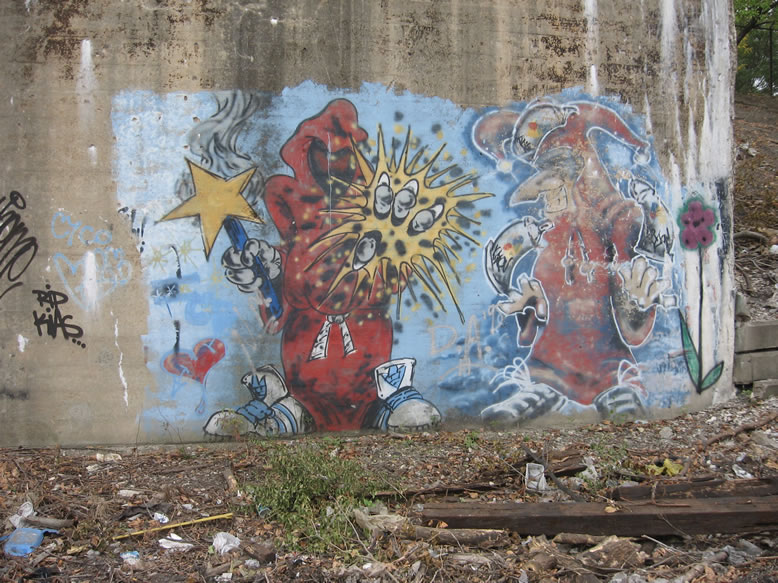
There were a few good names on this wall if I recall correctly. Again, I rarely focused my photography specifically on graffiti art, so what you see is what you get.
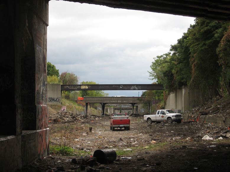
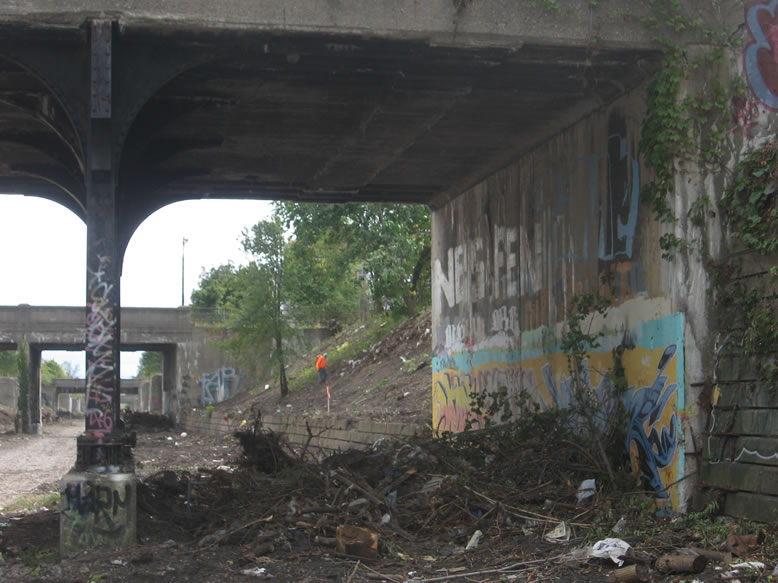
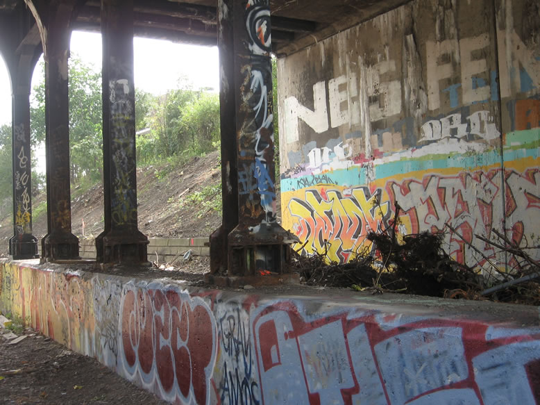
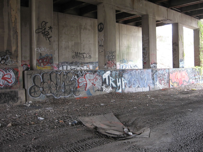
Now leaving Gratiot...you can see the old train tracks stop here:

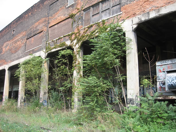
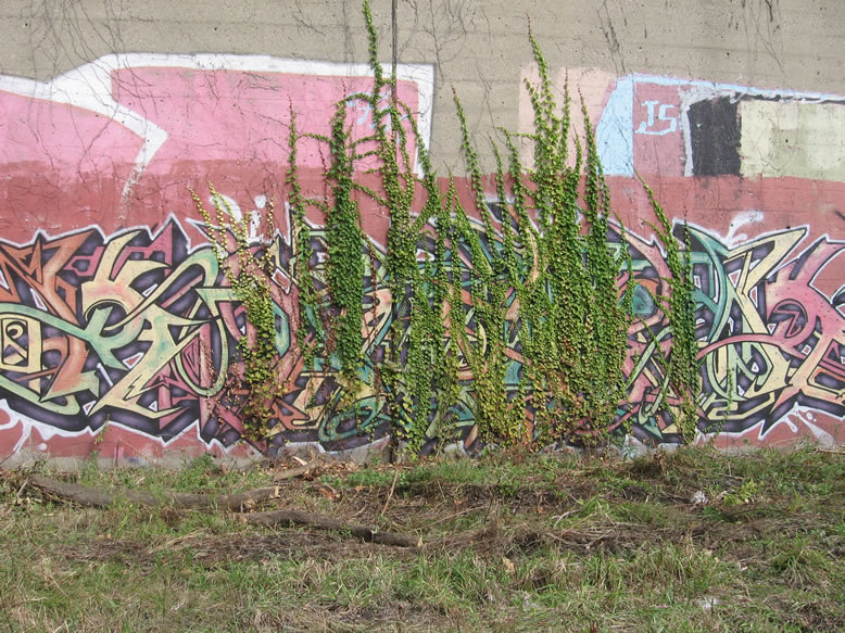
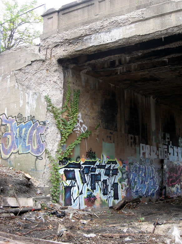
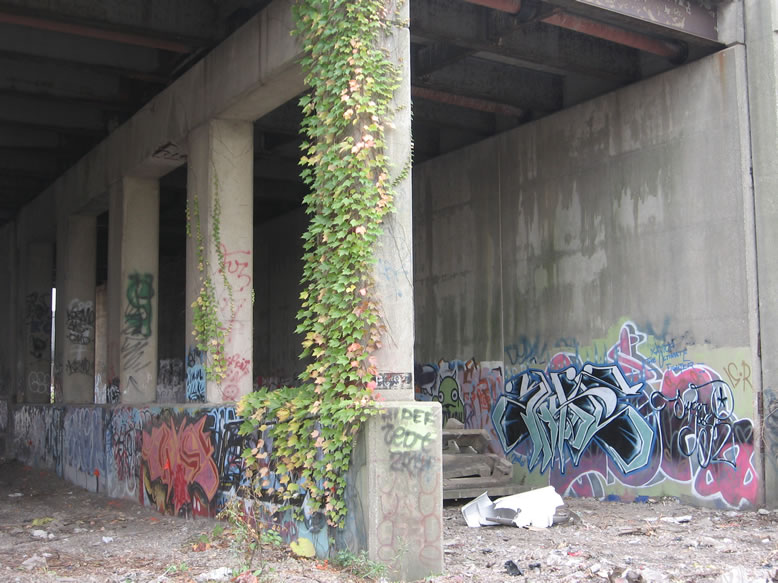
In some places it was evident that graffiti artists actually had to do a little groundskeeping and rip vines off the walls in order to get space to create a new mural...but they keep growing back:
Before the Cut was dug there was once a small Grand Trunk passenger terminal and a switch tower here (on the righthand side of the next photo) between Gratiot and Waterloo Street, according to Sanborn maps from the 1920s:

The short stub of Waterloo Street no longer exists on the city map, having probably been swallowed up by the widening of Gratiot Avenue after the advent of the automobile.
Jay Street, the next one, doesn't actually have a bridge across the Cut; this black thing that looks like a small pedestrian bridge actually contains massive steam pipes that provide downtown heating service from the trash incinerator. Normally they're underground, but here they jump over the Cut on their way downtown. The next actual bridge is Antietam Street:
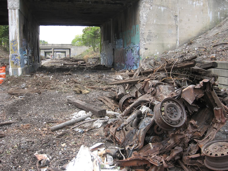
With the foliage cut away the epidemic of trash completely festooning all the slopes was exposed, as if it were an infestation of ants crawling in to feast upon the open wound of the Cut...
Speaking of trash and infestations, I believe the rat situation down here was off the chain...if you hung out here after dark I bet the ground probably came alive with hordes of the vermin swarming and riving around every nook and cranny of this filthy sh*thole, as well as in all the sewer pipes and abandoned slaughterhouse basements. Of course, I can only speculate, since I never actually hung out here at night.
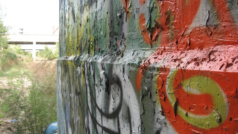
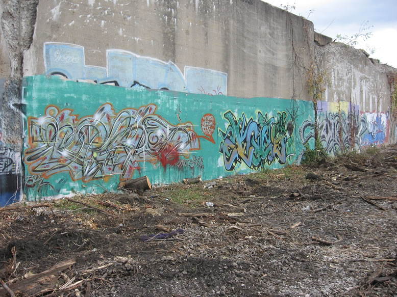
This wall, while already well decorated in 2007, has given way to much more complex and expensive burners in 2018...

It's like a fine art gallery now—everything is evenly spaced, well mannered, and well primed...nobody trying to squeeze in above or below. Only thing missing are the big gaudy picture frames like you see in the DIA. I say! Harumph!
The pieces are still amazing art, but it's not raw dog graffiti anymore, it's a groomed show dog jumping through hoops.

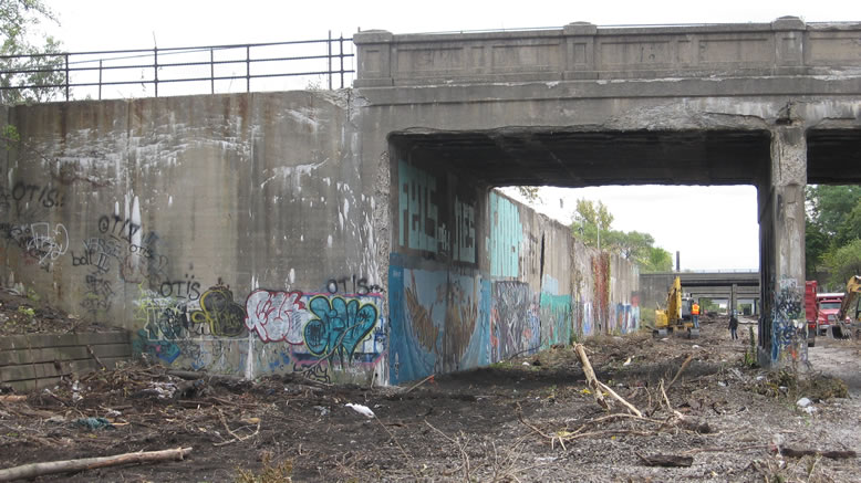
This is the Antietam Street Bridge...and yes the street was named after the gruesome Civil War battle:
According to MDOT, the Chestnut Street Bridge and the Antietam Street Bridge were both eligible for inclusion in the National Historic Register of Places "as a well-preserved representation of the urban grade separations built during a formative period of highway development." They were drawn up in June 1929, near the end of the initial 10-year project phase, and were among 16 other crossings that were completed by March of 1930.
During construction of the "Gratiot Redevelopment Area / Lafayette Park" urban renewal project in the 1960s, Chestnut and Antietam Streets were closed to vehicle traffic, and when it was completed in 1964 they were reopened as a pair of one-way streets, one inbound and the other outbound. St. Aubin Street was also reconstructed as a boulevard at that same time.

These old-school steel supports under the Antietam Bridge are gone now, so I guess it no longer qualifies for the National Register...?
The flaky footings of Antietam's iron supports:
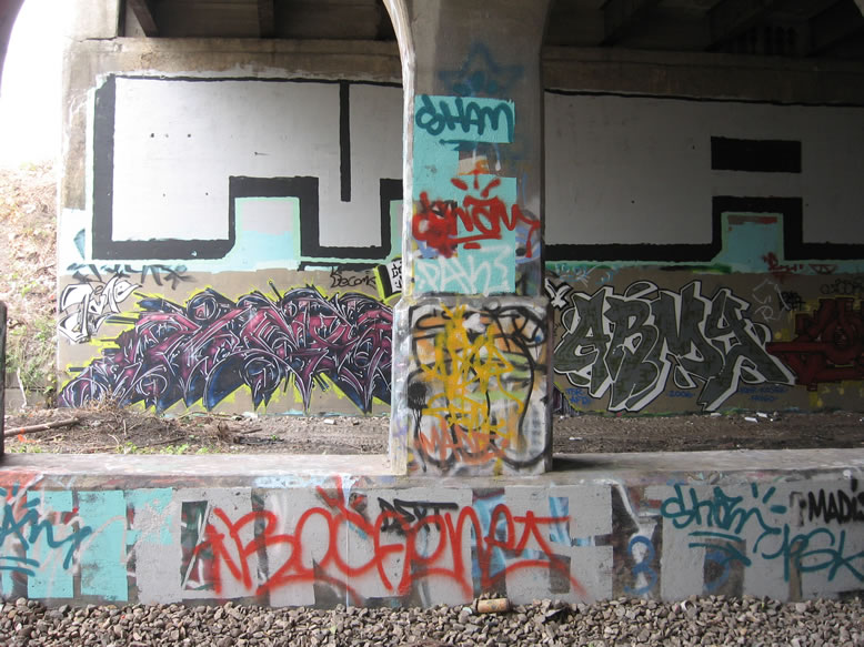
TSR burner:
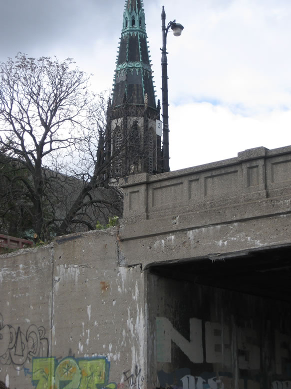
St. Joseph's massive spire jutting up above the Antietam Street Bridge...there was a time long ago when it was the tallest building in Detroit:
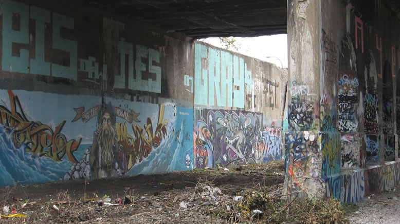
And now on to the Chestnut Street Bridge:
ORAL/FARS, GASM, and DEAD KRAKHEAD..."He Died for Your Sins, Now Go Shopping":

Here, standing under Chestnut looking south, we see the naked abutments of older, long-demolished bridges that used to connect the cross-streets of Black Bottom, Detroit's most noted historic ghetto:
The sharp historian might also observe that the Cut runs from "Lafayette Park" at its south end to "Forest Park" at its northern end. They were two former slum areas designated for Federal funds in the 1950s-'60s during Detroit's big "urban renewal" phase under Mayor Cobo, which was essentially just another term for "ghetto removal"...the idea of applied gentrification is not new to Detroit by any means.
The ruins of the Maple and Sherman Street bridges, with the Catherine Street Bridge crossing in the distance:
In post-WWII Detroit, organized city planning became a thing for the first time ever, and soon a master plan for a "New Detroit" was hatched, which would rebuild the tattered, aging city after decades of physical decay since before the Great Depression. Namely, the vast slum areas of Victorian-era shacks were to be cleared away and replaced by fresh Modernist developments that catered to middle and upper class city dwellers, and Lafayette Park was one of the most contentious of them. Forest Park on the other hand, was never redeveloped after everyone was shunted out of the area—which explains why it remains such a sparse urban prairie today.

Lafayette Park was one of the first suburban-style developments to be built in the city; in other words it did not conform to the existing street grid, but was laid over top of the urban fabric like a band-aid, and essentially functioned as an insular, exclusive community rather than an inclusive one that was physically connected to areas around it.
But this was the urban planning trend at the time. Basically all of Black Bottom was demolished to build Lafayette Park and Interstate-375, and since the Lafayette Park neighborhood was designed to be so insular, most of these old cross streets like Maple, Sherman, Mullett, Clinton, and Monroe didn't go through it, their bridges over the Cut were no longer needed and were demolished, disconnecting the new development from its surroundings even more.

I believe I also once heard that the cutting off of these bridges over the Dequindre Cut was a deliberate move to keep the new development isolated from the remaining poor people in the area (most of whom were obviously black), much like the purpose of the infamous Mendota Wall near 8 Mile, but it seems like this would've been moot.
But this was the urban planning trend at the time. Basically all of Black Bottom was demolished to build Lafayette Park and Interstate-375, and since the Lafayette Park neighborhood was designed to be so insular, most of these old cross streets like Maple, Sherman, Mullett, Clinton, and Monroe didn't go through it, their bridges over the Cut were no longer needed and were demolished, disconnecting the new development from its surroundings even more.
*It is also worth noting that similar redevelopment / gentrification moves were made at the same time to get rid of the white ghettoes in Corktown, "Skid Row," and the Wayne State area. This was also the same era in which the Medical Center, Civic Center, University Center, and Cobo Hall projects came about, and all of them involved mass-demolition of large sectors of the city. The freeways became derisively known as "Cobo's Canyons" as they too carved massive scars in the landscape.

So in a sense, the Dequindre Cut stretched from the "Forest Park Redevelopment Area" on the north, to the black slum centered around Black Bottom at its south end, labelled the "Gratiot Redevelopment Area," which was completely demolished by 1951. But the land sat in limbo for so long that it became known as "Ragweed Acres" to the embittered residents of the area. The city renamed it "Lafayette Park" when the glitzy new Modernist housing was finally built along the edges of the Cut.
Although Lafayette Park is considered a modern architectural landmark, it was (and still is) seen as a manifestation of "Negro Removal," one of the irrefutably racist legacies of the Jeffries and Cobo mayoral administrations. There was originally a promise that some of the new housing there would be reserved for low-income blacks to stay, but this was soon forgotten (big surprise). Of course, the reason there was a black slum in the first place was because black people weren't allowed to live anywhere else in the city, and most couldn't afford to anyway. So when these slums were demolished it exacerbated an acute housing crisis (since there was no real plan in place for what to do with the former inhabitants once their homes were torn down), which in turn became a major precipitating factor of the 1967 Riot.
The Catherine Street Bridge:
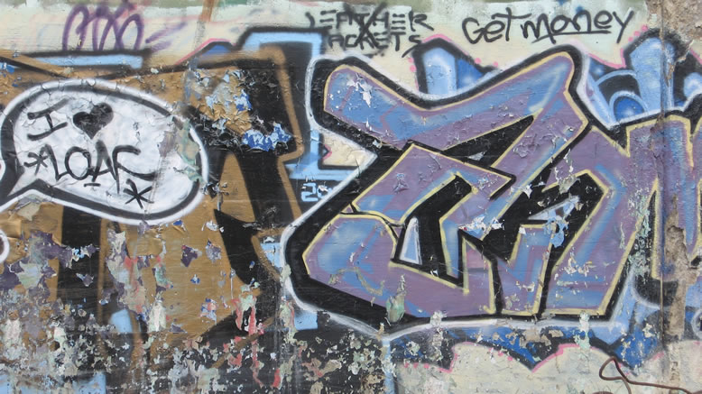
LOAF is always good:
Looking back north from Catherine:

The monolithic stub of the Mullett Street Bridge, with one of the Modernist towers looming behind it in a very different sort of monolithic way:

Oh dear, now this certainly isn't very "Detroit 2.0"...avert your eyes, dear readers, from this crass negativity:
Another ARMEE and a FYER on the ruins of the Clinton Street Bridge:
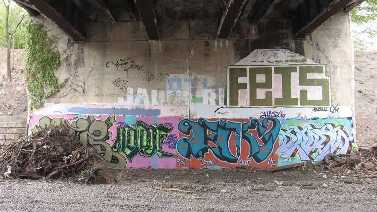
This next one was the Macomb Street Bridge—apparently in its last moments—since it was demolished at some point after I took this next photo:
I believe Macomb was an abandoned bridge anyway, since the street no longer crossed through this area (although it does pick back up again briefly a few blocks to the east of here as a short cul-de-sac). You can use the old FEIS roller tag on the lefthand pier to match up this image with the Google Streetview image below; it is the only piece of graffiti still intact. Note also the new entrance ramp from Lafayette:
 |
| Image from Google Streetview |
Personally, I don't think they made much of an improvement in this area, as far as the quality of the graffiti is concerned...
I thought the effect of submerging the tag in translucent water was pretty cool:

Here is what the same spot looks like today in 2018, everything completely covered yet again by a new mural:

On the opposite pier, the covered up AYEM RV roller and this FEL piece are the only remaining clues as to the true identity of this wall...

Before...
Before...

...after:
 |
| Image from Google Streetview |
That Streetview image was taken in 2014. Here is what the same abutment looks like today in 2018—it's now called the "Campell Terrace"...you can match it up using the big tree in the background:

Here's something I never noticed before—there seems to be more stacked limestone in the ruined foundation of the Macomb Street Bridge:

A view from atop the ruins of the Clinton Street Bridge:

The Clinton Street Bridge also has The Count painted on it, to help you keep track of how many calories you're burning while jogging the Cut by suddenly yelling at you from the bushes...followed by thunder and lightning of course. "Two, two fatasses! Ah ah ah ahhh...!"

This whole wall between Lafayette and Macomb was torn down as well, since that's where they put the ramp:


A view from atop the ruins of the Clinton Street Bridge:


This was another area where the foliage was so thick against the wall that you almost couldn't see half of the graffiti because it was in the bushes.
The ivy vines were even helping tear the face off the crumbling concrete...
SINTEX, 2006...all gone now:

More SINTEX, taken by my man Cavemonkey:
 |
| Photo by Cavemonkey |
Now this looks like some old-school sh*t...
"Avoid the Noid," man!

And now here we are under the E. Lafayette Bridge:
Buried deep in a 2017 Metro Times article about Mayor Duggan's ham-fisted "war on graffiti" is a quote from a graffiti writer that really rings true for me. It came after the Metro Times questioned the cop in command of the anti-graffiti task force as to why she thought taggers still engaged in graffiti into their adulthood:
"It's silly, it's sophomoric," says Detroit Police Sgt. Rebecca McKay, who commands the unit responsible for catching the graffiti writers. "So many of them are in their late-20s, mid-30s, and they're still doing this—climbing buildings and painting. And I'll tell you what—I think that a lot of these artists—vandals," she says, stopping to correct herself, "are true artists and they have true talent. But why are they doing this? It seems like they could be so much more than just a tag on a vacant building."
Metro Times then put the question to WUZN, a 34-year-old who recently quit painting after 20 years of having it as the focal point of his life:
"As a 12-year-old kid, I thought it looked cool and I wanted to be a part of it," he explained. "Then when I was a teenager and I started to wrap my head around why I was doing it, I was like, 'Oh, I'm an introverted, shy person who has a really hard time in public, and it's a way for me to kind of exist everywhere and nowhere at the same time.' Then as I got into my late 20s, it was like, 'Oh f*ck, I don't know how to transition out of this,' and, 'Oh, I might as well keep doing this because I'm finally good now.' Then as you get in your 30s it can go a few different ways. Your life can change and get more stable and you can't risk doing it, or you don't have sh*t because you've done graffiti your whole life and you just continue to do it because it's all you know how to do. The most beautiful part about the whole thing is that the common person cannot wrap their head around why someone would put so much time and effort into something that doesn't give back," he says. "That's why, if you're looking at it like art, it's a really high form of art."
...That may be the most perfect explanation I've ever seen for why, as a middle-aged man now, I find that my life is still heavily tied into exploring abandoned buildings, a hobby from my teenage years. Although I do more book research these days than scaling walls, this might be the best explanation that I've ever seen of why we are the way we are.
I'm certainly not saying it like I consider myself a role model because of how I've spent my youth, but it is a sort of accomplishment, and it feels good to see someone else coming from the same perspective. Luckily I fall more toward the "my life got more stable and now I can't risk legal trouble" camp; although I still have my ways of getting around certain barriers and into places I shouldn't be, I don't really do the balls-out risky stuff anymore.

And even though in my FAQ section I pretty much say that I don't get off on having a secret superhero persona, I can't deny that there is a certain irresistible attraction that is part of why I get enjoyment from sleuthing around these hard-to-access places under a pseudonym. I'm an introvert too, and have never been comfortable in public, but I am fascinated by it, and by the feeling of being able to live out a second, anonymous personality within it and yet apart from it. It is hard to overlook the bizarreness (and hypocrisy) of the fact that my "nailhed" persona is way more popular and way more respected than my real persona ever was. It helps compensate for a certain satisfaction, or a certain swagger, that was missing in my life due to my social awkwardness.
The fact that it was pretty much impossible to drive a squad car down here with all the trees and junk kept the police from being able to effectively patrol the Dequindre Cut, contributing to its reputation as a place of total freedom for graffiti and general lawlessness. Graffiti was never high on the DPD's priority list until Duggan became mayor anyway.
Moving on from East Lafayette to the abandoned East Fort Street Bridge, which was apparently demolished soon after I took these photos:

E. Fort Street itself doesn't even really exist anymore, except for maybe a tiny little stub near the old Wayne County Building. The other side of E. Fort, with the RenCen looming in the background:

This next photo shows what the ruined abutment of the E. Fort Bridge looks like today in 2018 (use the blue IRATE tag in the corner to match it up with the previous photo):

I bet the people watching the surveillance cameras must've thought I was a suspicious character, busting in and out of the bushes randomly, walking around in circles with a laptop and a camera in my hands, trying to figure all this stuff out.
Moving on to the abandoned E. Congress Street Bridge:
East Congress is another street that hasn't really existed through this part of town in a long time, so while the bridge is still standing, its road deck is totally overgrown with foliage and even small trees, just like E. Fort was.
PAK, FYER, ARMY...
More East Congress...
Before...
...and today, in 2018:

Most everything is whitewashed, and the far wall is plastered with a big new mural, but you can still spot a couple FYER throwies high up on the pillars that match the old photo.
What is that, a Pontiac 1000?
Back then it never occurred to me to go up on top of the abandoned bridges to see what their road decks looked like, so while writing this post I decided to make a trip back to the E. Congress Bridge and check it out on top.

It's about what you'd expect it to look like, but it's still a trip to imagine that this was once the middle of a busy city street.
Looking back north, to Lafayette:

Now leaving E. Congress, and on to the Larned Bridge:
It's small and hard to read in this picture but painted in small letters on the edge of the first column support is "M.P.092," undoubtedly a railroad marker of some kind.
Clearly the road was widened to twice its original width at some point, which is evident by the old and new pillar types standing side by side. This was done to Lafayette as well.
Most of the railroad lines here have already been bulldozed up, but one still has ties remaining:
Larned is also unique from the other bridges because it's double-supported, as you can see by the two walls:
I guess Adelaide originally had two support walls as well, but not anymore.

Under Larned, looking back north at E. Congress and E. Fort:
After passing Larned the last bridge before the end of the Cut is East Jefferson Avenue, which I don't have any photos of. If I remember right it didn't have anything good on it, or maybe I never bothered walking down that far south.
Closing thoughts: I personally think that it is a serious oversight for the Dequindre Greenway not to have any kind of signage identifying any of the streets that cross over (or used to cross over) the Cut. The bridges should be labelled, not just so people can know where they're at while biking, but I think a few interpretive signs would be appropriate as well so that people know where they are in history while biking, instead of just passing a series of anonymous concrete walls with expensive murals on them and then going to get sushi. Maybe they just haven't gotten around to installing such signs yet (I think Lafayette and Jefferson are marked but that's it).

For extra credit, count how many times I used the word "ham" in this series, multiply it by 211, then play that number in the Lotto, and share 53% of your winnings with me. I accept payment in Steel Reserve.
References:
Sanborn maps for Detroit, Vol. 3, Sheets 39, 40, 21, 22, 23, 24, 25 (c.1921)
Sanborn maps for Detroit, Vol. 4, Sheets 39, 40 , 41, 42, 43, 44, 45, 46, 47, 48 (c.1922)
Sanborn maps for Detroit, Vol. 3 Sheet 25 (c.1897)
American Odyssey, by Robert Conot, p. 399, 444-445
http://www.porthuronandnorthern.com/dtRickel.html
http://onedayindetroit.com/tours/20
http://web.mit.edu/nature/archive/student_projects/2009/jryoung/Pages/dequindre_history.html
http://www.michigan.gov/mdot/0,4616,7-151-9623_11154_11188-29422--,00.html
https://www.freep.com/story/opinion/contributors/2016/05/01/dequindre-cut-detroit-future/83702990/
http://www.roguehaa.com/a-brief-history-of-detroits-black-bottom-neighborhood/
http://www.miesdetroit.org
https://www.metrotimes.com/detroit/inside-detroits-merciless-graffiti-crackdown/Content?oid=5702408
http://www.atdetroit.net/forum/messages/6790/61926.html?1133416263
https://www.metrotimes.com/detroit/detroits-top-10-urban-planning-blunders-and-10-successes/Content?oid=11680985&showFullText=true
Special thanks to my homies Navi and Cavemonkey for their assistance on this post.
Looks like your thoughts trailed off here: "I believe I also once heard that the cutting off of these bridges over the Dequindre Cut was a deliberate move to keep the new development isolated from the remaining poor people in the area (most of whom were obviously black), much like the purpose of the infamous Mendota Wall near 8 Mile. But it seems like the"
ReplyDeleteDamn! good catch...fixed.
DeleteI worked at Rickel Malt from 1969/1975. The Dequinder cut between Gratiot and Adelaide was the best pheasant hunting in Michigan! I have been in the top floor room in the grain silos many times and have fond memories of the parties fellow workers and I had there. Thank for the memories!
ReplyDelete