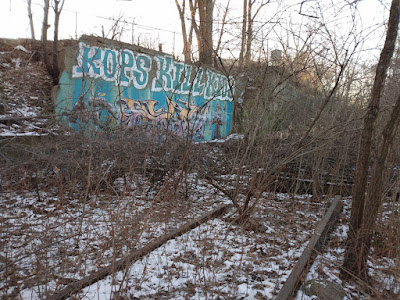
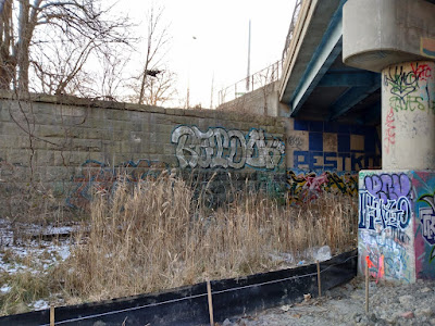
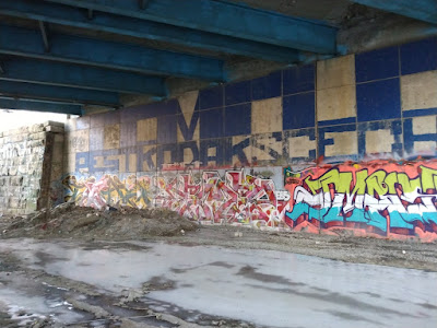
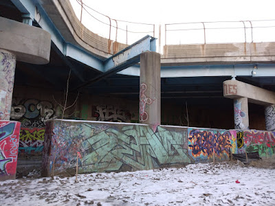
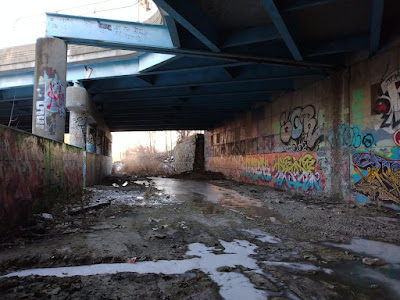
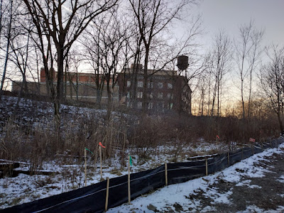
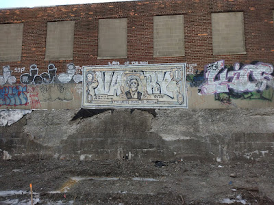
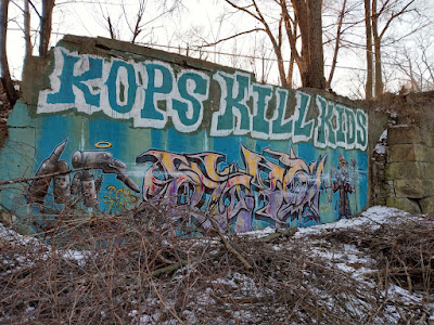
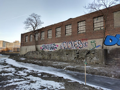
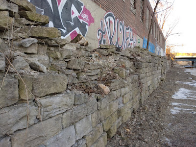
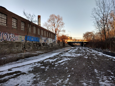
Not far from downtown, on the city's west side, there is another overgrown old railroad cut full of graffiti and homeless people, just like how the Dequindre Cut used to be before it was gentrified. Granted, this one is smaller, but it is also about to be gentrified, so I guess I'll bring it to you now before that happens. By the way, I
explored the Dequindre Cut in an older post.
I'll admit I knew about this one for a long time but never went down into it until recently, when I panicked because I noticed they suddenly cut back all the overgrowth to turn it into part of the new "Joe Louis Greenway" project. Looking down into the cut while driving along Rosa Parks or Fort Street provided one an enticing glimpse of old stone ruins from long-gone bridges and layers of graffiti, not to mention I knew it also corresponded to the path of an ancient creek bed. For all those reasons I had always wanted to check it out "someday," but now it was getting shot to the top of the list.
The Detroit Riverfront Conservancy set spring of 2022 for groundbreaking on the new "
May Creek Greenway," which would eventually link up to the greater "Joe Louis Greenway" that is currently stretching across the city and includes the Dequindre Cut. The May Creek name refers to the ancient stream that used to flow through here. My colleague Andrea Gallucci recalled reading something in perhaps a newspaper or the Journal of Common Council that talked about how May's Creek was encased in a wooden sewer pipe in the 1860s. I looked at the Sanborn maps going back to 1884 and no surface creek was indicated, so I would definitely say that the stream was put underground before that time. In the 1860s this area was already becoming highly industrialized. Then starting in 1906 the railroad tunnel to Canada was also dug along the same path as the former creek, right underneath this railroad bed.
Another colleague of mine, Paul Szewczyk,
wrote a post some years ago about the ancient streams that once veined across what is now urbanized Detroit. He showed a map drawn by Silas Farmer that superimposed the native streams on top of the downtown street grid...and you can see the original course of May's Creek (at lower left) and where it corresponds to the current railroad right of way:
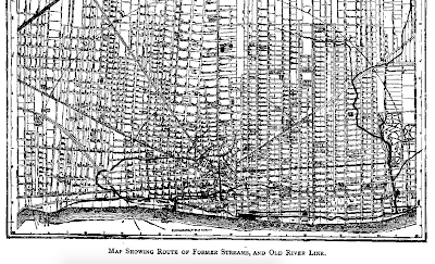 |
| Image from Silas Farmer, click to enlarge. |
Farmer writes,
The stream more recently known as May's Creek, after Judge May, was formerly called Cabacier's Creek, from Joseph Cabacie, or Cabacier, who lived here in 1780. It was designated in 1747 as Campau's River. It is claimed that Jaques Peltier erected the first grist-mill on the stream, just north of what is now Fort Street, and near the railroad crossing. The stream supplied water sufficient to run the mill six or eight months of the year.
If the Cabacier name sounds familiar, you may recall that Cabacier Street parallels this railroad corridor, a few blocks to the east. Looking at a Sanborn map, I thought his below-grade rail corridor used to be one of the approaches to the old Union Depot (which stood at Fort & 3rd), and the even older train stations that stood there before it in the heydays of railroading, well before the current Michigan Central Station was built. Local railroading guru Peter Dudley informs me however that it merely passed very close to the Union Depot (see his comment below this post).
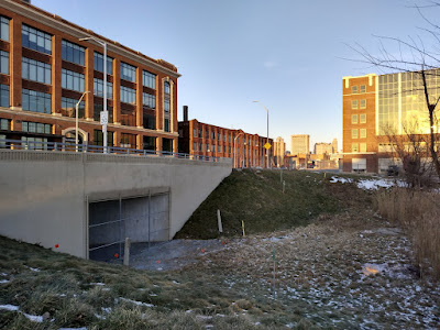
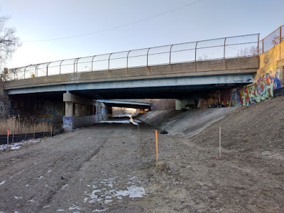
Here we see that the Fort Street bridge over the railway has also been rebuilt in the past couple years:
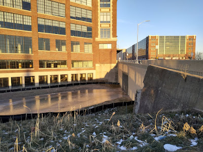
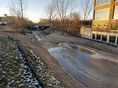
There is a bit of water down in here now, and a lot of phragmites...almost as if May's Creek wants to reappear.
I have to wonder if the fencing over the opening is to keep more homeless people from seeking shelter under it...?
...It certainly isn't big enough to accommodate trains anymore. And the railroad tracks have already been removed from the cut anyway, all except for the siding seen in the first photo.
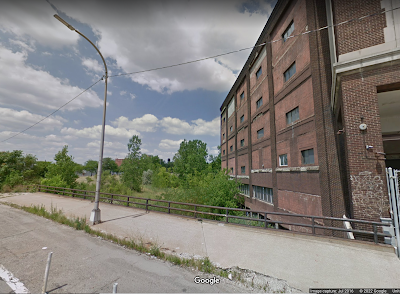
By the way, this is what the spot looked like in July of 2016, before the Fort Street bridge was rebuilt:
 |
| Image from Google Streetview |
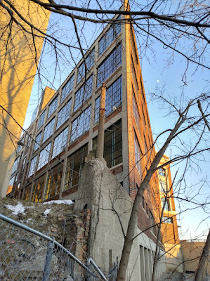
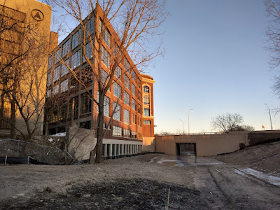
Despite its appearance, the large building on the corner here was not originally an old automobile factory...it was the Edson-Moore & Co. Wholesale Dry Goods warehouse. It was renovated around the same time and now appears it is going to be more lofts or something.
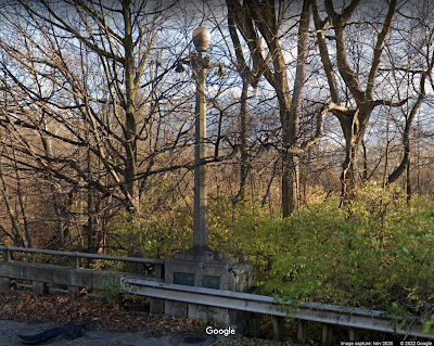
Note the ~1920s concrete streetlight pole, that looks like it may have flanked a bridge that no longer exists...? Which would be odd, considering this was not a street, but an alley. No such bridge is shown on the 1921 Sanborn map however, and no corresponding bridge footing currently stands on the opposite side. Perhaps it was more like a ramp or stairway down to the railroad tracks, for loading / unloading goods. It just reminds me a lot of the art-deco style lamps that you see on some of the other bridges around town, such as the one that passes over the Rouge River at Warren Avenue:
 |
| Image from Google Streetview |
Anyway, I dug into the archives for more info on when the May's Creek was put underground. Some reports I found in the Free Press from the Common Council referred to the creek in 1859 as being in a "culvert" at Fort Street, the covering and completion of which was being hotly debated by Council as to the costs associated. One from 1858 mentioned that the appropriations involved "mason work."
The Annual Report of the Controller of the City of Detroit for 1860 refers to funds for the May's Creek Sewer, as well as for several other sewers around town including Bloody Run (another "ghost" stream put into a sewer). The Detroit Water Board had just been established in 1853 by the way.
Beginning my walk up the cut to the northwest, towards Michigan Central Station:
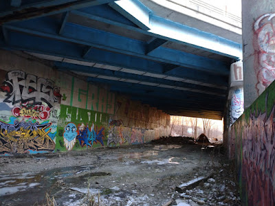
The first bridge you come to after Fort Street is Lafayette Street...you can see part of the abutment for the old bridge still making up a section of the wall:
Good ol' Lafayette...if you recall your Detroit geography, it also crosses the Dequindre Cut. ;)
The 1921 Sanborn refers to this crossing as a "steel trussed viaduct"...
This much more modern replacement seems to have been built adjacent to the original?
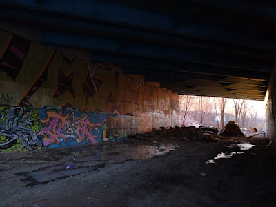
This is really starting to remind me of Dequindre...in fact, I wonder if any of these homeless people here used to live in the Dequindre Cut before getting kicked out when it was gentrified?
This weird curve is actually the intersection of Lafayette and Rosa Parks:
Looking back south toward the river:
Ahead is a tent belonging to one of the people who live down here:
One of the things that I detest about the "New Detroit" is that you hear about all these new developments and restorations of things that were once broken or abandoned announced with such bluster and fanfare, and everyone claps like a seal...but we all know damn well that they're just going to come through and make the police kick all the homeless people out, herding them somewhere else. Not solving anything, not addressing the issue of homelessness, not reducing poverty...just shooing it away so that yuppies can move in without having to look at it and feel guilty.
If anyone knows different, feel free to comment below or email me. I mean, I'm down with increasing bicycling infrastructure (especially for those who can't afford cars), but if we spent as much effort and money on addressing housing, poverty, and public transit in Detroit as we do on bike lanes for yuppy newcomers, we would be doing
much better.
In the midst of its much-touted "rebirth," Detroit is
still tied for the #1 highest poverty rate of any city in America (as of 2021). Foreclosures are still gutting the neighborhoods, while taxes and cost of living are going up, and truly affordable housing is disappearing. Corruption is even more pervasive than it was under Kwame. Downtown looks nice though, right? I don't know how we can look at another ribbon cutting ceremony with that grinning leprechaun Mayor Duggan and keep pretending like everything is all good.
We are witnessing the implementation of apartheid in Detroit.
This is the main encampment here...I say "encampment" because they have been here for about five years:
You can see that they have built semi-permanent staircases to make access to the "above world" easier, and have collected drums for perhaps storing water?
Because of the severe cold today, the inhabitants were all huddled inside their cocoons underneath the viaducts for warmth, paying me little attention, and I wasn't trying to be nosey. I noticed they also had stacks of firewood around that they had gathered for cooking and heat, and the usual spare clothing hanging on bushes and fences. I would say that this is an extraordinary level of work and detail put into creating a habitat by and for homeless people, but I have seen even more elaborate than this around town. Take a closer look, especially back in the wooded freeway medians and cloverleafs and you will see some shanty towns that rival the
Hoovervilles of the supposedly "Roaring" 1920s. Question it whenever the elites tell us that America is prospering...and do not become blind to the poverty that's right in our faces every day.
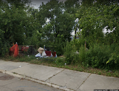
This is what the same spot looks like from alongside Rosa Parks Avenue, the only clue to its existence visible in the outside world:
 |
| Image from Google Streetview |
They had been living there since at least 2018 as best as I can recall. Now all of their items have been cleared out, and there is a NO TRESPASSING sign posted in this spot.
This stone section of the wall used to be the eastern abutment for the Howard Street viaduct, another steel trussed bridge:
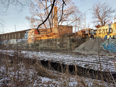
Up ahead can be seen the former Seaman-Patrick Paper Co. warehouse, which I recently
explored in a previous post:
Now we are getting close to the mouth of the train tunnel to Canada, in fact we are standing on top of the tunnel here...
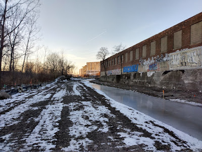
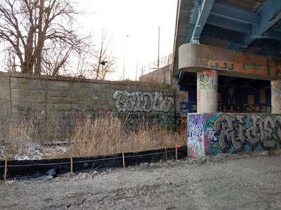
It also seems like graffiti is almost disappearing from the cityscape. Except for "sanctioned" walls sporting fashionable murals and comfortable messages, real street art is nearly gone from Detroit, and that has been the result of Mayor Duggan's relentless buff campaign (graffiti removal), and prosecution of painters. In my opinion this equates to a sort of censorship of dissent, ironically enough imposed by a suburbanite mayor, in order to make suburbanites "feel safer" in Detroit. In other words, worrying more about the feelings of outsiders than the feelings of residents. Since 2013, Detroit has felt more and more apartheid to me, and the change in the graffiti scene has been part of that. Other than the insides of abandoned buildings, this pit of despair along the cut seems to be one of the last refuges of real graffiti; you just don't really see it in the public thoroughfare anymore.
Now some of you may be asking why I would lament such a thing; you may think graffiti is pure vandalism and should be eradicated. You may also deem it to be one of the symptoms of "the big city" that in your mind make it dirty, decadent, and dissolute, completely at odds with your suburban or rural lifestyle. All I can say to that is mind your own business where you are, and be glad I don't judge the characteristics of your home as harshly as you judge ours.
Speaking of apartheid in Detroit,
77% of Detroit Police officers reside outside the city. The DPD is almost 50% white, and of those white officers 97% of them do not live here...yet they are policing a city that is almost 80% black. Sounds kind of like an occupying army to me, especially when you consider the DPD's tactics during the Summer of George Floyd, and their efforts to suppress protest.
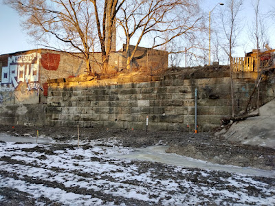
The sandstone wall here is the western side of the Howard Street abutment, by the way:
You may remember from
my post about the Seaman-Patrick warehouse where I pointed out that Howard Street takes a strange dead-end right there...well, that is what it looks like from below.
These limestone blocks may indicate that something especially old may have been here at one time...they were in common use in the 1850s:
For what it's worth there was not a corresponding wall of limestone block on the opposite side of the cut from it.
References:
Common Council column, Detroit Free Press, August 25, 1858, p. 1
Common Council column, Detroit Free Press, September 7, 1859, p. 1
Common Council column, Detroit Free Press, May 27, 1859, p. 1
The Annual Report of the Controller of the City of Detroit, Detroit Free Press, May 18, 1860, p. 6