Showing posts with label Beaver Island. Show all posts

Beaver Archipelago, Pt. 11: "Success"

May 2013.

RETURN to part 10


I sat down on the picnic table at Northcutt Harbor with extreme stiffness and watched, panting, as Jon shut off the motor, dropped anchor, and untied the landing boat. From across the water I could hear him whistling cheerfully as he prepared to come ashore. Ahhh….what a beautiful day.

As Jon stepped ashore, he asked me with an exuberant candor how my stay had been. Perhaps he did not see the extra gray hairs on my head, or the deepened worry lines carved into my face by this ordeal, haha, as I struggled to prepare a suitable response to his ironic line of questioning. I heaved a sigh and slowly groaned, "This place took me to f@#$%n' school, man."

The description lasted until we got all the way back aboard the Liberty, and continued in great detail well after we had gotten underway out of the harbor. He was just amazed at my reports on the trail conditions, but he was absolutely astounded at the amount of distance I had covered this morning. "God damn, that must have beat your feet up something terrible, walking on all those rocks!" He also said that he would look into doing some trail clearing, ASAP. I estimated that it would take several guys with chainsaws and at least five gallons of gas to make a dent, to which he again widened his eyes in amazement and pondered assembling a posse of Beaver Islanders to come help out since the DNR does not allow motorized equipment such as Bobcats on the island.


I laid back in my chair and watched the mysterious island shrink behind us. It reminded me of the time I had done this exact same thing when sitting on the ferry leaving Isle Royale after surviving my ordeal there...the kind of over-the-shoulder look you give when you stumble away from a fistfight that that you just lost.


My trip was not over yet, however. I still had about a day left on Beaver Island before my return to the mainland. I would spend this evening there and leave early in the morning on the first boat to Charlevoix. There were a few things of interest within walking distance of St. James Harbor that I could check out at my leisure.

Once we had docked at Captain Bonadeo's place again we decided it was time for breakfast, so we headed down the street of the sleepy little town to the local eatery. I ravenously consumed a large portion of island-priced people food, having been on the all-nut-&-berry diet for too long. Coffee was a welcome substance in my system as well, as Jon and I chatted at length about Detroit stuff. After we parted ways I made my way to the local chamber of commerce, which is a minuscule little building. The only maps of the island they had were humongus, and cost $5…whereas my pocket now contained a scant $3. So the guy in the office allowed me to take a picture of the one on the wall for free:


All I needed was the top portion anyway, since I wouldn't be able to go any further than that without a car. Both this guy and Jon had told me there is a public transport bus/van that you can call to take you pretty much anywhere you want for free, and I pondered doing this in order to visit the lighthouse on the southern tip of the island, but decided to stay in the northern end. Today was going to be a lazy day, because I was now feeling very tired. It was only 11:30am, and already I had done more hiking this morning than I usually do in an entire day.


Jon had asked me what my plan for lodgings was going to be, and I said that I planned to camp somewhere. He informed me that there was a large sand dune to the northwest of his dock, up Donegal Bay Road, and half a mile from that was a campground and a county park. This sounded good to me. I began walking up the street to the end of the main drag, where the Mormon Print Shop still stood.


It was the sole remaining building on Beaver Island that dates to the days of King James and his Strangites. Today it is the island's historical museum.


When I finally reached the campground, I was very tired indeed. But I realized that I still only had $3 in my pocket, and that the campsite fee was $5. I guess I could just camp without paying, but I decided it better to just stealth camp somewhere else nearby instead. There was a very nice view over a cliff here, and the cool perfect breeze drifting in off the water to rustle the shade-giving trees was absolutely heavenly.


I sat my heavy pack down and laid here against a stump for at least two or three hours, just daydreaming and relaxing with my socks off. No one else was around. The island that is in view across the water is the one I had just come from, Minis Gitigaan.

After I felt like moving about again, I decided it was time to check out this dune. The abandoned cell tower sat next to it. Jon had pointed this out to me from the water yesterday, blaming it as the reason why his phone doesn't work as good anymore.


I pondered climbing it for the assuredly kick-ass view that must be had from up there, but it was surrounded in a big mean fence that looked troublesome to climb at best, so I let it go in favor of lounging about on this nice warm dune sand for a couple more hours.

A few yards away was Font Lake:


I noted that the water level seemed curiously higher than the ground I was standing on at the bottom of this large sand bowl. In the wooded glen immediately adjacent to this dramatic dune area I found a nice place to hide my pack, and potentially set up my stealth-camping spot for the night. But I still had several hours to kill before the sun would be down. I decided that an unencumbered hike out to Indian Point would be just the ticket to burn some daylight and see some sights.


It was about a five mile walk from where I was. The significance is that this was a place of council for local tribes going back to ancient times, if I recall correctly.


What I didn't realize is that it was now all private property basically. I also got confused by the "road system" here…I would wager it was put together by developers, not a road commission. Case in point, Indian Point Rd. does not go to Indian Point.

Anyway, I set out and ran into a weird old geezer with a long scraggly beard and a walking stick out for a stroll with his wife as I was sitting at a confusing crossroads trying to analyze the picture of the map in my camera's viewer. He asked where I was trying to get, and said that I would be better off following the shoreline. I didn't mind that idea at all but it seemed to me that it was all private. He pointed me back to where I had come from and said to walk down in the woods over there and that's how you get there. He said you have to cut through private property but it's okay, everyone does it.

So that's what I did. Immediately I came to the dead-end which looked mysteriously like a driveway. The house looked dilapidated like it was abandoned, and this old Opel with an Ohio plate sat next to it, so I figured this was the ticket--clearly no one had been here in a long time.


The old man had said to go past where the driveway ends, and cut down to the beach so I did, cautiously as I entered the yard. Suddenly, I realized there was a man sitting quietly in a lawn chair here enjoying his waterfront view. Surprised, he asked me what I was doing. "Uhh, this old weirdo told me it was cool to cut through your yard, I guess?"

With a furrowed brow he told me that indeed I can get to Indian Point this way if I wish, but that this was private land. I sheepishly apologized and decided to just go back to the confusing roads. Anyway I did finally make it to Indian Point right at the peak warmth of the day, and removed my boots to bury my weary feet in the cool sand.


It was all private lots there too, but I managed to spot an undeveloped wooded lot for sale between two occupied ones and jumped into the trees to clandestinely make my way to the beach. In the shimmering distance past the clouds of midges, there was that humped silhouette of High Island again, beckoning from the horizon.


For some reason I had thought that there was something to Indian Point, like a huge sandy dune cliff overlooking the lake, or a historical marker, or...something. But there was nothing here of note except some gaudy modern house off to the left. I felt like I should probably have gone to see something else with my time. I made the best of it though, taking the opportunity to relax and soak in some rays for a couple hours before lazily making my way back to my camp.

When I arrived back, I spent more time laying on the warm sand reading from Ruchhoft's book as the sun went down on this phenomenally gorgeous day. I rolled out my bag and slept under a pine tree in the wooded hollow adjacent to the dune.


Day 5.
In the morning I awoke early and began hiking back into town to make sure I got a ticket for the first boat to the mainland.


Next to the old Mormon Print Shop I noticed the remnants of the old Beaver Island Jail, built in 1910 and burned in 1930:


Barely visible is the maker's nameplate stating it was made by Adam's Steel & Wire Works, Joliet, Illinois.


It was a gorgeous morning in the harbor.


I sat sipping some free coffee from the ticket office as the ferry was loaded with cargo.


The winds coming off the lake were quite brisk, even a little too cold to stand out on the deck as we got underway.


A little side-story regarding the Irish culture here. In 1938, according to the Lansing State Journal, Alan Lomax, an agent of the Library of Congress’s Archive of American Folk-Song recorded two versions of a c.1874 ballad called “The Gallagher Boys,” about the brothers Johnny and Owen Gallagher and their friend Tommy Boyle, who had tried to sail back from Traverse City in a storm and were lost on Lake Michigan.

One of the singers was Dominic Gallagher, whose father had sailed to Traverse City with the Gallagher boys but was convinced by the captain of another ship to wait out the storm. Dominic recalled "seeing his father walk very much alive into what was supposed to be his wake." You can listen to Lomax's recording of the ballad HERE.


The piers of the Mackinac Bridge, seen in mirage to the east:


The lake was eerily placid and reminiscent of my return trip from Isle Royale:


The 130-foot ferry built in East Boothbay, Maine rode perfectly flat, and again I was nearly the only person aboard on this ride. As we continued south, the image of the Mackinac Bridge, over 37 statute miles away, was swallowed up in maritime mirage as it went behind the bony arm of Waugoshance Point:


Around that time I also sighted the tower of what I can only imagine to be Waugoshance Shoal Light, or Ile Aux Galets Light, both essentially abandoned.


Thanks for reading.


References:
Exploring North Manitou, South Manitou, High and Garden Islands of the Lake Michigan Archipelago, by R.H. Ruchhoft

Beaver Archipelago, Pt. 1: "To the Kingdom of Strang"

May, 2013.

Of the significant islands in Michigan's waters, those of the Beaver Archipelago loom large in lore. I have wanted to go there for some time, and in May of 2013 my chance came. Years back I had gone to the Manitou Islands, and some years after that I came across a book written in 1990 by a history professor from University of Cincinnati, R.H. Ruchhoft, entitled Exploring North Manitou, South Manitou, High and Garden Islands of the Lake Michigan Archipelago. The tales told in this book of life as it was over a century ago bewitched me, as did seeing the author's small black & white pictures of the decaying ruins of the mid-1800s settlements. Ruchhoft spoke of the ruins in a way that made it sound like they would not be around for very much longer, installing a sense of urgency in my desire to get there. I already knew a little of Garden Island's mystical past too, so this just sweetened the pot.

Getting to these islands is either tricky, or easy, depending on your point of view. Of the Beaver Archipelago, only Beaver Island (MAP) itself is inhabited, but as a result there is fairly regular ferry service from the mainland at Charlevoix, starting in spring. The other islands have either never been populated, or haven't been in about 50 years. In my initial research, I found the website of a man named Jon Bonadeo, a Beaver Islander whose living is partially made by chartering out to the islands with his boats for wildlife researchers, lighthouse buffs, and hikers such as myself. There is no other way to get to the outer islands of this archipelago unless you have your own boat, which must be seaworthy enough to navigate in open waters. There are shallow reefs between the islands making for sharp currents, and seas can get quite high even in good weather.

I spent a few years doing a little reading up on the veiled history of these mysterious outer islands, whetting my appetite and building excitement for the eventual journey. I decided that out of all of them I wanted to see Squaw Island, Garden Island, and High Island the most…Squaw had an abandoned lighthouse, Garden was an ancient Indian burial ground, and High had once been home to a religious cult (plus its tall dune had the best view). Finally timing and finances lined up, and I contacted Captain Bonadeo for an early-season trip out. I initially hoped for an end-of-April trip, but he informed me that while it was possible to go to the islands then, there was still two feet of snow there, and there would still be ice, making beach landings tricky. I decided to push it out until mid-May.


I left out of Detroit at about 6am and arrived in the affluent harbor resort town of Charlevoix (MAP) at about 10:30am. It contains many examples of a style of architecture invented by local native Earl Young, sometimes called "Hobbit Houses." His work is not found anywhere outside of Charlevoix; here are two examples (not the one on the left):


The ferry Emerald Isle was scheduled to leave at 11:30am.


Beaver Island is actually quite large, about 55 square miles, and has plenty of roads. I could've brought my car over but I decided not to, being that I'd be spending most of my time on the outer islands anyway. I can always come back for a more detailed explore of Beaver Island at a later date, since it is relatively easy to get to (but compared to the untouched wildernesses of the outer islands this cottage island holds little for the explorer). The ferry ride out across the lake lasts about two hours in good weather. One can also charter a small airplane flight to the island's airstrip, but again, I decided to take the much cheaper nautical option.


Beaver Island has a deep history itself that is extremely fascinating on its own, but I shall not attempt to delve too deeply into it here; for the purposes of this story I will focus mainly on the histories of High and Garden Islands.

In order to properly contextualize my story however, I must at least sum it up. Beaver Island is the largest island in Lake Michigan and was of course originally populated by the native Anishinaabe people, and their ancient ancestors. It is said that people of the ancient Hopewell Culture had a solar calendar erected on the island to help govern their agricultural activities. It was made up of boulders placed in a pattern spread out across the island much like the standing stones of Stonehenge or Callenish Circle, which dates as far back as up to 5,000 years, though this figure is the subject of much debate. It can be safely said however that the calendar and the ancient gardens those elder people kept are at least 1,000 years old. The boulders' locations are not really publicized, but they have been documented by university scholars. Most are spread out, hidden deep in the woods of the now almost completely reforested island. How anyone pieced together that they might form a pattern is beyond me…perhaps it was first noticed a century ago when the island was logged?


In the early 1800s, Irish settlers came to the islands of the Great Lakes to eke out a living much as they did in their homeland by fishing the bountiful waters around Beaver. In 1848 a man named James Strang, an outcast prophet from the Mormon Church, chose Michigan as the place to lead his small flock away from the main body of Mormons, who chose Utah.

Strang is one of the most colorful characters in all of Michigan's history. He set up a colony on Beaver Island, was elected to the Michigan House of Representatives in 1853, and formed what at the time became known as Manitou County, which embraced most of the islands off the northwestern Mitten of Michigan. The county seat naturally was his colony on Beaver Island, the town of St. James, which is still the only town on the island today.


Strang then declared himself a polygamist, and the "king" of his people, the "Strangites," which is when things began to get weird. He even had a coronation ceremony, with a real crown, a scepter, robes, regalia, the whole bit. Though he only claimed rule over his own followers, he sought domination over everything he could and made a lot of enemies, especially the Irish fishermen who were on Beaver Island before his arrival.

Hostilities occurred between the two groups, often resulting in violence, and eventually the Irish mostly fled Beaver Island to surrounding islands rather than deal with King Strang and his bullshit. Strang also managed to piss off his own followers whenever possible, sometimes ordering floggings for transgressions of Strangite law. A jerk of this caliber was just looking to get a cap in his ass, and that cap came in 1856.


Not only were his enemies out for him, but it has been rumored that the federal government was looking for a piece of him as well, even orchestrating his assassination. He was probably the only person to ever establish an independent monarchy within the bounds of the United States, which is, well…clearly against the U.S. Constitution, heh.

Though again he only technically claimed to be a monarch in a religious, and not a political sense, he was still illegally seizing property and revenue, and screwing up the fishing industry in a big way with his shenanigans, an industry which by the 1880s was so important that Beaver Island was the largest supplier of fresh-water fish consumed in the entire nation. He had been ordered to federal court in Detroit by President Millard Fillmore three years prior on charges of counterfeiting, treason, and other crimes, but somehow walked. Probably because he was politically connected.


In any case, that summer the U.S. Navy's gunship USS Michigan pulled into St. James Harbor, and invited his majesty aboard. As King Strang walked the dock two men approached and shot him from behind, pistol whipped him savagely, then boarded the vessel—whose officers watched the entire incident from the deck without interceding. The Michigan then departed for Mackinac Island, where the two assassins were allowed to disembark.


Strang's assassins were given a mock trial at Fort Mackinac after which they were fined $1.25, then cheered by the locals. Strang died of his wounds a month later, at which time a "drunken mob" of Irish from Mackinac Island and St. Helena Island immediately descended upon Beaver Island to drive the remaining 2,600 Strangites out, stealing their possessions and forcibly herding them onto commandeered steamers bound for other states.

This effectively spelled the end of the Kingdom of Strang. Manitou County became reputed as a lawless territory and was soon abolished, at the calling of Governor Bagley.


The Beaver Islands became part of Charlevoix County, while the Manitou and Fox Islands became part of today's Leelanau County. Beaver Island was 100% Irish again, with fishermen coming back from the surrounding islands, and from County Donegal back in the old world. The common tongue on Beaver Island in those days was not English but Gaelic, and it earned its nickname as "America's Emerald Isle," which it retains to this day.

Logging also came to the islands once the mainland had been clearcut, but by the 1940s both this and commercial fishing ceased to be profitable in the archipelago, and almost all of the islanders left for the mainland. Only in recent times have people really started to move back to Beaver Island, mostly retirees and rich cottagers. Central Michigan University (my alma mater) has maintained a biological research station there for many years, and I remember seeing their Beaver Island posters on the walls of Brooks Hall whenever I cut through it during foul weather.

The peaked dune silhouettes of the North and South Fox Islands (MAP) in the distance off the port beam came into view about halfway through the journey:


Those islands have interesting stories of their own…both are uninhabited wildlife refuges, and there is no ferry service to them. South Fox contains an abandoned lighthouse while North Fox was once the Michael Jackson-style retreat of a rich philanthropist from Ann Arbor who cleared an airstrip and would take young boys there to molest them in the privacy of the absolute wilderness. His child porn ring / boys' camp was busted up in the 1970s. Stay tuned to see if I ever figure out a way to explore those islands.


Anyway, legends persist that during the Strangites' sudden eviction from Beaver Island by the barbaric mob of irate Irishmen, some of the followers hid King Strang's stash of gold by submerging it in Fox Lake on the southern end of Beaver Island. I had also read on the internet that (according to Carl A. Norberg's article "Lost Treasure of the Beaver Island Mormon Colony," in the Fall 1987 issue of Inland Seas) they may have also hidden the "royal treasury" by burying it 30 paces from a "large tree" on High Island, where I would be going shortly. The tree was "easily noticeable in 1856 from its prominent location overlooking the island's northeast harbor," and it was said that the gold had been hastily interred there while his followers were transporting their wounded king to the safety of Voree, Wisconsin, where he later died.

Part of the legend surrounding King Strang was that he claimed to be a seer who had communed with God, via having "discovered" three golden plates buried in Voree, which were inscribed with the last words of an ancient Native American named "Rajah Manchou." This was a hoax manufactured by Strang in order to install himself as the living prophet of the Mormon church (which of course didn't go over too well with the Mormon church, hence his self-exile on Beaver Island). Huh, sounds kind of reminiscent of the "Scotford Relics" hoax in Edmore, Michigan.

Whether the golden plates, known as the "Voree Record" are the same "gold" that his followers hid away is not clear, but the plates did exist, and according to one source, "disappeared" in the year 1900. Treasure hunters have sought to relocate King Strang's gold for 150 years. No news of it being found has ever surfaced.


The engines of the Emerald Isle throttled back as we glided into the crystal clear blue waters of St. James Harbor.


I could see the stony bottom even though the water was over 20ft. deep. The old Beaver Island Harbor Lighthouse tower still stood on the welcoming outstretched arm of the bay.


The Central Michigan University Biology Dept. now owns the entire lighthouse complex, and recently turned the old boathouse into a fish hatchery.


Garden Island's coast was very visible off the starboard bow as well:


Here, safely within the harbor, you can see the mainland of Michigan's Lower Peninsula looming in the distance:


I scanned the row of old buildings and docks to see if I could tell which one was the home of Captain Bonadeo. I was scheduled to depart with him immediately upon arrival, so as to make it to High Island with daylight to spare. I stepped off with my pack and began walking down the street. It wasn't long before someone waved to me from a boat—I had found my man. Captain Bonadeo was just finishing fueling up and his buddy Fred helped me get my 50lb pack aboard. I'm not sure why it weighed so much this time, but it did. He said his boat, the Liberty, was 34 feet, but it seemed shorter to me. He also had a small old motorboat tied behind the cabin cruiser for landing, since none of the outer islands have docks. To make things more complicated, we would soon find out just how much more challenging making landings on these rugged islands would be with the drastically reduced lake level resulting from the recent drought.

Jon informed me that I was his first trip of the season. And there are no other such captains who charter trips to these islands, so therefore I would probably be the first person on the island since last year.


I somehow got the impression that Fred was Jon's new first mate, but in actuality Fred was a buddy from Grand Rapids who was up for a visit and decided to tag along to help out, despite being a complete landlubber. Watching the Laurel & Hardy antics of these two guys was the source of much entertainment as Fred would do or say something silly, and Jon would get all frustrated. Fred was also a bit of a talker, constantly pestering Jon with questions.


Within minutes I was back on my way out of the harbor into Lake Michigan on a course around the northern end of Beaver, bound for the eastern shore of High Island, some 13 miles away by boat.


Passing Garden Island off the starboard quarter:


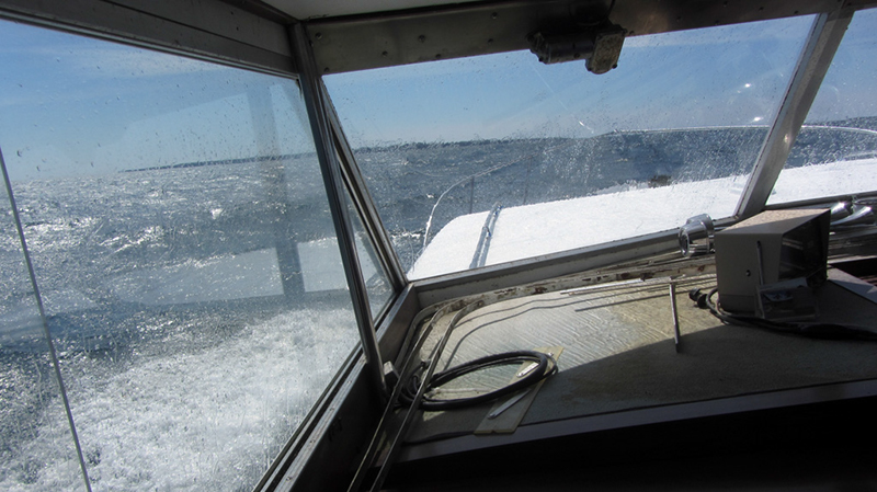
We plied the waves of what Jon called the "Highway," which is the passage between Garden and Beaver Islands, where the fishermen most frequently operate. We were rocking pretty good, with spray frequently blasting over the foredeck onto the windows.


Fred had asked Jon how high he thought the waves were, and he answered two to three feet. A particularly big wave a few minutes later sent us hurtling and grabbing onto loose items shifting in the cabin, and I heard the ship's bell clang loudly. "How big was that wave, Jon?" Fred asked in his slow, farm boy way. "I dunno, four feet, Fred," Jon answered flatly. I had worn my thermals and a jacket, and it was still a wee bit chilly. It had snowed here only two days ago, and none of the trees had leaves yet, whereas down in Detroit they had been out for at least a week. Finally, the strangely humped profile of High Island loomed into view:


I began to get excited as I laid eyes on this mysterious new land from a distance…. What secrets lay sleeping in those hills?


As the waters changed from sapphire to emerald the waves subsided, and we came into the protection of the island's natural harbor. Fred went up on deck to set the anchor while Jon made ready the landing craft.


Well, here we were.


CLICK for part 2


References:
Exploring North Manitou, South Manitou, High and Garden Islands of the Lake Michigan Archipelago, by R.H. Ruchhoft
Michigan: A History of the Wolverine State, by Willis F. Dunbar & George S. May
http://www.beaverisland.net/beaver-island-history/
http://www.lansingstatejournal.com/article/20130808/MICHIGANDER/308080009/alan-lomax-michigan-recordings