
Welcome to the second chapter of my Packard saga. The year 2006 was the first year I used a digital camera. Contextually speaking, it was also the first year that "urban exploring" in Detroit began to get big, and we suddenly weren't alone anymore. Graffiti began to increase exponentially, and so did vandalism. The beginnings of serious metal scrapping were also starting to be seen, and roof-trees also really began to take over the Packard. This was the year that Building 92 began collapsing in earnest, and the Packard first started to become known as a worldwide icon of urban decay. It was also the year the Michigan Supreme Court ruled against the City of Detroit, affirming that Mr. Christini was in fact the Packard's rightful owner (despite being in prison for narcotics). Later in the year the security guards were subsequently removed, and we could explore more comfortably.

As a result of these changes my perspective on abandoned buildings also changed, since I was not constrained by time or by the number of film exposures left in my camera...I could shoot as long as and as hard as I wanted, so I left the whole city covered in hot brass. Instead of shooting four rolls of film per weekend, now I was shooting that many digital frames every time I entered a building, which meant that I was capturing a lot more than in the beginning when I would often pass up taking a photo of something if I deemed it too mundane.

So you will begin to see these changes in my perspective play out in the next few Packard posts, 2007 and 2008.


Outside of Building 28, with its distinctly different brick exterior:

Ah yes, that old familiar walk up into the maw of the plant...

Just inside the door of Building 38, this was often the first stairwell we came to:

It was a crossroads of a sort; you could either go up into the main part of the plant, or down into the tunnels. I'll eventually get to posting photos from the tunnels in 2007. Often times there was water drizzling down the center of the shaft from rain or snow melt above.

It also had a little overlook on the other side that let you see out across the open space of the first floor area covered by the steel shed roof:

I wonder if it used to be a boss's office or something. Anyway, for us it most often served as shortstop when we first arrived and got into the plant. We would get inside, go up the stairs and stop here to uncap our 40s, adjust the paper bag, load film, spin up a doob, whatever we had to do before beginning that evening's mission. Often we would also sit in there chilling out while we decided what the mission was even going to be that evening, haha.

Some discarded couches and things in the alley:


The windows started to come out too, like entire sashes would disappear...it was strange, almost like seeing an old friend naked who you've never seen without clothes before.

This was a flaking COUPE piece that if I recall right was near either the Bellevue Bridge or the Boulevard Bridge:

Windows started disappearing, but for the moment vent stacks were still attached to the walls:

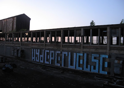
Graffiti was increasing steadily, but there was still plenty of real estate...

"CUE SUCKS" was an inside joke that I don't really remember now...anyway, CUE was the Chicago Urban Exploration crew. They were absolutely the most secretive exploring crew I knew of at the time, owing to the fact that there was a little bit of an FBI incident in 2002 that caused them go underground. I eventually met and explored with some of them, both here in the D and out in Chicagoland.

Anyway, this was the big cinderblock wall on the second floor of Building 35 near Palmer Avenue, in the main corridor where there was a long stretch of open windows letting in lots of light along Concord...and as such it was the perfect place to do graffiti. So over the years it became a sort of art gallery where some of the biggest and best pieces could be found (sort of like the Dequindre Cut), and as real estate started to get scarce you would see them start to overlap. I wish there was like a Google Streetview or something of this wall, where you could look back at it each year and see the changes.


South water tower's legs...notice the skybridge in the background connecting Buildings 33 (on left) and 32 (right):

This ghetto palmetto had grown right through the metal screen to reach daylight:


South water tower again:

Between Building 31 and 32:

The brownish color of those rust-stained panes of glass was the palette of the Packard; between the contrast of gray concrete and black iron, the rust-brown color was the only touch of warmth to be found anywhere on the mostly neutral spectrum here. They gave a new meaning to the term "stained glass windows" when the evening sun would spill through them and cast gorgeous golden light throughout the dank dungeons.

Can't remember precisely where this next room was located, maybe Building 33 or 35, but in the dark here I found an old wooden Faygo crate from the 1950s or so that was in like perfect condition...

I dug that boy out and kept it, awesome find. On one hand it was easy to say that the Packard was totally ravaged and there was nothing left in there that wasn't destroyed, but then you find something like that tucked away in some corner just outside of plain sight.
The diagonally-oriented tongue & groove flooring of Buildings 37 and 38 (which you may remember from my 2003-2005 post) disappeared suddenly, prompting me to take a photo:

I recall examining some of the slats at one point, and noticing that on their underside they were marked with the location of the mill they were cut at; they included up-north cities such as Pinconning, Gaylord, or Alpena. I'm not sure if those were the actual cities, but I recall seeing several different ones marked on flooring used in the same areas. I think there was also an Upper Peninsula town mentioned, maybe Menominee or something. A fellow explorer, Julian Bibb, actually picked up some of the wood before it all disappeared, and started making frames with it for some of his photographs. Now why didn't I think of that?

I assume the tongue-&-groove flooring slats were used in areas that were originally planned for light manufacturing processes, whereas the thick creosote blocks were used in heavier-duty areas of the plant.

The Sanborn map labels Buildings 37 and 38 as "Machine Shop, All Floors," presumably machining related to the body division. They were built in 1918.

The second floor of Building 38...the rectangular thing on the floor was a wooden cover over an opening that went through to the floor below...I think it might've once had something to do with the assembly line machinery:

This was also where the 1973 Lincoln carcass lay at repose...

That is, before it eventually ended up outside in the alley, after being pushed out the window a few years later.

But because it's not a dump truck or an RV in view of a major freeway, it just wasn't cool enough to make the news. If the same thing had happened in say, Livonia, it would not only make the news, but it would likely mark a watershed moment in the annals of city history.

This corner of Building 37 used to be a dead-end because it was bricked off from Building 38 by a newer cinder-block wall. You can see a small hole in the wall in the first photo of the Lincoln, above; over the years we helped widen that hole enough to where you could step through it and take a shortcut between the buildings.

Off in this direction was the stub of Building 38 that jutted out over Building 34:

As I recall if you walked into it, there was a hole in the wall where you could look though into one of the shed roofs of Building 34:

Here is a view outside across the same roof:


Originally a lot of these tarps were actually hung up from the ceiling rather than laying on the floor, but obviously they fell down before long. It was kinda trippy looking when they were all suspended from the ceiling. My guess is that they were put there to keep water from leaking down into the businesses that were renting space on the floors below.
The Palmer Avenue Bridge:

Standing in Building 31, looking across a vacant lot at Building 28:

The angled support trusses on the third floor of the Palmer Bridge:

Looking back at Building 31 from Building 28:

Building 27 and 28 seemed like they were a lesser-explored part of the plant, seeing as they were just two buildings off by themselves, separated from the rest of the complex by Palmer Ave. and Grand Boulevard, and by the time you got to them you had probably been walking the main corridor for awhile and were just cruising for the next bridge, or had your sights set on some other destination north of the Boulevard. Their second floor was more traveled, but the ground level and the upper two floors were almost never seen due to the fact that they were a dead end that did not connect to the rest of the plant.
This is a view out over the court in between 27 and 28:

Top floor of 28...notice the different shape of support columns in here:

27 seen across from 28:

Looking out of Building 28 across to Building 40, and Al's Place:

Zooming in, here is a pretty cool view over Buildings 40 to 42, and Building 90, with the RenCen in the background:

The skybridge between 27 and 28 was one of the ones that was barricaded on at least one end, rendering it basically unusable:

Looking back at the stairwell and elevator for 27 and 28:

Thinking back to my very first trip into the Packard in 2003, I think it was that part of Building 28 where we came across a live electrical box...my friend randomly flipped the switch on the disconnect box and a lightbulb in the same room suddenly came on! Needless to say we were "shocked" that there was still live power in what we thought was a long-abandoned building. Then again, it may've been in Building 35, which is right above Chemical Processing, which was still an operating business at the time.
Crossing the Boulevard Bridge on the third floor of Building 27 meant walking across its roof to Building 13...

Behind the Packard keystone...

Roller tags started to become a thing in Detroit around this time...

Notice the dumpsters off to the left...

...the city put the dumpsters there to dissuade people from dumping. If you remember from prior to this time, that lot over there used to be overgrown with trees and weeds and it was actually fenced...but anyway it had become an illegal dumping spot, so the city eventually cleared the lot and turned it into an official bulk waste collection site (since house-to-house bulk trash collection had been ended due to budget cuts).
Going across the Boulevard on the third floor also meant going in the window of the president's office. Picking up the nearest staircase there in Building 13, you could go all the way up to the "Skylight Room."

But first you had to cut through the fifth floor at the end of Building 12, which was the start of the "Doorpanel Corridor"...if you look close at the rubbish on the floor you'll notice that a lot of it is actually red interior doorpanels from mid-1990s Ford Mustangs. For some reason there was several thousand of these things up here, piled all over the floor for a hundred yards or more. And, of course, a boat thrown on top for good measure.
I know this next shot is badly overexposed, but because I don't think I have any other shots from this spot, I'm going to let it fly. If I'm not mistaken, I think Camilo José Vergara may have taken this same photograph in one of his books.

Coming around the corner and through a doorway, we are now back in the Skylight Room:

I talked more about this room in my last post, "2003-2005," but this was one of our hangouts.

I have to say it was a rather strange departure for a factory...considering that it did not ever seem to have a manufacturing function related to the rest of the plant. Not too many factories have superfluous "just for fun" rooms like this tacked onto them. I say that because of its location in the office wing, directly above the board room and president's office, and because the Sanborn map labels it as a "photo gallery."

Outside, here is the ladder that led up to the roof of the skylight, and the view of the south end of the plant:

It was also a good spot to look down the roof of Court 2-12:

And here the downtown skyline is visible:

Court 1 (below), and Building 1 on the right:

And of course here is the view across the roof of Building 12, which along with the Skylight Room has totally collapsed in recent years due to fire:

And here is the top of the skylight itself...I imagine not too many people went to the trouble to clamber up here:

A view over toward "the Pyramid," Building 5:

Original wooden sash windows, looking out over Court 10...the legs of the north watertower are seen outside:

This was the wrecked body of a Chrysler "K-Car," which sat in a little room off the end of Buildings 15 and 16:

The skeletal remains of Court 10, which also supported the north water tower:

In Building 16's top floor, this was the remnants of an old box truck:

And this is the "Paintball Corridor" I've mentioned before, where hundreds of empty cardboard boxes of paintballs from Splattball City were "disposed" of:

I'm sure it's just me, but every time I think of Splattball City I say it in my head to the tune of that Gwar song, "Slutman City"...
So the way that you got to the top of the north water tower was by going to the roof of Building 10, and then dropping down off the edge of the roof onto one of these iron outriggers that braced the tower legs to the side of the adjacent buildings. Then you had to balance-beam yourself across it until you reached one of the legs of the tower, and could begin climbing normally.

Easy as pie...

Somewhere out there is a documentary about "urban exploration" with a two-second clip of my doppelgänger climbing this water tower in the intro credits and movie trailer. I am almost embarrassed to admit that the clip also made it onto the evening news broadcast of a major Anaheim TV network when the movie debuted; my webmaster Tim had brought it to my attention, but I think this is no longer on Youtube. The movie trailer itself however, can still be viewed online.
It kinda reminded me of the time back in the 1990s when my cousin's girlfriend took a photo of me recklessly hanging from the janky water tower at the Detroit House of Corrections without my knowledge, framed it, and gave it to my mom as a present. What an evil girl...I mean who would even do that? ;) How predictive that photo was, though. Also that photo is the reason why I never told my ma about this website.
It kinda reminded me of the time back in the 1990s when my cousin's girlfriend took a photo of me recklessly hanging from the janky water tower at the Detroit House of Corrections without my knowledge, framed it, and gave it to my mom as a present. What an evil girl...I mean who would even do that? ;) How predictive that photo was, though. Also that photo is the reason why I never told my ma about this website.
Looking south toward the Pyramid / Building 5:
In the foreground is Building 4, with the wooden window sashes. Note the difference in windows where it joins with Building 3, on the left. You can also see some doors in the side of the building where there used to be a triple-decker skybridge that is no longer there. The building in the foreground with the hole in the roof is Building 10. |
| Panoramic, click for full size. Copyright nailhed.com. |
Here is a view looking north across the roofs of Buildings 15, 17, 19, and 21 (the Ramps):

Looking southeast toward Building 11:

There's Chisel down there, patiently waiting for me, and dialing "91..."

As you can see Building 15 received a new roof at some point more recently than the rest:

Unfortunately it went to waste when the end of the building collapsed at the "Tire Toss":

Why did it collapse? Honestly I never gave it much thought until now; I always just assumed "because Detroit," but it definitely had to be a structural issue on the second floor from the top...whether it was intentionally induced or not, I could't say. Also worth noting is the fact that if you look at my Packard Building Map, you will see that Building 15 was still fully intact when that aerial photo was taken in the late 1990s, yet the small hole in the roof of Building 10 was already there, and has not changed in size. So whatever happened to cause this collapse occurred very suddenly around the early 2000s.
Court 10 was different because for some reason the shed roof was stripped of all its actual roofing, leaving naked trusses:

Never was sure why that was either, since it was like that well before ferrous scrapping became a thing. Actually, come to think of it, Court 4 was stripped of its roofing like this as well, although the Packard Building Map tells a different story. Interesting. Maybe I don't know everything after all!
Now here's one for all you old school Packard-heads, let's see if you can remember this little setup:

It was a weird little part of a battlefield put together by Splattball City (you can tell by the pallets); they made a little ramp inside a stairwell of Building 10, leading out through a service door onto the roof of Court 2-11, here:

Honestly Splattball was a huge operation, now that I think about it...off the top of my head they had stuff set up on various floors of Buildings 21, 19, 17, 15, 10, and 5. That covers just about the entire north end of the plant! I'll show more of their battlefields in later updates. Anyway, here is an official Splattball City poster that I found and brought home...it's pretty old school, and kinda reads like it could be the inspiration for a Dead Kennedys song that never made it to wax. See if you can recognize anything in the photos...
 |
| Click for full size |
And right in the midst of Splattball City was the "Tire Toss"...


Basically you looked for a good tire (hopefully something smaller, like a 13 or a 14), grabbed it in one hand, got a running start and maybe a spin, and then when you got to the edge of the collapsed area you hurled it like a discus, as hard and as far as you could. It was hard to hit the post...it was even harder to get a ringer. I only saw it happen once in the several years that it took us to run out of tires to throw, and it wasn't me who made it. Needless to say Ryan got a hell of a lot of bragging rights when he put that one on. Hopefully I'll find my video clips of tire tossing somewhere, and post it...
Here's what "Tire Toss" looked like from the opposite side of the collapse:

Again, I couldn't tell you why this part of Building 15 collapsed, but you might note that its top floor was framed in steel members as opposed to the reinforced concrete design of the other floors. These buildings had floors added onto them (sometimes more than once) over the years as Packard kept growing. To Albert Kahn's credit, I don't believe this damage got any worse after the initial collapse; it was fairly stable.
But be careful standing on the edge there, she's a bit shifty...

...I'm being facetious of course, since I brashly climbed all over this mess like a complete idiot (stay tuned for some pretty stomach-turning photos in 2008).
The only way to access the rest of the top floor of Building 15 after the collapse was by taking the skybridge from Building 10:

Looking over Court 15 at Building 10:


About the only time it could've gotten direct sunlight was high noon, and other than that it was cloaked in perpetual "Manhattan" light. In the Canyon you couldn't see anything of the outside world, you were just surrounded in a blighted version of Albert Kahn's nightmarish cubic industrial utopia.


From the end of Building 1, looking back at Building 2 and its distinctly elongated window bays (above).


Actually this reminds me of one night when we were chilling out in that courtyard, probably around midnight, drinking and smoking as usual, when all of a sudden we noticed the sound of a vehicle approaching very fast with its headlights off, coming from the front gate where the guards used to sit. Stunned, we scattered into the bushes for cover, assuming it was some sort of cop or someone else we didn't want to tangle with. I leapt into the open window of Building 1 and my friend Donnie's girlfriend followed my lead. To our surprise, the vehicle—a crusty Dodge minivan—swerved into the bay door of the same building with us! We had ducked behind a large object for cover and for a second I thought they were actually coming after us, despite the fact that there was no way they could have seen us yet.
She was about to freak out and run but I forced her to pause when I realized the vehicle was just going to speed right past our spot, and further into the plant. Clearly it was not the cops, and even if it was some criminals looking to strip the car or dispose of a dead body, they were not interested in us idiots, but it was still wise to make sure that they didn't see us as potential witnesses, so we cleared out and made our way to the roof of Building 5 to regroup. We didn't see or hear anything else out of whoever was driving the van, but it was very mysterious and a little unsettling to see some random vehicle drive that quickly and deliberately into the plant with its lights off like they were up to some super-shady shit, or evading police or something. Either way, this was obviously their pre-planned hideout; they had been in here before.

Here's that spiral staircase next to the switch room again:


These shots were taken from the skybridge between Buildings 3 and 5.

Taking the second-floor bridge into Building 5:

I sure liked that bridge; I was extremely disappointed when it disappeared.
Mostly Building 5 was empty until you got to the 4th or 5th floor. There was some stuff on the 1st floor, including the wreckage of a burned up car or two, but for some reason we rarely went on the first floor of that building. Usually we took the bridges to get there, and when we got into that building our whole object was to go up to the top of the "Pyramid" anyway, so I guess that's why we hardly ever saw the first floor.


You may remember this stretch of asphalt pavement in the alley between Buildings 4 and 5, where all the 5-gallon paint buckets were strewn around, and it looked as if they had been turned upside down and used to draw the big colored lines on the ground...

Not sure why, but some of the windows in Building 4 were partially covered in horizontal wooden slats, as seen in the next photo:

Building 82 is seen out the windows of Building 5, with its huge severed skybridge:

Building 82, protected by some magic spell that apparently has to do with being on the other side of the train tracks, and the only part of the Packard Plant to remain unscathed by the clutches of urban decay, is seen looming behind the ruined foundation of Buildings 7, 8, and 9:

It served as the service department of the company back when people still took their automobiles back to the factory for service. The upper floors also served as the marine engine manufacturing department. Sometime in the 2010s I got around to climbing up onto the skeleton of that skybridge.

The fact that Building 5 sat in the middle of the "Canyon" surrounded by other buildings on three sides gifted it with some pretty enjoyable diffuse light. Except at sunset, when it was absolutely blasted with beautiful golden rays of direct light.

There were two different kinds of columns in Building 5, square and round "Martini glass" style, but I'll be damned if I know what the difference between them was. I'm not an architect or engineer. Now if I could go back and do things over, I would've spent a whole day going through the plant and photographing the types of columns found in each building of the complex floor by floor, and compiling a complete list of the different kinds, because there had to be at least 10 different kinds of columns in the plant that I can recall offhand.

The 5th floor of Building 5 was set up with another paintball battlefield from Splattball City (again, you can tell by the pallets). You came across the bridge and you were in the battlefield. In later years we used these pallets to fuel our insatiable need for rooftop bonfires on the Pyramid. Slowly, year after year, we lugged each one of these pallets up the stairs to be tossed on the fire. Trust me, it was exhausting carrying two pallets up five or six flights of stairs. I was in much better shape back then...

Looking from Building 5 over the roof of Building 1, toward the south end:

Hazy moonrise over the east side:

That was a nice night, I remember. It was our first big get-together of the summer, and the weather was very fine. We chose to spend most of it on the roof of Building 5.

The downtown skyline...if you remember it, this was the spot where Chisel took the photo for his website banner for ForgottenMichigan.com.

A large abandoned trash compactor or something sits next to Building 1, foliage pushing up from the cracks in the pavement:

The top of the Pyramid, also known to us as the BBQ room:

Leaving Building 5 by way of the open bridge on the 5th floor:

Building 3...

...you might notice this bridge is similar to the one from the story about the huge fire in 1959, where Building 5's fifth floor caught fire, as seen in this historic photo below. But as my reader Bill H. points out, that was actually different bridge, which used to connect to the western side of Building 5, from Building 8:

I mean, okay, it had a couple holes in the concrete but it was generally solid as a rock. You could've prolly still driven a forklift over it. Honestly I really am not sure why on earth they made this one bridge open to the elements, but it was different, so I liked it.

Inside Building 3 again...actually Building 2 and 3 are pretty much the same thing:


There goes the moon again over Building 12:

Looking left, where you can see the "Doorpanel Corridor" again on the top floor:
Back before it disappeared due to catastrophic scrapping, we used to walk across the roof of Court 2-12 all the time:

...It was the easy way to skip from the 4th floor of Building 12 (on the right) to the 4th floor of Building 2 (on the left).
Here was the window we used to climb through to get into Building 2:

Inside Building 2 there were a lot of the old factory lights, sprinkler pipes, and conduit still intact on the ceiling:

It also had wooden slat floors.
Corner of Building 1's top floor, looking southeast:


I suppose it's possible that they could have also been pipe chases for steam lines, since if I recall correctly there may have been radiators mounted on the ceilings of the plant at one time? I don't think I ever saw any pipes in any of the ventilation shafts, but then that heating system likely would have been dismantled and replaced long ago if such were the case. The fact that the shafts become slightly narrower on each floor as they go up also suggests they were more likely to be steam pipe chases rather than ventilation shafts.

Not every building had these shafts, but Buildings 1, 4, 27, 28, 15, and 10 had them—all of which were built from 1909 to 1916—and they were only seen on the south face of these buildings.
Looking back from the other end of Court 1, you can see the Skylight Room on top of Building 13:


Hazy moonrise over the east side:

That was a nice night, I remember. It was our first big get-together of the summer, and the weather was very fine. We chose to spend most of it on the roof of Building 5.


A large abandoned trash compactor or something sits next to Building 1, foliage pushing up from the cracks in the pavement:

The top of the Pyramid, also known to us as the BBQ room:

Leaving Building 5 by way of the open bridge on the 5th floor:

Building 3...

...you might notice this bridge is similar to the one from the story about the huge fire in 1959, where Building 5's fifth floor caught fire, as seen in this historic photo below. But as my reader Bill H. points out, that was actually different bridge, which used to connect to the western side of Building 5, from Building 8:
 |
| Image via Virtual Motor City Archives |
I remember some people were squicked out by walking on this bridge because it looked so fragile, and because it was open and so high up.

I mean, okay, it had a couple holes in the concrete but it was generally solid as a rock. You could've prolly still driven a forklift over it. Honestly I really am not sure why on earth they made this one bridge open to the elements, but it was different, so I liked it.

Inside Building 3 again...actually Building 2 and 3 are pretty much the same thing:

Damn, look at all those intact windows...so many squares....


The Packard's distinctly geometric architecture does not fall strictly within the definition of "cubism" as an art form, but interestingly enough the plant was mostly built squarely within the span of cubism's popularity, from 1907 to 1914.

Squarely....did you catch that little pun there? Okay, just making sure I didn't waste it.

Looking left, where you can see the "Doorpanel Corridor" again on the top floor:

Back before it disappeared due to catastrophic scrapping, we used to walk across the roof of Court 2-12 all the time:

...It was the easy way to skip from the 4th floor of Building 12 (on the right) to the 4th floor of Building 2 (on the left).
Here was the window we used to climb through to get into Building 2:

...imagine having to climb through a window to get around in the Packard Plant now!

It also had wooden slat floors.

Court 1...the brick columns on the right look sort of like buttresses to support the building's walls, but I later learned that they are actually hollow and I believe they functioned as ventilation shafts or heating ducts, since they connected to the tunnels under the plant, sort of like the way Kirkbride asylums were designed in the Victorian era:

I suppose it's possible that they could have also been pipe chases for steam lines, since if I recall correctly there may have been radiators mounted on the ceilings of the plant at one time? I don't think I ever saw any pipes in any of the ventilation shafts, but then that heating system likely would have been dismantled and replaced long ago if such were the case. The fact that the shafts become slightly narrower on each floor as they go up also suggests they were more likely to be steam pipe chases rather than ventilation shafts.

Not every building had these shafts, but Buildings 1, 4, 27, 28, 15, and 10 had them—all of which were built from 1909 to 1916—and they were only seen on the south face of these buildings.

CLICK HERE to go to Part B...
I still argue that the skylight room was originally for the development of blueprints, which before the diazo chemical process (developed in the 1940's) required a large amount of sunlight (incandescent lighting being weak at that time) - from Wikipedia: "Engineers and architects drew their designs on cartridge paper; these were then traced on to tracing paper using India ink for reproduction whenever needed. The tracing paper drawing is placed on top of the sensitized paper, and both are clamped under glass, in a daylight exposure frame, which is similar to a picture frame. The frame is put out into daylight, requiring a minute or two under a bright sun, or about ten minutes under an overcast sky to complete the exposure." Packard's engineers would have needed a dry, consistently sunlit area, and this was located above the office building.
ReplyDeleteI like the theory.
DeleteReading nailhed's comments on Bldg's 27 and 28 feeling isolated and about the bridges, which I'll shorten to just Bellevue, Boulevard, and Palmer; got me to thinking about my experiences using Blgd 31 for storage in the late 80's early 90's and historical photos. While I've never seen the Packard Cormorant article about the plants history, from historical photos, bldg's 27 and 28 were isolated from the rest of the plant, except on the ground, before 1939 when the Boulevard bridge was built. The Palmer bridge was built somewhere between 1939 and 1941.
ReplyDeleteIn the following I'll only refer to the reinforced concrete buildings, and reference Detroit Historical Society (DHS) and Detroit Public Library (DPL) online items (with reference numbers).
Bldg' 31,32,33,35,37, and 38 existed before the mid 1920's and were all connected together. Building 92 was built about 1925 (DHS-2004.043.294) and the Bellevue bridge was built, but was only one story high (third floor). By the mid 1930's the bridge was expanded to two stories (DHS-2013.028-117). The are numerous photos showing the construction of the Boulevard bridge and set the completion date as 1939. A 1940-1941 (DPL-na043398) photo shows all three bridges with the Palmer bridge two stories high. DHS also has some aerial photos and some postcards that show the same basic timeline (DHS-2013.095.185, DHS-2013.095.496, and DHS-2012-020.187).
While I never used the Bellevue bridge when I was in the Packard plant in the late 80's and early 90's I used the Boulevard and Palmer bridges each time I was there. In fact, as I was always focused on what I was doing with my stored car or boat, I really never noticed that I was on a bridge when I crossed the Palmer bridge on the 2nd floor. The trusses are on the third floor and the floors are level. I always noticed the Boulevard bridge because it was arched and I always saw it when I came to the Plant on East Grand Blvd.
For what it's worth, back then you could drive down as far as the fire doors Nailhed mentions between bldg 35 and 37. I often turned my pickup truck and various trailers around just before them.
Bill H.
Just wanted to clear up some poor typing/editing issues. In my comment referencing Detroit Public Library and Detroit Historical Society Online items, The Detroit Historical Society reference numbers don't have hyphens. So I listed for example DHS-2012-020.187 This is Detroit Historical Society item 2012.020.187 . While less confusing, but for clarity sake, what I listed as DPL-na043398 is Detroit Public Library item na043398 . - Bill H.
ReplyDeleteNailhed, I'm pretty sure I'm right here and double and triple checked, in you discussion above about Bldg. 15 (Tire Toss) you mention that the only ready access to the western portion of the 5th floor was through the skybridge from bldg. 10. I think that bridge comes from Bldg. 17. The bridge is connected to the North side of building 15 which is the Bldg. 17 side. Also as I have come to understand, Bldg. 10 is only 4 stories high, while all the others along that row (except Bldg. 5 and 13 are 5 stories). I have also finally realized that this is essentially the same area as the first picture in your Hollyweird posting, although that is a close-up from a slightly different angle with phenomenal lighting. - Bill H.
ReplyDeleteNailhead,
ReplyDeleteI'm guessing that you are aware that the Palmer Ave. Bridge is also gone. Based on Youtube videos, I believe that the bridge collapsed in either January or February 2020. I found no internet news about the demise of the bridge, which I found interesting as when the East Grand Blvd. bridge collapsed it was all over the news. In one video, taken from the ground, you can catch a glimpse of the structure on the ground. It appears to have failed on the Bldg. 31 side. In newer videos, some from drones you can see the cleaned up site with a clean separation on the Bldg. 28 side and significant damage to the 3rd floor of Bldg. 31. It's very painful to watch the steady and relentless decay of the plant, even from half a country away, from what I recall using for storage as recently as 1991. - Bill H.
Yes actually I was surprised to notice it was missing last month...is the video of it collapsed on Youtube?
DeleteNailhead,
DeleteThere is a YouTube video that shows views of some of the failed Palmer Ave. bridge. It’s called, ironically, “The Rebirth of the Packard motorcar company Factory Detroit Michigan”, with views of the bridge area at 1:43/8:43, 2:18/8:43, and 4:22/8:43. You can see some of the 3rd floor trusses still attached on the Bldg. 28 side. Some truss structure is visible on the ground, but most of the rubble appears to have been already been removed. You can also see a piece of heavy equipment.
The video was not shot about the bridge collapse. It appears to be a video of someone’s trip to the Packard plant. He’s narrating the video and initially listening to his GPS following directions. It’s a good thing he took the video because it’s the only one I could find that isn’t just a before or after. There are no leaves on the trees and maybe ice on his car’s cowl.
There is also a recent drone video “Packard Plant” by David Mascot that was also shot with no leaves on the trees with snow on the ground that shows the Palmer Ave Bridge intact see 3:50/6:02 and 5:18/6:02.
The former Palmer Ave. Bridge area can be seen in it's final cleaned up state in another drone video “Around Detroit Episode 10 - The Packard Plant” at 2:02/14:21 and 13:59/14:21. That video is well done and high definition. Sadly, it’s also an all to clear depiction of the sad state of the Packard. - Bill H.
Thanks Bill
DeleteNailhed,
ReplyDeleteI've been trying for some time to resolve an issue with the open bridge between bldg. 3 and bldg 5, and the bridge shown in the fire picture from 1959. I'm an engineer and structures are an interest. When I compared the two pictures I noticed that the diagonal bracing between the two bridges looked different. The one between Bldgs 3 and 5 have mirror symmetry about an upright, and have the appearance of an "A". While there is much less to go on, the one from the 1959 fire picture more resembles a saw tooth pattern. I know that there were numerous bridges than ran across Packard Ave, that sadly all disappeared in 1999 when the city demolished Bldgs. 7,8,9 and 23 and all the bridges across Packard Ave. I've also thought it would make more sense to fight the fire from the west side (Packard Ave.) rather than the east side (the canyon). So I went to the Wayne State University Digital Collection. If you search for Packard Plant Fires you won't find the close up of the bridge or the picture of the firefighters on the ladder at the open plant window, which is odd because the pictures have the WSU watermark on them. That's because WSU has those two pictures mislabeled as being from the Tuller Hotel. Those two pictures are items vmc38232_3 and vmc38232_1. (this just goes to show you how hard it is be keep all the stuff cataloged correctly) The three pictures labeled as
Packard Plant fire are vmc11579, vmc11579_1, and vmc11579_2. You have the latter two on the Packard Portal page. The first one vmc11579 is a daylight picture and shows the open bridge across Packard Ave very well. Also the zoom feature at the WSU digital collection website is excellent, the photo is very detailed and if you zoom in really close to the bridge you can see the safety screen and the diagonal bracing from the firefighters close up on the bridge. All in all, I'm pretty sure the bridge in the 1959 firefighter close-up was the one that ran across Packard Ave not the one between Bldgs. 5 and 3 (the canyon). - Yours - Bill H.
Wow, Bill, very good sleuth work! I should hire you on my staff full time lol!
DeleteI had compared the bridge to the old photos as well and I too noticed some dissimilarities within the scene (namely i could not match up the shape of the wall and the windows where it met up with the buildings), but I just wrote it off as the plant having been modified so many times, since I didnt know what other bridge like that there could possibly be. I totally missed the fact that it could have been on the western side of the building!
Good work.
Nailhed,
ReplyDeleteYour comments on not thinking about the bridge on the west side of Bldg. 5 got me to thinking that based on what you've written in the past, you may have never seen the Plant with Bldgs. 7, 8, 9, and 23 and the associated bridges across Packard Ave intact. This then in turn got me to thinking about my experience with the plant in person between 1986 and 1991, and what I saw online since the Boulevard Bridge collapsed in Jan 2019. If you'll allow me to indulge myself, what I have to share I hope will help illustrate the importance of the work you do at your site.
Back when there were numerous tenants in the plant, pre-1999, people either interacted with the many business that had doors on Connor Ave, or the other streets, or they drove into the Plant through the "underpass" near the western end of Bldg 13 (the administration building, on E. Grand Blvd.). They would check-in with the guard and then drive down Packard Ave. Camilo Jose Vergara has some wonderful pictures of what the view of Packard Ave looked like before 1999 and after (I'm guessing you don't use them because of copywrite issues). Any way, a good example is
https://www.camilojosevergara.com/Detroit/Former-Packard-PLant/15 and
https://www.camilojosevergara.com/Detroit/Former-Packard-PLant/16 . In case you don’t know, the two photos are from the same spot looking the same way. Amazing isn’t it.
While not as deep as the canyon on the east side of Bldg. 5, driving down Packard Ave had a definite "feel" to it, and open was not part of that feel. In my case, I drove down to Bldg. 21, up the ramp to the 2nd floor, down to the spine of the plant, turned right, drove through Bldgs. 18, 16, 11 and 12 then crossed the Boulevard Bridge, then through Bldgs. 27 and 28, across the Palmer Ave Bridge to Bldg. 31 where I rented two spots from the fellow who rented the entire 2nd floor of Bldg. 31. At the time, I didn't understand any of the buildings numbers or anything but the directions from the guard and the guy I talked to on the phone. Those directions were, stop and see the guard, drive down till you see a ramp, go up to the second floor, drive straight, turn right when you have to turn, drive straight, cross the bridge, then it's the third set of sliding steel doors. That set of directions and my other recollections were all I really remembered 12 months ago when I started looking for online information about places I had rented storage space from in Detroit. I was in the Packard last in the summer of 1991 and left the Detroit area permanently in 1999, but I digress.
When I initially tried to piece together google streetview and google maps to figure out where the ramp was, I couldn't make sense of it. I certainly didn't remember the drive to the ramp being open on one side as it is now. Once I learned that the buildings on the west side of Packard Ave had been torn down, it made sense and I figured out where the ramps were. This was all prior to Nailhed's Packard info, or before I knew who Nailhed was. So enter Nailhed and his massive collection of presentations about Michigan buildings.
due to length limit - End of Section 1 - Bill H.
You are correct--I never saw the plant prior to the demolition of Blgs 7-9 & 23, but i have seen photos of them with the bridges intact (including Vergara's). When I first looked up the Sanborns for the plant I was shocked at the number of bridges that had already gone away, but it explained why so many weird holes were in the sides of certain blgs.
DeleteThat must've been crazy driving through the whole plant back then! I have driven up the ramps in my pickup, and around on the roof of 21 but that's it.
due to length limit - Begin Section 2 - Bill H.
ReplyDeleteI first found Nailhed when I was trying to find out info about the storage place I rented from before the Packard, namely the Public Industrial Warehouse (name of the place when I rented there) or as I learned from Nailhed, The Detroit Screw Works. When I tried to find that place I couldn't find the building on google maps, because it was gone. A google search sent me to Nailhed's website and a wonderful description about the Detroit Screw Works history, great pictures and the fact that it was demolished in the early 2000's. I was impressed by his work, have read most of his postings and then finally he started posting his Packard Plant information. Of course, thanks to Nailhed I now know the building numbers, more in-depth history and have enjoyed all the wonderful pictures of the place. However, back to Packard Ave.
If you compare the views in Vergara’s pictures 15 and 16 you get a sense of the stark difference of what Packard Ave looked like before 1999 and after 1999. And of more significance, rather than the more gradual relentless decay of the rest of the Plant, the removal of those four buildings and the numerous bridges happened in something like 3 months.
So what's the point, well if you didn’t see Bldgs. 7, 8, 9, and 23 before 1999 then they are now just things from history. Pictures from a website, or if you are older, a book. To make matters worse, if no one ever bothered to capture that history, it's just gone. That's why what Nailhed does is so invaluable.
There would be little readily available about the Detroit Screw works, if not for Nailhed. Furthermore it’s all very available, because of him. The same can be said for most if not all of the buildings he’s chronicled. Take the Packard for example. Despite its popularity, there’s no collection of pictures, stories and context that’s even close that I’m aware of. Even better, he’s not done sharing additional information yet.
One last thought from someone nearing 60 years old. Despite Nailhed's extensive experience with the Packard, he said that the stuff on the west side of Bldg. 5 didn't occur to him, probably because he never saw Packard Ave before the four buildings were demolished, even though he's all too aware of their history. On the other hand, I couldn’t find the ramps because I remembered Packard Ave from before the four buildings were demolished. Opposite sides of the same coin; perspective is subtle and influenced by many things, and first hand experience is a major one. Yours - Bill H.
Thank you for that glowing commentary :)
DeleteNailhed,
ReplyDeleteDriving the 2nd floor of the North End of the plant was very disorienting. For much of the drive there was very little outside light. Almost all of eastern wall window sashes were replaced with cinder block walls with a single small high window. There was virtually no natural light on the west side of that section and there were metal sliding doors that allowed access to places that I assumed were more building wings like where I had storage. I don’t remember ever seeing them open though. Overall driving down the spine of the northern end of the 2nd floor of the Plant had a very “cave-like” feel to it (although there were several electric lights).
Crossing the Boulevard bridge which was distinctive and bright (daytime). Driving through Bldgs 27 and 28 during the daylight there was always that surreal green light coming through the corrugated plastic over the windows to the east. Then through the Palmer bridge section, which as I’ve stated elsewhere just seamed like more building when on the 2nd floor.
The third set of sliding steel doors south of the Boulevard bridge was building 31 where I had my storage. Once over the Palmer bridge the window sashes to the east were again cinder blocked in with the single small window. I’d often drive down past Bldgs 32 and 33 where the open pathway widened from two to three lanes (cells) and turning around was easier.
That’s about what I remembered and fortunately I found a helpful YouTube Video. The video “Packard Plant” by Masterkayin 6:51 listed as 10 years ago gives some sense of what the drive was like. In that video a fellow on a motorcycle starts in Bldg. 38 at the Bellevue bridge collapse on the 2nd floor, he then drives through Bldgs 38, 35, Palmer bridge,28, 27, Boulevard bridge, 12, 11, 16, 18, 21, and then out Packard Ave.
Based on the video and my better understanding of the Plant now, even if the western side of much of the 2nd floor had not been a block wall, there would have been almost no natural light because Bldgs C2-12 and C1-11 were 3 floors high. The metal sliding doors I had seen on the north end allowed access to buildings 10, 15, 17 and 19. Based on the video it looks like there was one window on the west wall overlooking court C19 and maybe one was overlooking C17.
If you watch the video realize that there had been many holes smashed through cinder block walls, much of Bldgs C2-12 and C1-11 had collapsed, and all the steel sliding doors were torn open by then. But you still get a sense of how dark the drive through the northern end of the spine of the Plant was on the 2nd floor. There is even a short glance at the 2nd floor of Bldg 31 (nostalgic for me).
I don’t recall seeing many other vehicles while driving down the spine, but occasionally I’d see something coming the other direction. Because of this, the drive down the spine also had an “isolated” feel to it. (more later on how different Driving down Packard Ave was) - Bill H.
Yes, i remember seeing the video from the motorcycle many years ago. I think there was also a stop-motion video done of a walk-through of the plant around the same time, which was actually done as an art exhibit that was on display at the DIA for some time.
DeleteI can say that on my first trips through the plant in 2003-2004, I did get a sense for what you describe inasmuch as the plant was still very much secure, insular, dark, and disorienting in that main corridor and similar areas.
Nailhed,
ReplyDeleteDriving down Packard Ave. and going up the ramps in the late 80's early 90's was rather lively. As I have said in other posts there wasn't an "open" feel to driving down Packard Ave. Most buildings were at least 4 stories high and from the window of a truck that was high enough that all you saw was building. I don't recall really noticing different buildings, it seamed very much like just continuous plant. The many bridges also helped with the sense of being closed in. However, there was lots of activity. You did see people and a fair number of other vehicles. In addition, it was clear that there was substantial activity just out of sight. The ramps were fairly busy and I recall having to occasionally having to wait to either go up or down.
I recall seeing the white box delivery tracks you see in Camilo Jose Vergara's 1993 and 1996 Packard Ave pictures (https://www.camilojosevergara.com/Detroit/Former-Packard-PLant/14 and https://www.camilojosevergara.com/Detroit/Former-Packard-PLant/15). In addition, you saw the cars of people that were working in some of the buildings which are clear in his 1993 photo. In a short 1:06 YouTube video, Vergara talks of the trucks being from a Bakery and a Laundry operating at the plant (https://www.youtube.com/watch?v=q60wcNOBkB8). I recall bakery trucks, but I seem to recall uniform supply trucks not laundry trucks per se. Of course that was a while ago, and I could be wrong. Vergara's two photos really do capture accurately what Packard Avenue looked and felt like.
Of all the photos of the plant that I saw when I first starting looking for info about the Packard Plant roughly a year ago (all prior to your postings) there are two that really grabbed me and "took me back" to 1986-1991. One was a high definition picture of Fernando Palazuelo (http://packardplantproject.com/news/wp-content/uploads/2015/02/Fernando-inside-Packard-Plant-JPG.jpg) standing on the 2nd floor of Bldg 27 with, the by then, rather tattered green corrugated plastic lit up. I'll never forget that green light. The second (well two) were Veragara's photos of Packard Ave from 1996 and 1993. Those pulled me back in an even more direct way because they looked like just what I remembered. Yours - Bill H.
Hey, just a heads up, 2007 has been posted!
Delete