
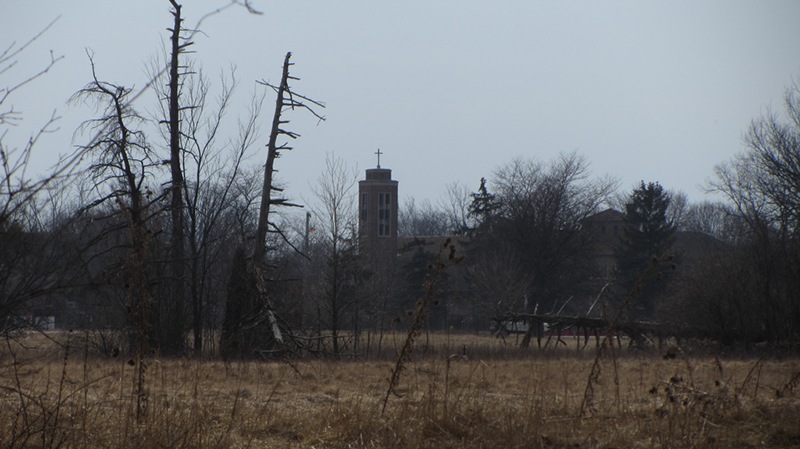
Rouge Park started in the 1920s when the City of Detroit was on an annexation binge, and bought up land from six farmers at the western edge of the city. Today it covers a total of 1,184 acres, making it one of the biggest municipal parks that probably exists in the world—bigger even than Belle Isle, and New York's Central Park. It's basically a huge wilderness refuge that was somehow spared from the inexorable development sprawl of Detroit—and a rather unexpected stroke of charity and foresight on the part of city planners.
At Spinoza Drive & Sawyer Street (just north of Warren) there is a weird little triangular traffic island off to the side, with this cannon sitting in the middle of it, and just past it Spinoza suddenly dead-ends in a grassy field. It didn't take me long to suspect that this wasn't always so—and as it turns out, the cannon might actually be a clue to the puzzle...

 |
| Image from Google Maps |
My knowledge of this cannon began several years ago when I learned that Detroit's Historic Fort Wayne was angling to get it relocated from this spot onto the grounds of Fort Wayne, so that it could join its other historic artillery brethren in a new cannon display there. At the time I think Fort Wayne's site manager Jim Conway typed up a short page of historical notes on this cannon, which revealed that it was actually of Spanish origin, and quite old.

Across the middle of the gun is the word "Encono," which is Español for "animosity," or "rancor," and is apparently the name of the cannon. The other intricate engravings on the piece indicate that it was forged at Sevilla, under the reign of King Charles III of Spain—which might explain the large Roman numeral "III" engraved under what I presume is his coat-of-arms.

There is also the date "29 de Mayo de 1779," which just so happens to be about one month prior to Spain's declaration of war against Great Britain, on June 21st, 1779. Britain was already embroiled in the American Revolutionary War, and Spain wanted to quietly aid the American cause—but more importantly they also wanted to use the opportunity to regain their long-lost territory of Gibraltar from the Brits as well.
Another Fort Wayne re-enactor and artillery historian, Lloyd Hevelhorst, was quoted by PreservationDetroit as saying that this gun was most likely a war trophy taken by the U.S. during the Spanish-American War, after the Battle of Santiago de Cuba, in 1898. During this dramatic engagement the U.S. Navy decimated the Spanish fleet completely when the tragically out-numbered and out-gunned Spaniards tried to break through the American blockade in Havana.

The Vizcaya was the only Spanish ship to make it through without being sunk, but she finally took a severe hit from the USS Brooklyn and ran aground, where four American ships circled and battered her to pieces. Ironically, the Vizcaya had been stationed in New York Harbor in reciprocity for the USS Maine being in Havana on the very day the USS Maine was allegedly sabotaged, serving as the original catalyst for the outbreak of the Spanish-American War. Vizcaya's destruction by USS Brooklyn was thought to have been retribution for the tragedy of the Maine.
The Vizcaya's main gun, which had inflicted the only American casualty of the battle, was removed and brought to Detroit as a trophy, supposedly due to the fact that the USS Brooklyn was manned almost entirely by sailors from Detroit (and/or the one U.S. casualty of the battle was a Detroit-born sailor aboard the Brooklyn, I'm not sure which). It sat on display in front of the old Wayne County Building for most of a century. According to a vague story I heard, it was allegedly rescued from being junked once, by an employee of the Detroit Historical Museum waving $20 bills in the face of the truck driver, bribing him to drop it off at Fort Wayne instead of the scrap yard. It has been sitting there rusting anonymously for many years while the Encono gun sits rusting quietly here in Rouge Park.

I am not certain exactly how Encono got here in Rouge Park, but it does seem plausible that it came at the same time as the one from Vizcaya. So far Encono has not moved from this spot, though preparations for building the new display at Fort Wayne have begun. Whether or not community proponents of Rouge Park are happy about seeing an attraction taken from their park, I can only speculate.
And how did Spinoza Drive get its name? I was anticipating that it would have Spanish origins to go along with our cannon, but britannica.com says that Benedict de Spinoza was a Dutch Jewish philosopher who lived from 1632 to 1677, "one of the foremost exponents of 17th-century Rationalism and one of the early and seminal figures of the Enlightenment." Like any good skeptic, it seems he was excommunicated from his synagogue as a heretic for questioning the historical accuracy of the Bible, as well as the notion that it is the literal word of God.
I find it pretty unexpected that Detroit would name a major road after this guy, but as Andrea later found out from another city correspondence, the choice was made at the recommendation of the Detroit Philosophical Society in October 1932 (Spinoza's 300th birthday). There was no mention of Spinoza's reputation for heresy, and the Detroit Common Council unanimously approved the motion to name this road after him. There was once also a plaque commemorating Benedict de Spinoza erected here next to the cannon Andrea says, which confirms my suspicions of why Encono is sort of positioned off to the side, and not in the center of the traffic island.
Anyway, the cannon is not the only interesting thing to be found at Spinoza & Sawyer. Several years ago I decided to attend a Friends of Rouge Park meeting at the Don Bosco Center, since I lived in the Warrendale area at the time, and because the Detroit Future City thing was just then coming out with its first maps and plans to show the community what parts of the city would be "saved," and what parts would be allowed to go back to nature (to put it crudely).
During the meeting I learned a couple very interesting things about Rouge Park, which is Detroit's largest. One member said that they had received an official reply back from the Department of the Army to a letter they had sent asking about the disposition of the former Nike missile base that was once there.
I knew that in the 1950s there had been a large Nike-Ajax missile base located in the part of the park that is near Joy Road, but according to this letter from the Army, the base had never been totally demolished. In fact the missile silos still existed under the park beneath a layer of fill dirt, and the missiles were still in their tubes with their warheads intact, albeit disarmed. Somebody get a shovel...
Anyway, the other piece of juicy information that I learned about the park at this meeting came from the presentation of a study on the park recently completed by students of Lawrence Tech if I recall correctly. They had generated an interpretive map of Rouge Park, which indicated (among other things) the presence of stone fence ruins along the Rouge River near Warren Avenue that lined a former pathway. I thought I might have been mistaken, but swore I also heard someone say that somewhere in the woods there was also the foundation of an old farm house nearby that predated the park. Naturally, having heard the "R-word," I was already gearing up for an expedition.
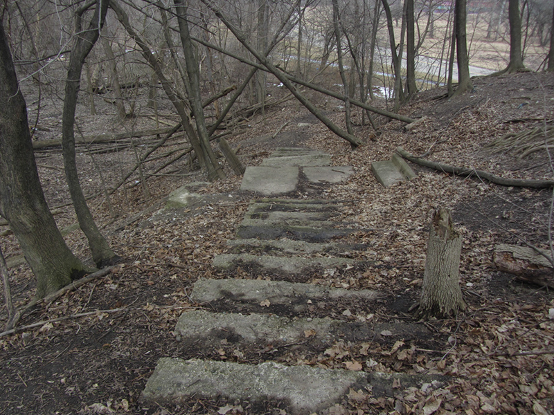
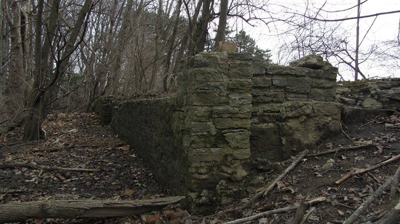
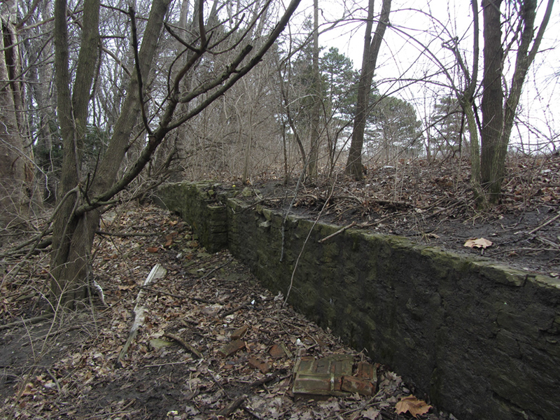
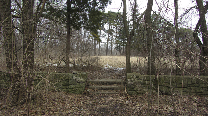
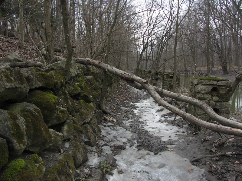
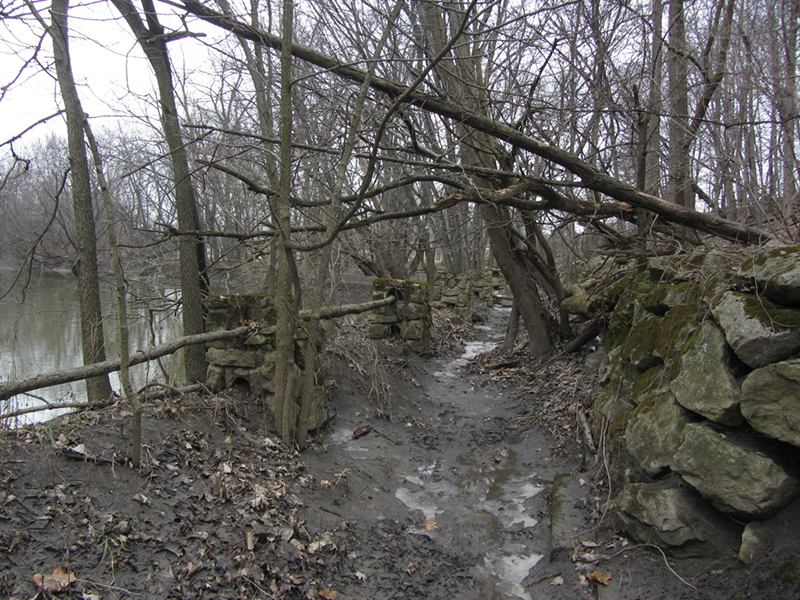
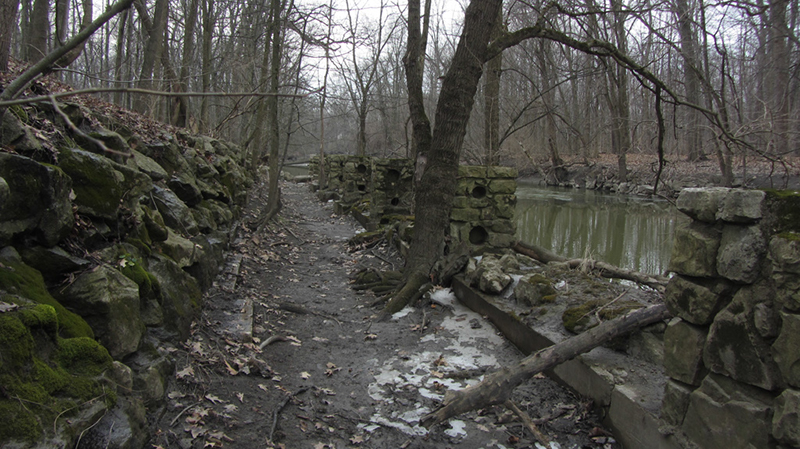
I set out the next morning, ready to hike. It was pretty easy to find the ruined stone piers along the river pathway, which was at the bottom of this shattered stairway:
Here was the beginning of the fancy old pathway:

Clearly it had been left abandoned for a couple decades, judging by the thickness of the trees growing on or near the trail...

This section of trail only seemed to go maybe 100 or 200 yards at the most. This might imply that this was more of a "river viewing area" or promenade than a true trail that actually went somewhere. Which might suggest the existence of a former recreation center nearby...
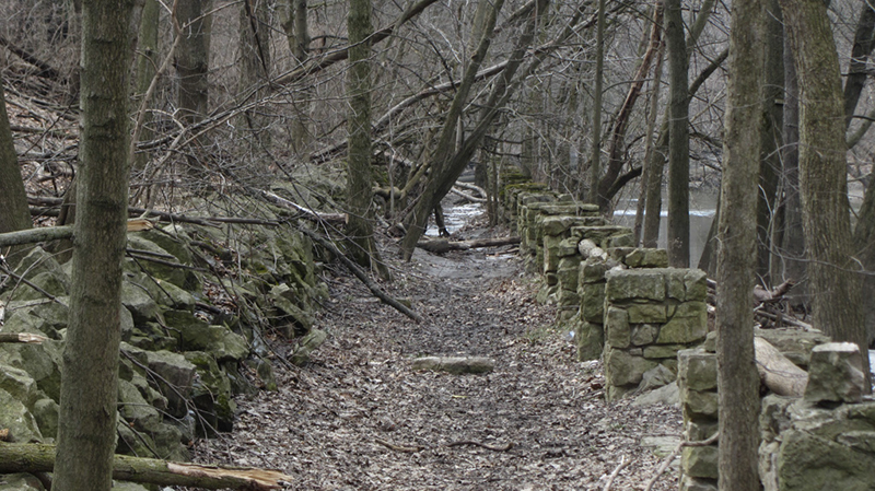
Erosion control was clearly done here at some point in the past to protect the trail and the escarpment from being eaten up by the voracious Rouge River:

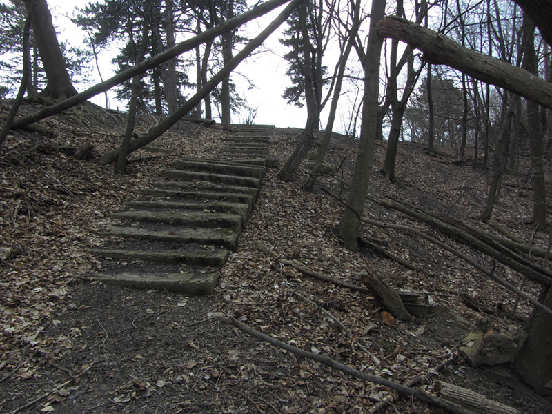
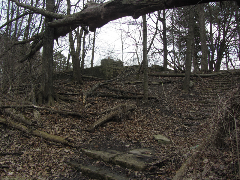
Finding this trail had been simple, but finding the supposed farmstead's ruins eluded me. Or so I thought, up until now...
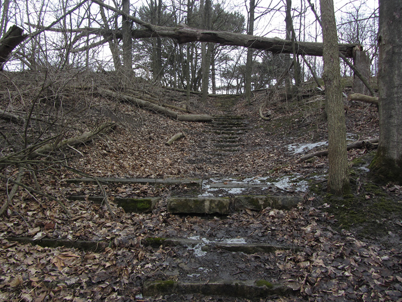
Another stairway led back up on top of the tall bank that looked over this trail, where I immediately spotted a long rectangular foundation. At the time I thought little of it, since to me it seemed more like it would likely have been a modern recreation center, or other mundane service building of the park.
I asked my friend Andrea Gallucci, who studies the histories of Detroit parks and writes about them at cityliterate.com, whether she knew anything about a potential rec center in this area. Her response was much more fascinating than I expected.
She said that according to her notes there was a "recreation center and servicemen's clubhouse" here, but it was originally an old farm house. The center was called "Rouge Rec Center," as well as "Rouge Park Casino," and it served as a place where, among other things, "they would dole out the military decorations to the surviving families of Detroit boys who died in WWII."
A servicemen's clubhouse? Well that might explain why there is a cannon sitting on display out in front of where it used to stand.
Andrea then dug up this photo, showing an aerial view of the structure, with the Encono cannon visible in the traffic island, sitting basically in what would have been the building's front yard:
 |
| Photo from rougepark.org |
Charles E. Sorenson was one of Henry Ford's highest-ranking lieutenants—once upon a time among the most powerful and feared men in the Motor City. I go into much deeper biographical detail on Mr. Sorenson in that post about his yacht Helene, if you would like to know more about him and his importance within Ford Motor Co.
I began searching for ties between Sorenson and Rouge Park, and turned up a few articles on Google Books that indeed correlated the two. A mention in the 1927 volume of Parks & Recreation describes the existence of a "casino" in the park, that was "formerly the beautiful country home of Charles E. Sorenson, general superintendent of the Ford Motor Company."
So according to that (and the Twenty-Fifth Annual Report of the Department of Parks and Boulevards), it looks like Belle Isle wasn't the only Detroit park that had a casino. A quick search revealed that Palmer Park had one too, according to a historic photo I found in the Detroit Public Library's Digital Collections.

Remember that in this context a "casino" is not a horrible windowless place of gambling, maddening noises, hypnotizing lights, and free booze; it was instead an old-timey gathering place for the purpose of recreation. It was a building in a pastoral setting that you might rent for a family reunion, club meeting, wedding reception, or similar function. In fact "casino" comes from the Latin word for "cottage," according to merriam-webster.com.
Another brief mention I found in a c.1919 article by Henry W. Busch, Commissioner of Parks and Boulevards, said that when Rouge Park opened "two refectories will be in operation," implying that there was another "casino" somewhere in Rouge Park. This was possibly the "Smith House," another old farm house that once stood near the corner of Outer Drive and West Chicago, according to a Detroit Parks & Rec map of the park from August of 1970 that Andrea found.
The same map shows this structure, and labels it as the "Sorenson Recreation Center." Its address was 7601 Spinoza.
The 1942 Annual Report of the Parks & Rec Dept. shows that a "new community center was opened in River Rouge Park in what was formerly the Charles Sorenson home." I suspect that this is when the "Rouge Park Casino" took on more of the WWII "veteran's center" function that Andrea described earlier. Mr. Sorenson was the production master of Ford's Willow Run Bomber Plant by that time, tasked with making the B-24s fly off of its assembly line once every hour.
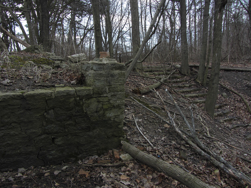
This close-up on the foundation reveals that it is made of piled stone, and features a coal-chute marked with the name "Smith-Matthews Foundry," a company which Clarence Burton indicates was formed in Detroit in 1910:

I tried to bring up this area on Sanborn maps to see if I could figure out when the Sorenson house was built, but none of the ones I could pull up show the area where this building would have stood; it was still part of Dearborn Township back in the 1920s, and I guess Sanborn didn't deem Dearborn's eastern fringes as worthy of documenting yet. So I went to the Illustrated Historical Atlas of Wayne County, Michigan of 1876, which showed the triangular parcel of land to be owned by "Ford":

In the c.1893 Detailed Official Atlas of Wayne County, Michigan, the ownership notation is shown as "Wm. Ford," (most likely Henry Ford's father, a farmer in the area) and the path of the Rouge River had either meandered wildly since 1876, or this atlas was drawn more precisely:

 |
| Photo from Wayne State University Virtual Motor City Archives |
By 1923 when he donated this farmhouse to the park, Charles Sorenson was at the height of his power within Ford Motor Co., acting as the czar of the new Rouge Plant in Dearborn where the first Model-A was being built. He also purchased the aforementioned yacht Helene a few years later, and his address reflected that he resided in the Detroit Towers on the waterfront across from Belle Isle. Sorenson's later use of engine casting methods for developing the one-piece Ford V8 engine block was perhaps his greatest innovation. It was produced for 21 years. He claimed to have known Henry Ford "better than any man dead or alive."
Once Andrea completed her initial archive dive, she uncovered a very useful article as well as some official city documents that helped reconstruct the history of the Sorenson house. The article was from The Suburban News, entitled "Vandalism Heavy, So Recreation Center Will Die," and refers to it as the "Rouge Recreation Center." The building had burned in late July of 1984, it reported, probably irreparably.
The article was supported by documents forwarded to the Suburban News staff by Geraldine V. Lamb, the Parks & Rec Department's "Properties Record Technician." From this it was confirmed that the Sorenson house was acquired by the city in April 1923, and contained a club room, gaming room, a hall, dining room, lobby, several meeting rooms, and an office at that time. Supposedly it comprised 4,240 square feet of space.
It was built atop what became known as Derby Hill, and was colloquially referred to by locals as the "White House" by mid-century. The neighborhoods of the Warrendale area still had not been built up yet prior to WWII, so this was essentially still the outskirts of civilization as far as urban Detroit was concerned.
The article confirmed that during WWII the Sorenson house was used as a USO site, offering recreation to local servicemen, many of whom were billeted in Rouge Park itself during the war. It provided billiards, ping-pong, music, dancing, and canteen facilities.
There was a fire on the second floor in January 1947, which destroyed many original furnishings, but the city paid to renovate the house afterward, which included some modernization. The article noted that there was some "unusual decorative woodwork," high "ballroom-style" ceilings, and fireplaces.
There was a stone bridge across the river somewhere as well, whose ruins I apparently did not see, or didn't photograph for some reason:
This next photo from the archive shows the bridge ruins in the 1980s(?)...perhaps they have been eroded away by now?
Boy Scouts and Girl Scouts also used this building over the years, and by the 1960s a program for senior citizens was being developed here. Andrea noted that the building might have suffered another minor fire in the early 1970s, and that knitting classes were offered there as late as 1977.

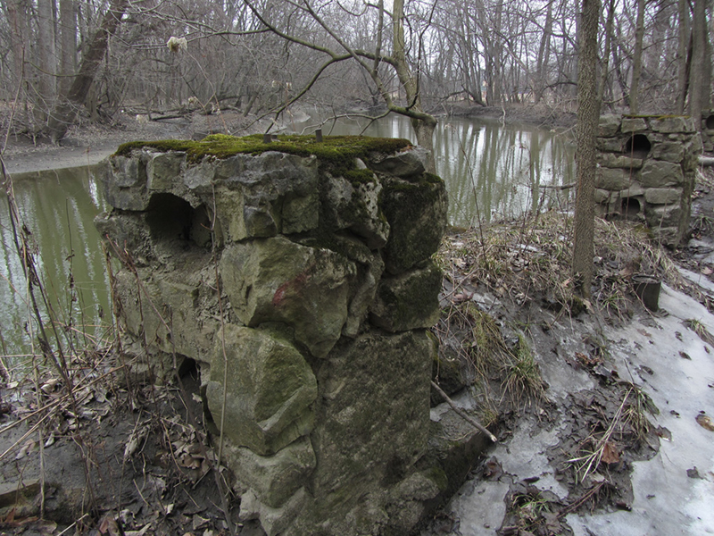
The article says these stone steps and stone wall along the river behind the house were built during Mr. Sorenson's residency, not as later additions by the park. I have to wonder then if he did not employ the services of famous landscape architect Jens Jenson, who did all of the landscaping at Henry Ford's own Fair Lane Estate nearby—apparently with the same type of stone, if my eyes do not deceive me. This stone breastwork also resembles that found at the Dahlinger Estate, which Ford built further down the Rouge River for his alleged mistress, Evangeline Cote. Jensen also designed the landscape at Edsel Ford's Haven Hill Estate.
We could find no reference to Jens Jensen in the extensive Sorenson files at the Benson Ford Research Center however, although there were numerous receipts for all kinds of stone purchases. Most likely the landscape design work was done by John Kasurin himself.

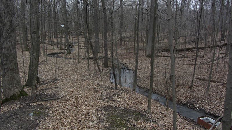
The Suburban News article states that the floodplain area behind the house has remained basically undisturbed by human influence thus far, and isolated from traffic noise by the escarpment it sits upon. I tend to agree with this; it was indeed a very unsuspecting piece of natural land to find oneself in. Supposedly blue herons, hawks, and other wild birds inhabited the area even in the 1980s, and there were also two "islands" found in the river at the time.

The old Sorenson house stood vacant for a few years before being demolished on October 9th, 1984. Here is a photo of it all boarded-up, presumably right before the fire that led to its demise:
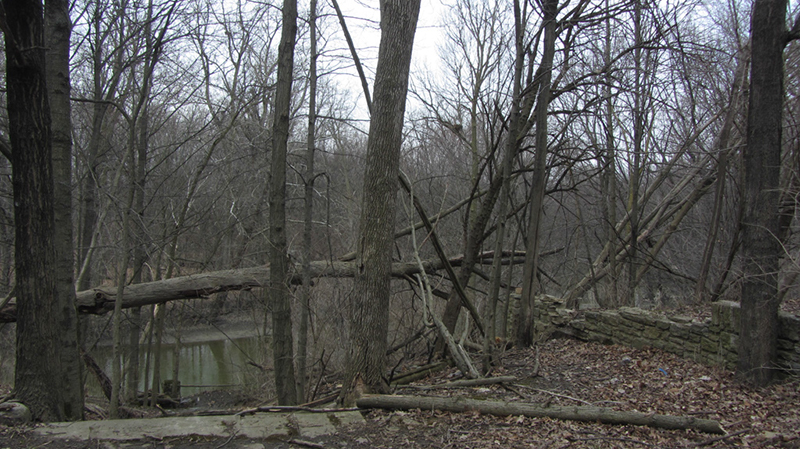
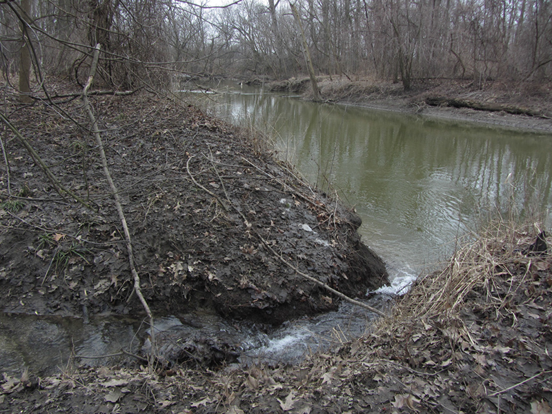
I kept on wandering down the river to see what else there might be hidden in these woods, but I didn't find much. There was a little micro-waterfall here though: |
| Photo from Detroit Dept. of Recreation |
The article confirmed that during WWII the Sorenson house was used as a USO site, offering recreation to local servicemen, many of whom were billeted in Rouge Park itself during the war. It provided billiards, ping-pong, music, dancing, and canteen facilities.
 |
| Photo from Detroit Dept. of Recreation |
 |
| Photo from Detroit Dept. of Recreation |
 |
| Photo from Detroit Dept. of Recreation |
 |
| Photo from Detroit Dept. of Recreation |
The article says these stone steps and stone wall along the river behind the house were built during Mr. Sorenson's residency, not as later additions by the park. I have to wonder then if he did not employ the services of famous landscape architect Jens Jenson, who did all of the landscaping at Henry Ford's own Fair Lane Estate nearby—apparently with the same type of stone, if my eyes do not deceive me. This stone breastwork also resembles that found at the Dahlinger Estate, which Ford built further down the Rouge River for his alleged mistress, Evangeline Cote. Jensen also designed the landscape at Edsel Ford's Haven Hill Estate.
We could find no reference to Jens Jensen in the extensive Sorenson files at the Benson Ford Research Center however, although there were numerous receipts for all kinds of stone purchases. Most likely the landscape design work was done by John Kasurin himself.
The Suburban News article states that the floodplain area behind the house has remained basically undisturbed by human influence thus far, and isolated from traffic noise by the escarpment it sits upon. I tend to agree with this; it was indeed a very unsuspecting piece of natural land to find oneself in. Supposedly blue herons, hawks, and other wild birds inhabited the area even in the 1980s, and there were also two "islands" found in the river at the time.
The old Sorenson house stood vacant for a few years before being demolished on October 9th, 1984. Here is a photo of it all boarded-up, presumably right before the fire that led to its demise:
 |
| Photo from Detroit Dept. of Recreation |
And a little concrete slide here, presumably designed to halt erosion:

Elsewhere in Rouge Park, at 21800 Joy Road, stands the Buffalo Soldiers Heritage Center, in what was previously an abandoned Detroit Police Mounted Division station:

Prior to being used by the Detroit Police, I suspect that it might've been part of the Sorenson farm as well. A reference in the introduction of My Forty Years with Ford, seems to confirm this.

The Buffalo Soldiers Heritage Association had been allowed to use this stables for several years through a series of short-term agreements with the city, but in 2012 they finally secured long-term use of the facility. Around that time they held a volunteer event that I went and helped out with, to fix up the grounds and the building, which was when I took these photos.

The "Buffalo Soldiers" were cavalry regiments of African-American soldiers in the U.S. Army that were formed in 1866, and served out on the western frontier. There they earned their "buffalo" nickname from the Cheyenne people, out of respect for their prowess in battle (and supposedly not their complexion).

This was the main stable, but out back toward the woods were a couple other structures that I didn't investigate:

Here is a historic photo of the Smith House, which I briefly mentioned earlier...it was also demolished in 1984 along with the Sorenson house:
 |
| Photo from Detroit Dept. of Recreation |

Today it is the place of the Parks & Rec Department's Walter I. Meyers Nursery, and I could not see much there in the way of ruins that might have once been a house.
References:
Illustrated Historical Atlas of Wayne County, Michigan, H. Belden & Co. (1876)
Detailed Official Atlas of Wayne County, Michigan (1893)
McAlpine's Wayne County Farm Atlas, 1925
Twenty-Fifth Annual Report of the Department of Parks and Boulevards, City of Detroit, June 30, 19141942 Annual Report of the Detroit Department of Parks & Recreation, p. 20
Parks & Recreation, Vol. 10 (1927), by the American Institute of Park Executives, p. 515
My Forty Years with Ford, by Charles E. Sorensen, Samuel T. Williams, p. xvii
"May Open River Park in Spring," Detroit Free Press, Sept. 4th, 1919, p. 5
"The River Rouge Park to be Detroit's Finest," by Henry W. Busch, Commissioner of Parks and Boulevards
"Vandalism Heavy, So Recreation Center Will Die," The Suburban News, Vol. 85, No. 33, p. 1
The City of Detroit, Michigan, 1701-1922, Vol. 4, by Clarence Monroe Burton, William Stocking, Gordon K. Miller, p. 660-663
http://www.rougepark.org/history.html
http://dlxs.lib.wayne.edu/cgi/i/image/image-idx?id=S-VMC-X-50891%5D50891
http://nikehercules.tripod.com/d-69.html
http://wdet.org/posts/2015/08/24/81279-curiosid-when-detroit-was-armed-with-nuclear-missiles/
Detroit Free Press, July 12, 1953, p. 51
http://www.detroitmemories.com
http://preservationdetroit.org/exploring-artillery-in-historic-warrendale/
http://www.warrendaleblog.com/2012/12/buffalo-soldiers-take-over-house-barn.html
http://www.buffalosoldiersdetroit.org
http://claslinux.clas.wayne.edu/photos/part1/low_res/aerial_photos/wayne/1949/ha-17-118.pdf
http://detroit1701.org/River%20Rouge%20Park.html
http://www.britannica.com/biography/Benedict-de-Spinoza
C.E. Sorenson files at the Benson Ford Research Center
The Model A never used a the flathead V8 engine. The first Ford to feature it was the 1932 Model 18. 18 meaning first (1) V(8). Model As were all 4 bangers.
ReplyDeleteWoops, you're right--will correct that! Definitely wrote that part a little too fast without thinking about it first...
DeleteRegarding the Nike/Ajax missiles, they didn't have silos or launch tubes underground, but were surface launched with additional missiles stored in underground bunkers to be raised to the surface for launching after the first battery was fired.
ReplyDeleteThanks for the clarification.
DeleteThe Smith house at 14245 West Outer Drive was also known as The Nature Center in Rouge Park by many area "kids of Warrendale" myself included. Found your article very interesting and enjoyed reminiscing my stomping grounds as a child from riding my bike down Derby hill to catching tadpoles in Rouge River, Swimming at Brennan Pools. The Nature Trails where they had exotic birds etc. Thank you!
ReplyDeleteThe Smith house was actually across Outer Dr. from the Nature Center. It had an odd number (14245) because Outer Dr. has its own unique numbers, odd on the east side. The Nature Center was on SW corner of Outer and Chicago. Had indoor and outdoor displays of wildlife. Live fox, coons, etc. We walked through the Smith house one evening in the mid-'70s when it was abandoned. Very creepy and scary... broken baby dolls, tricycles, teddy bears...
DeleteMany rides with our stingray bikes down and around those old river trails. Also remember a rope swing on the side of derby hill. Cody class 1979.
DeleteI grew up on West Parkway between Joy Rd. and West Chicago Rd. We played in the Park all day until the Street lights came on from the late 60's to the mid 70's. I remember the Nature Center well. They would nurse wounded animals back to health and release them. I remember some pretty big hawks in the outdoor cages. It was definitely on the South West corner of West Chicago and W. Outer Drive. And yes, the trails with wooden bridges across streams/wet lands were well maintained and fun to ride bikes on. The Joe Prance day camp was at the SE corner of West Chicago and West Parkway and had a cement fountain area with fountains that sprayed water in the air for kids to run through. Those were taken out soon after I was old enough to be in the park unfortunately.
DeleteI grew up on Dale, near the corner of West Chicago and Telegraph. I spent a LOT of time at that Nature Center as a kid - it was one of my favorite places. I always wondered what happened to it (it doesn't show up on Google Maps). It's too bad they let that place go - it was so cool. I also remember going ice skating in the park, right next to the river (we weren't allowed to skate on the river). The field would be flooded on one side of the road for skating and the other side had sledding hills. There was a little warming hut where you could put on your skates and get hot chocolate. It was lighted at night and very popular - it always seemed to be crowded! I loved that park.
DeleteI remember on Saturdays racing to the park on our bikes to see the missiles raise up from below the ground when they would preform the routine exercise. Then off to the soap box derby races on Derby Hill.
ReplyDeleteVery interesting article and pictures. Thank you.
thank you for the great overview of the Rouge Park. I offer just a little more regarding Detroit NIKE: in 1955 the US Army installed a NIKE-AJAX guided missile base and underground missile silos at the Naval Air Station on Grosse Ile. Station closed in 1969, turned over to the township in 1971 for general aviation use. Located on the Livingston landfill or the east end of Belle Isle, the base had two missile launch pads with 25-mile, or 70K ft range, and magazines with adjacent control buildings. To defend against Soviet long-range bombers during the Cold War, the US Army erected 18 NIKE-AJAX missile sites in the Detroit area—half of which were later converted to the NIKE-HERCULES system
ReplyDeleteBeing brought up in Warrendale, Rouge Park was a big part of our families life. I remember the Whitehouse, Derby hill soapbox races, ice skating, the trailer getting warm, tobogganing on the runs and hills in the park. It was well maintained and brought families much pleasure. Thanks for the walk through memory lane.
ReplyDeleteWonderful article about the area I grew up near. Recall playing on the canon. The outline of the missile base in Rouge Park, between Outer Drive and Parkland, can still be seen on Google map. As a small boy, I can recall going by the fence surrounding the site. I ''think'' I recall missiles on their above ground launchers....but maybe that is my imagination. It was a long time ago. Thanks again for the photos.
ReplyDeleteI notice on one of the maps you posted that the names of Havey Coon and Jos. Coon are listed as land owners. I ran into an article about a year ago that these names are tied to the Coon Bros. that owned Coon Bros. dealership. I went on to mention that the early Coons had something to due with the development of Rouge park. If you note their name appears on the land parcel right across from the triangular piece of land . Their residences were on that property. Sad for me that I didn't save the article and now can't find it.
ReplyDeleteFeel free to comment
City Park in New Orleans is 1300 acres...
ReplyDeleteGreat article. I grew up around this area and used to sit on those same stones and viewed the River. I hiked those two islands many times. Played baseball in the Park, before Lessinger school was built. Later, when I got my drivers license, Lovers Lane, became a hang out.
ReplyDeleteI would spend my entire day at the Park, in the summer.
I was very sorry to see it go into such disrepair, like it has. I have very many fond memories of that Park.
I spent many years growing up nearby, Joy and Evergreen and am now learning about the park. I worked at the rightand Rec west district headquarters for awhile and remember the Mounted Unit right there. My grandfather was Walter I Meyers whom the nursery is named after. We moved to a house further north by the Rouge River that looked rather like the Sorenson house and built about the same time. Now I wonder if it was the same architect or a copycat. Great article, are you going to have part 2?
ReplyDeleteThis comment has been removed by a blog administrator.
ReplyDeleteWow!! Fascinating reading. I grew up not far from Joy Road and Wyoming in the 1950's and 60's. We would have wiener roasts at the park. Our parents would get the food ready while my brother and I would walk/run around the trails of Rouge Park and explore what I remember as shallow muddy streams. It smelled like woods. I also remember riding in the car past the "Nike Site" on Joy Road thinking about the Russians and wondering if the missiles would rise up out of the ground as we drove by.
ReplyDeleteI remember going to a Boy Scout Court of Honor at the Sorenson House on Spinoza Drive at Warren. The time frame was circa 1960. I was a student at George Ford Elementary.
ReplyDeleteI grew up by Rouge Park just off Sawyer Street. I was in the park almost every day from 1965 to 1982 it was a great place, wish we had something like that by me now. You mention that Spinoza Drive suddenly dead-ended at a field, your are right that wasn't always so. Back in my day Sawyer Street and Spinoza Drive weren't paved like they are now they were like dirt with some asphalt packed hard. Spinoza Dr. continued through that field and went to Warren Av. Sometime in the 1970s they stopped maintaining it. They went on to improve Sawyer and the rest of Spinoza but let that part go. I drove on it couple of times but in the late 70s or early 80s they put up barricades. You can see the ruins of the old road on Google Earth set the time line to 6/29/2007 there was a bad drought that year. They never removed the road it just kind of crumbled and over time got covered over, in 07 with the drought and just a thin layer of dirt over the old pavement you can see the grass didn't do as well as the rest of the field.
ReplyDeleteThanks for all the great info on your site, I remember the rec center quite well, my wife had dance lesson there in the mid 60s. I always wondered what that big fancy house like that was doing sitting there in the middle of Rouge Park. I know it had to be someone special the only time I have seen a house like that back then was in the movies like Gone With The Wind. Thank you again with all the new info you from your page it should keep me busy till spring.
John C.
Ps I have a nice image of that area from Google Earth with everything labeled I can send you if you would like.
Could you send me the image? My father was born in the Sorenson house in 1921! He was the son of Claude Smith, superintendent of the Parks and Blvds dept from 1919-1945ish! I have many photos of the farmhouse the family moved to in 1923. Thank you for your information!
DeleteWOW! What a blast from the past! Can recall like it was yesterday, climbing up to straddle that cannon that was larger than life as a child and running our tiny hands across those engravings. Received many a spankings, after a long day of borrowing the old cement tubs and rowing them up n down the Rouge, for coming home late from disappearing into this land of enchantment. While the Soap Box Derby, the Toboggan Runs and pool days (all permitted) were a blast. It was the forbidden cement tub journeys taken to steel away and smoke those first cigarettes that bring the brightest smile to my face. Worth every butt whippin, that immediately followed my bike ride home to Joy n Braile St, for arriving after the street lights came on. King Donald
ReplyDeleteI remember the park as a kid in the 80s. The whitehouse burned down when I was a kid. Some of the older neighbors hung there and played cards. I remember the bike jumps people built that ran along the river from Warren ave. north. At Spinoza and Joy Rd. There was a remote airplane field, that people would fly the planes also.
ReplyDeleteI have a few updated pics I would love for you too have. There were a few trees you were not too far from that had hundreds on engravings, some with dates as far back as 1958
ReplyDeleteIn one of the upstairs bedrooms there was a secret passageway that led from the closet to the first floor. My sister, Billie, and I spent many hours in Rouge park and the "White House". Our home address was 8466 Burt Rd. I remember being able to see all the way down to Southfield Rd. as our house was one of the first built in that neighborhood. Lots of good memories.
ReplyDeleteAww, you missed the Sorensen midden. As teenagers in the 1970s, we knew about the trail behind the Sorensen house (we did indeed know it as the White House.) Back then, the cannon sat in the middle of the island, and pointed down the hill. At night, the bikers had their bonfire on the left at the bottom of the hill, and the hippies had their bonfire on the right. The foundation slab of the bridge was and still exists to the left from the stone stairs, near where the stone pillars end.
ReplyDeleteMy girlfriend and I walked our 10-speeds over it once, but the far side of the river is so severely mosquito-infested that exploration was not possible. The midden is also located to the left on the river-walk, way back exactly at the point where the river sweeps left, before passing under Warren avenue. People used to dig shallow pits looking for bottles back there, but we discovered that the easiest pickings were along the river's vertical embankment, where annual erosion exposed many intact cork-top bottles for milk, perfume, liquor, Clorox (in 3 different sizes!) etc, as well as many other things. You could just reach out and pull them out of the vertical dirt face. There was an island right there that came and went as the river meandered, but it's part of the Sorensen side now. The missiles are across from the old Mounted Police station, in the SW corner of Spinoza & Joy Rd. The control center for them was in the NW section of that intersection. There's a road that goes downhill next to the Police post, and there used to be an archery range on the right below the police post, and the cement foundation slab for the control station was across the road from them on the left. The electrics to the slab were still turned on in the '70s, so local rock bands would plug in and play all day for free on summer Sundays. At the back of that parking lot, there used to be a bridge across the river, but it was long-gone even back then.
Played MIC -MAC little league baseball in Rouge park north east of the triangle ...riding my 21inch bike to all the games from.... Stahelin ,,,and Dayton...up to Warren thru the park ...down Derby Hill ...what a blast that was....then back home the same way...up the hill ..it was a challenge.....fun times with the Boy Scouts....hiking thru the Park...building campfires to cook our HOBO MEALS...of aluminim wrapped potatoes ,carrots ,celery and steak...or hamburger....I remem those white tipped Missles showing above the tree tops ....searching the sky for those enemy air raiders ...while we were playing our ball games....what a sight....ths
ReplyDeleteA Nike Army base was at Greenview and Kirkwood ...Soldiers and their barracks .. Big Trucks and Jeeps...yep....All living just a couple of streets over from my house ......keeping us safe...thanks for the good read...
Lots of fun in that BIG Rouge Park
Thanks for the research it fills in alot of the memories of the white house ...canon and other park features
Growing up on Tireman and Warwick, Rouge Park was our football field, baseball field and our woods where we spent hours playing and exploring in throughout the '70's. I remember the impromptu free summer concerts, the archery range, petting the police horses, putting firecrackers in the cannon, sledding, forging the river at the falls, the "Rope Swing" and playing army for hours in the woods from Warren to Joy. RP was the last stop in the Warren bus line where the driver used to park and walk two blocks to get an ice cream. What a good article and thank you for bring me back to my childhood.
ReplyDeleteWow! I moved to Meadow Park, off west chicago and West Parkway. It was a brand new build and pheasants roamed freely, as did rats along the "creek behind our house. We neighbor kids went down to the creek and walked to the park thru the under West Parkway. We played on the swings and slide, trudged to tobaggon, skating after changing in the "hot house", went to the nature center (i dont remember live animals...it smelled funny and i particularly remember the taxidermy. I remember the mounted station but not missiles or cannon...it was the site of an indecent exposure, at the swings...broke my chqin trying to get away! Ran and left my bike til later (never told the folks). Yes, many hours, many days there...has the water ever been tested? I heard, many years ago, that a limo carrying a bride and groom, pullued over by the creek at Beech Daly, by Lola Valley park, to pee. It was winter and snowy and he slipped down to the water and died from whatever is in the water...anyone? Great article...many flashbacks
ReplyDeleteMore Memories of the Rouge
ReplyDeleteDuring the late 40’s, the White House was used as a recreation center where we spent entire summer days involved in a variety of activities.
Games like shuffleboard, ping pong, checkers and such were always available. As members of the 4 H Club, we started and maintained our own gardens. We have wonderful memories of riding our bikes, with veggie filled baskets, down Derby Hill on our way home. Dance, Drama, Music and Craft classes were all free. Most remarkable was that everything was supervised and directed by only one person……MISS MAC. At the end of the summer, our newly acquired skills were displayed at an outdoor variety show on top of Derby Hill. The community, Mayor and other dignitaries would attend. It was such an exciting time.
The Sullivan Sisters
Thanks to my nephew for this info. I grew up there in the 60s n 70s. All my friends hung out at the roller rink and the rope swings. Skateboarding down Derby hill. Tobogganing,tubing, sledding, ice skating, trails,biking. Awesome memories. Remember when they built the basketball courts with the chain nets. Also when the river used to flood and we would canoe,boat in the flooded waters. The best years of my life where hanging out with my friends at the rope swings and roller rink. I was lucky enough to work their with my buddy mark j. I also remember when the white house was open to the public. Alot of great memories on those trails growing up. Went back a few years ago and could still hear the laughter and joy in the air. Though it's an unsafe neighborhood now, it will always have been the best years of my life. God bless everyone
ReplyDeleteGrew up near Schoolcraft and Evergreen and loved going to Brennan Pools and tobagganing in Rouge Park.Later we practiced and Played some of the 1st games played by The Detroit Tradesmen Rugby Club. Also opened up a bar called Ruggers Pub on Plymouth Rd and Chatham.Great Memories
ReplyDeleteI lived on Bramell in the 50s, one block over from Chatham. The original name of Rutgers Pub was Ronaldo's I believe, or something like that. It was the only restaurant in the area, and introduced Pizza to the neighborhood.
DeleteThere was a topless bar at the corner of Outer Drive and Plymouth Road in the late 60,s. Dancers wore Pasties.
ReplyDeleteIt was called Jimmies. Worked their as a porter
DeleteGrew up in Warrendale, went to Lessenger Jr. High in the early 70's and had no idea of the missile range. Have some pictures of myself and a friend skateboarding down Spinoza from the cannon down the hill. Knew the house as the white house like everyone else. enjoyed Scout Hallow and launching my own model rockets in the park. So many great and wonderful memories growing up around that area......remember the Roller-Drome? Thank you for the history lesson. Now I have a bit of history that my family can ooooo and ahhhhh over next time I come to Michigan for a family visit.
ReplyDeleteMy Grandmother worked for the Detroit Parks & Recreation department. Her office was located at the Sorenson house. She was in charge of all the events at that location. My brothers and I were invited to participate in childrens events. I remember them as being year round. There was a “kids club” that was held on Saturday mornings. We went a few times. I have a few visual memories of the inside of the house. It was a lovely building. It had a wide staircase to the second floor, located in the center of the house. My grandmother’s office was in what would have previously been a bedroom, possibly the master bedroom, on the second floor. There was also a small/narrow stairway that went directly from the kitchen to the second floor. I recall the canon across the street, and playing in that area. There was always a picnic in June that may have ended the season for “club”.
ReplyDeleteI was blessed to find this article. I wanted to revisit this memory. Thank you for putting it together, with the photos.
I grew in the furthest area and within the City limits. I lived very close to Ann Arbor Trail. Our house was built after WWll. The area was fields and dirt roads then. My grade school was Ann Arbor Trail Elementary. It was a two room portable building. Later when it was bigger and a nice new building, I had a teacher, Charlotte Ford. She told us that all that area was part of the Ford farm. She was a relative of the Fords.
ReplyDeleteMy grandmother came out from further in city. She came on a bus on Warren. Sometimes the bus stopped further away and at Spinosa and Warrren. Usually she could take the bus to Ann Arbor Trail and Warren. We were close to the River. We were forbidden to go there but the boys did anyhow including my brother. I went Cody and will never forget walking home from there through Rouge Park to my home on Beaverland. I have never experienced those walks in the Fall anywhere else in our Country. Every Fall, I think of growing up in Detroit. (I have more if possible.) My mother worked at the Willow Run Plant during the war. I was left at a Rec. Center on Warren Ave. I played in the park and we went there for other events too. I loved reading this. Thank you.
I lived on Patton and Soyer in the 40 & 50. Many many great times at the whit house. That's where I discovered girls... At the White House the event was Square Dancing, holy cow we had to hold hands with girls. Yep, many baseball games the ride down the river in a cement tube to Henery Fords compound. The local police would take us off the property and drop us off at Evergreen and warren. Working at the horse back ranch on Ann Arbor trail and outer drive. After closing time the workers could rife free and ride for 1/2 hr. We would ride to the river at the bridge at warren and back to the barn. Cool down the horses and put evething away. The White House and Mrs.Mack was the BEST. Ping pong art classes summer were great and well remembered..Soap Box Durby was super FREE POP AND POTATOES CHIPS...and may be ice cream. Swimming in the cement waiding pool at the bottom of Durby hill than We can ride are bikes to Brenning pools. Diving off the TOP platform was a challenge, we did it all. Ice skating behind the toboggan run in the winter time. The Roller Rink would host teen dance and everyone would go and have fun.
ReplyDeleteThanks for the history of the park gooood memory for sure.
I grew up on Parkland between Lamphere and Belton beginning in 1950 when I was 3 years old. Our house was directly across the street from the park. There was a small stream that ran through the area between Parkland and Outer Drive I where I played with other kids until they built the NIke base around 1955 (the eastern end of that little stream still exists just west of Outer drive and Tireman). I remember seeing a couple large helicopters landing across from our house with VIPs checking out the site before it was built. When they had an exercise and raised the missiles from under ground they were pointed right at our house and the houses of our neighbors. Then they would raise them up toward the sky before lowering them and covering them up. I always worried if it was practice or the real thing. Right after the missile site opened, our cub scout pack planted flowers and bushes outside the fence to hide the scary view a bit. Within a few months the Army tore them all down to maintain perimeter visibility.
ReplyDeleteI remember going to the Sorensen House with my dad from an early age. he was a member of the Far West Civic Association and they had meetings there. It was usually a busy place with classes and other activities. I often climbed on the old Spanish Cannon. I still wonder how an 18th century bronze cannon from Spain wound up in Rouge Park.
I grew up exploring the park. It was a passion with me. I still love the park and river although I left Michigan for California in 1968. I've always visited the park when I've visited Detroit over the years. The large flood plain below the Sorenson house fills much of the river valley between the Warren and Tireman bridges. It was the most secluded part of the park and often a challenge to explore with serious mud, debris and sewage smell even when not flooded. I wonder if it is a bit of vestigial primeval ecosystem.
I did not not know that Henry Ford's father owned land along the river there but it somewhat confirms a story I heard as a child. A kid named Robbie England lived on Rockdale near Warren. His dad grew up in the area and owned a service station nearby on Warren. Robbie's dad said that as a child he actually swam in the river during the summer. By the time we moved there in the 1950s, the city had built sewer overflow outlets upstream that turned the river into a scenic cesspool. He also said that Henry Ford, as a child, used to herd sheep down to the river to wash them. In the 1876 historical illustrated Wayne County atlas I saw an engraving of the J. Coon farm along the river in this area that showed some sheep, so it seems plausible.
Lived on parkland and Warren. There are underground silos with a wooden covers. They are filled with water now. Also across from my house, there is an underground communications satellite relay station. Every year they have to come out and bring the markers up to the surface, because the big tractors cutting the grass run over them. They are brass markers, with markers of national defense.
ReplyDeleteHello and thank you for such an excellent historical recollection of Rouge Park's history.
ReplyDeleteI grew up on Braile and my parent's property ran west from the street right into the park, albeit up to the 40 foot cliff that separated the park from Frishkorn's Parkdale Subdivision, where we lived. Given the close proximity, right out the back door and down the hill, I, as well as the neighborhood kids spent plenty of time, especially summers exploring the park.
The White House presented a certain mystery, as it was already a rec center for a portion of the time I knew it. My Dad and I used to explore the trail behind the house. The rock columns you see in the photos were connected by round timber poles that spanned the space between the columns. It was truly a rustic area. One of the previous commenters mentioned the bugs around the river and was he right! You only wanted to go only so far before the swarms attacked you.
Some of the comments that people have made are incorrect. The Nike base had two components (which you can confirm through old Federal records listed on Wikipedia under Nike - Detroit). The component that almost everyone referred to between West Parkway and Outer Drive was north of Tireman and south of Joy Rd. It had underground pits that housed the rockets on trajectories that rose up from underground. Dual doors opened when the missiles were raised from one end of the pit. The missiles were positioned along a north-south axis and never aimed at the houses!
The second component of the base was located on the south-west corner of Joy Road and Trinity. There was a bare bones white building surrounded by a high barbed wire fence that was the control center for launching the missiles. I believe cables ran underground from that location to the launch site. The separation served as a safety precaution for the workers. The initial Nikie missiles were replaced by a more sophisticated version at certain similar sites ringing the city. To my knowledge the newer version was never installed at the Rouge River Park site.
We used to take a route though the park every Sunday morning on the way to church and I'd crane my head to see what I could see of the site as it was left to deteriorate. GAK 1 of 2
Your comments regarding the Police stables were interesting. My father used to stop by and chat with the cops and pet the horses every once in awhile. However, my point in mentioning the area is that to the east of the toboggan hill along the crest of the valley before you got to Spinoza Drive was a hidden Police Rifle/Gun Range. It was positioned so that no one wandering around down there would be hit with stray bullets. I don't know when it opened or closed, but you could at times hear the police firing away.
ReplyDeleteIn 1967 the Stables and Police Gun Range were used to stage heavy SWAT strike equipment like tanks and to equp the cops to deal with the riots taking place that summer.
I can vividly recall seeing the tanks moving down Tireman and Joy Rd. heading to downtown. It was really quite scarry to see a military-like operation rolling through the neighborhoods.
Also, to put to rumor the odd quarter circle drives located at Pearson and Warren Ave and at Spinoza and Joy Rd. -- they were both used by the old DSR (Detroit Street Railroads) the old name for the public busses that turned around there. The one at Warren housed an electrical transformer in the middle of the island as before gasoline busses were introduced, the Warren Ave busses were electric. The bus line was called "The Crosstown" and ran from far West Detroit to far East Detroit.
The Rouge River used to be a smelly mess after large rains as the city allowed storm water and sewage to intermix and used the river as an overflow. A contaminated mess it was until Federal monies were used to install an overflow upstream, which helped greatly, but did not eliminate the contamination. I can recall walking to Lessenger Junior High and smelling the river several blocks away.
BTW Derby Hill was actually used for the city-wide soap box derby competitions until a larger, artificial hill was constructed south of 8 Mile Road and north of E. Outer Drive on the East side of town.
Someone among these comments mentioned that the cannon pointed down the hill. It never did -- it always pointed southeast toward Pierson.
Thanks again for the opportunity to correct a few errors of fact. AND, thank you for doing such a great job in capturing the history and photos that you have. Nice job! GAK
GAK 2 of 2
P.S. The area south of the Tireman bridge over the Rouge River between Spinoza and Outer Drive became a forbidden zone for the kids of the neighborhood. This was because, for whatever reason, that area of the river was used as a dumping ground for dead bodies. We knew at that time that the city was in decline. It is a shame what has become of the park. It used to be a treasure with so many amenities that we all enjoyed and took for granted. Detroit should be ashamed of how run down the area has become. I haven't been back since 2000, but have seen photos on Google and elsewhere. Friends tell me it is a mess and I'm glad that I have relocated to Florida! GAK 3
ReplyDelete