
Jager said that they were thought to be an "ancient stone calendar," or a stellar observatory, which of course brings to mind images of Callenish Circle, Stonehenge, and other such well-known neolithic ruins, but as you'll see these are different. The only scholarly book about Michigan archaeology that I actually own, The Archaeology of Michigan, written by James E. Fitting in 1975, doesn't mention anything about an archaeological site in Negwegon, or Alpena County. But that's okay because neither does any other book I can search via Google Books, which illustrates just how unstudied this site is.

Negwegon State Park is not your average state park...it is what is called an "undeveloped" park, meaning that there are very few visitor amenities, there is no office or staff, and it is hard to reach by car. Getting there means driving for miles over a truck trail that is basically just a narrow, winding bulldozer path straight through the woods. Negwegon has been left in this "rustic" state so as to preserve its wildness; you don't have to worry about crowds of screaming kids, or jackass drunks in RVs here. Negwegon does not get many visitors at all, and it isn't really advertised like other state parks; it is like a slice of the Yoopee in the Mitten. The nearest village is Ossineke, 10 miles away.
A DNR document says that the park was named after an Ojibwa chief named Negwegon, who lived in this area with his band because of the plentiful fish and game in the area. Thunder Bay has also been home to the Ottawa and Potawatomi tribes, but it has not been shown definitively that the ruins in Negwegon State Park were the work of these "post-prehistoric" tribes.
More than any other place in the state perhaps, these ruins were harder for me to find than any other, and it in fact took me three separate attempts over the course of about eight years to finally achieve success. The first attempt was in 2007, another was in 2014, and finally in 2015 I spent the night camping in the woods there to make sure I didn't come back empty-handed again. Since the sites of the ruins are obviously both culturally and archaeologically sensitive, their location is not advertised openly by the DNR or the universities that have studied them, and with good reason. Therefore I had to read extremely carefully between the lines and use a lot of intuition and map analysis skill before having any idea where in the 3,738-acre preserve I should set out to look.
By the same token, I will not disclose the whereabouts of the ruins in this post, other than to say that they are near the Alpena-Alcona county line. This is a potentially 2,500-year-old archaeological treasure that has not been well studied yet, and does not need to be disturbed by idiots like us. For someone who writes about these places with a mind to spark people's interest in their home state, it is a challenge to walk the line between writing to inform and educate versus portraying them in too seductive a light, or portraying them in a way that could invite superficial tourism as opposed to respectful tourism.
The last thing I need to do is help the fetish-oriented treasure hunters and arrowhead-diggers find another place to plunder. But by the same token if I were to keep these places totally secret and never talk about them at all, then I am taking away the opportunity for new people to be introduced to something that may spark their imagination and inspire them to learn more about our cultural heritage and history (perhaps even becoming an archaeologist themselves). If no one learns about old places and why they're valuable, if no one experiences the wonder of fading ruins, then our culture will continue to cheapen and hold superficial values instead of cherishing things like wilderness, and the subtle remnants of ancient cultures.
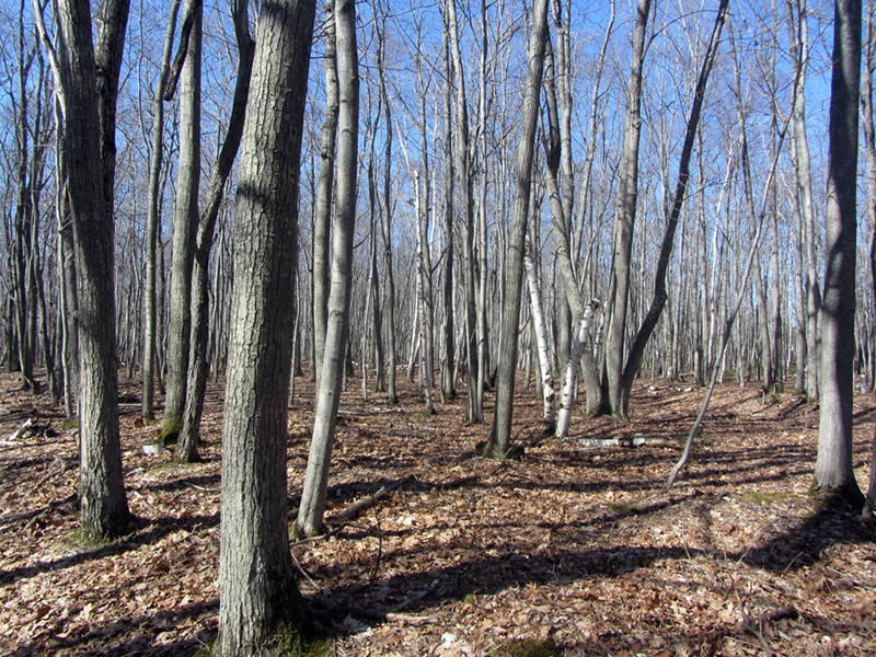
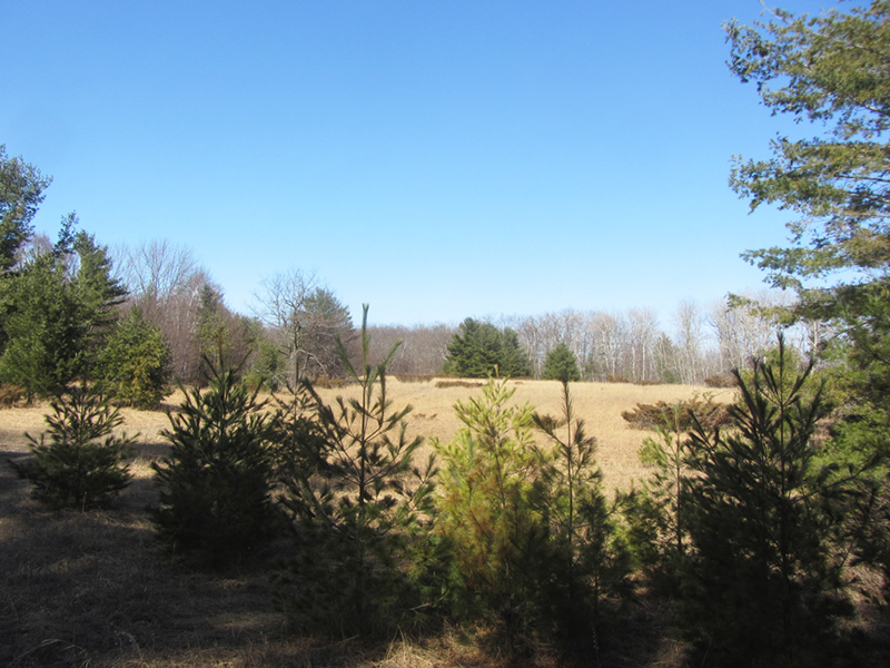
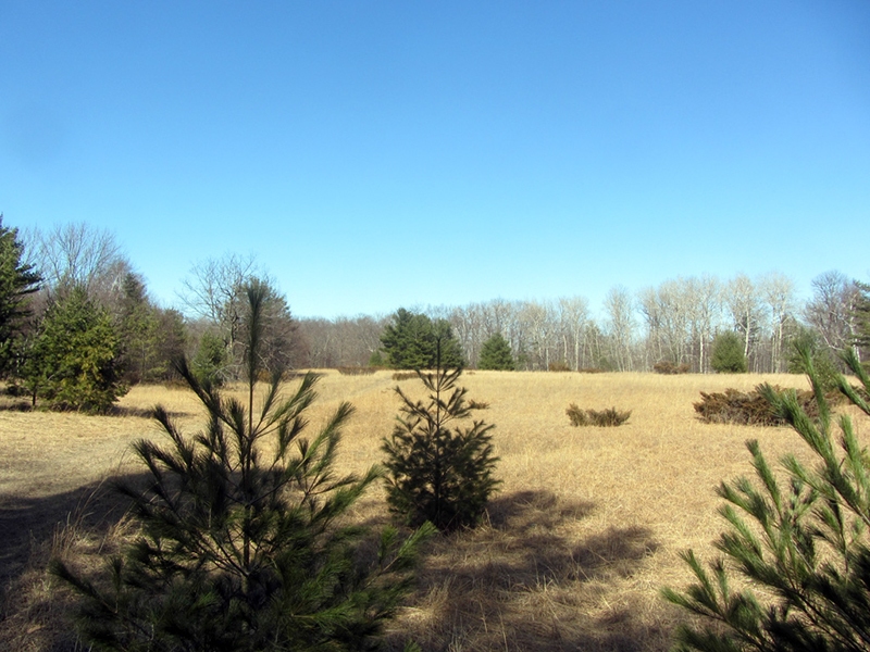
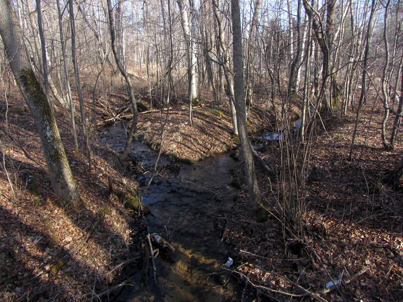
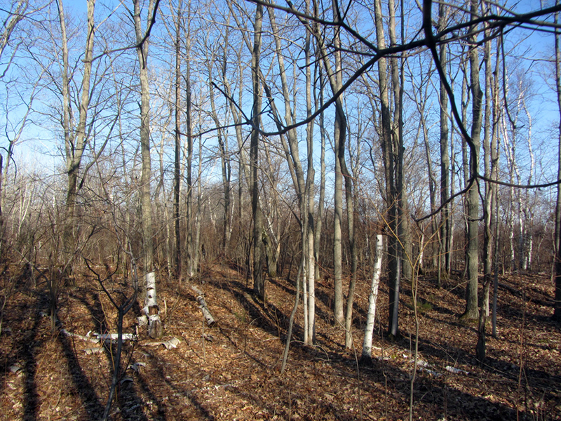
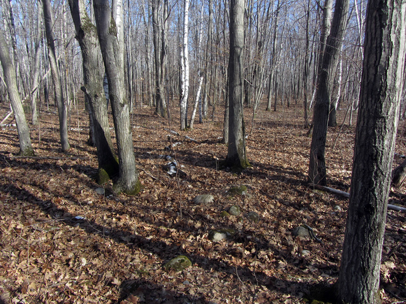
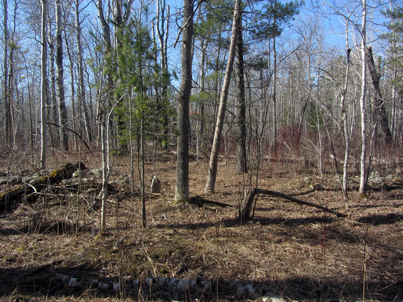
For a companion this time I chose a colleague whose knowledge of the forest I trusted more than my own, and who was no stranger to navigating deep in the woods far from any trail for extended periods of time. We began by setting out on the designated trail that leads away from the parking area for a couple miles before we did any bushwhacking. It led us through a bright, open stand of oaks and beeches. Eventually we began starting to see lots of wetland areas. This was our first landmark.
A c.2005 junk archeology tome, Discovering the Mysteries of Ancient America, by Frank Joseph and Zecharia Sitchin, says that Ojibwe elders maintain that sites like this were located at intersections of "Thunderbird Lines," and that the alleged stone circle hidden in the woods on Beaver Island was one such site, whose points marked these leylines. One such line pointed to the ancient copper mines on Isle Royale, while the rest pointed to other important cultural or spiritual sites in the Great Lakes.
Joseph & Sitchin cite the observations of Greg Bambanek and Glen Langhorst of Minnesota, who studied cairns found near Thunder Bay at the northern end of Lake Superior, which they called "cosmic cairns." Supposedly these cairns (rock piles) stood on what was the shoreline 4,000 years ago and marked the sunrise and sunset points during the summer solstice, so that the local tribes would know when the trout and whitefish spawning seasons were to begin.
Joseph & Sitchin speculate that the Negwegon ruins (which they refer to as the Black River Cairns) served a similar purpose "as guideposts and calendars for ancient travelers along the copper trade routes." I spoke of the ancient copper culture in a couple older posts ("Manitoti, the Copper Magnet", "The Entrance is Guarded by A Giant Snake", "Ultima Thule"), and of the alleged ancient stone dolmens of Lake Superior in one of my posts about the Huron Mountains.
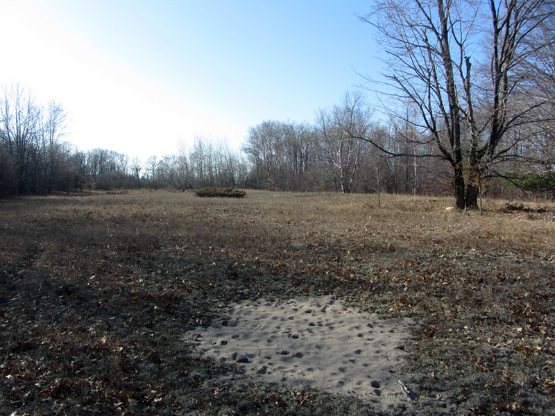
Our next point of reference was a three-acre clearing said to have been a pre-Civil War farmstead. According to a Youtube video produced by someone who went out in search of these ruins years ago, the homestead was owned by an escaped or freed slave known as "Nigger Marshall," as well as his wife and daughter, but I've also heard that it might have been a stagecoach stop in earlier years.
The old stage coach route from Harrisville to Alpena used to follow the shoreline along here, and supposedly an original segment of its trailbed is still visible, though we did not definitively locate it (unless maybe it was actually part of the trail we walked on). At any rate, the DNR study said that there was the foundation of a house, a chimney, and a well to be found here near this clearing.
When we arrived in the clearing we knew that our campsite was not much further up the trail, so we decided to keep hiking for now and set up camp before doing any real investigating, but our attention was arrested when we spotted something that looked like it might be a clue.
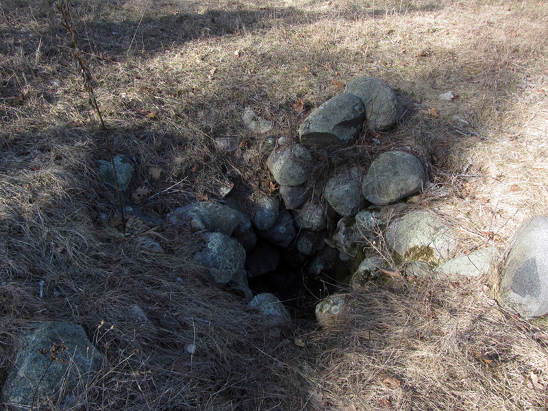
This stone-lined pit must have been the well mentioned in the DNR document where it was talking about the homestead! I was excited to be finding things so quickly; this promised to be a very fruitful mission.
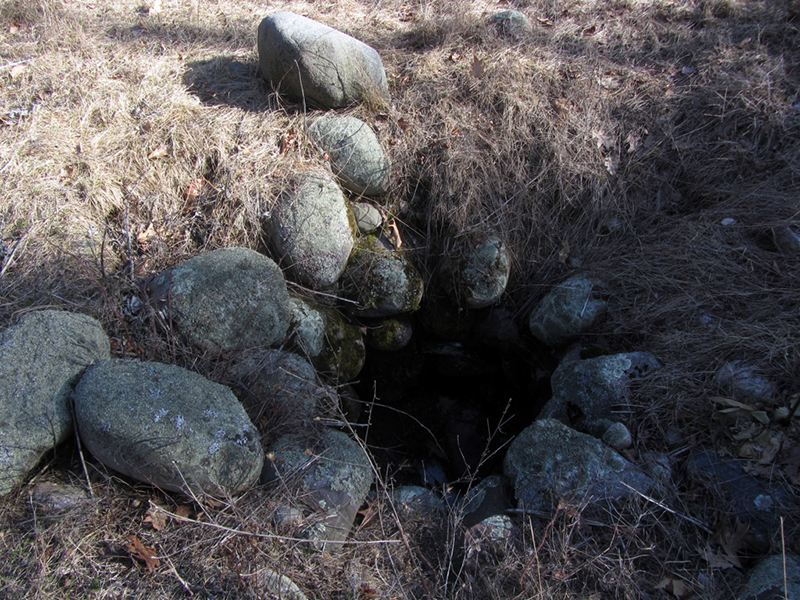
It wasn't very deep, perhaps it had filled in over the century and a half since it was dug? A little glob of snow and some leaves were all that was to be found in the bottom of this otherwise dry well:

We took a quick look about us for anything else that jumped out, but seeing nothing we decided to keep hiking to make camp and come back in a little bit to begin working.
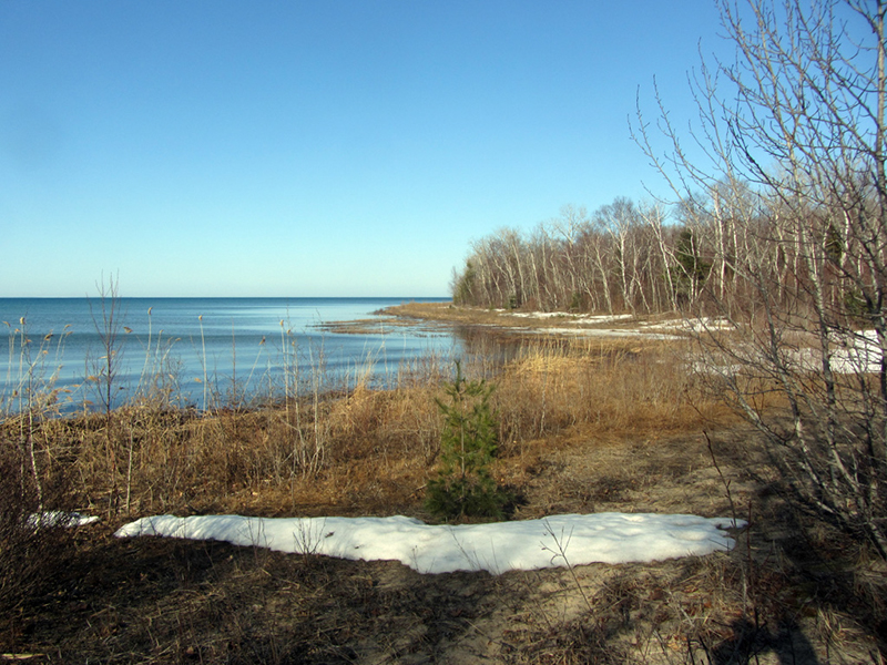
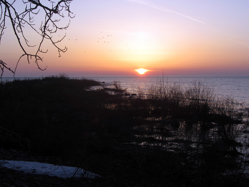
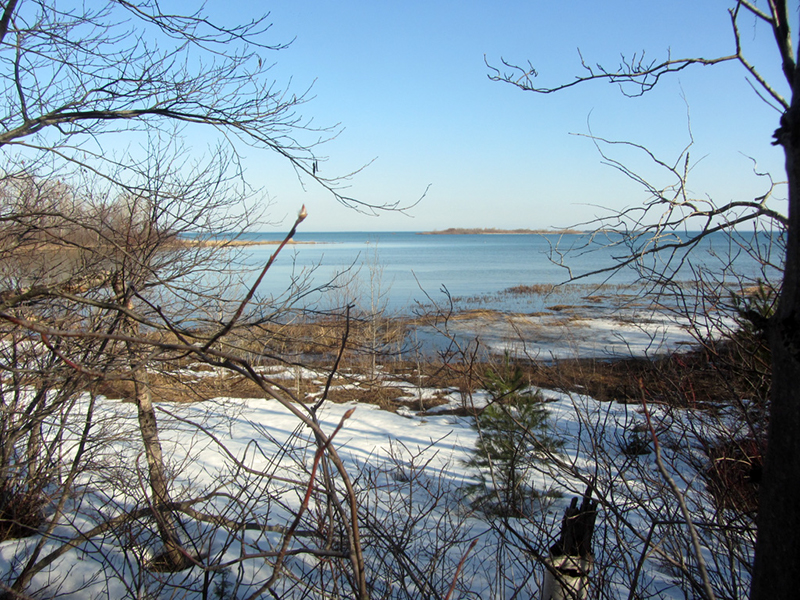
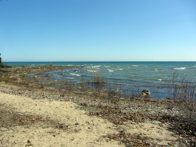
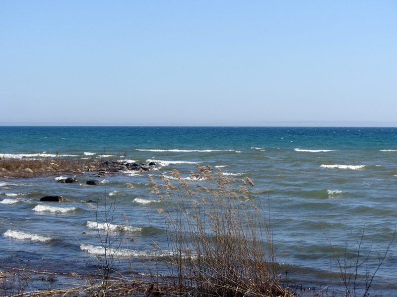
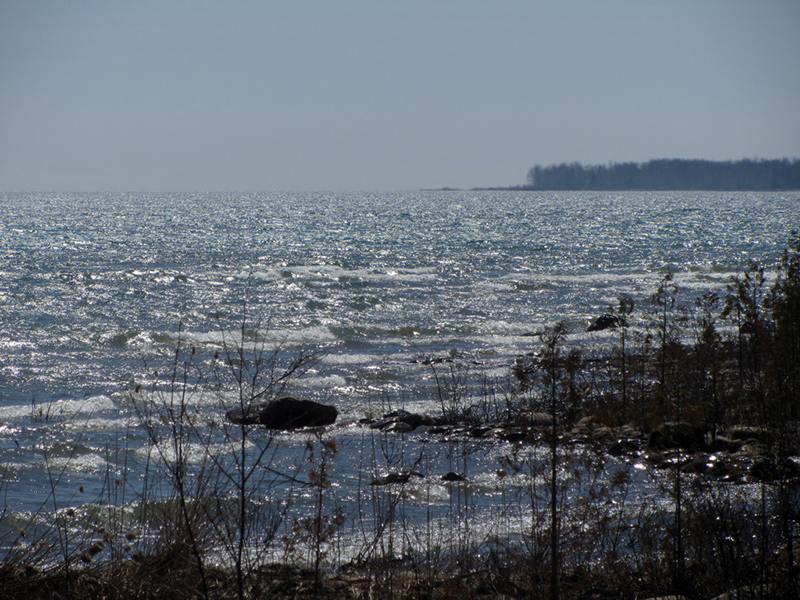
Even though it was mid-April, there were still plenty of heavy snow drifts left on the beach near our campsite, still trying to melt. Here was Thunder Bay in all of its azure glory, the city of Alpena barely visible on the horizon:
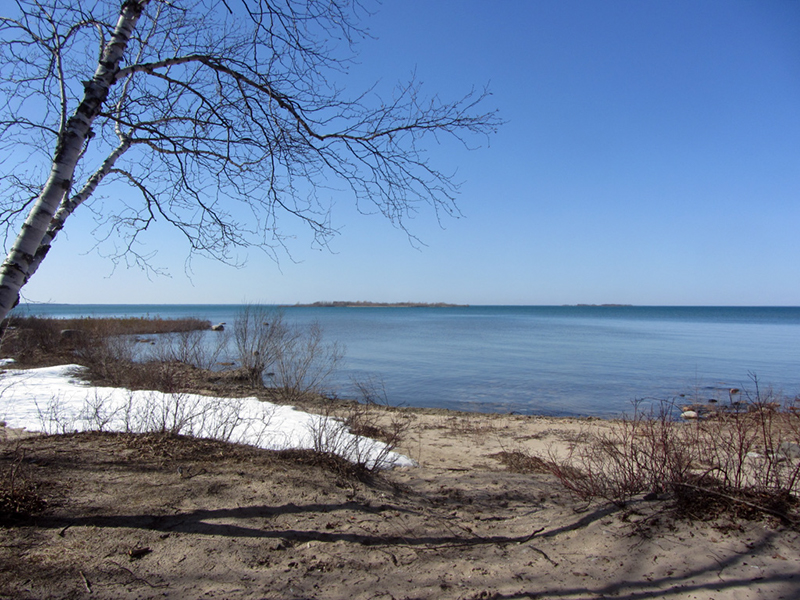
Compared to the bitter temps that had reigned all winter, this sunny weather was quite enjoyable--snow mounds be damned.

After finishing with setting up camp and hanging our food from a bear pole (yes, there are black bears in Negwegon), we returned to the homestead clearing and combed the area for any signs of foundations or chimney ruins that might have been attached to such a farmstead or old stagecoach stop.
Using the well as a starting point, we guesstimated how someone might have set this area up as a farm once upon a time. Naturally the well would have been close to either the house or the barn, but after about half an hour of searching we had turned up nothing that conclusively resembled the site of a former structure.
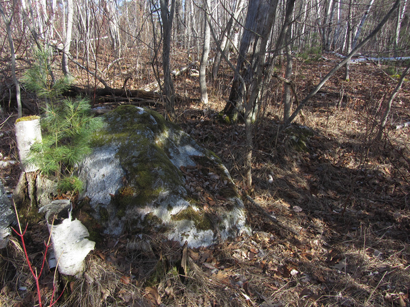
It wasn't long before we were moving up further into the woods in search of something, anything that looked like ruins or a manmade landscape. Our main objective was to locate the ancient high water mark where the beach had been when the Negwegon ruins were supposedly constructed, 20 feet of elevation above the present lake level. Finding the occasional boulder in the woods kept our excitement at a low boil:
An article in The Alpena News from January 2008 entitled "Old Stone Walls Remain A Mystery" says that studies of the Negwegon ruins have been done in 1970, 1986 to 1987, 1997, and 2008. It seems to be a once-a-decade thing, and I reckon we're due for another look, and perhaps a more in-depth scholarly analysis, like that done elsewhere in Michigan for the Ogemaw Earth Rings by Meghan Howey and John O'Shea.
So far the general consensus is that the ruins could possibly have been either livestock pens built by 19th-century settlers, or fish containment ponds built by aboriginal peoples up to 2,500 years ago. The Besser Museum for Northeast Michigan in Alpena is currently engaged in further study of the Negwegon ruins and other mysterious cobblestone walls elsewhere in Alpena County. So far there have been similar walls found at El Cajon Beach, near North Shore Drive, and a few of the small islands that dot Thunder Bay.
The Michigan Department of Parks and Recreation mapped out the stone walls and cairns of Negwegon in 1970, and determined some of them to be up to 90 meters in length. The work in 1986 was a basic archaeological study, and though it was inconclusive at the time, all of the archaeologists involved came away from it with a strong feeling that this was a prehistoric formation, not something that was put there by white settlers.
Dr. Richard Clute, curator of the Besser Museum, has led most of the studies of the Negwegon ruins and observes that some historical records from the mid-1800s noted that ponds were used along the Lake Huron shoreline to contain fish, presumably sturgeon. "Stone barriers may have been used to create or expand these fish containment ponds" he said, and that at least two of the walls that have been found are indeed sitting within the fluctuation range of what lake levels would have been back then.
There is a third ruins site however that is found several hundred yards inland of the current shoreline, about 20 feet higher in elevation. This just so happens to line up with what the water level of Lake Huron was about 2,500 years ago, which is what has Dr. Clute and others hypothesizing that these walls could have been built for the same fish containment purposes, but in ancient times. These were the ruins that my partner and I were searching for today. The oldest artifacts ever discovered in Alpena County are stone and copper tools dating to the Late Archaic period, or about 1500BCE, which means 3,500 years ago. So there was definitely human presence here in northern Michigan in ancient times.
Here is a rough illustration of what the Great Lakes area looked like at the end of the Ice Age, with blue showing where the level of the lakes was at, and white showing the receding glacier:
 |
| From geocaching.com |
It is possible to walk through the forests of northern Michigan today and see where some of the ancient beaches used to be--they are usually abrupt changes in topography and may feature large boulders that seem otherwise out of place, and appear smoothed by wave action. The topography of Negwegon also features what are called "dune-swale complexes," which are a repeating series of elongated hills of sand or gravel, that run parallel to the lakeshore and have wet marshy valleys between them.
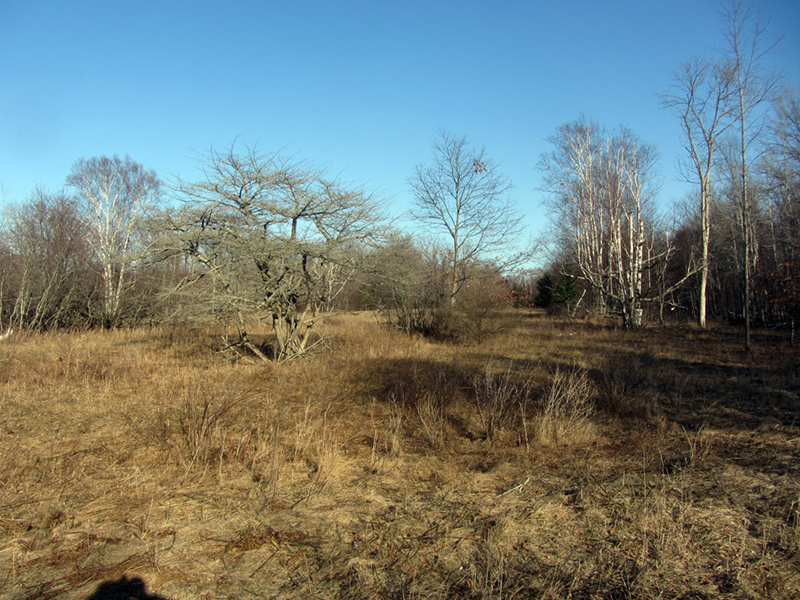
After a bit of wandering we crossed a river and came upon the *other* big clearing in the area, which based on aerial maps I was unsure as to whether it was the homestead clearing, or if the first one was. Maybe they both were?
At any rate we found no manmade traces at all in this second clearing, and concluded that it was just a natural feature of the dune-swale complex that echoed the beach running northwesterly up from our campsite. It was starting to get toward sunset and we still had to gather wood to make a fire for dinner, so we headed back to camp. At least we got a general mental picture of the lay of the land that we would be exploring for tomorrow, hopefully with better luck.
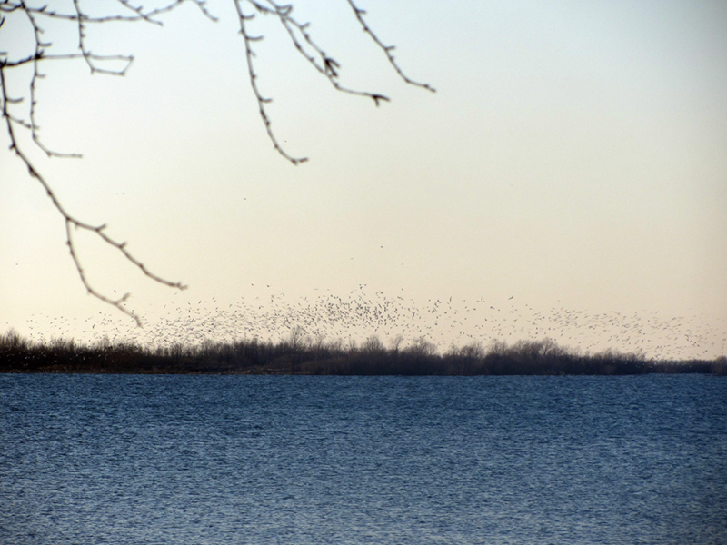
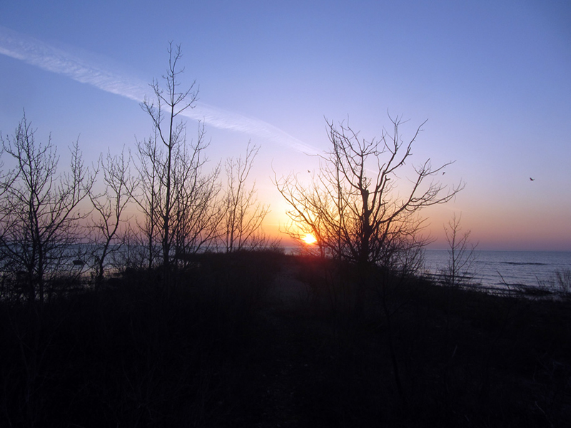
The small island in the bay across from our camp was full of thousands of birds, and their cackling punctuated this still spring evening as we made dinner and sipped on the campin' whiskey. We sat up for several hours soaking in the beauty and freedom of being outdoors again without our faces hurting from sub-zero temperatures for a change. The lights of Alpena began twinkling in the distance as twilight deepened on Thunder Bay:
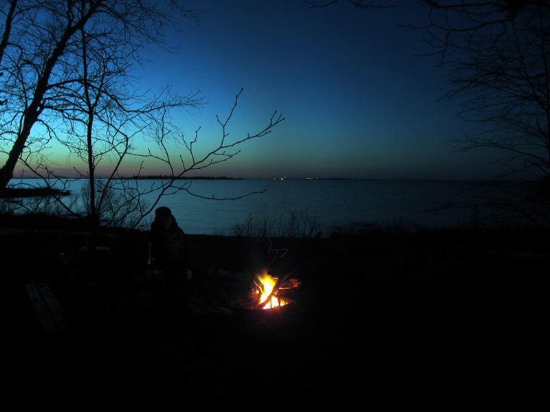
The Thunder Bay Island Lighthouse slowly blipped off in the lonely blackness of Lake Huron as we were enveloped by the forest's gloom, and the Milky Way glowed overhead while we stayed huddled around the fire. It being this early in the season was a guarantee that we were the only people camping in the 3,700-acre preserve tonight.
* * *
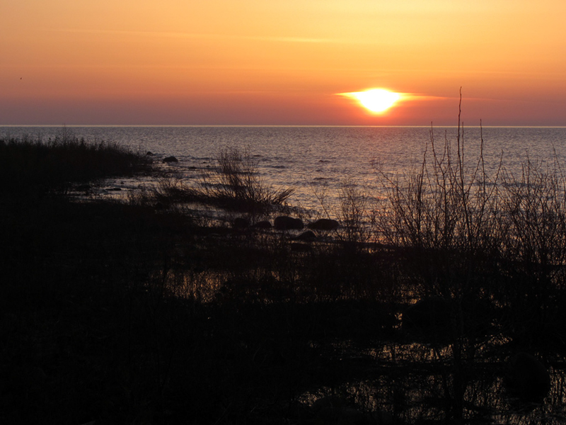
When morning broke again I wrested myself from the sleeping bag's warm grip to walk out to South Point and watch the sun break over the foggy waters of Lake Huron while my partner snoozed.
It was a pretty cold morning, and I was worried we might be wasting valuable daylight, so I hastily stoked our fire back to life and we made coffee and oatmeal to turn the crank on this particularly rough first camping morning of the year, before gearing up to go back to work in the woods.
The fact that it had dipped to the freezing mark overnight, and that our tent was a bit too small had made for an uncomfortable night; neither of us had winter camped in years. Happily, signs pointed toward this shaping up into a very fair, very warm day for hiking.
We hit the woods with a good head of steam and a stronger plan of action than yesterday, which was mostly a day for feeling-out our surroundings anyway. Nonetheless, I couldn't shake the sinking feeling that this was going to be yet another wild goose chase.
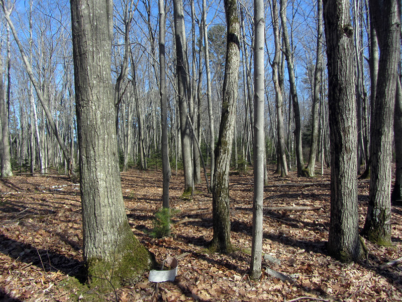
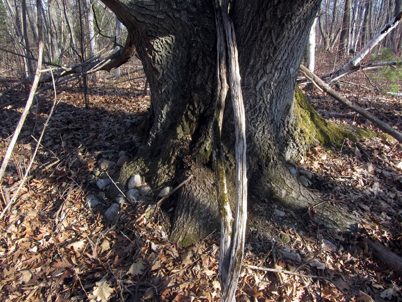
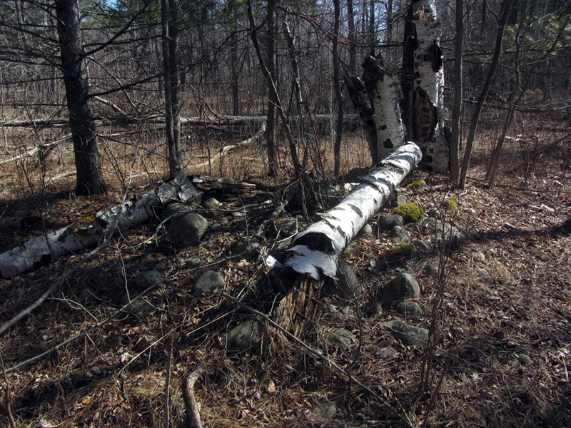
Two things kept messing with our heads out there. One, the forest floor was made up of a series of long ridges (dunes), which are basically old beachlines, and which also happen to look almost exactly like the three-foot-high walls we were searching for. Two, just below the surface soil, the dune ridges were often made up of rounded glacial stones, as seen clutched by the roots of this massive tree, which only made our job of discerning natural features from unnatural ones all the more ambiguous:
I was literally going by memory of one single photo I had ever seen to find this stone wall. I'm not sure if you can make it out definitively, but here is a shot of a dune ridge running left to right across the photo, with another one of identical height about 10 yards behind it:
Every naturally occurring dune ridge we crossed seemed to offer the promise of a naked stone wall peeking its head out just beyond.

Deeper and deeper we probed back into the woods, until we could no longer hear the sound of Lake Huron surf. Then suddenly we would find ourselves zigzagging back to some quiet bay we had already explored the night before, much to my frustration:
We looped back to the area that seemed the most logical, and I shot some compass bearings to keep tabs on what ground we were covering. We split up so that we were far enough apart to cover more ground, but stayed within earshot.
Coming across these errant boulders embedded in the landscape became increasingly common:
It was somewhat odd to be walking through a mostly flat forested wetland and suddenly find a big boulder all by itself. Either dragged and deposited here by the retreating glaciers 11,000 years ago, or uncovered by the wave action of some ancient beach that time forgot.
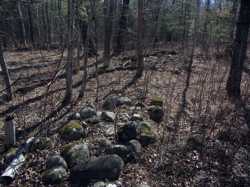
Every now and then the forest floor would also give glimpses of what lay just beneath the surface, with random piles of smaller stones, all with that smooth-rounded shape, just like the ones that supposedly made up the ruined walls that we were looking for:
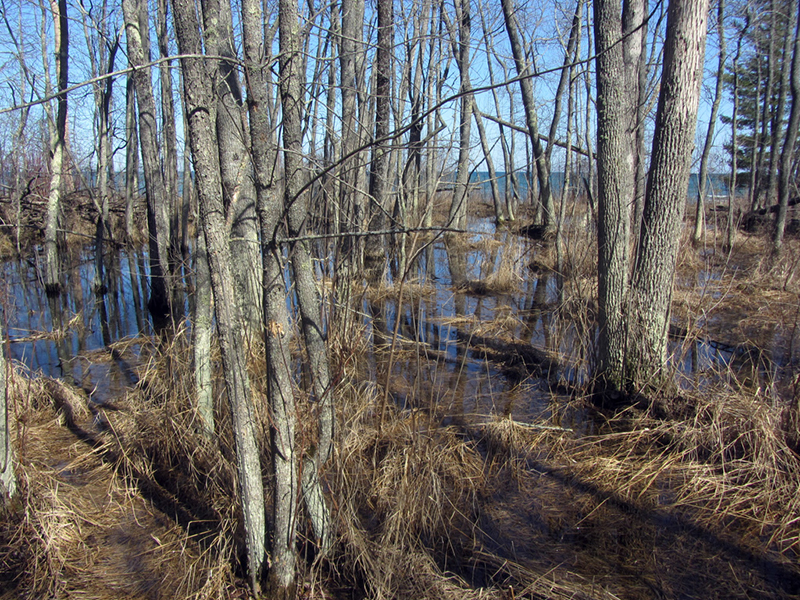
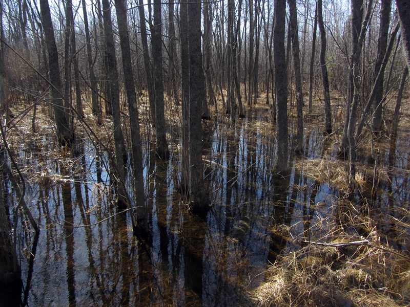
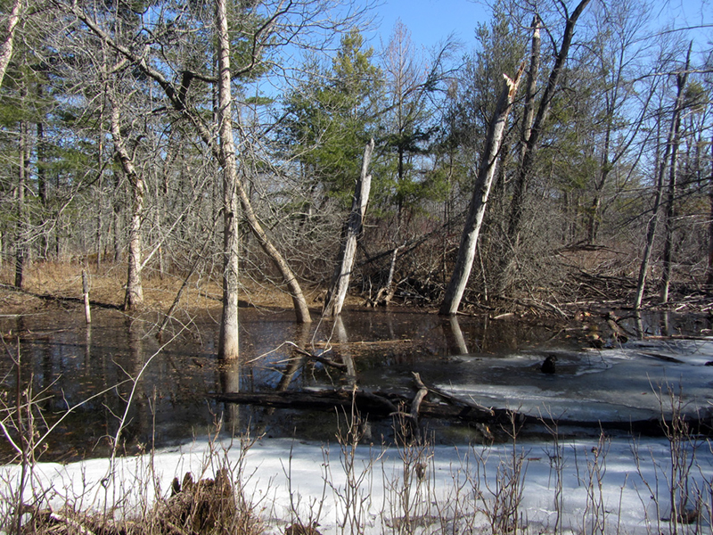
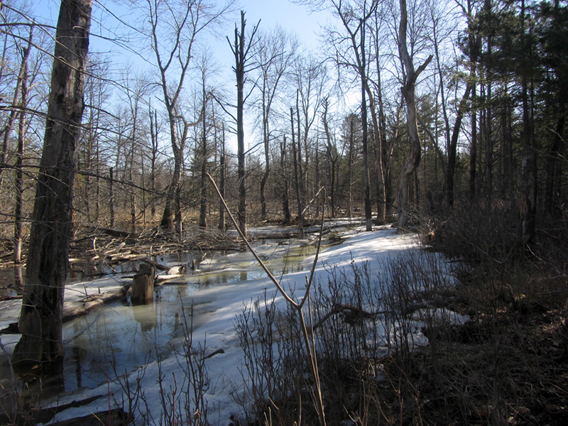
By about lunchtime we started to come across a very swampy area that I found intriguing:

It represented an awfully big barrier that we would basically have to completely reset ourselves in order to get around, and I had already begun to reach the point where I was feeling like we had lost the scent of what we were hunting. We had either zigged or zagged through nearly every single area that fell into the zone where the ruins should be, and we had not seen a single damned clue yet.
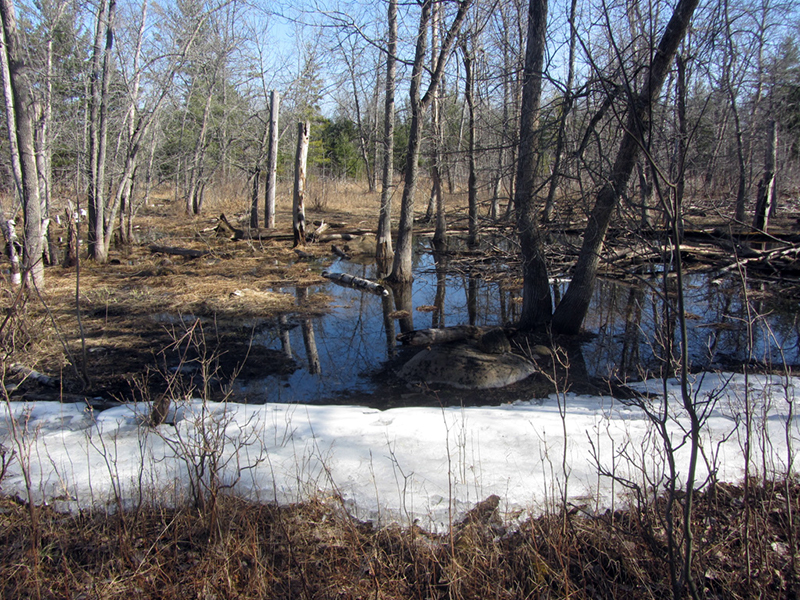
This swamp was one of our waypoints, but the disposition in which we encountered it was not matching up with what I expected we should be seeing.
We began the long, circuitous retrograde back to the trail in order to get around this monster wetland. By the time we were almost back on the trail I had already resigned myself to the depressing idea that I was going home from Negwegon empty-handed for a third time. As we were plowing our way through some dense brush I suddenly paused when I noticed that one or two of the sapling boughs I was pushing out of the way with my hand had evidently been cut, by pruners or some other similar tool.
This was odd, and I immediately brought it to the attention of my partner, who likewise found it to be rather strange. Had some hunter been here in the past couple months?
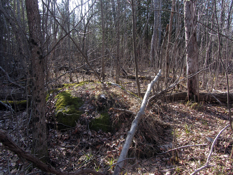
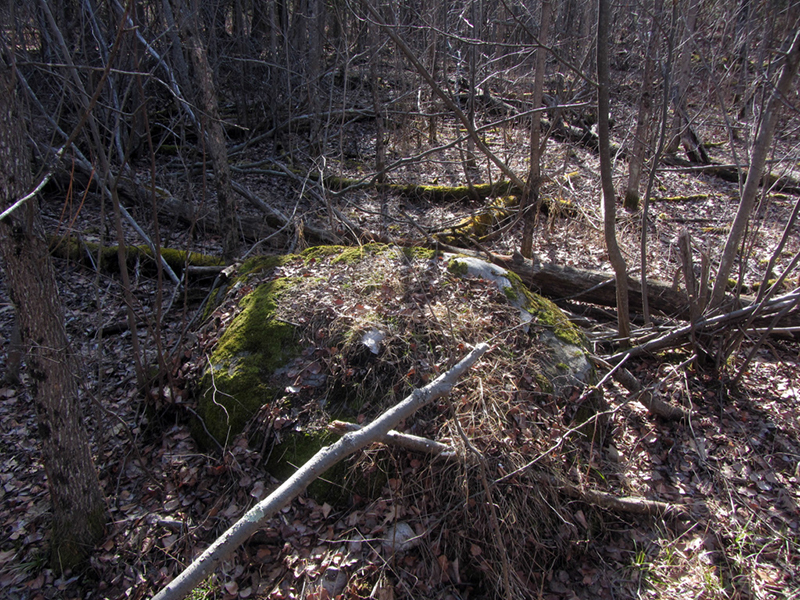
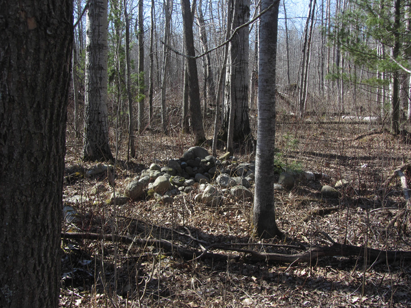
I hardly had a moment to ponder this when I heard my partner exclaim that she saw something up ahead--piles of rock!
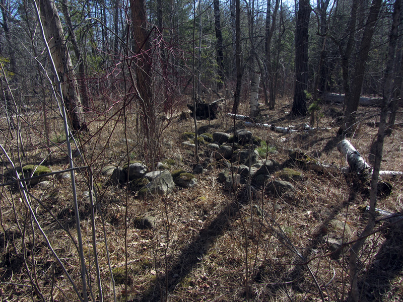
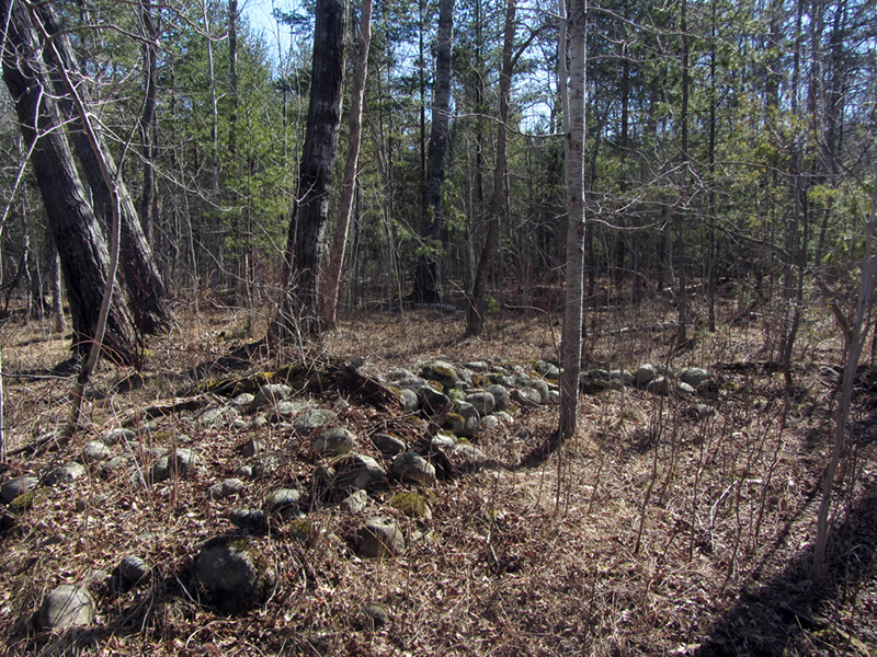
Sure enough, here was what looked like a cairn:
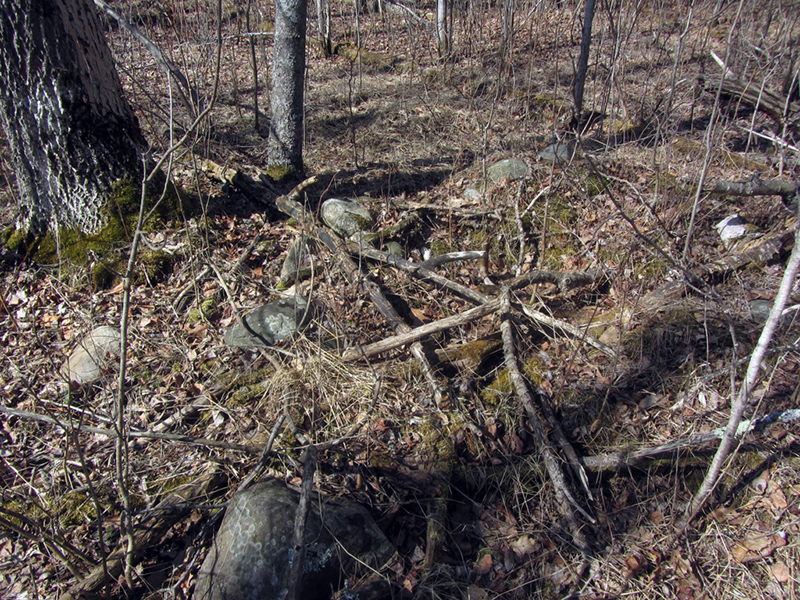
As I looked around I saw more and more of the stone piles, and my excitement rose. This was it--I had finally found the Negwegon Ruins! I hadn't realized that there were so many of the pits though, nor that they were not in fact part of the wall (which I hadn't located yet) as I had been led to believe.
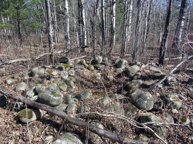
Some were very defined round stone pits, while others were much more overgrown in grass, but still subtly evident in shape:

From a few feet away, the pits look just like piles of rocks:
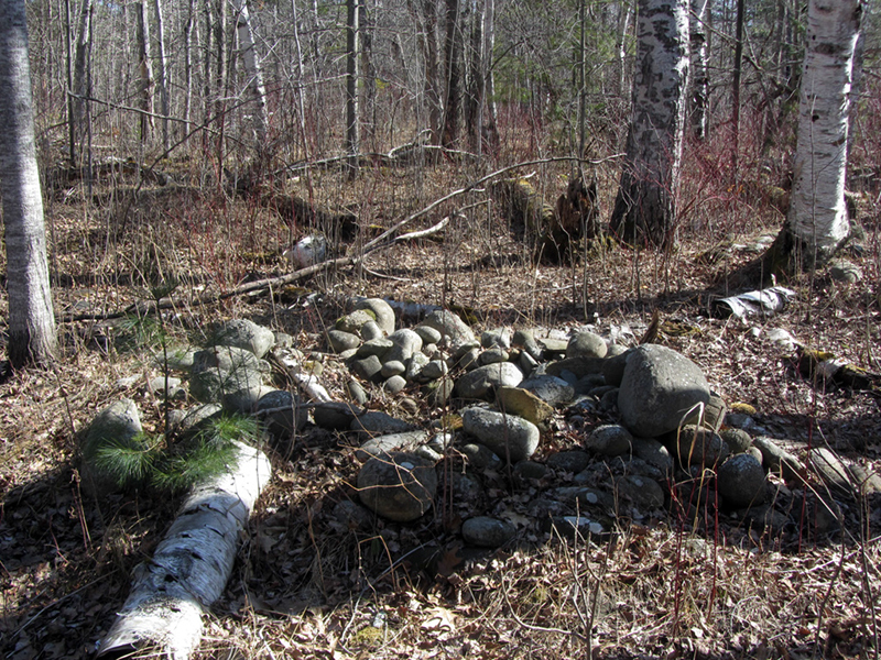
But upon closer inspection, they clearly resemble something like a fire circle:

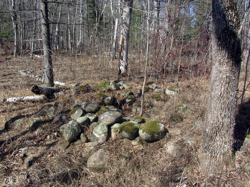
Here we go, this one is very well defined:
This one is also mostly covered but still holds its bowl shape very well, and in the background you can see two more piles:
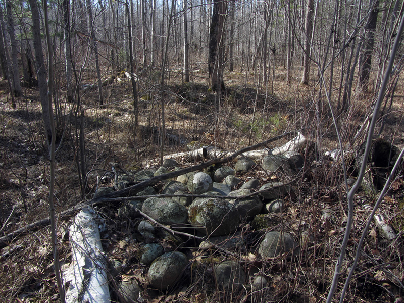
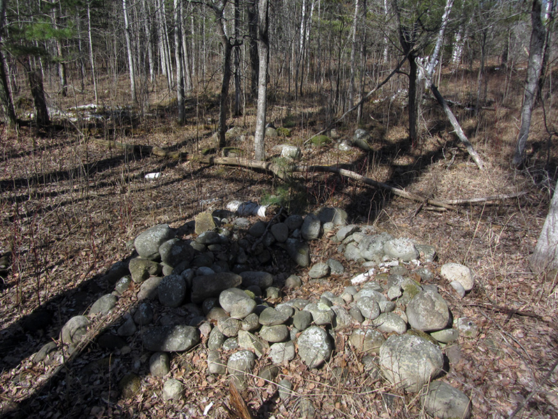
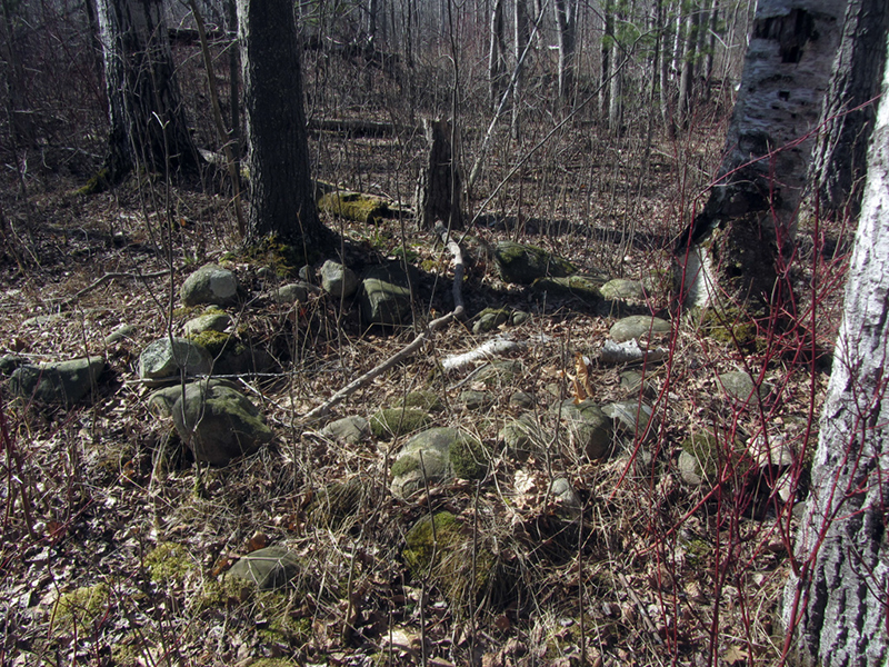
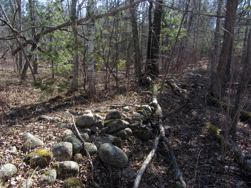
This was when my partner pointed out the fact that the stone wall was here, right behind me:
I was in fact standing at the very end of the wall, and the pits seemed to be clustered around it. For now though I went back to documenting the five or six pits I was standing in the midst of.
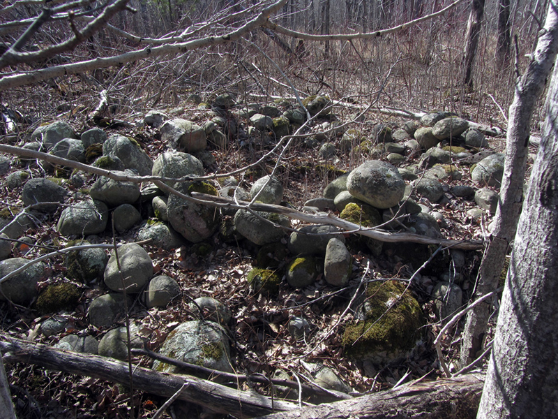
I sat down on a log and began to draw out a crude reference diagram mapping the locations of the pits in relation to each other and to the end of the wall. I also counted the number of pits that I could see in the area. There were six actual pits on the south side of the wall, and a seventh pile that didn't quite have a bowl shape to it and resembled more of a small cairn.
The pits averaged about six feet apart, and on the south side of the wall they seemed to be arranged in a ring or circle, while on the north side of the wall they seemed to be arranged in a line.
My idea was that they may have been sturgeon catchments; when the lake level was higher and it covered much greater area, the tides may have been much more emphasized, whereas today the lake tides are almost undetectable. The fish may have swam up nearer the shore when the tide was high, but when it started to go back out they found themselves trapped by the stone walls, to be harvested by the ancient people who lived here.
My partner wasn't so sure about that, but said that she felt the walls were containments for keeping already-caught sturgeon alive longer so that they could be kept fresher for smoking in the smaller pits at a later date. She thinks that because of the numbers of people that would presumably need to be fed, drying and preserving the large amount of fish would be a long and time consuming process, so keeping them alive as long as possible would be key. The pits would have soaked, green wood sticks placed inside them like a grille with the fish laid on top, which would then be smoked. And then they would invite me over to inspect them for proper flavor, of course.
My partner, who is a wetland biologist by trade and who has experience in forestry, suddenly posited a very interesting observation that might lend some insight as to the historical context of the landscape we currently found ourselves in. She pointed out that even though we were clearly in a wetland, there were white pine growing here--a species of tree that is not commonly found growing in wetlands.
"One of the ways we identify wetlands is by the kind of plants that grow there," she said. For instance, "You don't find cattails growing in the desert. We know white pine typically is not found in a wetland, so when we find it growing like this it is unusual." This was something that only happens in groundwater-driven scenarios she said, so something unusual is going on at this location related to the hydrology and geomorphology of the landscape if we are seeing trees that usually only grow in upland areas. In other words, the way it has apparently changed over time is abnormal.
Here was one that was extremely rough and hard to discern, but nonetheless a pit like its brethren:
After completing my rough diagram I stood up again and got out my compass to estimate the general direction that the wall was oriented in. It turned out to be running about 120° from my position (which is about East-Southeast).
Sadly, that was about the best photo I was able to get of the wall itself due to the fact that the sunlight was currently also coming from about East-Southeast, and the trees' shadows were not cooperating when I attempted a shot from the opposite end of the wall.
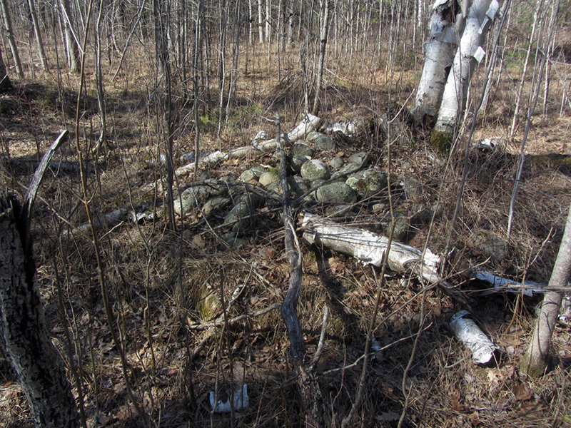
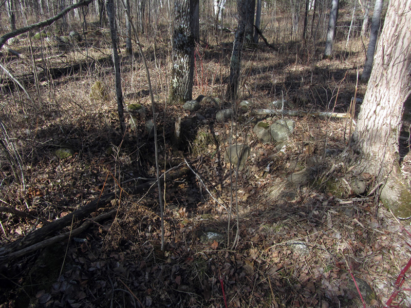
I now turned my attentions to the group of pits and cairns that appeared to cluster on the north side of the wall. This one was another that just looked like a mound of stones, about five feet across and two feet high:
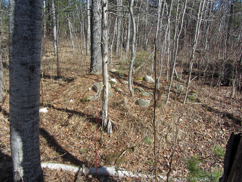
This one was bigger, and still had a cavity in the center:
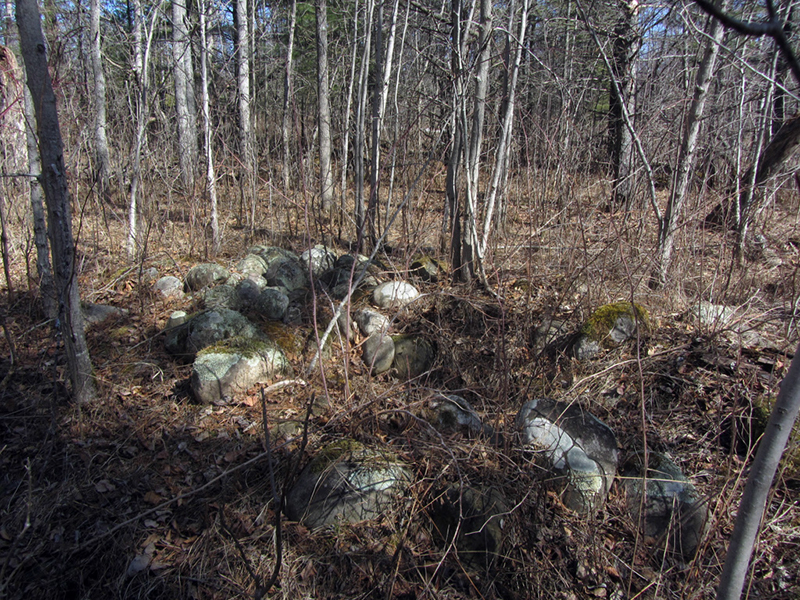
Other structures were not as clear any longer, but still appeared to be artificially grouped together:
This pile was sort of spread out, almost as if the two-and-a-half millenniums of rainstorms had made it melt like a sandcastle on the beach:
Here was another that remained quite defined:
One has to wonder why certain pits were in a state of advanced decay while others still looked relatively fresh...was this an indication that some pits were abandoned over time while others were kept in use longer? Was it an effect of having accidentally built some of them in places where they would be more susceptible to decay over time, or that some were just built with better care than others? Have they been disturbed or reused by modern men? When you're talking about something that could easily be thousands of years old, questions like this become harder and harder to answer with certainty.
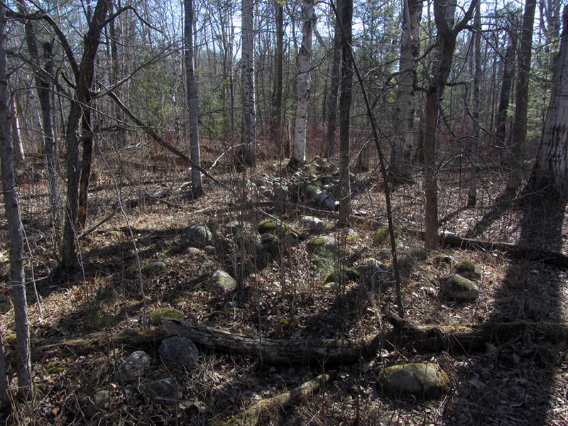
I now turned my attention back to the wall, which I had reached the end of, or at least one of the "gateways" in it:
This gap in the stone wall must be one of the "gateway" openings that was described. My parter was already ahead of me, and calling out that just east of the gate the wall took a sudden 90° bend to the right (south). I stepped off to the side for a shot perpendicular to the wall, looking through the gateway (center)...you can sort of see the two ends of the wall at far left and far right:
A better, angled view looking back up the wall to the west, again, with the gateway at center:

This was also when I decided to pace-off the length of the wall that I had already surveyed so far, to gauge its approximate dimensions. The long straight section that led back to where the pits were clustered measured about 60 (admittedly large) paces. That seems to add up, since the figure that I had seen quoted by the DNR was that the walls were up to 80 to 90 meters in length.
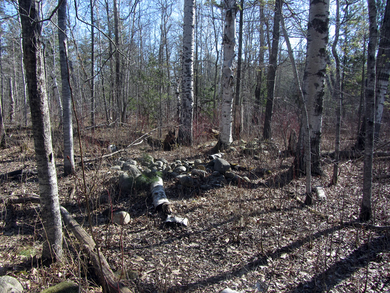
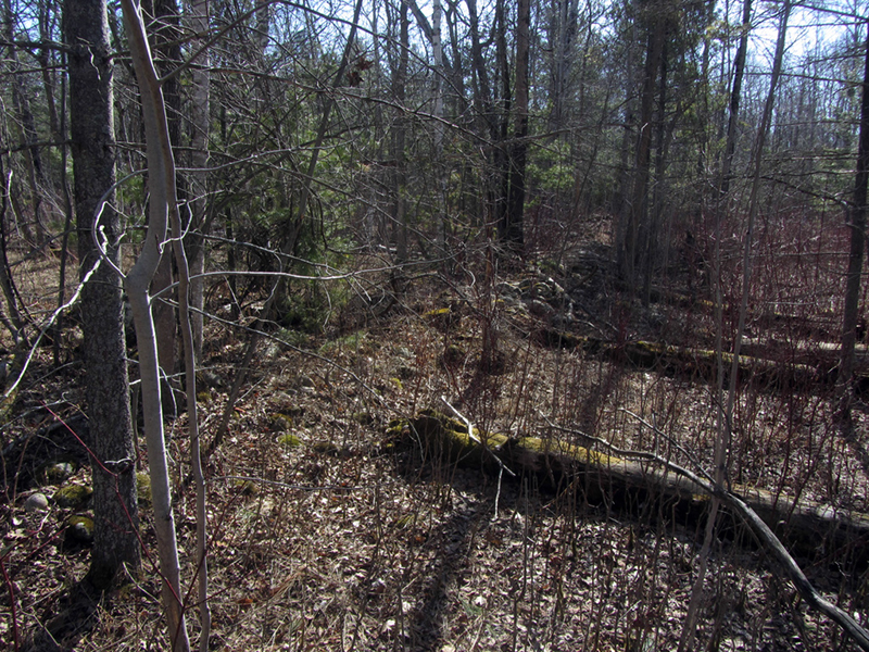
Now I started looking at the wall beyond the "gate," where it curved suddenly to the south:

Seen from the perspective of the east-west-running straight wall, you can see it veering to the righthand side of the frame:
I paced-off this section of north-south wall now, recording it at 27 paces before it seemed to taper off into nothingness. Where the rest of the wall might have gone or what it might have been shaped like--or conversely, if there never were any other parts of this wall, what such an odd shape would have been used for--was beyond me. But then again I majored in English, not Archaeology.
I had read that some of the ruins had been carted away for modern-era construction uses at some point before it was realized what they were, so perhaps that is why we are left with these incongruous fragments? But why anyone would come this far out into the woods to take these particular stones when there are so many other more easily accessible ones laying about doesn't make sense. At any rate, it was getting late in the day and we needed to get back to camp so we could pack up and make the long hike back to our car.
I would've liked to have spent more time out here doing a more thorough investigation and trying to find the two or three other ruin sites that we missed, but like I said I'm not an archaeologist, so I'll leave it to the professionals and hope that sometime soon I'll finally get to read a more definitive scholarly article on just what the Negwegon Ruins were.
'Til next time.
Just Like an Aborigine
References:
http://www.michigan.gov/documents/dnr/negwegon_analysis_315538_7.pdf
http://www.thealpenanews.com/page/content.detail/id/500177/Old-stone-walls-remain-a-mystery.html
http://thunderbay.noaa.gov/history/prehistory.html
http://geo.msu.edu/extra/geogmich/glaciallake_algonq.html
Mystic Michigan Part 3, by Mark Jager, p. 60-61
The Archaeology of Michigan, A Guide to the Prehistory of the Great Lakes Region, by James E. Fitting
Discovering the Mysteries of Ancient America, by Frank Joseph, Zecharia Sitchin, p. 121
The Archaeology of Michigan, A Guide to the Prehistory of the Great Lakes Region, by James E. Fitting
Discovering the Mysteries of Ancient America, by Frank Joseph, Zecharia Sitchin, p. 121
You certainly got my attention with this! It really does resemble some Ceremonial Stone Landscape Features where I am in CT {http://wakinguponturtleisland.blogspot.com/} and MA {http://rockpiles.blogspot.com/} and elsewhere in New England. There are a few thousand photos of similar features at these two sites and more in all those links at both...
ReplyDeleteThanks for reading man. I'd come across a website before that talked about stone formations in New England which I found really cool (http://www.cellarwalls.com), but i don't think i'd ever heard of there being this kind of rockpile stuff like we have in Michigan. I guess it doesnt surprise me.
DeleteWell all these months later, I see you responded to my comment! I should've clicked that little "notify me" box. The author of "cellarwalls" is a contributor to Rock Piles. I happened upon a video about O'Shea just this morning: http://scitechnow.org/videos/what-lies-beneath-the-great-lakes/#
ReplyDeleteI admire his work greatly (unlike that of "Frank Joseph" Collin - https://en.wikipedia.org/wiki/Frank_Collin)
The open (pits) are rock piles that have been opened up by people looking for Indian bones, as this used to be called an Indian Cemetery...its why there are mixed new stones, with the older weathered stones....
ReplyDelete