
CLICK to return to previous episode
The reason I was doing this mission was that according to my colleagues on the CopperCountryExplorer (CCE) forum, Norwich Hill was a quintessential anachronism or time capsule of the "old," pre-industrial Copper Country that still somehow managed to survive to the modern day, known only to the few locals who live in the area. It offered a rare, unparalleled opportunity to experience raw, unmolested history in the form of truly older ruins that had never been modified with the changing times—it was abandoned in an era when everything was still mined by hand—and lay in a setting that's about as remote and wild as you will find in mainland Michigan. But time was running out for being able to see it in this pristine state.
Discussions between locals on CCE hinted toward rumblings that the US Forest Service was planning to do mineshaft capping at Norwich. Basically equating to spending a lot of tax money on f#$%ing up a lot of pristine wilderness areas and irreplaceable historic remains that had heretofore lain undisturbed for decades by driving heavy machinery back there and obliterating any historic or natural character that these sites once possessed, to half-assedly seal up some holes in the ground that no one even knew about in the first place. Perhaps the doom-sayers' fears were hyperbolic, but all the same I knew I had to see this place.
One colleague in particular, an old-timer whose screen name on CCE was “ROC,” had told me much of these areas—he had a list of some mysterious locations that he had found bushwhacking over the years—and gave me detailed instructions on how to reach them. I compiled all of the rambling messages he wrote to me, printed them on a piece of paper, and folded it up in my backpack for use in the field. Crude, yes, but I felt confident in my ability; the locations are not mapped anyway, so it didn’t really matter. Basically from here on out, it would be a full-on backpacking and bushwhacking affair, hiking miles between locations, and camping out in the field.

From my exploration of the Cliff Mine Sunday night, I headed back to Calumet and stayed the night at the motel on Elm Street so that I could purchase provisions, charge things, communicate with the people from the forum, get a shower, and sleep in an actual bed before the hardcore expedition began tomorrow.
Calumet is such a beautiful town. It is straight out of the Wild West. Every single building in this town is made from either basaltic poor rock or Lake Superior Sandstone, giving it that Colonel’s Extra-Crispy patina, which just absolutely glows in the setting sun. Here is the closed Sta. Mary Church:

The old Calumet Theater (now also police station):

Former fire house across the street; next to it, the roving band of bike-riding youths who patrol the empty streets of this forlorn town all night:


An alley between 5th and 6th Streets:

Calumet is the only Yoopee town that ever reminded me of Detroit...it was truly like a ghost town.

In one of the many, many abandoned buildings, a bowling ball has been used to bolster some of the masonry...doesn't get much more Yooper than that:

As the sun set, I found myself with quite a bit of time on my hands. I wandered the streets of this desolate downtown, just taking in the atmosphere and the perfect weather. It was eerie…so quiet and deserted in this town…except for that rogue band of kids who rode their bikes perpetually around between the buildings and streets. No cops, no nobody here. Total population is supposedly about 800, though it feels like much, much less.

I grabbed a pizza and a six pack of da KBCs (everything comes in cans here, eh!) from the corner place and took it back to my room, where I could laid out my map and my notes, and formulate a plan of attack for the next four to five days I would be at Norwich. I figured it might be best to set base camp at my car at the foot of the hill (since you can drive right up to the bottom), and run sorties from there. Based on the info I was given, the ruins spread out from that spot to the east around the bottom and the north, and up on top. Other than that I would largely be going on intuition.
I awoke early and drove south back through Hancock/Houghton where I stopped for breakfast again at the Soumi Bakery. I also stopped on Quincy Hill to behold the grand view out across the Portage:

In the distance (to the right) you can see the Huron Mountains beyond the Keweenaw Bay, which rise up behind Marquette, some 30 or 40 miles away:

From there I took M-26 through the hills of Ontonagon County toward Rockland, then found the Old Victoria Road, which led past the old settlement of Victoria—one of the first prosperous mining camps in Copper Country, where the legendary “Ontonagon Boulder” had been discovered. I explored Old Victoria in another post on this website.

A massive shard of pure copper weighing several tons, sitting prominently in the middle of the Ontonagon River, the “Ontonagon Boulder” had been known in rumor and fable since the French voyageurs and Jesuit missionaries first traversed Lake Superior. The Ononagon Boulder was first reported by Fr. Dublon in 1635, it was later confirmed when Fr. Allouez saw it in 1667, and later again by fur traders.
The New York Times reported that it "was supposed" at that time the boulder had been removed once by ancient miners from its native bed, who then attempted to raft it down the river, but it sank due to its immense weight. "When the water was low it projected above the waves and was an object of religious veneration."
The Jesuits who first visited that part of the country heard of it from the Indian priests, who, however, refused to conduct the missionaries to the spot where it lay, on account of a superstitious belief among the Indians that when the white man had seen it the Indians would be destroyed, and the control of the country pass out of their possession.The mythical Ontonagon Boulder was deified by the natives, who referred to the it as the "Manitoti." It could be asked for divine help and guidance, and was used as a place of human sacrifice by the tribes in exchange for these favors, according to lurid (though questionable) early accounts recorded by explorers who had claimed to have seen people slain upon it. At least one of the sacrifice stories was credited to Pierre François Xavier de Charlevoix, published in the October 8, 1857 Sacramento Daily Union. The boulder also allegedly had the power to speak in a booming voice, as of thunder.
There was talk in the beginning of moving the Ontonagon Boulder, which had been estimated to weigh up to 20 tons, except for a few pieces that had already been hacked off of it with great difficulty. But the boulder was in such an inaccessible location that it resisted attempts at swiping it for 208 years after the white man first gained the knowledge that it was there. In 1820 General Lewis Cass led an expedition with Henry Rowe Schoolcraft and others, to survey the western reaches of the Michigan Territory, of which Cass was then governor. They found and attempted to remove the Ontonagon Boulder, but failed. Another attempt in 1827 failed as well.
The soon to be famous boulder was finally removed in 1843 by Julius Eldred of Detroit, who had it shipped back there (as something of a sideshow attraction), where it was subsequently confiscated by the War Department. As the Ontonagon Boulder was transported from Detroit to Washington D.C. it became a famous tourist attraction, and the Navy later handed it over to the Smithsonian, who still retain it to this day, though it has not been on display for decades. It was the public sensation generated by the Ontonagon Boulder that helped spark the Michigan copper rush, initiating the growth of the mining industry of the once-great Red Metal Empire whose senescent ruins surrounded me today.
What I didn’t know was that Old Victoria Road was a little rough…I could see by my road map that it was not paved, but there were parts of it that were pretty treacherous for my poor old T-Bird. Ruts from logging trucks, and mudholes, etc…but I still made it. I had to carefully creep over it at low speed for most of the way. By the time I got to Norwich Road, I knew that I would not be returning this way. If I wanted to use paved roads, I would have to drive all the way around through Ontonagon, for miles and miles…which was unfortunate, but it is the only paved route established through this country.

I arrived at the foot of Norwich Hill at 12:30pm, and geared up for a brief exploration before having to meet Mike and Tricia from CCE at 6pm in Calumet for dinner. When I pulled in I found a Forest Service truck already parked there…for what, I could only guess. Perhaps they were doing more site surveying work prior to the mineshaft capping.

One of the warnings that ROC and other locals had given me was that there were wolves here. He said the only time he ever encountered another backpacker out there, the guy was practically running and looked to be "scared shitless." I've still never personally encountered a wolf or a bear in Michigan, but I knew they were around.
There are two camps regarding wolves and bears, and both have very strong logical points and evidence to back up their position. One says that they will never attack a human unless provoked, and the other camp maintains that they have done it before, and could potentially do it again, so carrying protection is wise. I am not necessarily a member of either camp, but as a Boy Scout I live my life by the motto "Be Prepared" regardless of political or rhetorical arguments. When in da Yoopee, do as da Yoopers do—and some of them were telling me I was crazy for thinking about going out there unarmed when some of them who lived in the area had spike mats outside all the windows and doors of their cabins. As such, amongst the rest of my gear I packed my revolver with me, loaded with solids, neatly attached to the top of my backpack frame where I could get at it easily. Not your average exploring gear.
I parked at the base of Norwich Hill, donned my smaller backpack, and started hiking. At the “entrance” per se, there is a locked gate across the trail to prevent vehicle access, and next to that I was surprised to see this sign (which some Yooperz had decorated with bullet-holes of their own):

For some reason it got me stoked after I read that. I mean I already knew what was back there, but to see it presented like this, almost like “Welcome Ruin Hunters!” was sort of exciting…plus it was cool to see the government really do something right for a change—i.e., not over-curate places like this that have their own strong, genuine character that can only be truly experienced in a natural state, not through some touristy “Interpretive Path” with hand railings and big annoying signs pointing out the obvious. I don’t like having my hand held; I want to figure stuff out for myself. I don’t need the brush cleared away for me so I can find the “old ____,” I want the experience of having to search for it. Otherwise you’re just a pedestrian. Makes it so much more visceral and educational when it’s not bureaucratized like your average National Park. But seeing the language on the sign also made me wonder how their plan to cap all the shafts fit in with the warnings not to alter the site…what a bunch of maroons.
Anyway the part that says “ancient ruins” isn't an exaggeration; copper mining has been going on in Michigan since about 4000 BC, which was well before the pyramids of Egypt were built. The ancient predecessors of the Anishinaabe people mined copper in pits along the Keweenaw and on Isle Royale using a method that involved digging pits and heating exposed ore-rich rock with small fires, then dousing it with water to cause it to crack apart. The metal was then harvested in pure lump form and beaten into tools, weapons, or idols that were traded with other tribes and peoples. The trade networks of the ancient times were vast, and it has been asserted that proto-Great Lakes peoples spread copper all across the world during the Bronze Age, but professional archaeologists agree that the network was limited to this continent. It was really a huge operation, and these pits can still be found, especially on Isle Royale. And some here at Norwich Hill.
In fact, it was these ancient pits (and the tribes' knowledge of their ancestors’ sacred mining locations), that led early prospectors to find the richest lodes in the 1840s as the modern Michigan copper boom was taking root. Basically they just picked up where the ancients left off. In some cases on Isle Royale, if you know where to look you can see some of these pits that still have the 5,000 year old tools sitting next to them, undisturbed since work stopped in prehistoric times. Nothing else is really known about the ancient copper miners, other than it all mysteriously ceased around the same time, for what reason no one can tell.
What one of these pits looked like I couldn't say, since it must be pretty damned overgrown, probably today resembling no more than a depression in the forest floor, the tools and other evidence laying under a biodegraded carpet of leaves and pine needles several millennia thick. Nonetheless ROC said they were out here, so I would have to keep my eyes peeled. I beseeched Gitchi Manitou for his blessing, walked around the gate and into the woods.
I set out on the “Miner’s Trail,” which is now just a small trail through the woods wrapping east along the base of the bluff. According to what ROC had wrote, I would come across a side path leading down to a cemetery, and past that there will be a different side path leading to most of the old shafts. Right before I come to it on my left will be an adit and a shaft directly beside the trail, which I can walk into (remember, an adit is a horizontal tunnel, a shaft is a vertical hole). This old miner’s road he said was also the path that they used to bring the extracted ore down from the top to be processed.
According to author Joseph Papineau, the “Miner’s Trail” (and many others in the Yoopee) actually started out as an ancient Indian trail, one of a network of “highways through the endless forests” stretching across the entire peninsula. It is believed that the ancients used these trails here when they mined these bluffs, up to 6,000 years ago.
Sure enough I came to the cemetery trail to the right back down the slope, and checked it with my compass to make sure it indeed ran south as described. After about a half mile I came upon a sight similar to the Cliff Cemetery:

The mosquitoes were pretty vicious here and this is where I chose to put on the repellant.
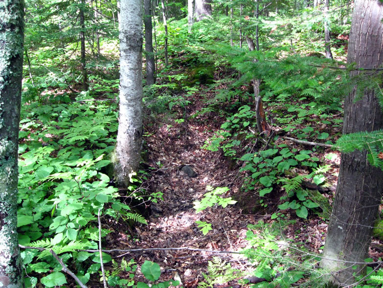
I returned to the main trail and came across what looked to be a manmade pit…but probably not one of the ancient mining pits:

Not too much further up I passed the first mine. I saw that it had already been tagged and labeled “Ohio Traprock #1” and the small, unlocked gate that ROC described:

The opening on the left was an adit, and the one on the right was a shaft, sunk at about 45 degrees:

It was flooded several feet down…how far it went I did not know. This here was a helluva crazy sight—until I began talking with ROC I had no idea that open mine entrances existed in Michigan still. Amazing.
Anyway, the shaft looked to be flooded and clogged with leaves; this is how many of the ones I’d find would look:

The adit was primitively cut, and took on a slanted shape to correspond to the vein they were following:

Stepping inside the adit…this was with a flash:

Photoshopped:

A 15-second exposure plus light-painting with two flashlights produced this:

Seems the adit only goes about 30 feet, and had been blocked off long ago. The rocks in the ceiling looked so loose I could’ve pulled them down with my hand and caused a cave-in. And they looked sharp. No timbering either. You can see the vein they were following, cutting diagonally in from the upper left and down the tunnel. It's possible this mine was delved by a prospector in the 1840s based on a pit he found that had already been started by ancient aboriginals around the time of Christ.
Looking back:

I then bolted back out of there (gingerly) to safety once more.
Further along the trail, more odd pits:

As a matter of fact, the popular North Country Trail (running from New York to North Dakota) passes through here across the bluff, though it does not really go by any of the mining ruins. As the trail became steeper, I came to the intersection of what is marked the “Interpretive Trail” with these pink streamers, but I think this is a mere proposal, perhaps as part of something still to come (with capped shafts, etc). I'm holding my compass so as to indicate the bearing of the trail if you can't make it out:

I however continued along the main trail to the bluff top for a few miles and came to some gorgeous overlooks:

Near the peak was a trail intersection with a mileage sign that indicated I was in fact now on part of the North Country Trail (as if the "blue blazes" every ten feet hadn’t already tipped me off, haha). From here I could cut across a small valley to the former Forest Service fire tower at the summit. Here I also found the first of many recently-placed, numbered stakes left by USFS “Heritage Resources” officials:


I did in fact opt to cut over to the summit and the former fire tower, and along the way was surprised to find a fenced off area.

At first I thought it was the former Forest Road 642 that led up to the tower, but realized it merely cordoned off a small circle…and inside was a depression—a flooded mine shaft:

Further on I came to the summit, at an elevation of 1,597 feet, where the old footings of the former fire tower itself could still be seen:

Just down on the other side of this rise I found the cul de sac where the former access road terminated, and there was a signpost, that once held a map. Then I looked closer and noticed that it still indeed did hold a map—but it was so faded that it could not be read. As I stared at it trying to get something out of it, I saw that it was basically a ruins map! Score!!

I took these pictures with the intent of going back to my car where my laptop was, and blowing the contrast out in Photoshop so I could read it better, and have a slightly better advantage in my mission. Sweet…this was like finding the labyrinth map in Legend of Zelda. Suddenly I had a real mental picture of where I was going and what I was trying to do. I spent several minutes orienting my brain to this map, and internalizing it so that I could guide myself better tomorrow.
You probably can’t read it, but to the lower left are shown the stamp mill ruins, the stamp sand, and along the east-west trail connecting them to the trail I was on were listed about six mine shafts and an adit. There were a few dam ruins, and it also identified that mystery pit I had found earlier as a cellar hole, not a mining pit. In fact, that same side-trail that branched off east from where that pit was supposedly went to a ruined dam itself.

What I did not know was that this map showed only a very brief and incomplete view of the Norwich Hill, and that it would later hamper me as much as hinder me. At this juncture, I decided that it was time to head back down to my car so I could meet Mike from CCE in Calumet for dinner. The view from the summit:

I wondered whether this ridge off in the distance was the southern end of the Porcupine Mountains:

On my way back down toward the bottom I decided to take a jaunt off on the side trail by the pit that supposedly led to a ruined dam. It immediately led downhill and crossed a tiny creek before rising back up on the other side through bracken-covered forest floor and on back up into the wooded uplands. I followed this trail for some time, wondering where the dam could be, since the map didn’t show it too far from the turn-off. I climbed some very strenuous ascents onto the bluffs once again and eventually came out to a pine-crowned height that looked out over a magnificent vista.
Vultures circled and played on the thermals in the great and expansive valley I had just crossed. I could see that I had indeed left Norwich Hill behind and climbed the next hill over…I was merely following the North Country Trail out of the area now. I was tired, and decided it was definitely time to head back. That very first little creek I hopped must have been the dam; I bet it was just so old that it had become indistinguishable from its surroundings. It was probably made of logs and earth to begin with, so it could very easily have taken on a natural appearance by now. The Michigan weather does not preserve such things for long, certainly not for a century and a half!
I made it to my car by 4:35pm…the Forest Service truck I saw there earlier had already gone.
Now that my quick initial run-through was complete I returned to Calumet to meet Mike for dinner, and to acquire some provisions for the next four or five days that I would be out in the bush at Norwich—three Roma tomatoes, a bag of raw granola, beef jerky, and something unique to the Yoopee that I had been wanting to try—Trenary Toast. I believe it is also known as korpua (in Finnish), being a type of preserved cinnamon toast that was popular with hunters since the old days, and those who own cabins in the backwoods, stocked with rations in case of emergency. The toast is made in some special way similar to candying, I want to say, so that it keeps for years and is extremely light weight, though filling and good-tasting. Thus it is just about the most ideal backpacking food I can imagine. Think along the lines of Lembas bread from the Lord of the Rings.
CLICK for part three.
Sources cited in this series:
http://www.coppercountryexplorer.com/explorations/mines/cliff-mine/
http://cliffmine.wordpress.com/history-of-cliff/
http://cliffmine.wordpress.com/2011/05/21/field-trips-part-1-the-norwich-bluff/
http://www.passportintime.com/summaries/96/mi96_ottawa_nwoods.html
http://www.mindat.org/loc-17462.html
http://www.mindat.org/loc-17100.html
Norwich Mine, An Historical Journey Across Time, by Joseph R. Papineau
A Guide to Michigan's Historic Keweenaw Copper District, by Lawrence J. Molloy
"The Copper of Michigan," New York Times, Oct. 14, 1890
"The Ontonagon Copper Rock," Sacramento Daily Union, Oct. 8, 1857
http://www.mpm.edu/research-collections/anthropology/online-collections-research/old-copper-culture
Wonderful Power, The Story of Ancient Copper Working in the Lake Superior Basin, by Susan R. Martin
Wonderful Power, The Story of Ancient Copper Working in the Lake Superior Basin, by Susan R. Martin
No comments:
Post a Comment
Note: Only a member of this blog may post a comment.