

I began by going into the triangular lagoon at the southern tip of the island, where I climbed a tree for a look about. The narrow strip of land I'm looking down on is actually made up of piled rocky material that was dredged up from the river-bottom when the shipping channel was dug, way back in the day (map).

The triangular lagoon is a popular resting place for boaters, a calm spot where they can drop anchor and take a nap, or just enjoy a calm Saturday without the high traffic and chaotic wakes of the main body of the river.

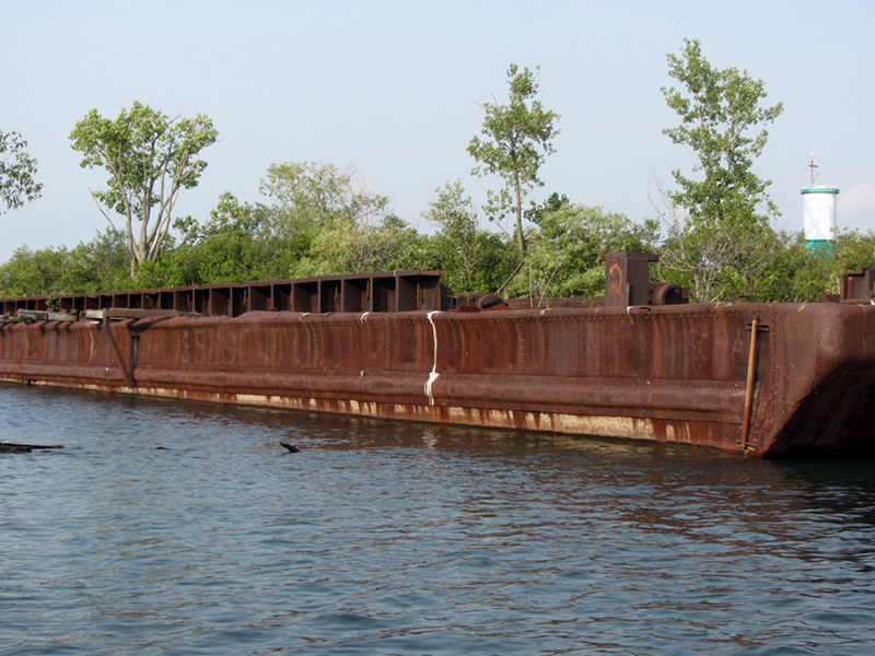
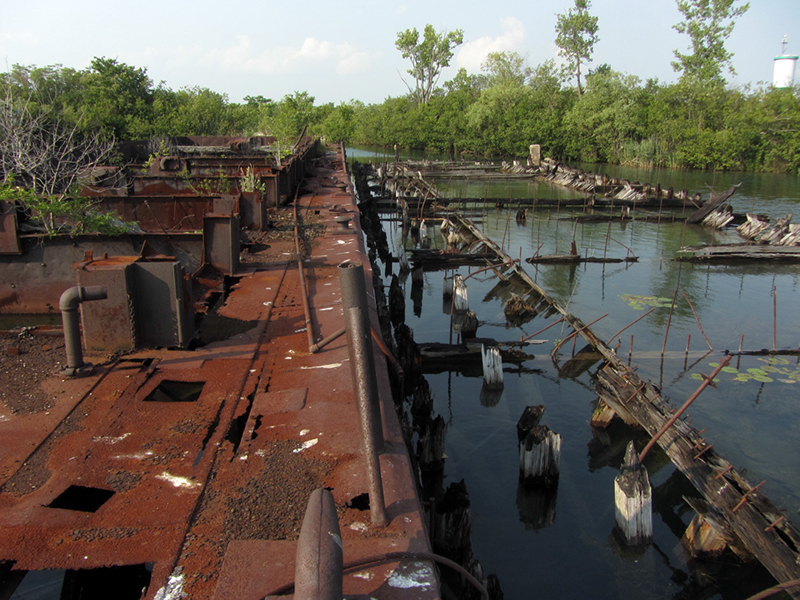
I also wanted to make a more thorough investigation of some more barge wrecks outside of the lagoons, on the southern shores of the island. Now that the Great Lakes' water levels were back up to where they should be, it was much easier for me to get back there without getting my boat hung up in the rocky shallows.
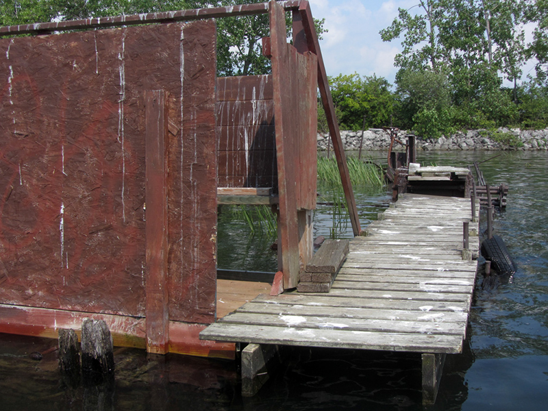
Someone had apparently transformed this submerged barge wreck into a duck hunting station by building their own dock and blind onto it:

Quite the accommodations!
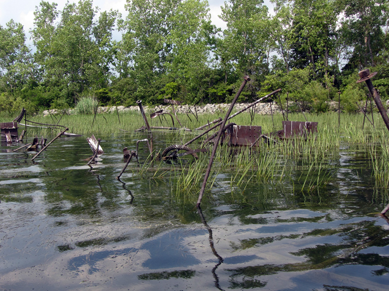
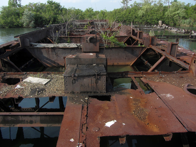
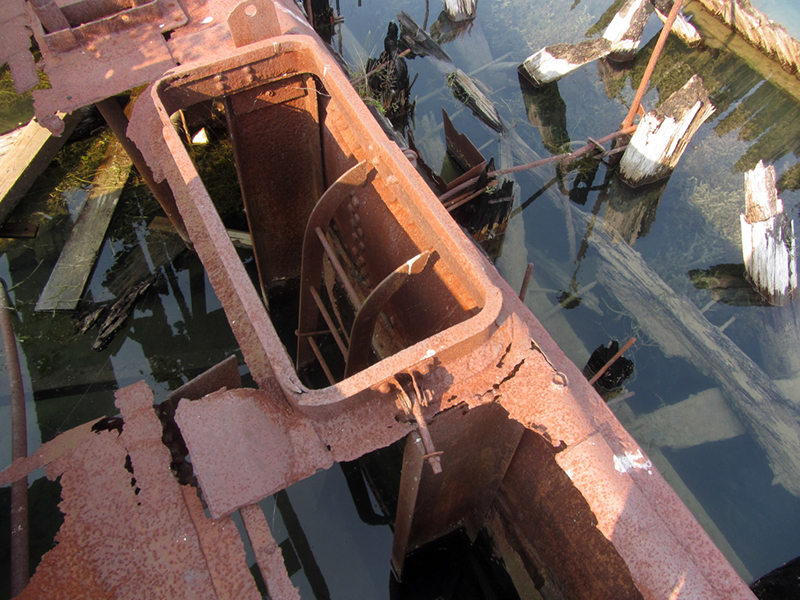
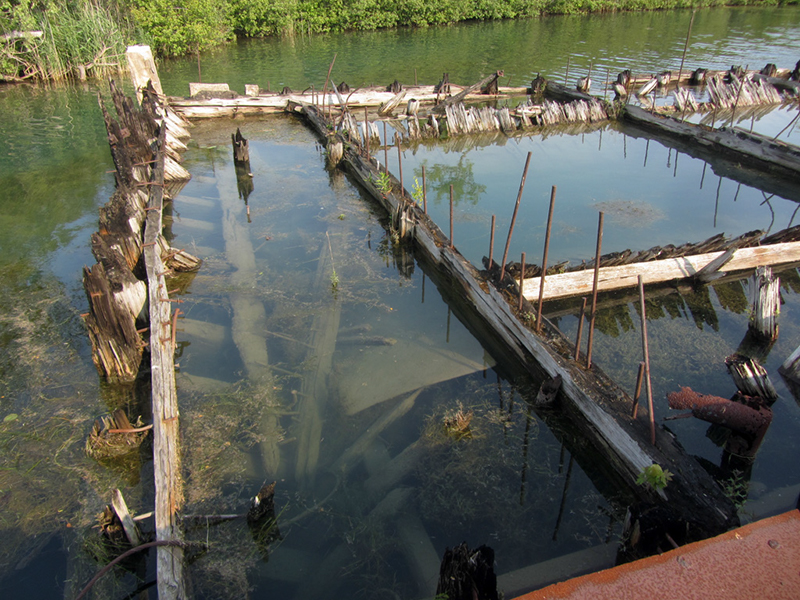
Not much was sticking up above the waterline, but looking down into it we could see that there was quite the shipwreck under us:

In one of the Detroit Free Press articles I dug up, entitled "Rum Warfare Match of Wits," a reporter described riding along on a night cruise with some federal revenue officers in 1931, and recalled passing Stony Island on a stormy night in May.
The lights of Dunbar & Sullivan were glowing brightly as the company was working 24-hours a day in preparation for the deepening of the St. Clair River up north, while the glow of a grounded barge that had been on fire for more than a day also lit up the night near the island's southern tip. "More honest fishermen," one of the revenuers sarcastically remarked.
I wonder if that burned barge from the story might be this one?

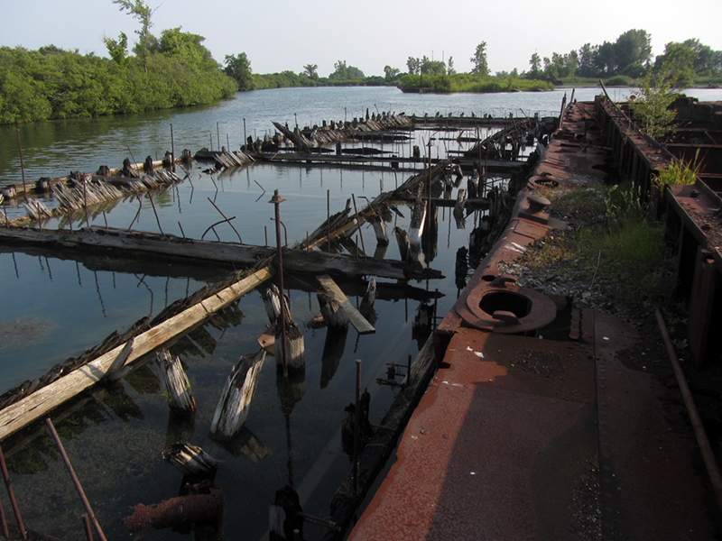
Having seen as much of that one as we could, we now made our way back into the Dunbar & Sullivan lagoon where there were some still-floating barges that we had never really checked out before. I couldn't quite make out what had once been painted on the side:
"Dunbar & Sullivan," perhaps?
I decided to hop up on deck for a better look.
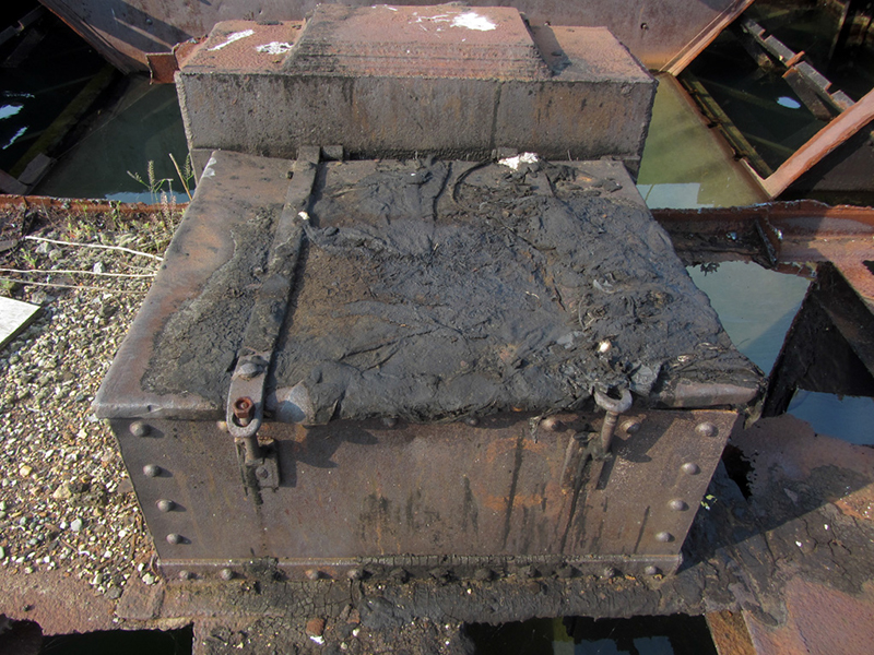
A close-up of a weld on this piece here says "PAT, Dec. '56, St. Lawren N.Y.":

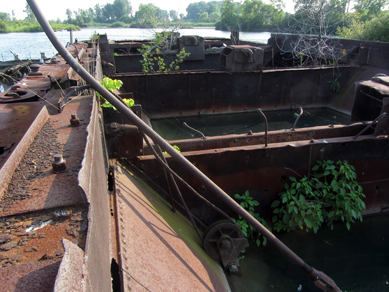
Looking down into the holds, or hoppers, there is quite an ecosystem taking root already:
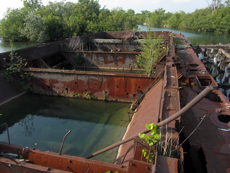
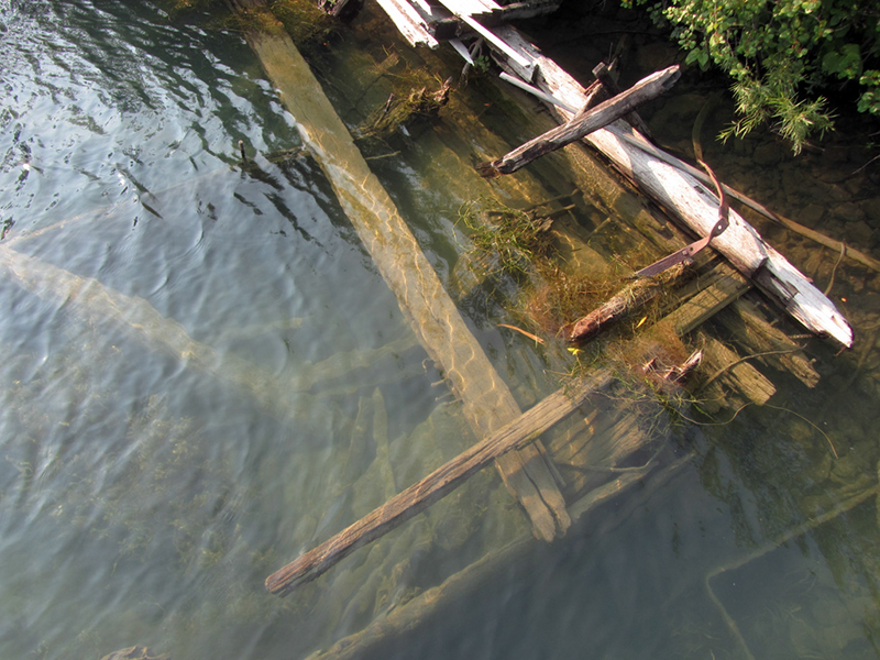
This steel barge was sitting between two older wooden barges, one of which you can see here:
I'm guessing it may have been set on fire at some point and burned down to the waterline, judging by the fact that the bottom is all that's left.
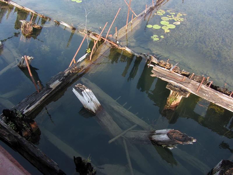
Basically the way these things work as far as I can tell is that they contain several compartments called hoppers, that are filled up with dredged material from a dredge boat. Once they are full, they are escorted away by a tugboat to a dumping area, or an area to be reclaimed.
The hoppers in the barges have large metal trapdoors in their bottoms, which allows the material to be dumped out from below, once the barge has been positioned over an area to be filled.
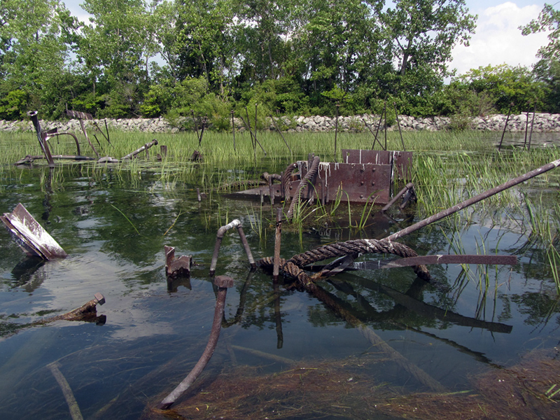
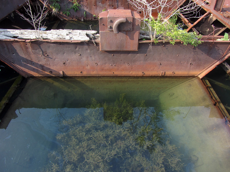
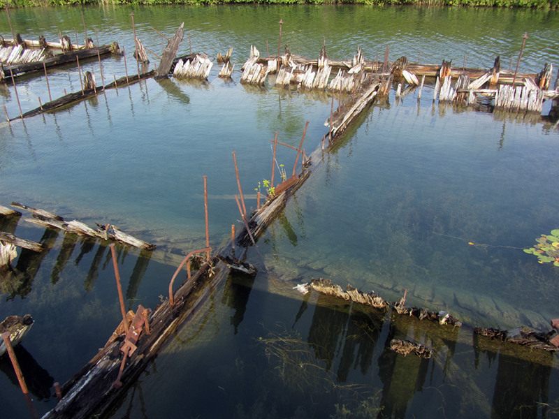
Once again you can see a sort of hinged door here, which seems to indicate to me that this barge was used for dredging and/or holding the spoils thereof:
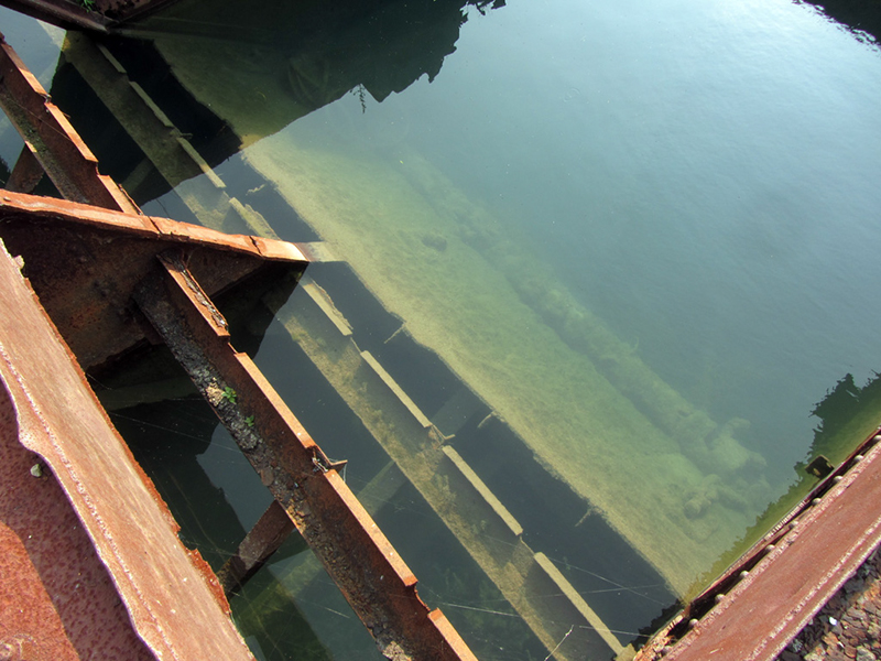

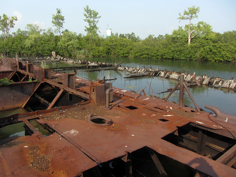
Looking down into the water on the other side of the steel barge, we could see the skeleton of a third barge resting on the bottom, beached against this mini-islet of dumped spoils:
I wonder if this is the one that the old hermit watchman Mr. Mather used to live on?
Another fairly mocking Prohibition-era article in the Free Press tells the tale of the day three federal immigration officers were patrolling Grosse Ile for illegal alien hideouts when they thought they saw some interlopers on nearby Stony Island. They stripped down to their skivvies and used a makeshift watercraft to ambush the supposed aliens.
The reporter chuckled at the hardships the agents took upon themselves in this misadventure only to discover 150 beer crates that had been partially smuggled from Canada, while the shoe-wearing smugglers escaped easily across the loose sharp rocks of Stony Island, leaving the shivering naked feds behind. The beer was eventually loaded onto a truck and taken to Detroit to be "smashed into a gutter." Gotta make those press photos I guess.
I decided to take another stab at getting into the steel building with all the welded-shut doors that I never could get into:

Hidden in the overgrowth, a small opening near the roofline allowed me to somersault my way in from above, but sadly there was little of interest inside.

I guessed that this was Dunbar & Sullivan's offices, and/or supply house.

I've also read that this may have been a machine shop though.

Big hooks on the wall, presumably for hanging large objects like chains or cables, or maybe just Carhartts:

It was absolutely sweltering inside this metal hotbox, so it wasn't long before I bailed out. It was also possibly infested with some sort of bees, judging by the angry buzzing coming from somewhere.

After having done a bit more research since last time I was here on Stony Island, I had learned that once there was in fact a village, or shantytown of temporary workers' housing somewhere on the island. Now that I knew whereabouts it might be located, I set off into the dense, picker-filled, mosquito-ridden thickets that guarded it.


In 1873 the Chicago & Canadian Southern RR completed their Detroit-to-Buffalo segment via a bridge from Trenton, slicing across Grosse Ile and straight over to Stony Island where the railcars were then loaded onto ferries to cross the shipping channel of the river to Amherstberg—right where the General Chemical plant is today. Here is an image of what it would have looked like, from a c.1893 map of Wayne County:

If you look at an aerial map you can see a telltale line in the trees on Stony Island that matches up with where the existing railroads are today on the American and Canadian sides of the river, but no bridge links them anymore. The line would have followed what is now the Grosse Ile Parkway, and if you look closer, you should be able to make out some faint dots underwater where I think the bridge's footings may have been.

In fact the southern bridge to Grosse Ile was built solely for the Chicago & Canadian Southern Railroad, but they terminated their rail ferry service at Stony Island around 1883 due to “financial difficulties.” In 1879, there was still enough traffic on that line that they even started working on a rail tunnel underneath Grosse Ile to replace this cumbersome swing-bridge/ferry setup.
It was found however that the limestone under the river here was not strong enough for such a construction, and to complete the tunnel would've been cost-prohibitive, so it was abandoned. If this tunnel had been completed, it would have preceded the famed St. Clair River Tunnel in Port Huron as the world’s first underwater vehicular tunnel (and first international tunnel) by about 12 years, but today I imagine it has been filled in.

For what it's worth, this was also the site of the first international telephone line. It connected the Chicago & Canadian Southern's railroad office on Stony Island to Gorden, Ontario, according to discoverdownriver.com. The Michigan Central Railroad later built a passenger depot on Grosse Ile (today the structure is home to the Grosse Ile Historical Society), which allowed vastly better access for residents to and from the island, but in the 1930s the bridge from Trenton to Grosse Ile was converted for automobile traffic as a WPA project.
The bridge from Grosse Ile to Stony Island was scrapped sometime between 1904 and 1925. In 1903 a man named Louis J. Trombla, of 859 McDougall Avenue, Detroit, fell through the pier near here and drowned one foggy night while he and his friends were exploring the area, possibly for fish. Another grisly death occurred here back in 1878 when a man was mysteriously decapitated on the roof of a railroad passenger coach while it was being transferred to the ferry, and another scary incident occurred on a stormy night when a sleeper coach full of passengers was knocked off of the ferry into the river after striking the pier.

There was a lot of coal littering the ground near the trail (see next photo). The railroad bridge that went to Stony Island was being used during the heyday of classic coal-fired steam locomotives. But the workers' village I was looking for today existed from about 1908 to 1912, which was when the great Livingstone Channel was dug.
For mariners, this area between Stony Island and Boblo Island was once a treacherous shallows known as Lime Kiln Crossing. Since at least the 1880s dredging work has been attempted there in order to improve conditions for shipping, but in about 1907 Dunbar & Sullivan participated in a major rock cut project through the area to provide the deep, straight passage known as the Livingstone Channel. The workers lived on the island with their families in this shack-town for the duration of the massive project, which involved damming up part of the river so that steam shovels could actually go down onto the limestone riverbed and excavate it to the needed depth.

Newspaper results from the late 1800s and early 1900s are rife with accounts of ships foundering at the hazardous Limekiln Crossing. One such victim was the Brazil, whose steering gear broke one night in 1905 while downbound from her port in Wisconsin loaded with coal, causing her to shear out of her intended course and "come hard upon the reef at Stony Island," where she still lay taking on water the morning when it was reported in the paper.
I don't know where the name "Lime Kiln Crossing" comes from, as there were no lime kilns here that I know of, unless the British had one during the construction of Fort Malden on the Canadian shore in 1795? This pile of rot looks to have once been a wooden spool of industrial steel cable:

The Library of Congress has some incredible historic photos taken by the Detroit Publishing Co., showing the construction process for the Stony Island section of the Livingstone Channel:
 |
| From the Library of Congress |
 |
| From the Library of Congress |
The LoC even has a photo of "Stony Island Village" itself, as it looked in 1908. I imagine this view is either looking east or west, with the railroad grade to the left behind the row of houses. There is a sign posted on the big tree in the center but I can't read it, even in the biggest file size available.
 |
| From the Library of Congress |
On a related note, Dunbar & Sullivan stored all the dynamite they used for blasting the rock out of the Livingstone Channel over on tiny Powderhouse Island, which I will be exploring in the next episode.
As I pushed my way through the ensnaring brush, swatting mosquitoes angrily, it wasn't long before I started finding debris that gave hints of former habitation.

Then suddenly, I became excited when I stumbled across the remnant of some sort of wooden structure:

It was right about in the area it should be, not far from the trail...it had to be part of one of the village houses! I wonder if the huge tree trunk in this shot was the one in the Library of Congress photo that had the sign on it:

It looks like there is part of an old bed frame in here...

Not more than a few yards away was a second house, right in line with the first, which was even more collapsed:

The cinder block chunk was part of the chimney.

Even in a state of total carnage, it still bore telltale traces of an early 20th century home:

Besides the workers village, I have also learned that in 1892 Detroit Mayor Hazen Pingree and the Detroit Board of Health sent a delegation to several Detroit River islands to survey for a suitable place for a quarantine station, in order to prevent another cholera outbreak in the city. Grassy Island, Mama Juda Island, and Stony Island were all considered. The first two were found unsuitable for building such a facility, but Stony Island was found to be favorable.
What became of these plans is unknown to me. It's odd that Detroit never had a quarantine island, when pretty much every other major waterfront city had them. I know New York and Boston had a few each, for various purposes.

This was a door to a kitchen cabinet, still attached to its collapsed wall:

Back a little ways further into the woods I spied something odd, and old steel boat about the size of a canoe, filled up with plant life and rotting into the forest floor. It looks rather utilitarian:

A third house in this row stood in almost total shambles:

After a pretty exhaustive search, I only was able to find the ruins of these three distinct structures. There were six shanties on each side of the street in the historic photo of Stony Island Village seen earlier in this post.
By chance I happened to notice that the Grosse Ile Historical Society has another very interesting photo of the village street, which it curiously calls "Matrimoney Avenue," taken from the exact same spot:
 |
| Photo from gihistory.org |
Not far from the ruins of the third house lay the pieces of a smokestack to some old steam-powered machine?

I had also apparently found the town dump, a pit where a lot of old bottles and other refuse had been chucked. This was an old milk cannister:

A lot of what was discarded in here and in the ruins of the homes themselves was very old, but a lot of it was also more mid-century stuff, making me think that when the Livingstone Channel was completed in 1915, that wasn't the end for these workers' shanties.

I'm thinking that the homes may have been kept maintained and used as hunting cabins or seasonal cottages. Perhaps even Dunbar & Sullivan had some use for them at some point. Or maybe they were occupied by nautical hermits, sort of like the people that lived on Fordson Island?

I think I've also heard that some of the shanties were moved off of the island and reused as houses elsewhere in the area. Undoubtedly most of them were torched by vandals however, judging by the fates of most other abandoned island structures in the Great Lakes.
Interestingly, I've also come across a c.1897 newspaper article in the Detroit Free Press that tells of visiting Stony Island in those days after the railroad had abandoned the island and before the dredging operations began. The reporter talked of the recently condemned railroad bridge, and of finding a family living in a 6'x12' shanty on a corner of the island, who made their living by fishing.

This whitewall tire, found on the trail itself, is probably from the 1930s:

Not far from the dump was another surprise--two very large concrete foundations:

They had threaded metal studs sticking out of their tops, as if they once mounted a large piece of machinery such as an engine, compressor, or boiler. There was also a pair of extremely tall skeletal towers built near this area during the Livingstone Channel work, that I presume were part of a very large hoist or crane system, and these could've been their footings.

Perhaps also it could have been the last footing of the railroad bridge before the cars were brought down to a level where they could be loaded onto the aforementioned ferry for the last leg of their journey to the Canadian side of the river?
I don't know exactly when the bridge to Stony Island was demolished, but McAlpine's c.1925 Farm Atlas of Wayne County does not show the bridge anymore, so it was definitely taken out by that time.

A Detroit Free Press article from 1907 talks about 1,000-horsepower compressors being used to actuate large "aerial dumps" and of other pneumatic equipment, so there is a good bet that these were the foundations of a compressor.
The article also says that the village being built there would turn the sleepy island into a "hive of activity," hold 300 to 500 people, (with "the foreigners," mostly Italians, being "kept separate from the rest"), and would include homes, bunkhouses, a hotel, a company office, churches, a school, stores, a hospital, and places of entertainment. I'm not sure if all of that was actually built however; the article was mostly speculating I think, based on the workers' village that was erected up north near Neebish Island during the similar dredging of the Neebish Rock Cut. Later articles indicate that Stony Island had its own baseball team, and that among the structures built there were powerhouses, a smithy, and a machine shop. It is also stated that the firm of Grant Smith & Co. & Locher was just as involved in the work as Dunbar & Sullivan.

Another Free Press article from December 17th, 1911 suggests that the village here on Stony Island did indeed have a name, and that it was "Locherville" after the president of the company doing the dry excavation (Dunbar & Sullivan did the subaqueous work). At that time it was predicted that only about a week's worth of work remained to be done on the channel cut here, and then the village would be demolished. I have also seen the village spelled "Locharville."
Many earlier articles splashed photos across entire pages of the Free Press's miscellany section. One from 1910 was suspiciously entitled "Where Life is Joy," declaring that "the little colony on Stony Island, practically cut off from the outside world, can give pointers on contentment to communities whose opportunities are greater." The reporter seems to have been paid handsomely to paint as utopian a picture of the work village as possible. Later in the article, he writes that "Stony Island is an absolute monarchy, but it is as nearly a typical Happyland as can well be imagined." Yeah, I'm sure that everyone just adored the life of constant toil under company paternalism and isolation, with nary an ill thought or imperfect mood. Mr. C.H. Locher (Lochar?) was the big company patriarch in charge. "With all the strength of a czar, and the tenderness of an indulgent father," the reporter sings of Locher, "he rules the little community for whose welfare he assumes full responsibility."
The cottages for "the Italians" were clustered along one side of the main "road," and 50 yards away on the opposite side were the homes for "the American workmen, the skilled mechanics," in a grove of oak trees that "lend a touch of the primitive to the scene." It was stated repeatedly in the article that the two colonies did not mix socially, and even that "effete" Grosse Ile society stirred in an uproar upon hearing that a railroad bridge would be built between the two islands, opening the potential for the "foreigners" to invade their paradise.

After I had finished exploring this area, I decided to continue hiking westward along the path of the former railroad right-of-way, to check out the cluster of giant cottonwood trees that huddled on the only part of Stony Island that was definitely not manmade. The heavy curtains of grapevine were here too, just like on many other small river islands in this area.

At first I didn't see much besides that and the monstrous trunks of cottonwoods that typically grow on the islands around here.

Then suddenly I noticed a foul stench, weird cackling noises coming from the trees way up above our heads, and the white speckles of bird feces coating every single leaf in the forest...

We were in a heron rookery. I looked up to see endless tufts in the tree boughs, indicating where they had their innumerable nests:

So nasty...I kept my hat on to ensure that I didn't get shit in my hair, and kept going.

Deciding it best not to wind down our day by getting pecked to death by the scimitar-sized beaks of a thousand disgruntled herons, we remained as hushed as possible while containing our disgust at the fecal-fest that surrounded us so that we could at least say we made it to the west shore of the island.

This was about as far as I could make it however before the stench and fears of inciting an avian riot made us turn around. I wanted to see if there were any possible ruined foundations that might have gone to the old railroad bridge here at the west shore of the island, but nothing seemed to indicate that, so we headed back to the boat.
Click to continue to Powderhouse Island.
References:
http://www.loc.gov/resource/g4113w.la000363a/
http://www.loc.gov/pictures/search/?q=stony%20island&co=det&sg=true
Michigan, a Guide to the Wolverine State, WPA Writer's Program (1941)
http://tps.cr.nps.gov/nhl/detail.cfm?ResourceId=996&ResourceType=Structure
http://www.gihistory.org
Images of America: Grosse Ile, by the Grosse Ile Historical Society, p. 55-58
The Federal Reporter, Volume 159: Cases Argued and Determined in the Circuit Courts of Appeals and Circuit and District Courts of the United States, May-June 1908
http://riccawu.mnsi.net/story3.html
General Map of Wayne County, Wm. Sauer (1893)
http://www.discoverdownriver.com/downriver-government/grosse-ile-michigan-government/about-grosse-ile-michigan/
McAlpine's Farm Atlas of Wayne County (1925), W.S. McAlpine Map Co., p. 17
"Stony Island Will Get on the Map," Detroit Free Press, Apr. 5, 1908, p. C7
"Stony Island A.C. Wins Close Game," Detroit Free Press, July 1, 1910, p. 12
"Conquering the Lime Kiln Crossing," Detroit Free Press, Oct. 18, 1908, p. C1
"Exit Locherville," Detroit Free Press, Dec. 17, 1911, p. D10
"They Saved Their Home," Detroit Free Press, April 4, 1897, p. 18
"Remove Old M.C. Bridge," Detroit Free Press, Sept. 2, 1904, p. 7
"Drowned at Stony Island," Detroit Free Press, Aug. 17, 1903, p. 5
"A Flying Death," Detroit Free Press, June 27, 1878, p. 1
"Railway Accident," Detroit Free Press, Sept. 27, 1881, p. 6
"Where Life is Joy," Detroit Free Press, April 3, 1910, p. 70
"Scooping Out the River Bottom," Detroit Free Press, December 13, 1908, p. 51
"Breaking Records at Stony Island," Detroit Free Press, March 27, 1910, p. 65
"Rocky Barriers are Disappearing," Detroit Free Press, July 11, 1909, p. 49
"Islands in the Stream: Local Tales," Detroit Free Press, May 3, 1984, p. 135
"Brazil on Stony Island," Detroit Free Press, October 6, 1905, p. 2
"Vigorous Measures Outlined," Detroit Free Press, September 8, 1892, p. 8
"Rum Warefare Match of Wits," Detroit Free Press, May 31, 1931, p. 24
"Officers Looking for Aliens Discover Abandoned Cache," Detroit Free Press, July 9, 1931, p. 2
Having grown up on Grosse Ile, I had always wanted to see the right of way for the railroad. Throughout the 80's and 90's I looked at Stony Island and saw a piece of the railroad bridge to Stony Island on a sunken barge on the west side of the island (On the Grosse Ile side of the triangle lagoon, the sunken barge can still be seen on Google Maps. Is there any chance that you've traveled to that barge in the shallows?
ReplyDeleteYes, but the water level was too high at the time to see any of it really.
DeleteSome of the homes that were on the island had been moved to Bellevue Street and are still there.
ReplyDeleteReally! Bellevue Street in Detroit? Do you know what part? I'd like to go take pictures.
DeleteThere is a Bellevue Street on Grosse Ile . It's about 300 yards South of the Railroad Depot!
ReplyDeleteGreat stuff. I'm doing some research on the Detroit River islands. We are planning some adventures to explore the islands looking for trash, and removing it. If you would like to join us this summer, that would be AMAZING. TrashFishing.com is our website. Thanks!
ReplyDeleteThis was just sent me by my brother. We grew up there and I just want to say BRAVO. My memory was when Carl Batternay used to go over to Stony to paint ... and the painting blew out of the boat on his row back! It was retrieved much later. Thanks for allowing my mind to drift way back there too!
ReplyDeleteGreat stuff. I know that at least one of the houses in the worker village (Locherville?) was brought over on the ice to Grosse Ile in 1913, and placed on a foundation on Macomb St. I know because I grew up in that house. I was wondering if you had a plan view picture or drawing of Stoney Island that you marked the area and "street" where the houses located? i I would really be interested as i am doing a family history. Thanks.
ReplyDelete